

Surf Forecasts:

E-Bay surf forecast from 2 Aug 2026:
- Best quality surf: Wednesday 5 Aug, 7PM (local time) - 3.5ft (1.0m), 19s period, S swell with offshore winds.
- Most powerful swell: Friday 7 Aug, 7AM (local time) - 6ft (1.8m), 19s period, S swell with 2,322 kJ wave energy.
- Next surfable swell (1★+): Monday 3 Aug, 1AM (local time) - 4ft (1.2m), 16s period with S swell.
Best Forecast Surf Conditions for E-Bay this week:
The surf forecast for E-Bay over the next 16 days: The first swell (rated 1 star or higher) is forecast to arrive on Monday (Aug 03) at 1AM. The primary swell is predicted to be 1.2m and 16s period. The wind is predicted to be glassy as the swell arrives.
The most powerful waves expected at E-Bay in the next 16 days are 1.8m 19s and forecast to arrive on Friday (Aug 07) at 7AM. Winds are predicted to be offshore at the time the swell arrives. The largest open ocean swell (not directed at the beach) is 0.9m 8s period and expected on Sunday (Aug 02) at 10PM.
| Wave Type | Time (WIB) & Date | Wave Height & Period |
|---|---|---|
| Next good surf (1 star+) | 1AM (Mon 3rd Aug) | 4ft (1.2m) 16s |
| Best Surf | 7PM (Wed 5th Aug) | 3.5ft (1.0m) 19s |
| Most Powerful | 7AM (Fri 7th Aug) | 6ft (1.8m) 19s |
Table - best surf conditions forecast for E-Bay over the next 16 days.
The Lowdown
Alright, this is Rusty, and I’m looking at what’s on the cards for the next couple of weeks at E-Bay. This reef break is exposed to the south swell and likes it from the west, so we’ll need to see if that combo lines up.
The water temperature is sitting at 85°, which is about 0.9° warmer than the long-term average for this time of year, so it’s pretty much what you’d expect – nothing unusual there.
The first few days of this run are kind of a mixed bag, but there’s a real standout window coming up. From Monday the 3rd through to Saturday the 8th, we’ve got a solid south swell pushing through, with wave heights around 3ft to 6ft and a nice long period of 15 to 18 seconds, which means plenty of energy and good shape. The combined swell energy during this period is moderate to strong (633 to 2208), so there’s some real push out there.
The best of the best is going to be Thursday the 6th and Friday the 7th. Thursday morning we’ve got a solid 5ft south swell, a 17-second period, and a clean offshore wind from the NNW. The combined energy is a strong 1654, so it’s packing a punch. This is excellent for experienced surfers, and the offshore wind will keep it glassy and clean. Friday’s afternoon session is even bigger, with 6ft south swell, 17-second period, and a good offshore wind, giving you a combined energy of 2208. That’s a serious amount of juice, and it’s going to be a handful – definitely for the experienced crew only. Crowds are possible at E-Bay, so getting in early or late will pay off.
The weekend of the 9th and 10th starts to drop off a bit. The swell is still there, around 5ft to 6ft, but the wind turns onshore or cross-onshore, chopping up the surface. The combined energy is still moderate (1256 to 1748), but it’s not as clean, and the quality takes a hit.
Then we hit a pretty big gap. From Monday the 11th through to Friday the 14th, the conditions go downhill fast. The wind swings onshore from the SSE, and the swell gets messy. Combined energy drops to weak levels (161 to 945), and the wave sizes are small, down to 1.0ft. It’s a real dry spell – no good surf on offer for almost a week.
The forecast does start to show some life again from Saturday the 15th and into Sunday the 16th. The swell picks back up to 3ft to 7ft, with a long period of 16 to 23 seconds, so the energy is back in the moderate to strong range (1032 to 2487). The catch is that the wind is onshore or cross-onshore, so it’s not going to be as clean as the first standout window. It’s a promising, but less certain option that far out.
So, if you’re looking to score, lock in the Thursday to Friday window this week for the best quality, clean waves. That’s the true standout.
Rusty.
Short Range ForecastHeavy rain (total 58mm), heaviest during Sun night. Warm (max 29°C on Sun afternoon, min 25°C on Mon night). Wind will be generally light. | Days 5-7 Weather SummaryHeavy rain (total 84mm), heaviest during Wed night. Warm (max 29°C on Wed afternoon, min 24°C on Wed night). Wind will be generally light. | |||||||||||||||||||
Sun 2 | Monday 3 | Tuesday 4 | Wednesday 5 | Thursday 6 | Friday 7 | Saturday 8 | ||||||||||||||
PM | Night | AM | PM | Night | AM | PM | Night | AM | PM | Night | AM | PM | Night | AM | PM | Night | AM | PM | Night | |
Swell Height Map |  |  |  |  | 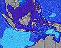 | 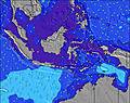 | 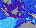 | |||||||||||||
Wave Height (m) Direction Period (s) | S 18 | S 16 | S 15 | S 14 | SSW 14 | S 16 | S 16 | S 15 | S 15 | SSW 20 | SSW 18 | S 17 | S 16 | S 16 | S 18 | S 17 | S 16 | S 16 | S 16 | S 15 |
Wave Graph | ||||||||||||||||||||
741 | 734 | 619 | 411 | 304 | 847 | 858 | 644 | 644 | 507 | 1274 | 1484 | 1330 | 954 | 2038 | 2149 | 2028 | 1626 | 1384 | 1051 | |
Wind (km/h) | ||||||||||||||||||||
Wind State on-shore cross-onshore cross-shore cross-offshore off-shore glassy | on | glassy | glassy | cross-off | cross-off | off | off | glassy | cross-off | cross-off | off | off | off | off | off | off | off | off | off | glassy |
High Tide | 8:53PM0.96m | 8:47AM1.05m | 9:26PM1.00m | 9:17AM0.97m | 10:03PM1.01m | 9:51AM0.87m | 10:49PM1.01m | 10:33AM0.76m | 11:48PM1.00m | 11:33AM0.64m | 1:06AM1.00m | 1:19PM0.56m | 2:34AM1.03m | |||||||
Low Tide | 2:39AM0.17m | 3:06PM0.05m | 3:22AM0.20m | 3:37PM0.07m | 4:09AM0.24m | 4:12PM0.10m | 5:04AM0.29m | 4:52PM0.14m | 6:14AM0.33m | 5:43PM0.18m | 7:49AM0.34m | 6:52PM0.22m | ||||||||
— | — | 6:28 | — | — | 6:26 | — | — | 6:26 | — | — | 6:26 | — | — | 6:26 | — | — | 6:26 | — | — | |
6:30 | — | — | 6:30 | — | — | 6:30 | — | — | 6:30 | — | — | 6:30 | — | — | 6:30 | — | — | 6:30 | — | |
mm | 1 | 17 | 7 | 12 | 3 | 2 | 4 | 8 | 4 | 4 | 31 | 14 | 7 | 6 | 5 | 6 | 10 | 1 | — | 7 |
Temp °C | 29 | 28 | 27 | 27 | 25 | 28 | 28 | 27 | 28 | 29 | 27 | 26 | 26 | 26 | 27 | 27 | 26 | 28 | 28 | 27 |
Feels °C | 33 | 32 | 31 | 29 | 26 | 31 | 32 | 31 | 30 | 31 | 29 | 27 | 27 | 27 | 27 | 28 | 28 | 30 | 31 | 32 |
Swell 1 Height (m) Direction Period (s) | S 18 | S 16 | S 15 | S 14 | SSW 14 | S 16 | S 16 | S 15 | S 15 | SSW 15 | SSW 18 | S 17 | S 16 | S 16 | S 18 | S 17 | S 16 | S 16 | S 16 | S 15 |
741 | 734 | 619 | 411 | 304 | 847 | 858 | 644 | 644 | 474 | 1274 | 1484 | 1330 | 954 | 2038 | 2149 | 2028 | 1626 | 1384 | 1051 | |
Swell 2 Height (m) Direction Period (s) | SSE 8 | SSE 8 | SSE 7 | SSE 7 | S 17 | SSE 7 | SW 8 | S 24 | N 5 | SSW 20 | SSE 6 | SSE 6 | SSE 5 | S 20 | SW 7 | WSW 7 | W 6 | WSW 6 | WSW 6 | SSE 8 |
94 | 66 | 62 | 54 | 287 | 9 | 3 | 11 | 12 | 507 | 4 | 11 | 11 | 482 | 12 | 17 | 76 | 6 | 3 | 55 | |
Swell 3 Height (m) Direction Period (s) | SSW 14 | S 8 | S 9 | S 18 | S 7 | SE 8 | SW 8 | SW 7 | S 21 | SSE 6 | WNW 10 | SSE 4 | SSE 5 | WSW 7 | WSW 7 | WNW 10 | — | WSW 5 | ESE 6 | SW 5 |
80 | 1 | 14 | 222 | 35 | 3 | 3 | 2 | 227 | 4 | 98 | 11 | 11 | 10 | 29 | 18 | — | 17 | 4 | 7 | |
Wind waves Height (m) Direction Period (s) | — | — | — | — | NNW 5 | N 4 | N 4 | N 4 | — | N 5 | N 6 | NNW 6 | N 5 | N 5 | N 5 | NW 6 | WNW 6 | — | — | — |
— | — | — | — | 9 | 4 | 7 | 5 | — | 7 | 42 | 170 | 43 | 18 | 16 | 24 | 22 | — | — | — | |
Nearest Offshore or Glassy | ||||||||||||||||||||
Distance (km) | 0 | 0 | 0 | 0 | 0 | 0 | 0 | 0 | 0 | 9 | 0 | 0 | 0 | 12 | 12 | 0 | 0 | 0 | 0 | 0 |
Best forecast wave conditions in Mentawi Islands | ||||||||||||||||||||
Best forecast wave conditions in Indonesia | ||||||||||||||||||||
Header Global | ||||||||||||||||||||
- Map Icons:
 Break
Break Live Wave Height (m)
 Live Wind Speed (km/h)
 Surf Rating (10 Max)
 Ocean Swells (m)
- Wind Speed (km/h)
Latest Updates


FREE! Surf-Forecast.com widget for your website
The surf report / weather widget below is available to embed on third party websites free of charge and provides a summary of our E-Bay surf forecast. Simply grab the html code snippet that we provide and paste it into your own site. You can choose your preferred language and metric/imperial units for the surf forecast feed to suit users of your site. Click here to get the code.
Information about the E-Bay Surf forecast
The above surf forecast table for E-Bay provides essential information for determining whether the surfing conditions will be good over the next 16 days. A general guide to surfing at E-Bay can be found by selecting the local surf guide option on the grey menu. Our E-Bay surf forecast is unique since it includes wave energy (power) that defines the real feel of the surf rather than just the height or the period. If you surf the same spot (E-Bay) regularly then make a mental note of the wave energy from the surf forecast table each time you go. Very soon you may start to choose your surf days based on the wave energy alone combined with our forecast of favourable offshore wind conditions. Our star ratings will help here and of course you will also find the usual wave height and period predictions on our surf forecasts as well as a full break down of the swell components under our advanced users option (to reveal that, click the little Einstein character under the tide times).
Further information to help with frequently asked questions about our surf forecast for E-Bay may be found under the help tab on the top menu and also by moving your mouse over the question marks on the surf forecast table itself. Please always bear in mind that the forecast is for near-shore open water and local factors at each surf break influence the actual breaking wave height, such as the beach / reef profile, water depths offshore and shelter.
Are you planning a holiday in Mentawi Islands? If you are looking for accommodation near E-Bay, camping, hotels and holiday cottages in Mentawi Islands, consider staying in Padang which is 168 km (104 miles) away.
 Nearest