

Surf Forecasts:

Pitstops surf forecast from 3 Aug 2026:
- Best quality surf: Wednesday 5 Aug, 1PM (local time) - 3.5ft (1.1m), 15s period, S swell with cross-offshore winds.
- Most powerful swell: Friday 7 Aug, 7PM (local time) - 6.5ft (2.0m), 17s period, S swell with 2,289 kJ wave energy.
- Next surfable swell (1★+): Wednesday 5 Aug, 1PM (local time) - 3.5ft (1.1m), 15s period with S swell.
Best Forecast Surf Conditions for Pitstops this week:
The surf forecast for Pitstops over the next 16 days: The first swell (rated 1 star or higher) is forecast to arrive on Wednesday (Aug 05) at 1PM. The primary swell is predicted to be 1.1m and 15s period with a secondary swell of 0.7m and 20s. The wind is predicted to be cross-offshore as the swell arrives.
The most powerful waves expected at Pitstops in the next 16 days are 2.0m 17s and forecast to arrive on Friday (Aug 07) at 7PM. Winds are predicted to be cross-shore at the time the swell arrives. The largest open ocean swell (not directed at the beach) is 1.0m 5s period and expected on Thursday (Aug 06) at 1PM.
| Wave Type | Time (WIB) & Date | Wave Height & Period |
|---|---|---|
| Next good surf (1 star+) | 1PM (Wed 5th Aug) | 3.5ft (1.1m) 15s |
| Best Surf | 1PM (Wed 5th Aug) | 3.5ft (1.1m) 15s |
| Most Powerful | 7PM (Fri 7th Aug) | 6.5ft (2.0m) 17s |
Table - best surf conditions forecast for Pitstops over the next 16 days.
The Lowdown
Alright, Rusty here. Let's have a look at the only game in town for the next couple of weeks.
Honestly, for a spot that's usually dependable, we're looking at a bit of a slow start. The first few days are a write-off thanks to stormy weather and messy winds. The surf that is there just isn't worth the effort until we get some cleaner conditions. The water temp is sitting right around 85°, which is bang on average for this time of year, so no surprises there.
The real story starts to build from the middle of next week. The combo energy values are climbing into the four-digit range, signaling some solid, moderate wave energy pushing in. The real standout is going to be Sunday, the 9th of August. We've got a clean 6ft S swell, a period of 16 seconds – that's proper groundswell – and most importantly, glassy offshore ENE breeze. That's the kind of setup that makes Pitstops (reef) really shine. The guides are calling it excellent for experienced surfers, and it's easy to see why. The swell direction is a perfect match for the break's optimum. This is the pick of the whole window.
The rest of that week keeps the S swell going, with the cross-off winds keeping things reasonably clean. The Monday the 10th and Friday the 14th of August both have more excellent sessions in the 5ft to 6ft range, with that same period and clean winds. The swell is solid but not too big, so it's manageable for a confident intermediate, but with that long period, it'll be better on the takeoff and less of a closeout machine.
Heading into the second week, the swell stays consistent but the wind picks up a bit. The 11th and 12th of August see a bump in size to 7ft, but with stronger cross-off winds, it gets a bit more challenging. Then things clean up nicely again from the 14th of August onwards, with a fantastic run of light breeze and cross-off conditions through the 17th and 18th of August. The 18th of August pushes up to 7ft again, which is getting into the expert-only zone, but the wind is still clean. It's a long-range call, so it's promising but not locked in.
To be honest, the whole 16-day window is about this one break, and it's a pretty good one. The early week is a washout, but the second half of the window has more than enough good, clean days to make up for it. The only thing to watch for is that the break is 'often' crowded, so get in early for the best of it.
Rusty.
Short Range ForecastHeavy rain (total 64mm), heaviest during Thu morning. Warm (max 29°C on Wed morning, min 24°C on Thu morning). Wind will be generally light. | Days 5-7 Weather SummaryHeavy rain (total 40mm), heaviest during Fri night. Warm (max 29°C on Fri morning, min 26°C on Thu afternoon). Wind will be generally light. | |||||||||||||||||||
Mon 3 | Tuesday 4 | Wednesday 5 | Thursday 6 | Friday 7 | Saturday 8 | Sunday 9 | ||||||||||||||
PM | Night | AM | PM | Night | AM | PM | Night | AM | PM | Night | AM | PM | Night | AM | PM | Night | AM | PM | Night | |
Swell Height Map |  |  |  |  | 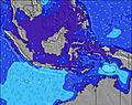 | 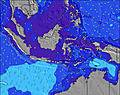 | 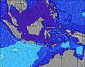 | |||||||||||||
Wave Height (m) Direction Period (s) | S 14 | SSW 14 | S 16 | S 16 | S 15 | SSW 15 | SSW 15 | SSW 18 | S 17 | S 16 | S 16 | S 18 | S 17 | S 16 | S 16 | S 16 | S 15 | S 16 | S 16 | S 15 |
Wave Graph | ||||||||||||||||||||
411 | 304 | 724 | 858 | 644 | 666 | 566 | 1497 | 1467 | 1330 | 1117 | 2015 | 2167 | 2028 | 1626 | 1380 | 1349 | 1415 | 1092 | 1229 | |
Wind (km/h) | ||||||||||||||||||||
Wind State on-shore cross-onshore cross-shore cross-offshore off-shore glassy | on | cross-on | cross | cross-on | cross | cross | cross | cross | cross-on | cross-off | cross | cross-off | cross | cross | cross | cross-on | cross-off | off | cross-off | cross-off |
High Tide | 9:26PM1.00m | 9:17AM0.97m | 10:03PM1.01m | 9:51AM0.87m | 10:49PM1.01m | 10:33AM0.76m | 11:48PM1.00m | 11:33AM0.64m | 1:06AM1.00m | 1:19PM0.56m | 2:34AM1.03m | 3:15PM0.56m | 3:50AM1.10m | |||||||
Low Tide | 3:22AM0.20m | 3:37PM0.07m | 4:09AM0.24m | 4:12PM0.10m | 5:04AM0.29m | 4:52PM0.14m | 6:14AM0.33m | 5:43PM0.18m | 7:49AM0.34m | 6:52PM0.22m | 9:36AM0.29m | 8:18PM0.23m | ||||||||
— | — | 6:26 | — | — | 6:26 | — | — | 6:26 | — | — | 6:26 | — | — | 6:26 | — | — | 6:26 | — | — | |
6:30 | — | — | 6:30 | — | — | 6:30 | — | — | 6:30 | — | — | 6:30 | — | — | 6:30 | — | — | 6:29 | — | |
mm | 3 | 13 | 4 | 5 | 2 | 2 | 3 | 19 | 13 | 3 | 1 | — | — | 18 | 5 | 9 | 4 | — | 2 | 6 |
Temp °C | 26 | 26 | 27 | 26 | 26 | 29 | 28 | 27 | 25 | 26 | 27 | 29 | 29 | 27 | 28 | 28 | 27 | 27 | 27 | 27 |
Feels °C | 27 | 29 | 28 | 27 | 28 | 31 | 32 | 30 | 27 | 28 | 28 | 30 | 30 | 29 | 31 | 32 | 31 | 30 | 30 | 31 |
Swell 1 Height (m) Direction Period (s) | S 14 | SSW 14 | S 16 | S 16 | S 15 | SSW 15 | SSW 15 | SSW 18 | S 17 | S 16 | S 16 | S 18 | S 17 | S 16 | S 16 | S 16 | S 15 | S 16 | S 16 | S 15 |
411 | 304 | 724 | 858 | 644 | 666 | 566 | 1497 | 1467 | 1330 | 1117 | 2015 | 2167 | 2028 | 1626 | 1380 | 1349 | 1415 | 1092 | 1229 | |
Swell 2 Height (m) Direction Period (s) | S 7 | S 17 | SSE 7 | SSE 6 | WSW 9 | SSW 21 | SSW 20 | WNW 9 | S 12 | WNW 10 | S 20 | WNW 8 | WNW 8 | WNW 9 | WNW 9 | WNW 9 | WNW 9 | WNW 10 | — | SSW 26 |
67 | 287 | 9 | 4 | 8 | 151 | 507 | 164 | 11 | 159 | 365 | 113 | 96 | 88 | 68 | 68 | 48 | 52 | — | 66 | |
Swell 3 Height (m) Direction Period (s) | S 18 | S 7 | SW 8 | W 10 | S 24 | WSW 8 | WNW 10 | W 9 | S 12 | — | SSW 19 | W 8 | — | — | — | SSE 6 | — | — | S 28 | S 25 |
222 | 25 | 3 | 8 | 11 | 6 | 201 | 83 | 11 | — | 627 | 46 | — | — | — | 3 | — | — | 15 | 12 | |
Wind waves Height (m) Direction Period (s) | SSW 7 | NNW 3 | NNE 4 | N 4 | N 4 | NNE 4 | NW 6 | NNW 4 | N 5 | N 6 | N 4 | N 4 | — | NW 7 | — | — | — | SE 4 | SSE 5 | SSE 6 |
76 | 1 | 25 | 15 | 6 | 4 | 20 | 10 | 34 | 48 | 10 | 5 | — | 47 | — | — | — | 6 | 23 | 55 | |
Nearest Offshore or Glassy | ||||||||||||||||||||
Distance (km) | 702 | 0 | 0 | 0 | 0 | 0 | 0 | 0 | 0 | 11 | 0 | 11 | 0 | 0 | 0 | 0 | 0 | 0 | 0 | 0 |
Best forecast wave conditions in Mentawi Islands | ||||||||||||||||||||
Best forecast wave conditions in Indonesia | ||||||||||||||||||||
Header Global | ||||||||||||||||||||
- Map Icons:
 Break
Break Live Wave Height (m)
 Live Wind Speed (km/h)
 Surf Rating (10 Max)
 Ocean Swells (m)
- Wind Speed (km/h)
Latest Updates


FREE! Surf-Forecast.com widget for your website
The surf report / weather widget below is available to embed on third party websites free of charge and provides a summary of our Pitstops surf forecast. Simply grab the html code snippet that we provide and paste it into your own site. You can choose your preferred language and metric/imperial units for the surf forecast feed to suit users of your site. Click here to get the code.
Information about the Pitstops Surf forecast
The above surf forecast table for Pitstops provides essential information for determining whether the surfing conditions will be good over the next 16 days. A general guide to surfing at Pitstops can be found by selecting the local surf guide option on the grey menu. Our Pitstops surf forecast is unique since it includes wave energy (power) that defines the real feel of the surf rather than just the height or the period. If you surf the same spot (Pitstops) regularly then make a mental note of the wave energy from the surf forecast table each time you go. Very soon you may start to choose your surf days based on the wave energy alone combined with our forecast of favourable offshore wind conditions. Our star ratings will help here and of course you will also find the usual wave height and period predictions on our surf forecasts as well as a full break down of the swell components under our advanced users option (to reveal that, click the little Einstein character under the tide times).
Further information to help with frequently asked questions about our surf forecast for Pitstops may be found under the help tab on the top menu and also by moving your mouse over the question marks on the surf forecast table itself. Please always bear in mind that the forecast is for near-shore open water and local factors at each surf break influence the actual breaking wave height, such as the beach / reef profile, water depths offshore and shelter.
 Nearest