

Surf Forecasts:

Macaronis surf forecast from 23 Jul 2026:
- Best quality surf: Friday 31 Jul, 1AM (local time) - 4ft (1.2m), 18s period, SW swell with cross-offshore winds.
- Most powerful swell: Friday 31 Jul, 1AM (local time) - 4ft (1.2m), 18s period, SW swell with 895 kJ wave energy.
- Next surfable swell (1★+): Sunday 26 Jul, 10PM (local time) - 3.5ft (1.1m), 10s period with S swell.
Best Forecast Surf Conditions for Macaronis this week:
The surf forecast for Macaronis over the next 16 days: The first swell (rated 1 star or higher) is forecast to arrive on Sunday (Jul 26) at 10PM. The primary swell is predicted to be 1.1m and 10s period with a secondary swell of 0.6m and 14s. The wind is predicted to be cross-offshore as the swell arrives.
The most powerful waves expected at Macaronis in the next 16 days are 1.2m 18s and forecast to arrive on Friday (Jul 31) at 1AM. Winds are predicted to be cross-offshore at the time the swell arrives.
| Wave Type | Time (WIB) & Date | Wave Height & Period |
|---|---|---|
| Next good surf (1 star+) | 10PM (Sun 26th Jul) | 3.5ft (1.1m) 10s |
| Best Surf | 1AM (Fri 31st Jul) | 4ft (1.2m) 18s |
| Most Powerful | 1AM (Fri 31st Jul) | 4ft (1.2m) 18s |
Table - best surf conditions forecast for Macaronis over the next 16 days.
The Lowdown
Alright, let’s get into it. The forecast is a bit of a slow burn here at Macaronis, but there’s a solid payoff waiting in the first week of August. The next few days have some swell, but the winds are messy, so it’s a waiting game for the clean stuff.
Right now, we’re looking at Friday the 24th and Saturday the 25th of July, with a 7ft to 5ft SSE swell coming in. The wind is cross-shore at 19 mph, which is creating a lumpy cross-chop. The combined wave energy is moderate, around 855 to 897 (units), but the conditions are just poor. Not worth paddling out. Sunday the 26th drops to 4ft and the wind stays on it, so still no good.
Then we hit a bit of a lull. Monday the 27th through Tuesday the 28th have tiny swell, 2ft to 3ft, with a very long period groundswell from the SW (17 seconds). The energy is weak (366 to 462 units), but the wind is light. It’s marginal at best. You’d be floating around waiting for a set.
The real turnaround starts Wednesday the 29th of July. The swell bumps up to 3ft from the SSW, with a 15-second period, and the wind goes light cross-offshore. The energy is moderate (511 units), and the forecast says “clean.” That’s the first real window. Thursday the 30th is even better, with a 3ft SW groundswell at a very long 19 seconds, and the same light cross-offshore wind. The energy jumps to 989 units. This is setting up to be a standout session for the end of July. The long period will make those waves peel nicely at this reef, with longer gaps between sets.
But the absolute best on offer? That’s the weekend of the 1st and 2nd of August. Saturday morning the 1st has a 5ft SW swell at 18 seconds, with glassy conditions. The energy is strong (1441 units). Sunday the 2nd starts with a 4ft SSW swell at a very long 19 seconds, and the wind is dead calm. The energy is even higher (1671 units). These are excellent surf conditions for experienced surfers. The water temperature is about average for the time of year. Keep in mind, this is a very consistent spot, but crowds are possible here, especially when it’s this good.
Monday the 3rd of August holds at 6ft with a light offshore wind in the morning, then goes cross-on in the afternoon. Tuesday the 4th and Wednesday the 5th are also looking strong, with 6ft to 6ft SSW swells and clean, cross-offshore or glassy conditions. The energy is very strong, in the 1600 to 1700 units range. Late in the run, Friday the 7th of August brings a bigger 7ft SSW swell, but the wind picks up to 12 mph, creating a cross-chop, so that’s more for the experts.
Overall, if you can wait, the 29th and 30th of July, and especially the 1st and 2nd of August, are the ones to circle. Clean, glassy, and proper groundswell.
Rusty
Short Range ForecastLight rain (total 2mm), mostly falling on Sat morning. Warm (max 29°C on Sun morning, min 26°C on Thu night). Mainly fresh winds. | Days 4-6 Weather SummaryModerate rain (total 11mm), heaviest on Mon night. Warm (max 28°C on Mon morning, min 25°C on Sun night). Wind will be generally light. | ||||||||||||||||||||
Friday 24 | Saturday 25 | Sunday 26 | Monday 27 | Tuesday 28 | Wednesday 29 | Thursday 30 | |||||||||||||||
AM | PM | Night | AM | PM | Night | AM | PM | Night | AM | PM | Night | AM | PM | Night | AM | PM | Night | AM | PM | Night | |
Swell Height Map |  |  |  | 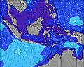 | 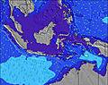 | 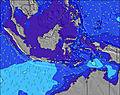 | 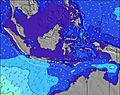 | ||||||||||||||
Wave Height (m) Direction Period (s) | SSE 10 | SSE 10 | SSE 10 | SSE 10 | S 10 | SSE 10 | SSE 9 | SSE 10 | SW 13 | SW 17 | SSE 11 | SW 16 | SW 16 | SW 15 | SSW 15 | SSW 15 | SSW 14 | SW 20 | SW 19 | SW 18 | SW 18 |
Wave Graph | |||||||||||||||||||||
778 | 678 | 512 | 492 | 450 | 426 | 259 | 255 | 180 | 145 | 194 | 255 | 196 | 229 | 298 | 372 | 362 | 388 | 715 | 628 | 895 | |
Wind (km/h) | |||||||||||||||||||||
Wind State on-shore cross-onshore cross-shore cross-offshore off-shore glassy | cross | cross | cross | cross | cross | cross | cross | cross-on | cross-off | cross | cross | cross-off | cross | cross-on | cross-off | cross-off | cross | cross-off | cross-off | cross-on | cross-off |
High Tide | 1:47PM0.42m | 2:54AM0.79m | 3:26PM0.41m | 3:55AM0.82m | 4:37PM0.44m | 4:46AM0.86m | 5:26PM0.49m | 5:28AM0.91m | 6:05PM0.54m | 6:05AM0.96m | 6:39PM0.60m | 6:39AM1.00m | 7:11PM0.67m | ||||||||
Low Tide | 9:27AM0.35m | 6:53PM0.26m | 10:46AM0.29m | 8:10PM0.27m | 11:28AM0.23m | 9:26PM0.26m | 12:00PM0.18m | 10:26PM0.23m | 12:27PM0.14m | 11:15PM0.20m | 12:53PM0.11m | 11:57PM0.17m | 1:19PM0.08m | 00:36AM0.16m | |||||||
6:26 | — | — | 6:26 | — | — | 6:26 | — | — | 6:26 | — | — | 6:26 | — | — | 6:26 | — | — | 6:26 | — | — | |
— | 6:25 | — | — | 6:25 | — | — | 6:25 | — | — | 6:25 | — | — | 6:25 | — | — | 6:25 | — | — | 6:25 | — | |
mm | — | — | — | 2 | — | — | — | — | — | 1 | 1 | 5 | 1 | 1 | 1 | — | 1 | — | — | — | — |
Temp °C | 28 | 28 | 27 | 28 | 28 | 27 | 29 | 28 | 26 | 28 | 27 | 26 | 28 | 27 | 26 | 28 | 28 | 26 | 29 | 28 | 27 |
Feels °C | 27 | 27 | 27 | 29 | 29 | 28 | 30 | 30 | 28 | 31 | 30 | 29 | 31 | 30 | 30 | 31 | 31 | 29 | 32 | 31 | 30 |
Swell 1 Height (m) Direction Period (s) | SW 15 | SW 15 | SW 16 | SW 15 | SW 15 | SW 14 | SW 13 | SSE 10 | S 9 | SSE 9 | SSE 11 | SSE 10 | SSE 10 | SSE 10 | SSE 9 | SSW 15 | SSW 14 | SSW 14 | SW 19 | SW 18 | SW 18 |
34 | 147 | 155 | 209 | 134 | 189 | 183 | 255 | 180 | 115 | 194 | 125 | 147 | 180 | 147 | 372 | 362 | 243 | 715 | 628 | 895 | |
Swell 2 Height (m) Direction Period (s) | SSW 18 | SSW 18 | S 16 | S 15 | S 15 | WNW 11 | WNW 11 | SW 14 | SW 13 | SSW 13 | SSW 13 | SW 16 | SW 16 | SW 15 | SSW 15 | SSE 9 | S 8 | SSE 8 | SSW 13 | SSW 13 | SSW 13 |
33 | 62 | 137 | 115 | 113 | 12 | 11 | 191 | 172 | 106 | 106 | 255 | 196 | 229 | 298 | 101 | 84 | 77 | 222 | 282 | 149 | |
Swell 3 Height (m) Direction Period (s) | WNW 10 | WNW 10 | WNW 10 | WNW 9 | WNW 11 | W 11 | W 14 | SSW 18 | SSW 18 | SW 17 | SW 17 | SW 12 | SW 12 | SSW 12 | SW 11 | S 15 | SW 21 | SW 20 | S 7 | S 7 | S 8 |
10 | 10 | 9 | 8 | 12 | 2 | 4 | 34 | 34 | 145 | 138 | 69 | 68 | 53 | 19 | 38 | 162 | 388 | 52 | 37 | 43 | |
Wind waves Height (m) Direction Period (s) | SSE 10 | SSE 10 | SSE 10 | SSE 10 | S 10 | SSE 10 | SSE 9 | — | — | — | — | — | — | — | — | — | — | — | — | — | — |
778 | 678 | 512 | 492 | 450 | 426 | 259 | — | — | — | — | — | — | — | — | — | — | — | — | — | — | |
Nearest Offshore or Glassy | |||||||||||||||||||||
Distance (km) | 464 | 128 | 128 | 204 | 443 | 204 | 10 | 25 | 0 | 10 | 25 | 0 | 10 | 25 | 0 | 0 | 25 | 0 | 0 | 25 | 0 |
Best forecast wave conditions in Mentawi Islands | |||||||||||||||||||||
Best forecast wave conditions in Indonesia | |||||||||||||||||||||
Header Global | |||||||||||||||||||||
- Map Icons:
 Break
Break Live Wave Height (m)
 Live Wind Speed (km/h)
 Surf Rating (10 Max)
 Ocean Swells (m)
- Wind Speed (km/h)


FREE! Surf-Forecast.com widget for your website
The surf report / weather widget below is available to embed on third party websites free of charge and provides a summary of our Macaronis surf forecast. Simply grab the html code snippet that we provide and paste it into your own site. You can choose your preferred language and metric/imperial units for the surf forecast feed to suit users of your site. Click here to get the code.
Information about the Macaronis Surf forecast
The above surf forecast table for Macaronis provides essential information for determining whether the surfing conditions will be good over the next 16 days. A general guide to surfing at Macaronis can be found by selecting the local surf guide option on the grey menu. Our Macaronis surf forecast is unique since it includes wave energy (power) that defines the real feel of the surf rather than just the height or the period. If you surf the same spot (Macaronis) regularly then make a mental note of the wave energy from the surf forecast table each time you go. Very soon you may start to choose your surf days based on the wave energy alone combined with our forecast of favourable offshore wind conditions. Our star ratings will help here and of course you will also find the usual wave height and period predictions on our surf forecasts as well as a full break down of the swell components under our advanced users option (to reveal that, click the little Einstein character under the tide times).
Further information to help with frequently asked questions about our surf forecast for Macaronis may be found under the help tab on the top menu and also by moving your mouse over the question marks on the surf forecast table itself. Please always bear in mind that the forecast is for near-shore open water and local factors at each surf break influence the actual breaking wave height, such as the beach / reef profile, water depths offshore and shelter.
Are you planning a holiday in Mentawi Islands? If you are looking for accommodation near Macaronis, camping, hotels and holiday cottages in Mentawi Islands, consider staying in Sungaipenuh which is 175 km (109 miles) away.
 Nearest