

Surf Forecasts:

Pantai Air Manis surf forecast from 25 Jul 2026:
- Best quality surf: Thursday 30 Jul, 10AM (local time) - 2ft (0.6m), 19s period, SW swell with glassy winds.
- Most powerful swell: Saturday 1 Aug, 4PM (local time) - 4ft (1.2m), 17s period, SW swell with 885 kJ wave energy.
- Next surfable swell (1★+): Sunday 26 Jul, 1AM (local time) - 1.5ft (0.5m), 14s period with SW swell.
Best Forecast Surf Conditions for Pantai Air Manis this week:
The surf forecast for Pantai Air Manis over the next 16 days: The first swell (rated 1 star or higher) is forecast to arrive on Sunday (Jul 26) at 1AM. The primary swell is predicted to be 0.5m and 14s period with a secondary swell of 0.9m and 6s. The wind is predicted to be glassy as the swell arrives.
The most powerful waves expected at Pantai Air Manis in the next 16 days are 1.2m 17s and forecast to arrive on Saturday (Aug 01) at 4PM. Winds are predicted to be onshore at the time the swell arrives. The largest open ocean swell (not directed at the beach) is 1.4m 10s period and expected on Sunday (Jul 26) at 1AM.
| Wave Type | Time (WIB) & Date | Wave Height & Period |
|---|---|---|
| Next good surf (1 star+) | 1AM (Sun 26th Jul) | 1.5ft (0.5m) 14s |
| Best Surf | 10AM (Thu 30th Jul) | 2ft (0.6m) 19s |
| Most Powerful | 4PM (Sat 1st Aug) | 4ft (1.2m) 17s |
Table - best surf conditions forecast for Pantai Air Manis over the next 16 days.
The Lowdown
Alright folks, Rusty here. Let's have a look at what's cooking for the next couple of weeks.
Right off the bat, we’re looking at a spot that’s a real local workhorse. Pantai Air Manis is the only game in town from what I can see, and it’s a very consistent little number, especially for beginners. The water's sitting at a balmy 85°, which is pretty much bang on average for this time of year, so no surprises there.
The next few days are a bit of a mixed bag. Saturday afternoon (25th July) is a write-off with a risk of thunderstorms and a messy cross-onshore breeze, so I’d give that a miss. Sunday morning the 26th looks glassy and clean, with a tiny 2 ft SW swell rolling in. The energy is weak at 135, so it’s not firing, but for a longboard or a foamie it'd be alright for a paddle. The afternoon turns a bit choppy again.
Now, Monday morning on the 27th is where we start to see a bit of life. Glassy conditions again, with a 2 ft S swell and a 10-second period. The energy is ticking up to a moderate 238. This is the kind of small but clean surf that makes for a fun session on the right board. The glassy wind is a major positive.
The real standout on the horizon is shaping up nicely. From the 30th of July (Thursday) right through to the 1st of August, we’ve got a run of mornings with glassy conditions and building swell. The 30th has a 2 ft SW swell with a long 19-second period – that’s proper groundswell energy, and the combined energy is a strong 508. The following morning, Friday the 31st, sees that swell size up to 3 ft with a 17-second period and the energy jumps to a very strong 634. But the best morning of the bunch looks like Saturday the 1st of August. The swell is up to 4 ft, still from the SW, with a 17-second period and the combined energy is a thumping 754. With glassy winds and that kind of long-period groundswell, the waves will have proper shape and punch for its size. It’s still small enough for most abilities, too.
There's a bit of a gap in quality after that first week. The second week sees that SW groundswell ease off, and the direction swings more to the SSW. The mornings of the 2nd, 3rd, and 4th are still glassy but the swell drops back to the 3 ft to 3 ft range and the period shortens up, so the energy drops off from the previous highs. Still surfable, but nothing that's going to blow your socks off.
A big shift is on the cards for the second weekend. On the morning of Sunday the 9th of August, we’ve got a solid 7 ft SSW groundswell with a 17-second period and an insane combined energy of 2261. That’s a very strong pulse. The wind is offshore and glassy, which would normally be a recipe for perfection. However, at 7 ft, this is expert territory. At a beach break, a long-period swell this size can get pretty unruly and close out, but if the banks are good, it’ll be a proper session for the crew with the skills.
So to sum it up, the best windows are the mornings of the 30th and 31st of July, and the 1st of August, for clean, glassy, building groundswell. Keep an eye on Sunday the 9th of August for a much bigger, more powerful swell that’s strictly for the experts if it cleans up. The rest of the week in between is just small, average surf.
Stay safe, and I'll see you in the water.
Rusty
Short Range ForecastHeavy rain (total 24mm), heaviest during Sat night. Warm (max 29°C on Tue morning, min 25°C on Sat night). Wind will be generally light. | Days 5-7 Weather SummarySome drizzle, heaviest during Wed night. Warm (max 29°C on Tue afternoon, min 25°C on Tue night). Wind will be generally light. | |||||||||||||||||||
Sat 25 | Sunday 26 | Monday 27 | Tuesday 28 | Wednesday 29 | Thursday 30 | Friday 31 | ||||||||||||||
PM | Night | AM | PM | Night | AM | PM | Night | AM | PM | Night | AM | PM | Night | AM | PM | Night | AM | PM | Night | |
Swell Height Map |  |  |  |  | 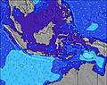 | 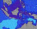 | 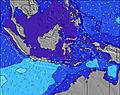 | |||||||||||||
Wave Height (m) Direction Period (s) | SW 15 | SW 14 | SW 14 | SW 14 | SW 14 | S 10 | SW 17 | SW 13 | SW 16 | SW 15 | SSW 15 | SW 15 | SW 14 | SW 20 | SW 19 | SW 18 | SW 18 | SW 17 | SW 16 | SW 16 |
Wave Graph | ||||||||||||||||||||
76 | 100 | 89 | 89 | 92 | 87 | 78 | 82 | 121 | 112 | 148 | 171 | 214 | 206 | 303 | 401 | 375 | 423 | 318 | 427 | |
Wind (km/h) | ||||||||||||||||||||
Wind State on-shore cross-onshore cross-shore cross-offshore off-shore glassy | cross-on | glassy | glassy | cross-on | glassy | glassy | on | glassy | glassy | on | cross-off | glassy | on | cross-off | glassy | on | glassy | glassy | on | glassy |
High Tide | 4:16AM0.96m | 4:51PM0.58m | 5:05AM1.02m | 5:39PM0.63m | 5:48AM1.08m | 6:19PM0.70m | 6:25AM1.13m | 6:55PM0.76m | 6:59AM1.17m | 7:27PM0.82m | 7:30AM1.18m | 7:58PM0.88m | ||||||||
Low Tide | 8:21PM0.32m | 11:34AM0.31m | 9:34PM0.29m | 12:01PM0.25m | 10:34PM0.25m | 12:25PM0.19m | 11:23PM0.21m | 12:50PM0.15m | 00:06AM0.17m | 1:16PM0.11m | 00:46AM0.15m | 1:43PM0.08m | 1:24AM0.14m | |||||||
— | — | 6:22 | — | — | 6:22 | — | — | 6:22 | — | — | 6:22 | — | — | 6:22 | — | — | 6:22 | — | — | |
6:27 | — | — | 6:27 | — | — | 6:27 | — | — | 6:27 | — | — | 6:27 | — | — | 6:27 | — | — | 6:27 | — | |
mm | 5 | 12 | 1 | 3 | 1 | 1 | 1 | — | — | — | — | — | — | 1 | — | — | — | — | 1 | — |
Temp °C | 28 | 26 | 27 | 27 | 26 | 28 | 27 | 26 | 29 | 29 | 26 | 28 | 28 | 25 | 29 | 28 | 26 | 29 | 29 | 26 |
Feels °C | 31 | 31 | 31 | 31 | 31 | 33 | 31 | 31 | 32 | 33 | 30 | 32 | 32 | 29 | 32 | 32 | 30 | 32 | 33 | 30 |
Swell 1 Height (m) Direction Period (s) | S 10 | S 6 | S 6 | S 6 | S 6 | S 10 | S 9 | S 10 | SW 16 | S 11 | SSW 15 | SW 15 | SW 14 | SW 14 | SW 14 | SW 18 | SW 18 | SW 17 | SW 16 | SW 16 |
100 | 64 | 46 | 34 | 22 | 87 | 62 | 49 | 121 | 55 | 148 | 171 | 214 | 200 | 186 | 401 | 375 | 423 | 318 | 427 | |
Swell 2 Height (m) Direction Period (s) | SW 15 | S 10 | S 10 | SW 14 | SW 14 | SW 13 | SW 13 | SW 13 | S 9 | SW 15 | S 10 | S 9 | S 8 | SW 20 | SW 19 | SW 13 | SW 14 | SSW 13 | SSW 13 | SSW 12 |
76 | 94 | 65 | 89 | 92 | 80 | 78 | 82 | 43 | 112 | 29 | 24 | 22 | 206 | 303 | 175 | 191 | 201 | 201 | 115 | |
Swell 3 Height (m) Direction Period (s) | SSW 15 | SW 14 | SW 14 | S 9 | S 10 | SW 17 | SW 17 | SW 16 | SW 12 | SW 12 | SW 11 | SSW 11 | SW 22 | S 8 | S 8 | S 7 | S 7 | WNW 10 | SW 21 | SW 20 |
43 | 100 | 89 | 44 | 48 | 71 | 75 | 67 | 36 | 35 | 19 | 12 | 73 | 21 | 19 | 17 | 16 | 10 | 72 | 186 | |
Wind waves Height (m) Direction Period (s) | S 6 | S 10 | — | — | — | — | — | — | — | — | — | — | — | — | — | — | — | — | — | — |
58 | 369 | — | — | — | — | — | — | — | — | — | — | — | — | — | — | — | — | — | — | |
Nearest Offshore or Glassy | ||||||||||||||||||||
Distance (km) | 406 | 0 | 0 | 354 | 0 | 0 | 151 | 0 | 0 | 145 | 0 | 0 | 145 | 0 | 0 | 145 | 0 | 0 | 145 | 0 |
Best forecast wave conditions in Indonesia - Sumatra - Mainland | ||||||||||||||||||||
Best forecast wave conditions in Indonesia | ||||||||||||||||||||
Header Global | ||||||||||||||||||||
- Map Icons:
 Break
Break Live Wave Height (m)
 Live Wind Speed (km/h)
 Surf Rating (10 Max)
 Ocean Swells (m)
- Wind Speed (km/h)


FREE! Surf-Forecast.com widget for your website
The surf report / weather widget below is available to embed on third party websites free of charge and provides a summary of our Pantai Air Manis surf forecast. Simply grab the html code snippet that we provide and paste it into your own site. You can choose your preferred language and metric/imperial units for the surf forecast feed to suit users of your site. Click here to get the code.
Information about the Pantai Air Manis Surf forecast
The above surf forecast table for Pantai Air Manis provides essential information for determining whether the surfing conditions will be good over the next 16 days. A general guide to surfing at Pantai Air Manis can be found by selecting the local surf guide option on the grey menu. Our Pantai Air Manis surf forecast is unique since it includes wave energy (power) that defines the real feel of the surf rather than just the height or the period. If you surf the same spot (Pantai Air Manis) regularly then make a mental note of the wave energy from the surf forecast table each time you go. Very soon you may start to choose your surf days based on the wave energy alone combined with our forecast of favourable offshore wind conditions. Our star ratings will help here and of course you will also find the usual wave height and period predictions on our surf forecasts as well as a full break down of the swell components under our advanced users option (to reveal that, click the little Einstein character under the tide times).
Further information to help with frequently asked questions about our surf forecast for Pantai Air Manis may be found under the help tab on the top menu and also by moving your mouse over the question marks on the surf forecast table itself. Please always bear in mind that the forecast is for near-shore open water and local factors at each surf break influence the actual breaking wave height, such as the beach / reef profile, water depths offshore and shelter.
Are you planning a holiday in Indonesia - Sumatra - Mainland? If you are looking for accommodation near Pantai Air Manis, camping, hotels and holiday cottages in Indonesia - Sumatra - Mainland, consider staying in Padang which is 2 km (1 miles) away. Other places in and around Indonesia - Sumatra - Mainland where you can find information about places to rent, and car hire include Solok which is 40 km (25 miles) away, Pariaman, Sijunjung and Bukittinggi.
 Nearest