

Surf Forecasts:

Curvone surf forecast from 9 Jul 2026:
- Most powerful swell: Saturday 11 Jul, 11PM (local time) - 2.5ft (0.7m), 5s period, S swell with 20 kJ wave energy.
Best Forecast Surf Conditions for Curvone this week:
The most powerful waves expected at Curvone in the next 16 days are 0.7m 5s and forecast to arrive on Saturday (Jul 11) at 11PM. Winds are predicted to be cross-onshore at the time the swell arrives. The largest open ocean swell (not directed at the beach) is 0.7m 4s period and expected on Monday (Jul 13) at 5PM.
| Wave Type | Time (CEST) & Date | Wave Height & Period |
|---|---|---|
| Next good surf (1 star+) | - | - |
| Best Surf | - | - |
| Most Powerful | 11PM (Sat 11th Jul) | 2.5ft (0.7m) 5s |
Table - best surf conditions forecast for Curvone over the next 16 days.
Alright, Rusty here again. Let’s talk about Curvone. It’s a beach and reef setup, exposed to the south, and it’s an advanced wave. But over the next 16 days, the ocean is pretty much dead. We’re looking at a long, dry stretch with nothing worth chasing.
The forecast kicks off Friday, July 10th, and from there it’s a near total blank. The first swell shows up Saturday morning, July 11th—a tiny 0.7ft SSE swell with a 2-second period, combined energy of just 1. That’s barely a ripple. The wind is cross-onshore, so it’s choppy. By Saturday afternoon, it’s a 1ft SSE swell, period 3 seconds, energy 3, with onshore wind. Not worth a second look.
Sunday, July 12th, offers a cleaner look in the morning. A 1ft S swell with a 4-second period, weak energy (6), and a light offshore wind from the NNW. The water will be clean, but the swell is too small and short period to make anything of. Afternoon shows a 1.0ft SSW swell, cross-onshore wind. Not it.
The rest of the first week and into the second week is a desert. The combined energy is 0 for most days, with the odd brief spike to 2 or 6. The wind is often offshore or glassy, which is a tease—the ocean is smooth, but there’s no swell. On Monday, July 20th, we see a 2ft S swell, period 5 seconds, energy of 11 (weak), and glassy conditions in the morning. That’s the best of a bad lot, but it’s still tiny and weak. The swell direction is from the south, which matches the optimum direction for Curvone, but the size and period are just too low.
Tuesday, July 21st, has a similar story: 2ft S swell, period 4 seconds, energy 15, glassy in the morning. The swell lacks any punch. From July 22nd through the 25th, the energy drops back to zero. The wind is strong offshore at times, but with no swell, it’s a waste of good wind.
The water temperature anomaly isn’t listed, so I can’t say much there.
Honestly, there’s no standout here. Not a single day cracks a decent ride. The surf breaks are inconsistent in this area, so a blank run like this is more normal for the spot. It’s the kind of forecast where you check the wind and the sunset, maybe take a longboard for a paddle, but you’re not surfing. If you’re in a wetsuit, bring a camera, not a board.
Rusty.
Short Range ForecastMostly dry. Warm (max 33°C on Sun afternoon, min 25°C on Thu night). Wind will be generally light. | Days 5-7 Weather SummaryMostly dry. Warm (max 36°C on Wed afternoon, min 25°C on Sun night). Mainly fresh winds. | ||||||||||||||||||||
Friday 10 | Saturday 11 | Sunday 12 | Monday 13 | Tuesday 14 | Wednesday 15 | Thu 16 | |||||||||||||||
Night | AM | PM | Night | AM | PM | Night | AM | PM | Night | AM | PM | Night | AM | PM | Night | AM | PM | Night | AM | PM | |
Swell Height Map | 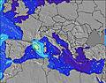 | 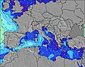 | 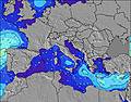 | 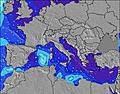 | 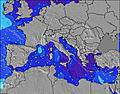 | 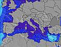 | 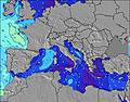 | 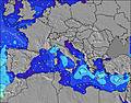 | |||||||||||||
Wave Height (m) Direction Period (s) | S 6 | — | — | — | SSE 2 | SSE 3 | S 5 | S 4 | SSW 4 | NNE 3 | NNW 2 | S 7 | NNW 4 | NNW 3 | N 3 | — | NNW 3 | WNW 3 | — | — | — |
Wave Graph | |||||||||||||||||||||
1 | 0 | 0 | 0 | 1 | 3 | 20 | 6 | 3 | 0 | 0 | 1 | 0 | 0 | 0 | 0 | 0 | 0 | 0 | 0 | 0 | |
Wind (km/h) | |||||||||||||||||||||
Wind State on-shore cross-onshore cross-shore cross-offshore off-shore glassy | cross-off | off | glassy | cross-off | cross-on | on | glassy | off | cross-on | cross-off | cross-off | off | cross-off | off | off | cross-off | cross-off | cross-off | cross-off | cross-off | glassy |
High Tide | 00:19AM0.12m | 1:15PM0.19m | 1:37AM0.13m | 2:12PM0.20m | 2:37AM0.14m | 3:02PM0.22m | 3:27AM0.15m | 3:47PM0.23m | 4:12AM0.16m | 4:29PM0.23m | 4:55AM0.16m | 5:09PM0.23m | 5:37AM0.16m | ||||||||
Low Tide | 6:15AM0.04m | 8:03PM0.04m | 7:22AM0.03m | 8:56PM0.03m | 8:20AM0.02m | 9:42PM0.01m | 9:11AM0.01m | 10:24PM0.00m | 9:57AM0.01m | 11:03PM-0.00m | 10:41AM0.01m | 11:41PM-0.00m | 11:23AM0.01m | ||||||||
— | 5:28 | — | — | 5:28 | — | — | 5:30 | — | — | 5:31 | — | — | 5:31 | — | — | 5:31 | — | — | 5:33 | — | |
8:22 | — | 8:21 | — | — | 8:21 | — | — | 8:21 | — | — | 8:20 | — | — | 8:20 | — | — | 8:19 | — | — | 8:17 | |
mm | — | — | — | — | — | — | — | — | — | — | — | — | — | — | — | — | — | — | — | — | — |
Temp °C | 29 | 30 | 30 | 30 | 28 | 28 | 27 | 31 | 33 | 29 | 32 | 33 | 31 | 33 | 34 | 32 | 35 | 36 | 34 | 34 | 36 |
Feels °C | 27 | 28 | 29 | 29 | 27 | 27 | 28 | 31 | 31 | 28 | 30 | 29 | 26 | 28 | 28 | 29 | 33 | 33 | 32 | 32 | 36 |
Swell 1 Height (m) Direction Period (s) | S 6 | — | — | — | — | — | S 5 | S 4 | SSW 4 | — | — | S 6 | — | — | — | — | — | — | — | — | — |
1 | — | — | — | — | — | 20 | 6 | 3 | — | — | 1 | — | — | — | — | — | — | — | — | — | |
Swell 2 Height (m) Direction Period (s) | — | — | — | — | — | — | — | — | — | — | — | S 7 | — | — | — | — | — | WNW 3 | — | — | — |
— | — | — | — | — | — | — | — | — | — | — | 1 | — | — | — | — | — | 1 | — | — | — | |
Swell 3 Height (m) Direction Period (s) | — | — | — | — | — | — | — | — | — | — | — | — | — | — | — | — | — | — | — | — | — |
— | — | — | — | — | — | — | — | — | — | — | — | — | — | — | — | — | — | — | — | — | |
Wind waves Height (m) Direction Period (s) | — | — | — | — | SSE 2 | SSE 3 | — | — | S 4 | NNE 3 | NNW 2 | N 3 | NNW 4 | NNW 3 | N 3 | — | NNW 3 | NNE 3 | — | — | — |
— | — | — | — | 1 | 3 | — | — | 3 | 2 | 1 | 5 | 12 | 8 | 6 | — | 3 | 1 | — | — | — | |
Nearest Offshore or Glassy | |||||||||||||||||||||
Distance (km) | 1603 | 1625 | 1597 | 1621 | 1596 | 1653 | 696 | 562 | 1741 | 505 | 1546 | 1965 | 219 | 219 | 2069 | 200 | 1906 | 1838 | 899 | 1772 | 1833 |
Best forecast wave conditions in West Coast of Italy | |||||||||||||||||||||
Best forecast wave conditions in Italy | |||||||||||||||||||||
Header Global | |||||||||||||||||||||
- Map Icons:
 Break
Break Live Wave Height (m)
 Live Wind Speed (km/h)
 Surf Rating (10 Max)
 Ocean Swells (m)
- Wind Speed (km/h)


FREE! Surf-Forecast.com widget for your website
The surf report / weather widget below is available to embed on third party websites free of charge and provides a summary of our Curvone surf forecast. Simply grab the html code snippet that we provide and paste it into your own site. You can choose your preferred language and metric/imperial units for the surf forecast feed to suit users of your site. Click here to get the code.
Information about the Curvone Surf forecast
The above surf forecast table for Curvone provides essential information for determining whether the surfing conditions will be good over the next 16 days. A general guide to surfing at Curvone can be found by selecting the local surf guide option on the grey menu. Our Curvone surf forecast is unique since it includes wave energy (power) that defines the real feel of the surf rather than just the height or the period. If you surf the same spot (Curvone) regularly then make a mental note of the wave energy from the surf forecast table each time you go. Very soon you may start to choose your surf days based on the wave energy alone combined with our forecast of favourable offshore wind conditions. Our star ratings will help here and of course you will also find the usual wave height and period predictions on our surf forecasts as well as a full break down of the swell components under our advanced users option (to reveal that, click the little Einstein character under the tide times).
Further information to help with frequently asked questions about our surf forecast for Curvone may be found under the help tab on the top menu and also by moving your mouse over the question marks on the surf forecast table itself. Please always bear in mind that the forecast is for near-shore open water and local factors at each surf break influence the actual breaking wave height, such as the beach / reef profile, water depths offshore and shelter.
Curvone is 14 km (9 miles) from Sava. If you plan a holiday in West Coast of Italy, look for hotels and other accommodation in Sava. Sava has rooms for a wide range of budgets as well as car hire and transport links.
 Nearest