

Surf Forecasts:

Baboon Point surf forecast from 14 Jul 2026:
- Best quality surf: Wednesday 15 Jul, 11PM (local time) - 6.5ft (2.0m), 14s period, WSW swell with cross-offshore winds.
- Most powerful swell: Thursday 16 Jul, 2AM (local time) - 6.5ft (2.0m), 14s period, WSW swell with 1,647 kJ wave energy.
- Next surfable swell (1★+): Wednesday 15 Jul, 5AM (local time) - 3ft (0.9m), 9s period with W swell.
Best Forecast Surf Conditions for Baboon Point this week:
The surf forecast for Baboon Point over the next 16 days: The first swell (rated 1 star or higher) is forecast to arrive on Wednesday (Jul 15) at 5AM. The primary swell is predicted to be 0.9m and 9s period with a secondary swell of 0.3m and 18s. The wind is predicted to be cross-offshore as the swell arrives.
The most powerful waves expected at Baboon Point in the next 16 days are 2.0m 14s and forecast to arrive on Thursday (Jul 16) at 2AM. Winds are predicted to be cross-offshore at the time the swell arrives. The largest open ocean swell (not directed at the beach) is 0.3m 3s period and expected on Monday (Jul 20) at 2AM.
| Wave Type | Time (SAST) & Date | Wave Height & Period |
|---|---|---|
| Next good surf (1 star+) | 5AM (Wed 15th Jul) | 3ft (0.9m) 9s |
| Best Surf | 11PM (Wed 15th Jul) | 6.5ft (2.0m) 14s |
| Most Powerful | 2AM (Thu 16th Jul) | 6.5ft (2.0m) 14s |
Table - best surf conditions forecast for Baboon Point over the next 16 days.
The Lowdown
Alright, grab your board, let's see what's cookin' at Baboon Point. We've got a mixed bag of a sixteen-day window ahead, but there are some proper gems to be excited about.
Initially, the surf is a bit quiet, but it picks up nicely. The water temp is about average for this time of year, nothing too wild.
The first real standout is the Thursday morning, July 16th session. We're looking at a solid 6 ft swell from the WSW, with a long 13-second period pushing a strong wave energy of 1264. The wind is a light cross-offshore, keeping things clean. This is excellent for experienced surfers—it's got some grunt to it, but it'll be lined up with that long period. Expect it to be a bit of a paddle out, but the waves will be worth it.
Another morning that has me stoked is Tuesday, July 21st. It's glassy calm, with another solid 5 ft groundswell from the SW, running on a very long 16-second period. That's a lot of energy (1203) and those waves will have some serious push. The winds are dead calm, so the surface will be like a mirror. Perfect for a point break like this.
Then, look out for Thursday, July 23rd morning. The swell is up to 7 ft from the WSW, with a 13-second period and a whopping energy of 1606. The wind is a clean cross-offshore. This is expert territory, folks. It's going to be powerful and hollow. If you're on it, you're in for a treat.
July 24th Friday morning is another glassy one, with a 6 ft WSW swell. It's a touch smaller, but still plenty of juice (1372) and the conditions will be pristine.
There's also a promising call for July 26th Sunday morning. The swell has switched to a 7 ft W swell, with glassy conditions. That's a good combo for a reef break, giving it a different angle.
Now, a heads-up. The 25th July Saturday and the 29th July Wednesday morning see the swell pumping up to 10 ft. That's a lot of water (over 3000 energy). The forecast notes it might be too big for this spot. For the average surfer, it'll be a washing machine. For the elite, it could be a session of a lifetime, but it's a serious call.
The afternoons are generally a write-off due to onshore winds, so stick to the early slots. The crowds at Baboon Point can show up, so you might have some company on those peak days.
For the second week, the trend holds up with solid, clean mornings. The 27th Monday morning and 28th Tuesday morning look good for experienced surfers with clean, glassy-to-light cross-off conditions and solid 6 ft to 7 ft swells from the W and WSW. The long-range outlook for the 23rd and 24th is promising, but like all far-off forecasts, keep an eye on it as it gets closer.
Rusty.
Short Range ForecastMostly dry. Warm (max 24°C on Fri afternoon, min 13°C on Tue night). Wind will be generally light. | Days 5-7 Weather SummaryMostly dry. Warm (max 23°C on Fri night, min 12°C on Sun night). Wind will be generally light. | ||||||||||||||||||||
Wednesday 15 | Thursday 16 | Friday 17 | Saturday 18 | Sunday 19 | Monday 20 | Tue 21 | |||||||||||||||
Night | AM | PM | Night | AM | PM | Night | AM | PM | Night | AM | PM | Night | AM | PM | Night | AM | PM | Night | AM | PM | |
Swell Height Map |  |  |  |  | 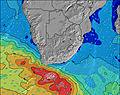 | 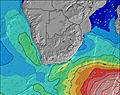 | 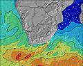 | 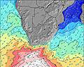 | |||||||||||||
Wave Height (m) Direction Period (s) | W 9 | WSW 16 | WSW 16 | WSW 14 | WSW 13 | WSW 13 | SW 12 | SW 11 | SW 11 | SW 10 | WSW 10 | WSW 13 | WSW 12 | WSW 11 | W 11 | SW 11 | SW 11 | SW 11 | SW 14 | SW 16 | SW 15 |
Wave Graph | |||||||||||||||||||||
108 | 302 | 817 | 1647 | 1264 | 943 | 587 | 360 | 297 | 192 | 148 | 120 | 579 | 356 | 233 | 258 | 220 | 162 | 153 | 1179 | 1466 | |
Wind (km/h) | |||||||||||||||||||||
Wind State on-shore cross-onshore cross-shore cross-offshore off-shore glassy | cross | glassy | cross-on | cross-off | cross-off | cross | cross-off | cross-off | cross | glassy | cross | glassy | cross | cross-off | cross | cross-off | cross-off | cross-on | cross | glassy | cross-on |
High Tide | 3:44AM1.71m | 4:13PM1.77m | 4:30AM1.69m | 4:56PM1.78m | 5:14AM1.62m | 5:39PM1.74m | 5:58AM1.52m | 6:21PM1.66m | 6:42AM1.41m | 7:03PM1.55m | 7:28AM1.29m | 7:48PM1.42m | 8:22AM1.19m | ||||||||
Low Tide | 9:39PM0.11m | 9:59AM0.01m | 10:26PM0.08m | 10:41AM0.03m | 11:11PM0.10m | 11:21AM0.10m | 11:56PM0.16m | 12:01PM0.20m | 00:40AM0.26m | 12:41PM0.32m | 1:25AM0.36m | 1:23PM0.45m | 2:15AM0.47m | 2:12PM0.57m | |||||||
— | 7:46 | — | — | 7:45 | — | — | 7:45 | — | — | 7:45 | — | — | 7:43 | — | — | 7:43 | — | — | 7:43 | — | |
5:58 | — | 5:59 | — | — | 5:59 | — | — | 6:00 | — | — | 6:00 | — | — | 6:00 | — | — | 6:01 | — | — | 6:01 | |
mm | — | — | — | — | — | — | — | — | — | — | — | — | — | — | — | — | — | — | — | — | — |
Temp °C | 14 | 15 | 17 | 16 | 17 | 21 | 18 | 21 | 24 | 23 | 19 | 18 | 17 | 14 | 17 | 13 | 16 | 18 | 14 | 12 | 14 |
Feels °C | 12 | 14 | 15 | 14 | 15 | 18 | 15 | 19 | 21 | 20 | 18 | 16 | 16 | 12 | 14 | 9 | 13 | 15 | 10 | 11 | 11 |
Swell 1 Height (m) Direction Period (s) | W 9 | W 9 | WSW 16 | WSW 14 | WSW 13 | WSW 13 | SW 12 | SW 11 | SW 11 | SW 10 | WSW 10 | WSW 9 | WSW 12 | WSW 11 | W 11 | SW 11 | SW 11 | SW 11 | SW 10 | SW 16 | SW 15 |
108 | 80 | 817 | 1647 | 1264 | 943 | 587 | 360 | 297 | 192 | 148 | 113 | 579 | 356 | 233 | 258 | 220 | 162 | 150 | 1179 | 1466 | |
Swell 2 Height (m) Direction Period (s) | SW 12 | WSW 16 | W 9 | — | — | — | — | — | — | SW 16 | SW 14 | WSW 13 | — | SW 12 | SW 12 | W 10 | W 10 | W 9 | SW 14 | W 9 | W 9 |
40 | 302 | 110 | — | — | — | — | — | — | 10 | 53 | 120 | — | 169 | 195 | 125 | 89 | 60 | 153 | 24 | 13 | |
Swell 3 Height (m) Direction Period (s) | WSW 18 | W 11 | — | — | — | — | — | — | — | — | W 13 | WSW 12 | — | — | — | W 18 | W 16 | W 14 | W 9 | — | — |
31 | 39 | — | — | — | — | — | — | — | — | 13 | 48 | — | — | — | 6 | 5 | 15 | 39 | — | — | |
Wind waves Height (m) Direction Period (s) | — | — | — | — | — | SW 3 | S 3 | — | — | — | — | — | — | — | SW 4 | SSE 3 | — | SW 3 | — | — | — |
— | — | — | — | — | 2 | 1 | — | — | — | — | — | — | — | 16 | 2 | — | 2 | — | — | — | |
Nearest Offshore or Glassy | |||||||||||||||||||||
Distance (km) | 2 | 0 | 2 | 0 | 0 | 55 | 0 | 0 | 2 | 0 | 52 | 0 | 2 | 55 | 55 | 0 | 0 | 55 | 2 | 0 | 52 |
Best forecast wave conditions in West Coast | |||||||||||||||||||||
Best forecast wave conditions in South Africa | |||||||||||||||||||||
Header Global | |||||||||||||||||||||
- Map Icons:
 Break
Break Live Wave Height (m)
 Live Wind Speed (km/h)
 Surf Rating (10 Max)
 Ocean Swells (m)
- Wind Speed (km/h)


FREE! Surf-Forecast.com widget for your website
The surf report / weather widget below is available to embed on third party websites free of charge and provides a summary of our Baboon Point surf forecast. Simply grab the html code snippet that we provide and paste it into your own site. You can choose your preferred language and metric/imperial units for the surf forecast feed to suit users of your site. Click here to get the code.
Information about the Baboon Point Surf forecast
The above surf forecast table for Baboon Point provides essential information for determining whether the surfing conditions will be good over the next 16 days. A general guide to surfing at Baboon Point can be found by selecting the local surf guide option on the grey menu. Our Baboon Point surf forecast is unique since it includes wave energy (power) that defines the real feel of the surf rather than just the height or the period. If you surf the same spot (Baboon Point) regularly then make a mental note of the wave energy from the surf forecast table each time you go. Very soon you may start to choose your surf days based on the wave energy alone combined with our forecast of favourable offshore wind conditions. Our star ratings will help here and of course you will also find the usual wave height and period predictions on our surf forecasts as well as a full break down of the swell components under our advanced users option (to reveal that, click the little Einstein character under the tide times).
Further information to help with frequently asked questions about our surf forecast for Baboon Point may be found under the help tab on the top menu and also by moving your mouse over the question marks on the surf forecast table itself. Please always bear in mind that the forecast is for near-shore open water and local factors at each surf break influence the actual breaking wave height, such as the beach / reef profile, water depths offshore and shelter.
Baboon Point is 84 km (52 miles) from Saldanha. If you plan a holiday in West Coast, look for hotels and other accommodation in Saldanha. Saldanha has rooms for a wide range of budgets as well as car hire and transport links.
 Nearest