

Surf Forecasts:

How big are the waves at Avana today (03 Aug):
- Morning surf: Morning surf (03 Aug, local time) - 2ft (0.6m), 13s period with SSW swell.
- Afternoon surf: Afternoon surf (03 Aug, local time) - 2.5ft (0.8m), 14s period with SSW swell.
- Evening surf: Evening surf (03 Aug, local time) - 3.5ft (1.1m), 15s period with SSW swell.
The current surf forecast for Avana at 1AM is: 0.6m 14s primary swell from a South-southwest direction and 0.7m 10s secondary swell from a South-southeast direction, 1.2m 5s secondary swell from a Northeast direction (forecast issued at 07:00pm August 02). The wind direction is predicted to be cross-shore.
| Time (-10) & Date | Wave Height | Wave Period |
|---|---|---|
| Morning (03 Aug) | 2ft (0.6m) | 13s |
| Afternoon (03 Aug) | 2.5ft (0.8m) | 14s |
| Evening (03 Aug) | 3.5ft (1.1m) | 15s |
Table - waves today at Avana. (Swell directed towards the surf break)
Short Range ForecastModerate rain (total 11mm), heaviest on Mon afternoon. Warm (max 24°C on Mon morning, min 20°C on Tue night). Winds decreasing (fresh winds from the NNW on Mon morning, light winds from the WSW by Tue night). | |||||||||||||||||||
Sun 2 | Monday 3 | Tuesday 4 | |||||||||||||||||
5 PM | 8 PM | 11 PM | 2 AM | 5 AM | 8 AM | 11 AM | 2 PM | 5 PM | 8 PM | 11 PM | 2 AM | 5 AM | 8 AM | 11 AM | 2 PM | 5 PM | 8 PM | 11 PM | |
Swell Height Map | 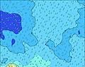 | 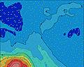 | 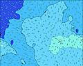 | 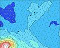 | 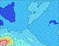 | 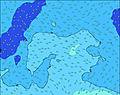 | 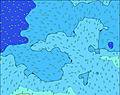 | ||||||||||||
Wave Height (m) Direction Period (s) | SSW 14 | SSW 14 | SSW 14 | SSW 13 | SSW 13 | SSW 13 | SSW 16 | SSW 16 | SSW 15 | SSW 15 | SSW 14 | SSW 13 | SSW 13 | SSW 13 | SSW 13 | SW 12 | SW 12 | SSW 12 | SSW 12 |
Wave Graph | |||||||||||||||||||
175 | 180 | 136 | 116 | 114 | 116 | 147 | 223 | 522 | 411 | 822 | 768 | 745 | 690 | 596 | 864 | 918 | 952 | 850 | |
Wind (km/h) | |||||||||||||||||||
Wind State on-shore cross-onshore cross-shore cross-offshore off-shore glassy | cross-on | cross-on | cross-on | cross | cross | cross-off | cross-off | cross-off | off | off | cross-off | off | cross-off | cross-off | cross-off | cross-off | cross-off | cross-off | cross-off |
High Tide | 11:43PM0.50m | 12:03PM0.48m | 00:36AM0.50m | 1:01PM0.43m | |||||||||||||||
Low Tide | 5:04PM0.01m | 5:30AM0.06m | 5:52PM0.04m | 6:34AM0.08m | 6:52PM0.07m | ||||||||||||||
— | — | — | — | 7:09 | — | — | — | — | — | — | — | 7:07 | — | — | — | — | — | — | |
6:20 | — | — | — | — | — | — | — | 6:20 | — | — | — | — | — | — | — | 6:21 | — | — | |
mm | — | — | — | — | 1 | 1 | 1 | 2 | 2 | 1 | 1 | 1 | — | — | — | — | — | — | — |
Temp °C | 23 | 23 | 23 | 23 | 23 | 24 | 24 | 24 | 24 | 23 | 22 | 22 | 22 | 22 | 21 | 21 | 21 | 21 | 20 |
Feels °C | 21 | 21 | 22 | 21 | 21 | 22 | 21 | 21 | 22 | 22 | 22 | 23 | 22 | 22 | 21 | 20 | 20 | 20 | 20 |
Swell 1 Height (m) Direction Period (s) | SSW 14 | SSW 14 | SSE 9 | SSE 10 | SSE 10 | SSW 13 | SSW 13 | SSW 13 | SSW 15 | SSW 15 | SSW 14 | SSW 13 | SSW 13 | SSW 13 | SSW 13 | SW 12 | SW 12 | SSW 12 | SSW 12 |
175 | 180 | 65 | 90 | 65 | 116 | 114 | 154 | 522 | 411 | 822 | 768 | 745 | 690 | 596 | 864 | 918 | 952 | 850 | |
Swell 2 Height (m) Direction Period (s) | SSE 9 | SSE 9 | SSW 14 | SSW 13 | SSW 13 | SSE 10 | SSW 16 | SSW 16 | NE 6 | NE 6 | WNW 6 | W 6 | W 6 | WSW 6 | NE 7 | NNE 6 | NE 6 | SSW 19 | SSW 19 |
53 | 53 | 136 | 116 | 114 | 64 | 147 | 223 | 78 | 66 | 84 | 62 | 50 | 55 | 52 | 24 | 19 | 332 | 251 | |
Swell 3 Height (m) Direction Period (s) | SSE 11 | SE 11 | ESE 7 | ESE 6 | ESE 7 | ESE 7 | SE 9 | SSE 9 | SE 10 | SSW 13 | NE 6 | NE 6 | NNE 6 | NE 6 | WSW 13 | WSW 12 | WSW 12 | NNE 6 | NE 8 |
79 | 42 | 25 | 16 | 26 | 16 | 43 | 34 | 23 | 249 | 58 | 66 | 47 | 39 | 64 | 83 | 56 | 25 | 33 | |
Wind waves Height (m) Direction Period (s) | E 6 | ENE 6 | NE 8 | NE 5 | NNE 5 | NNE 5 | NNE 5 | N 6 | NW 6 | WNW 6 | — | WSW 6 | — | — | WSW 5 | — | — | — | — |
68 | 70 | 129 | 65 | 77 | 103 | 113 | 178 | 141 | 115 | — | 45 | — | — | 42 | — | — | — | — | |
Nearest Offshore or Glassy | |||||||||||||||||||
Distance (km) | 7 | 1043 | 999 | 999 | 999 | 994 | 994 | 994 | 994 | 994 | 2 | 0 | 0 | 2 | 2 | 2 | 2 | 0 | 0 |
Best forecast wave conditions in Cook-Islands - Rarotonga | |||||||||||||||||||
Best forecast wave conditions in Cook Islands | |||||||||||||||||||
Header Global | |||||||||||||||||||
- Map Icons:
 Break
Break Live Wave Height (m)
 Live Wind Speed (km/h)
 Surf Rating (10 Max)
 Ocean Swells (m)
- Wind Speed (km/h)
Latest Updates


FREE! Surf-Forecast.com widget for your website
The surf report / weather widget below is available to embed on third party websites free of charge and provides a summary of our Avana surf forecast. Simply grab the html code snippet that we provide and paste it into your own site. You can choose your preferred language and metric/imperial units for the surf forecast feed to suit users of your site. Click here to get the code.
 Nearest