
Surf Forecasts:

Alabama Point surf forecast from 2 Aug 2026:
- Best quality surf: Monday 3 Aug, 1AM (local time) - 3.5ft (1.1m), 5s period, SW swell with offshore winds.
- Most powerful swell: Monday 3 Aug, 1AM (local time) - 3.5ft (1.1m), 5s period, SW swell with 65 kJ wave energy.
- Next surfable swell (1★+): Monday 3 Aug, 1AM (local time) - 3.5ft (1.1m), 5s period with SW swell.
Best Forecast Surf Conditions for Alabama Point this week:
The surf forecast for Alabama Point over the next 16 days: The first swell (rated 1 star or higher) is forecast to arrive on Monday (Aug 03) at 1AM. The primary swell is predicted to be 1.1m and 5s period with a secondary swell of 0.6m and 5s. Another secondary swell of 0.1m and 9s is also forecast. The wind is predicted to be offshore as the swell arrives.
The most powerful waves expected at Alabama Point in the next 16 days are 1.1m 5s and forecast to arrive on Monday (Aug 03) at 1AM. Winds are predicted to be offshore at the time the swell arrives. The largest open ocean swell (not directed at the beach) is 0.3m 2s period and expected on Monday (Aug 03) at 4PM.
| Wave Type | Time (CDT) & Date | Wave Height & Period |
|---|---|---|
| Next good surf (1 star+) | 1AM (Mon 3rd Aug) | 3.5ft (1.1m) 5s |
| Best Surf | 1AM (Mon 3rd Aug) | 3.5ft (1.1m) 5s |
| Most Powerful | 1AM (Mon 3rd Aug) | 3.5ft (1.1m) 5s |
Table - best surf conditions forecast for Alabama Point over the next 16 days.
The Lowdown
Alright, Rusty here, and I gotta be straight with you – the next couple of weeks are looking pretty grim for the waves around here. We’ve got a long stretch of small, weak, and messy surf on the cards. The first real window of anything worth getting wet for is a long way off.
The whole 16-day forecast is a bit of a write-off for decent waves. The best we can see is a tiny window of clean conditions on the morning of Saturday, August 15th, but even then the swell is tiny. For the most part, we’re looking at a flat spell with onshore or cross-shore winds messing up what little bump there is. There’s a gap of poor surf that runs from the start of the period all the way until that Saturday morning, so it’s a long wait.
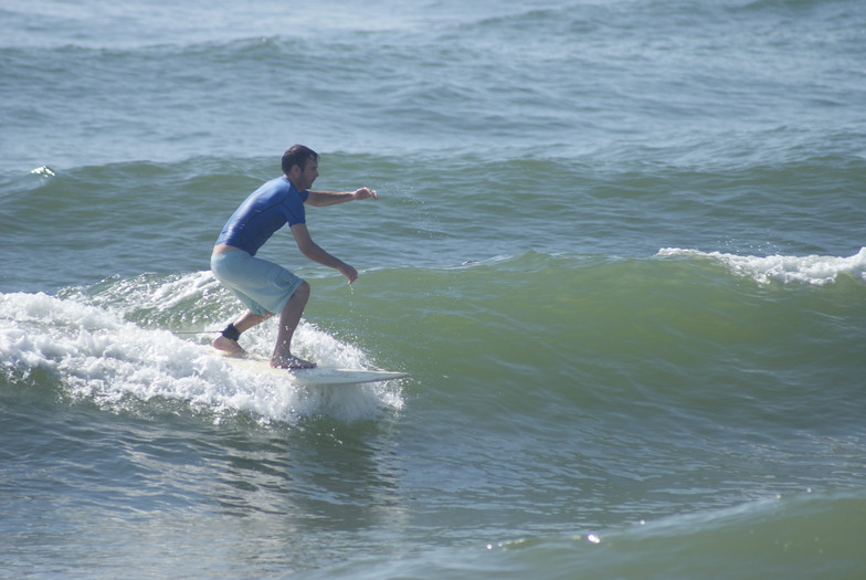
Let’s break it down by the only break in the area: Alabama Point.
The water temp is sitting at a warm 86°F, which is a touch above the long-term average for this time of year – nothing crazy, but it’s a nice bit of warmth if you do decide to get in.
The first few days, from Sunday, August 2nd right through to the middle of the month, are all “poor surf conditions.” The combined wave energy is weak, barely cracking 54 on the Sunday. Swells are tiny, mostly under 3 ft, coming from the SW and S with short periods around 4 to 6 seconds. Winds are mostly cross or onshore, with a fresh breeze on Sunday kicking up lumpy chop. Not a single day is worth paddling for.
We get a bit of a tease on the morning of Friday, August 14th, with a light offshore wind from the NNW, but the swell is only 0.7 ft – that’s just a ripple. It’s clean, but there’s nothing to ride.
The one standout, and I mean the *only* one, is the morning of Saturday, August 15th. For a few hours, we get a glassy, clean surface with a light NNE wind. The swell is a tiny 2 ft from the SE, with a period of just 4 seconds. It’s not going to be any kind of epic session, but it’s the only time in the whole forecast where the conditions are even close to surfable. The energy is a low 9, so don’t expect much push. Because it’s a beach break with hardly any power, this could be a spot for a beginner to have a splash on a foamie, but even then, it’s slim pickings.
After that, it’s right back to poor, onshore slop for the rest of the period. The afternoon of the 16th has a tiny bump from the S with a longer period of 10 seconds, but it’s only 0.3 ft and cross-shore winds – not worth a look.
Honestly, if you’ve got a kite, this setup might be more interesting than trying to paddle. The onshore winds and lack of any real swell mean the paddle surfing is a no-go. Keep an eye on the forecasts, but this one’s a bummer.
Rusty.
Short Range ForecastModerate rain (total 10mm), heaviest on Sun afternoon. Warm (max 30°C on Mon morning, min 25°C on Sun night). Winds decreasing (fresh winds from the WSW on Sun morning, calm by Mon night). | Days 4-6 Weather SummaryLight rain (total 3mm), mostly falling on Fri morning. Warm (max 29°C on Wed morning, min 28°C on Wed night). Wind will be generally light. | ||||||||||||||||||||
Sunday 2 | Monday 3 | Tuesday 4 | Wednesday 5 | Thursday 6 | Friday 7 | Saturday 8 | |||||||||||||||
AM | PM | Night | AM | PM | Night | AM | PM | Night | AM | PM | Night | AM | PM | Night | AM | PM | Night | AM | PM | Night | |
Swell Height Map |  |  |  |  |  |  |  | ||||||||||||||
Wave Height (m) Direction Period (s) | SW 6 | SW 6 | SW 5 | SW 5 | S 5 | SSW 5 | SW 4 | SW 4 | SSW 4 | SSW 4 | SSW 4 | S 6 | S 5 | — | S 6 | SSE 5 | SE 5 | SE 6 | SE 6 | SE 6 | SE 6 |
Wave Graph | |||||||||||||||||||||
52 | 44 | 65 | 7 | 8 | 15 | 11 | 7 | 5 | 3 | 2 | 1 | 1 | 0 | 2 | 5 | 8 | 9 | 11 | 8 | 8 | |
Wind (km/h) | |||||||||||||||||||||
Wind State on-shore cross-onshore cross-shore cross-offshore off-shore glassy | cross | cross | off | cross-off | cross-on | glassy | cross-on | cross-on | cross | cross-on | cross-on | on | on | on | cross-on | cross-on | on | cross-on | cross-on | on | cross |
High Tide | 11:34AM0.19m | 00:35AM0.15m | 11:00AM0.13m | 3:41PM0.12m | 1:26AM0.20m | 10:34AM0.09m | 5:05PM0.07m | 2:15AM0.26m | 3:04AM0.30m | 3:58AM0.33m | 5:05AM0.35m | ||||||||||
Low Tide | 6:57PM0.07m | 1:42AM0.14m | 7:06AM0.09m | 2:34PM0.12m | 3:13AM0.20m | 9:22AM0.08m | 3:09PM0.06m | 3:49PM-0.00m | 4:31PM-0.05m | 5:13PM-0.09m | 6:25AM0.35m | 5:54PM-0.12m | |||||||||
6:09 | — | — | 6:09 | — | — | 6:09 | — | — | 6:09 | — | — | 6:11 | — | — | 6:11 | — | — | 6:11 | — | — | |
— | 7:43 | — | — | 7:42 | — | — | 7:42 | — | — | 7:40 | — | — | 7:39 | — | — | 7:38 | — | — | 7:37 | — | |
mm | 4 | 5 | 1 | — | — | — | — | — | — | — | — | — | — | — | — | 2 | — | 1 | — | — | 1 |
Temp °C | 29 | 29 | 29 | 30 | 30 | 29 | 30 | 30 | 29 | 29 | 29 | 28 | 28 | 28 | 28 | 29 | 29 | 29 | 28 | 29 | 29 |
Feels °C | 28 | 28 | 30 | 30 | 29 | 31 | 33 | 30 | 30 | 31 | 31 | 30 | 32 | 29 | 31 | 30 | 30 | 32 | 31 | 30 | 32 |
Swell 1 Height (m) Direction Period (s) | S 11 | S 10 | SW 5 | SW 5 | S 5 | SSW 5 | SSW 4 | S 5 | S 4 | SSW 4 | SE 4 | — | S 5 | — | S 6 | SSE 5 | S 7 | SE 6 | SE 6 | SE 6 | SE 6 |
2 | 2 | 23 | 7 | 8 | 7 | 7 | 1 | 1 | 3 | 1 | — | 1 | — | 2 | 5 | 1 | 9 | 11 | 8 | 8 | |
Swell 2 Height (m) Direction Period (s) | — | — | S 9 | SSE 6 | SSW 5 | — | — | — | — | — | — | SE 4 | — | — | — | SE 4 | SE 7 | — | — | — | — |
— | — | 2 | 6 | 2 | — | — | — | — | — | — | 1 | — | — | — | 1 | 2 | — | — | — | — | |
Swell 3 Height (m) Direction Period (s) | — | — | — | — | S 9 | — | — | — | — | — | — | S 6 | — | — | S 6 | S 8 | — | — | — | — | — |
— | — | — | — | 2 | — | — | — | — | — | — | 1 | — | — | 1 | 1 | — | — | — | — | — | |
Wind waves Height (m) Direction Period (s) | SW 6 | SW 6 | SW 5 | — | WSW 2 | SSW 5 | SW 4 | SW 4 | SSW 4 | — | SSW 4 | — | — | — | — | — | SE 5 | — | — | — | — |
52 | 44 | 65 | — | 1 | 15 | 11 | 7 | 5 | — | 2 | — | — | — | — | — | 8 | — | — | — | — | |
Nearest Offshore or Glassy | |||||||||||||||||||||
Distance (km) | 736 | 736 | 0 | 593 | 591 | 592 | 591 | 1300 | 591 | 592 | 1000 | 592 | 592 | 1776 | 1669 | 1002 | 1185 | 1185 | 864 | 1185 | 594 |
Best forecast wave conditions in Alabama | |||||||||||||||||||||
Best forecast wave conditions in United States | |||||||||||||||||||||
Header Global | |||||||||||||||||||||
- Map Icons:
 Break
Break Live Wave Height (m)
 Live Wind Speed (km/h)
 Surf Rating (10 Max)
 Ocean Swells (m)
- Wind Speed (km/h)
Latest Updates


FREE! Surf-Forecast.com widget for your website
The surf report / weather widget below is available to embed on third party websites free of charge and provides a summary of our Alabama Point surf forecast. Simply grab the html code snippet that we provide and paste it into your own site. You can choose your preferred language and metric/imperial units for the surf forecast feed to suit users of your site. Click here to get the code.
Information about the Alabama Point Surf forecast
The above surf forecast table for Alabama Point provides essential information for determining whether the surfing conditions will be good over the next 16 days. A general guide to surfing at Alabama Point can be found by selecting the local surf guide option on the grey menu. Our Alabama Point surf forecast is unique since it includes wave energy (power) that defines the real feel of the surf rather than just the height or the period. If you surf the same spot (Alabama Point) regularly then make a mental note of the wave energy from the surf forecast table each time you go. Very soon you may start to choose your surf days based on the wave energy alone combined with our forecast of favourable offshore wind conditions. Our star ratings will help here and of course you will also find the usual wave height and period predictions on our surf forecasts as well as a full break down of the swell components under our advanced users option (to reveal that, click the little Einstein character under the tide times).
Further information to help with frequently asked questions about our surf forecast for Alabama Point may be found under the help tab on the top menu and also by moving your mouse over the question marks on the surf forecast table itself. Please always bear in mind that the forecast is for near-shore open water and local factors at each surf break influence the actual breaking wave height, such as the beach / reef profile, water depths offshore and shelter.
Alabama Point is 29 km (18 miles) from Myrtle Grove. If you plan a vacation in Alabama, look for hotels and other accommodation in Myrtle Grove. Myrtle Grove has rooms for a wide range of budgets as well as car hire and transport links.
 Nearest