

Surf Forecasts:

How big are the waves at Summerville today (19 Jun):
- Morning surf: Morning surf (19 Jun, local time) - 6ft (1.8m), 7s period with SSW swell.
- Afternoon surf: Afternoon surf (19 Jun, local time) - 5.5ft (1.7m), 8s period with SSW swell.
- Evening surf: Evening surf (19 Jun, local time) - 6ft (1.9m), 8s period with SSW swell.
The current surf forecast for Summerville at 5PM is: 1.7m 8s primary swell from a South-southwest direction and 0.1m 13s secondary swell from a Southeast direction, 0.1m 10s secondary swell from a East direction (forecast issued at 08:00am June 19). The wind direction is predicted to be cross-offshore.
| Time (ADT) & Date | Wave Height | Wave Period |
|---|---|---|
| Morning (19 Jun) | 6ft (1.8m) | 7s |
| Afternoon (19 Jun) | 5.5ft (1.7m) | 8s |
| Evening (19 Jun) | 6ft (1.9m) | 8s |
Table - waves today at Summerville. (Swell directed towards the surf break)
Updates in hr min s Forecast update imminent
Short Range ForecastMostly dry. Warm (max 20°C on Fri morning, min 10°C on Sat night). Winds decreasing (fresh winds from the WSW on Fri afternoon, calm by Sun night). | ||||||||||||||||||||||||
Friday 19 | Saturday 20 | Sunday 21 | Mon 22 | |||||||||||||||||||||
6 AM | 9 AM | 12 PM | 3 PM | 6 PM | 9 PM | 12 AM | 3 AM | 6 AM | 9 AM | 12 PM | 3 PM | 6 PM | 9 PM | 12 AM | 3 AM | 6 AM | 9 AM | 12 PM | 3 PM | 6 PM | 9 PM | 12 AM | 3 AM | |
Swell Height Map | 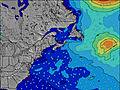 | 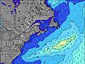 | 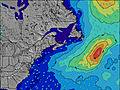 | 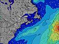 | 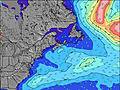 | 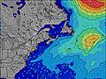 | 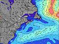 | 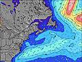 | 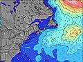 | |||||||||||||||
Wave Height (m) Direction Period (s) | SSW 7 | SSW 7 | S 8 | SSW 8 | SSW 8 | SSW 8 | SSW 8 | SSW 8 | SSW 8 | SSW 8 | SSW 8 | SSW 9 | SW 8 | SSW 8 | SSW 8 | SSW 8 | SSW 8 | SSW 8 | SSW 8 | SSW 8 | SSW 8 | SSW 8 | SSW 8 | SSW 8 |
Wave Graph | ||||||||||||||||||||||||
308 | 355 | 294 | 327 | 344 | 476 | 465 | 477 | 412 | 400 | 290 | 316 | 571 | 234 | 190 | 160 | 122 | 103 | 151 | 151 | 122 | 96 | 87 | 63 | |
Wind (km/h) | ||||||||||||||||||||||||
Wind State on-shore cross-onshore cross-shore cross-offshore off-shore glassy | cross | cross-off | cross-off | cross-off | cross-off | cross | cross-off | cross | cross | cross-off | cross-off | cross-off | cross-off | cross-off | cross-off | cross-off | cross-off | off | cross-off | cross-off | off | glassy | glassy | glassy |
High Tide | 1:00PM1.82m | 00:58AM1.91m | 1:54PM1.79m | 1:54AM1.79m | 2:47PM1.77m | 2:53AM1.67m | ||||||||||||||||||
Low Tide | 6:50AM0.22m | 7:09PM0.63m | 7:45AM0.31m | 8:14PM0.65m | 8:40AM0.40m | 9:17PM0.65m | ||||||||||||||||||
5:35 | — | — | — | — | — | — | 5:35 | — | — | — | — | — | — | — | 5:35 | — | — | — | — | — | — | — | 5:35 | |
— | — | — | — | — | 9:04 | — | — | — | — | — | — | — | 9:05 | — | — | — | — | — | — | — | 9:05 | — | 9:05 | |
mm | — | — | — | — | — | — | — | — | — | — | — | — | — | — | — | — | — | — | — | — | — | — | — | — |
Temp °C | 15 | 16 | 20 | 20 | 20 | 16 | 14 | 12 | 12 | 16 | 16 | 17 | 15 | 14 | 13 | 12 | 10 | 15 | 18 | 18 | 17 | 15 | 15 | 14 |
Feels °C | 13 | 14 | 16 | 15 | 16 | 13 | 11 | 10 | 10 | 12 | 11 | 11 | 10 | 10 | 10 | 9 | 7 | 11 | 15 | 15 | 15 | 14 | 14 | 13 |
Swell 1 Height (m) Direction Period (s) | S 7 | S 7 | SE 13 | SE 13 | SE 13 | SSW 8 | SSW 8 | SSW 8 | SSW 8 | SSW 8 | SE 13 | SE 12 | SSW 8 | SSW 8 | SSW 8 | SSW 8 | SSW 8 | SSW 8 | SSW 8 | SSW 8 | SSW 8 | SSW 8 | SSW 8 | SSW 8 |
225 | 247 | 7 | 7 | 7 | 310 | 280 | 286 | 250 | 221 | 7 | 6 | 294 | 234 | 190 | 160 | 122 | 103 | 151 | 151 | 122 | 96 | 87 | 63 | |
Swell 2 Height (m) Direction Period (s) | E 6 | SE 13 | E 10 | E 10 | E 9 | SE 13 | SE 13 | SE 13 | SE 13 | SE 13 | E 7 | E 6 | SE 12 | SE 12 | SE 12 | S 11 | S 11 | S 10 | SE 12 | SE 12 | SE 12 | SE 12 | E 8 | E 7 |
3 | 7 | 2 | 2 | 2 | 7 | 7 | 7 | 7 | 7 | 1 | 1 | 6 | 6 | 6 | 10 | 37 | 75 | 6 | 6 | 6 | 6 | 1 | 1 | |
Swell 3 Height (m) Direction Period (s) | S 9 | E 10 | E 10 | — | — | E 9 | E 7 | E 6 | E 6 | E 6 | E 9 | E 9 | E 7 | — | — | SE 12 | SE 12 | SE 12 | E 8 | E 8 | E 8 | E 8 | SE 12 | SE 12 |
6 | 2 | 2 | — | — | 2 | 1 | 1 | 1 | 1 | 2 | 2 | 1 | — | — | 6 | 6 | 6 | 1 | 1 | 1 | 1 | 6 | 5 | |
Wind waves Height (m) Direction Period (s) | SSW 7 | SSW 7 | S 8 | SSW 8 | SSW 8 | SSW 8 | SSW 8 | SSW 8 | SSW 8 | SSW 8 | SSW 8 | SSW 9 | SW 8 | W 3 | WNW 3 | W 3 | W 3 | — | — | — | — | — | — | — |
308 | 355 | 294 | 327 | 344 | 476 | 465 | 477 | 412 | 400 | 290 | 316 | 571 | 5 | 3 | 1 | 1 | — | — | — | — | — | — | — | |
Nearest Offshore or Glassy | ||||||||||||||||||||||||
Distance (km) | 475 | 478 | 460 | 474 | 460 | 460 | 460 | 460 | 134 | 861 | 611 | 611 | 611 | 37 | 575 | 134 | 0 | 0 | 0 | 0 | 0 | 0 | 0 | 0 |
Best forecast wave conditions in Nova Scotia | ||||||||||||||||||||||||
Best forecast wave conditions in Canada | ||||||||||||||||||||||||
Header Global | ||||||||||||||||||||||||
- Map Icons:
 Break
Break Live Wave Height (m)
 Live Wind Speed (km/h)
 Surf Rating (10 Max)
 Ocean Swells (m)
- Wind Speed (km/h)


FREE! Surf-Forecast.com widget for your website
The surf report / weather widget below is available to embed on third party websites free of charge and provides a summary of our Summerville surf forecast. Simply grab the html code snippet that we provide and paste it into your own site. You can choose your preferred language and metric/imperial units for the surf forecast feed to suit users of your site. Click here to get the code.
 Nearest