

Surf Forecasts:

Sopelana surf forecast from 8 Jul 2026:
- Best quality surf: Wednesday 8 Jul, 11PM (local time) - 1.5ft (0.4m), 11s period, NW swell with glassy winds.
- Most powerful swell: Sunday 12 Jul, 8PM (local time) - 3.5ft (1.1m), 9s period, NW swell with 178 kJ wave energy.
- Next surfable swell (1★+): Wednesday 8 Jul, 11PM (local time) - 1.5ft (0.4m), 11s period with NW swell.
Best Forecast Surf Conditions for Sopelana this week:
The surf forecast for Sopelana over the next 16 days: The first swell (rated 1 star or higher) is forecast to arrive on Wednesday (Jul 08) at 11PM. The primary swell is predicted to be 0.4m and 11s period with a secondary swell of 0.4m and 4s. The wind is predicted to be glassy as the swell arrives.
The most powerful waves expected at Sopelana in the next 16 days are 1.1m 9s and forecast to arrive on Sunday (Jul 12) at 8PM. Winds are predicted to be onshore at the time the swell arrives.
| Wave Type | Time (CEST) & Date | Wave Height & Period |
|---|---|---|
| Next good surf (1 star+) | 11PM (Wed 8th Jul) | 1.5ft (0.4m) 11s |
| Best Surf | 11PM (Wed 8th Jul) | 1.5ft (0.4m) 11s |
| Most Powerful | 8PM (Sun 12th Jul) | 3.5ft (1.1m) 9s |
Table - best surf conditions forecast for Sopelana over the next 16 days.
Right, let’s have a look at what’s on the cards here. Honestly, for the next week or so, it’s pretty grim. We’re looking at a long stretch of tiny, weak swell and wonky wind. The first real glimmer of something worth paddling out for doesn’t show up until Saturday morning the 11th, and even then it’s just barely surfable with a bit of a clean look.
That Saturday morning, the 11th, we get a little pulse from the NNW at 1ft and a period of 12 seconds. That’s a proper groundswell, so it’ll have some shape, and with the ENE cross-offshore breeze it’ll be clean. The combined energy is weak though, only 89. It’s better than the rubbish we’ve had, but don’t expect much.
Sunday the 12th morning is worth a mention – glassy conditions with the wind dead calm, and 2ft from the NW at 10 seconds. It’ll be pretty, but the energy is still low at 64. A longboarder’s dream, maybe.
Then Monday the 13th morning, it’s glassy again with a bit of WNW swell at 3ft, but the period is a short 7 seconds, so it’ll be a bit crumbly and weak.
Now, the real standout in this entire forecast is Thursday the 23rd of July. That morning, we’re looking at clean glassy conditions, a solid 8ft of swell from the NW, with a moderate energy of 682. The file says the wind is calm and it’s clear. That’s a big swell, over 8ft, so this is strictly for experienced surfers only. The size and the clean conditions will mean some proper, chunky walls at Sopelana. It’s a long way out, so treat this as a promising but uncertain call, but if it comes together, it’ll be the day to clear your schedule.
Water temp is about average for the time of year, so nothing wild to report there except maybe a slight relief from the summer heat.
Over the whole period, it’s mostly poor conditions with onshore wind or tiny swell. The 23rd is the one true highlight. Before that, you’re hunting for scraps on the clean, glassy mornings, but it’s going to be small.
Rusty
Short Range ForecastSome drizzle, heaviest during Thu night. Warm (max 25°C on Thu afternoon, min 19°C on Tue night). Wind will be generally light. | Days 5-7 Weather SummaryMostly dry. Warm (max 29°C on Sun morning, min 18°C on Mon morning). Wind will be generally light. | ||||||||||||||||||||
Wednesday 8 | Thursday 9 | Friday 10 | Saturday 11 | Sunday 12 | Monday 13 | Tue 14 | |||||||||||||||
Night | AM | PM | Night | AM | PM | Night | AM | PM | Night | AM | PM | Night | AM | PM | Night | AM | PM | Night | AM | PM | |
Swell Height Map |  |  |  |  |  |  |  | 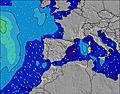 | |||||||||||||
Wave Height (m) Direction Period (s) | NW 5 | NW 10 | NW 10 | NW 10 | NW 10 | NW 9 | NW 9 | NW 9 | NW 10 | WNW 9 | NNW 12 | NW 11 | NW 10 | NW 10 | NW 9 | WNW 5 | WNW 7 | WNW 7 | NNW 6 | NW 8 | N 4 |
Wave Graph | |||||||||||||||||||||
23 | 17 | 16 | 54 | 76 | 55 | 54 | 41 | 74 | 52 | 55 | 59 | 98 | 57 | 132 | 47 | 64 | 31 | 13 | 9 | 6 | |
Wind (km/h) | |||||||||||||||||||||
Wind State on-shore cross-onshore cross-shore cross-offshore off-shore glassy | cross-on | on | cross-on | glassy | cross | cross | on | on | on | cross-off | cross-off | cross | glassy | glassy | on | cross-on | glassy | cross-on | glassy | on | on |
High Tide | 10:28PM3.14m | 11:05AM2.95m | 11:30PM3.07m | 12:12PM2.96m | 00:42AM3.06m | 1:23PM3.06m | 1:58AM3.13m | 2:33PM3.24m | 3:07AM3.29m | 3:35PM3.47m | 4:09AM3.47m | 4:32PM3.72m | 5:04AM3.63m | 5:24PM3.93m | |||||||
Low Tide | 4:50AM0.80m | 5:13PM0.95m | 5:52AM0.85m | 6:22PM0.94m | 7:01AM0.83m | 7:35PM0.83m | 8:09AM0.74m | 8:44PM0.63m | 9:12AM0.59m | 9:46PM0.38m | 10:09AM0.41m | 10:43PM0.15m | 11:02AM0.24m | ||||||||
— | 6:39 | — | — | 6:39 | — | — | 6:39 | — | — | 6:41 | — | — | 6:41 | — | — | 6:41 | — | — | 6:43 | — | |
9:53 | — | — | 9:53 | — | — | 9:53 | — | — | 9:52 | — | — | 9:52 | — | — | 9:52 | — | — | 9:52 | — | 9:51 | |
mm | — | — | — | — | — | — | 1 | — | — | — | — | — | — | — | — | — | — | — | — | — | — |
Temp °C | 23 | 22 | 23 | 21 | 24 | 25 | 24 | 24 | 25 | 24 | 25 | 26 | 26 | 29 | 28 | 23 | 23 | 24 | 22 | 23 | 23 |
Feels °C | 23 | 23 | 24 | 22 | 26 | 26 | 26 | 26 | 26 | 24 | 26 | 26 | 29 | 30 | 30 | 23 | 25 | 24 | 24 | 25 | 23 |
Swell 1 Height (m) Direction Period (s) | NW 5 | WNW 8 | NW 4 | NW 10 | NW 10 | NW 9 | NW 9 | NW 9 | NW 10 | WNW 9 | WNW 8 | NW 11 | NW 10 | NW 10 | — | N 6 | WNW 7 | WNW 7 | NNW 6 | NNW 5 | N 4 |
23 | 6 | 9 | 54 | 76 | 55 | 54 | 41 | 74 | 52 | 27 | 59 | 98 | 57 | — | 20 | 64 | 31 | 13 | 5 | 6 | |
Swell 2 Height (m) Direction Period (s) | NW 8 | NW 10 | NW 10 | NW 4 | N 4 | NW 6 | WNW 5 | NW 5 | NW 5 | NNW 6 | NNW 12 | NW 8 | N 5 | NNE 5 | — | NW 9 | N 5 | NW 8 | NW 8 | WNW 5 | WNW 4 |
10 | 17 | 16 | 4 | 1 | 5 | 3 | 13 | 6 | 14 | 55 | 33 | 15 | 7 | — | 27 | 8 | 11 | 10 | 2 | 2 | |
Swell 3 Height (m) Direction Period (s) | NW 11 | W 8 | WNW 7 | — | — | — | — | NE 4 | NNE 4 | NNW 13 | NW 5 | N 5 | NW 6 | — | — | — | NW 9 | N 6 | N 10 | NW 8 | NW 12 |
5 | 1 | 5 | — | — | — | — | 1 | 2 | 17 | 7 | 8 | 1 | — | — | — | 12 | 1 | 2 | 9 | 6 | |
Wind waves Height (m) Direction Period (s) | — | WNW 5 | — | — | — | — | WNW 2 | — | — | — | — | NNE 5 | — | — | NW 9 | WNW 5 | — | N 5 | NW 5 | — | — |
— | 14 | — | — | — | — | 1 | — | — | — | — | 11 | — | — | 132 | 47 | — | 4 | 7 | — | — | |
Nearest Offshore or Glassy | |||||||||||||||||||||
Distance (km) | 27 | 437 | 499 | 0 | 25 | 25 | 60 | 60 | 25 | 0 | 0 | 2 | 0 | 0 | 227 | 68 | 0 | 86 | 215 | 294 | 471 |
Best forecast wave conditions in Pais Vasco | |||||||||||||||||||||
Best forecast wave conditions in Spain (Europe) | |||||||||||||||||||||
Header Global | |||||||||||||||||||||
- Map Icons:
 Break
Break Live Wave Height (m)
 Live Wind Speed (km/h)
 Surf Rating (10 Max)
 Ocean Swells (m)
- Wind Speed (km/h)


FREE! Surf-Forecast.com widget for your website
The surf report / weather widget below is available to embed on third party websites free of charge and provides a summary of our Sopelana surf forecast. Simply grab the html code snippet that we provide and paste it into your own site. You can choose your preferred language and metric/imperial units for the surf forecast feed to suit users of your site. Click here to get the code.
Information about the Sopelana Surf forecast
The above surf forecast table for Sopelana provides essential information for determining whether the surfing conditions will be good over the next 16 days. A general guide to surfing at Sopelana can be found by selecting the local surf guide option on the grey menu. Our Sopelana surf forecast is unique since it includes wave energy (power) that defines the real feel of the surf rather than just the height or the period. If you surf the same spot (Sopelana) regularly then make a mental note of the wave energy from the surf forecast table each time you go. Very soon you may start to choose your surf days based on the wave energy alone combined with our forecast of favourable offshore wind conditions. Our star ratings will help here and of course you will also find the usual wave height and period predictions on our surf forecasts as well as a full break down of the swell components under our advanced users option (to reveal that, click the little Einstein character under the tide times).
Further information to help with frequently asked questions about our surf forecast for Sopelana may be found under the help tab on the top menu and also by moving your mouse over the question marks on the surf forecast table itself. Please always bear in mind that the forecast is for near-shore open water and local factors at each surf break influence the actual breaking wave height, such as the beach / reef profile, water depths offshore and shelter.
Sopelana is 4 km (2 miles) from the city of Getxo. If you plan a holiday in Pais Vasco, look for hotels and other accommodation in Getxo. Getxo has rooms for a wide range of budgets as well as car hire and transport links.
 Nearest