

Surf Forecasts:

711 surf forecast from 29 Jul 2026:
- Best quality surf: Wednesday 29 Jul, 5AM (local time) - 5ft (1.6m), 6s period, SSE swell with cross-offshore winds.
- Most powerful swell: Wednesday 29 Jul, 5AM (local time) - 5ft (1.6m), 6s period, SSE swell with 190 kJ wave energy.
- Next surfable swell (1★+): Wednesday 29 Jul, 5AM (local time) - 5ft (1.6m), 6s period with SSE swell.
Best Forecast Surf Conditions for 711 this week:
The surf forecast for 711 over the next 16 days: The first swell (rated 1 star or higher) is forecast to arrive on Wednesday (Jul 29) at 5AM. The primary swell is predicted to be 1.6m and 6s period with a secondary swell of 1.2m and 6s. Another secondary swell of 0.1m and 6s is also forecast. The wind is predicted to be cross-offshore as the swell arrives.
The most powerful waves expected at 711 in the next 16 days are 1.6m 6s and forecast to arrive on Wednesday (Jul 29) at 5AM. Winds are predicted to be cross-offshore at the time the swell arrives. The largest open ocean swell (not directed at the beach) is 0.4m 3s period and expected on Thursday (Jul 30) at 2AM.
| Wave Type | Time (EDT) & Date | Wave Height & Period |
|---|---|---|
| Next good surf (1 star+) | 5AM (Wed 29th Jul) | 5ft (1.6m) 6s |
| Best Surf | 5AM (Wed 29th Jul) | 5ft (1.6m) 6s |
| Most Powerful | 5AM (Wed 29th Jul) | 5ft (1.6m) 6s |
Table - best surf conditions forecast for 711 over the next 16 days.
The Lowdown
Alright folks, Rusty here. Let's have a look at what's on the cards for our local stretch.
Honestly, it’s a tough run ahead. We’ve got a long gap of flat, poor conditions staring us down. The first sniff of anything rideable doesn't pop up until Wednesday the 29th of July, and even then, it's a pretty grim start. The whole period is a struggle.
The only real window of interest comes right at the end of the forecast. Tuesday the 11th of August is your best bet. The morning at 711 sees a small 2ft swell from the east (7 second period) with a light offshore breeze from the northwest. The combined energy is weak at 56, but it’s clean. Then Tuesday afternoon is the real standout: the wind goes glassy, dead calm, and the swell holds at 2ft from the east. That’s a rare, clean window in a very bleak outlook. The water temp is about average for this time of year.
Wednesday the 12th of August afternoon offers a tiny bit of hope with a 2ft east swell and a clean offshore wind from the WNW. The combined energy is only 60, so it’s small and weak, but it’s surfable.
The rest of the 16-day window is a write-off. We’re talking day after day of poor surf conditions, tiny swell, and messy wind. It’s a long stretch of flatness, so don't hold your breath. Keep the board waxed and wait for the next system.
Stay patient,
Rusty
Short Range ForecastHeavy rain (total 30mm), heaviest during Tue night. Warm (max 26°C on Wed afternoon, min 19°C on Thu night). Wind will be generally light. | Days 5-7 Weather SummaryLight rain (total 7mm), mostly falling on Mon afternoon. Warm (max 27°C on Mon afternoon, min 21°C on Fri night). Wind will be generally light. | ||||||||||||||||||
Wednesday 29 | Thursday 30 | Friday 31 | Saturday 1 | Sunday 2 | Monday 3 | ||||||||||||||
Night | AM | PM | Night | AM | PM | Night | AM | PM | Night | AM | PM | Night | AM | PM | Night | AM | PM | Night | |
Swell Height Map |  |  |  |  | 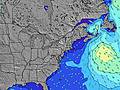 | 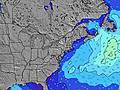 | 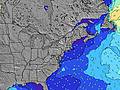 | ||||||||||||
Wave Height (m) Direction Period (s) | SSE 6 | SSE 6 | SE 7 | SE 7 | SE 8 | SSE 8 | ENE 5 | NE 6 | SSE 8 | SSE 8 | SE 7 | SSE 7 | SSE 7 | SSE 6 | SSE 8 | SE 7 | SE 8 | SSE 7 | SSE 7 |
Wave Graph | |||||||||||||||||||
145 | 74 | 46 | 42 | 33 | 23 | 23 | 40 | 24 | 20 | 14 | 27 | 9 | 4 | 39 | 13 | 15 | 70 | 44 | |
Wind (km/h) | |||||||||||||||||||
Wind State on-shore cross-onshore cross-shore cross-offshore off-shore glassy | cross | cross-off | cross-off | cross-off | cross-off | cross-on | cross-off | cross | on | glassy | cross-on | cross | cross | cross-on | cross-on | cross | cross-off | cross-off | off |
High Tide | 7:58AM1.25m | 8:06PM1.52m | 8:34AM1.28m | 8:41PM1.51m | 9:10AM1.30m | 9:16PM1.49m | 9:47AM1.33m | 9:54PM1.45m | 10:26AM1.36m | 10:35PM1.40m | 11:10AM1.40m | 11:23PM1.34m | |||||||
Low Tide | 2:01AM0.09m | 1:58PM0.20m | 2:41AM0.06m | 2:40PM0.19m | 3:17AM0.04m | 3:20PM0.18m | 3:51AM0.04m | 3:58PM0.19m | 4:24AM0.05m | 4:37PM0.20m | 4:56AM0.06m | 5:19PM0.23m | |||||||
— | 5:52 | — | — | 5:52 | — | — | 5:54 | — | — | 5:54 | — | — | 5:56 | — | — | 5:56 | — | — | |
8:13 | — | 8:13 | — | — | 8:12 | — | — | 8:10 | — | — | 8:09 | — | — | 8:07 | — | — | 8:07 | — | |
mm | 25 | 1 | — | — | — | 3 | 1 | — | — | — | — | — | 1 | — | 1 | 1 | 1 | 3 | 1 |
Temp °C | 23 | 23 | 26 | 25 | 23 | 23 | 22 | 22 | 22 | 22 | 23 | 23 | 24 | 25 | 25 | 24 | 25 | 27 | 25 |
Feels °C | 22 | 24 | 27 | 24 | 22 | 23 | 21 | 22 | 21 | 23 | 24 | 23 | 24 | 25 | 24 | 23 | 26 | 27 | 25 |
Swell 1 Height (m) Direction Period (s) | E 6 | SSE 6 | SE 7 | SE 7 | SE 8 | SSE 8 | SSE 8 | ENE 6 | E 6 | SSE 8 | SE 7 | ENE 6 | SSE 7 | SSE 6 | E 5 | SE 7 | SSE 4 | SSE 7 | SSE 7 |
1 | 74 | 46 | 42 | 33 | 23 | 23 | 18 | 18 | 20 | 14 | 3 | 9 | 4 | 1 | 12 | 11 | 70 | 44 | |
Swell 2 Height (m) Direction Period (s) | E 9 | E 6 | E 6 | S 7 | E 5 | E 5 | — | SSE 8 | SSE 8 | ENE 6 | ENE 6 | SE 9 | SE 9 | SE 8 | S 8 | E 5 | SE 8 | — | — |
6 | 1 | 1 | 34 | 2 | 5 | — | 26 | 24 | 7 | 3 | 3 | 3 | 3 | 5 | 1 | 15 | — | — | |
Swell 3 Height (m) Direction Period (s) | — | E 9 | E 8 | ENE 6 | — | E 7 | — | — | — | SSE 9 | SE 9 | SE 7 | E 6 | S 8 | NE 5 | NE 5 | — | — | — |
— | 1 | 1 | 6 | — | 1 | — | — | — | 8 | 3 | 7 | 1 | 1 | 1 | 1 | — | — | — | |
Wind waves Height (m) Direction Period (s) | SSE 6 | — | NNW 2 | NW 3 | NNW 3 | — | ENE 5 | NE 6 | — | — | — | SSE 7 | SSE 3 | SSE 4 | SSE 8 | SSE 4 | — | — | — |
145 | — | 1 | 2 | 1 | — | 19 | 40 | — | — | — | 27 | 3 | 3 | 39 | 13 | — | — | — | |
Nearest Offshore or Glassy | |||||||||||||||||||
Distance (km) | 218 | 0 | 2 | 2 | 2 | 111 | 2 | 2 | 131 | 2 | 288 | 296 | 242 | 989 | 1279 | 1279 | 77 | 66 | 2 |
Best forecast wave conditions in New Jersey | |||||||||||||||||||
Best forecast wave conditions in United States | |||||||||||||||||||
Header Global | |||||||||||||||||||
- Map Icons:
 Break
Break Live Wave Height (m)
 Live Wind Speed (km/h)
 Surf Rating (10 Max)
 Ocean Swells (m)
- Wind Speed (km/h)


FREE! Surf-Forecast.com widget for your website
The surf report / weather widget below is available to embed on third party websites free of charge and provides a summary of our 711 surf forecast. Simply grab the html code snippet that we provide and paste it into your own site. You can choose your preferred language and metric/imperial units for the surf forecast feed to suit users of your site. Click here to get the code.
Information about the 711 Surf forecast
The above surf forecast table for 711 provides essential information for determining whether the surfing conditions will be good over the next 16 days. A general guide to surfing at 711 can be found by selecting the local surf guide option on the grey menu. Our 711 surf forecast is unique since it includes wave energy (power) that defines the real feel of the surf rather than just the height or the period. If you surf the same spot (711) regularly then make a mental note of the wave energy from the surf forecast table each time you go. Very soon you may start to choose your surf days based on the wave energy alone combined with our forecast of favourable offshore wind conditions. Our star ratings will help here and of course you will also find the usual wave height and period predictions on our surf forecasts as well as a full break down of the swell components under our advanced users option (to reveal that, click the little Einstein character under the tide times).
Further information to help with frequently asked questions about our surf forecast for 711 may be found under the help tab on the top menu and also by moving your mouse over the question marks on the surf forecast table itself. Please always bear in mind that the forecast is for near-shore open water and local factors at each surf break influence the actual breaking wave height, such as the beach / reef profile, water depths offshore and shelter.
Are you planning a vacation in New Jersey? If you are looking for accommodation near 711, camping, hotels and condos and appartments in New Jersey, consider staying in Ocean Acres which is 14 km (9 miles) away. Other places in and around New Jersey where you can find information about places to rent, and car hire include Toms River which is 34 km (21 miles) away, Atlantic City, Pleasantville and Point Pleasant.
 Nearest