

Surf Forecasts:

Salinas surf forecast from 9 Jul 2026:
- Best quality surf: Thursday 9 Jul, 11PM (local time) - 2ft (0.6m), 9s period, WNW swell with glassy winds.
- Most powerful swell: Sunday 12 Jul, 11AM (local time) - 3ft (0.9m), 9s period, WNW swell with 121 kJ wave energy.
- Next surfable swell (1★+): Thursday 9 Jul, 11PM (local time) - 2ft (0.6m), 9s period with WNW swell.
Best Forecast Surf Conditions for Salinas this week:
The surf forecast for Salinas over the next 16 days: The first swell (rated 1 star or higher) is forecast to arrive on Thursday (Jul 09) at 11PM. The primary swell is predicted to be 0.6m and 9s period with a secondary swell of 0.3m and 5s. The wind is predicted to be glassy as the swell arrives.
The most powerful waves expected at Salinas in the next 16 days are 0.9m 9s and forecast to arrive on Sunday (Jul 12) at 11AM. Winds are predicted to be onshore at the time the swell arrives. The largest open ocean swell (not directed at the beach) is 0.7m 4s period and expected on Saturday (Jul 11) at 11PM.
| Wave Type | Time (CEST) & Date | Wave Height & Period |
|---|---|---|
| Next good surf (1 star+) | 11PM (Thu 9th Jul) | 2ft (0.6m) 9s |
| Best Surf | 11PM (Thu 9th Jul) | 2ft (0.6m) 9s |
| Most Powerful | 11AM (Sun 12th Jul) | 3ft (0.9m) 9s |
Table - best surf conditions forecast for Salinas over the next 16 days.
Alright, let’s talk about Salinas. Over the next 16 days, it’s mostly going to be a quiet stretch with a lot of small, weak surf that just isn’t worth getting excited about. There’s a long, slow period, and then a couple of mornings that might just be worth a look. The water temp is about 66°, which is pretty normal for the season.
Right from the start, July 9th through to the 19th, it’s a tough watch. The swell is tiny, running from about 1 foot to 3 feet, with combined energy readings mostly in the low double digits or low triple digits, like 28 mm or 139 mm – that’s weak to just moderate energy at best. The winds are a real mix of cross, cross-on, and onshore, and the ocean is just messy and uninviting. Nothing is happening for a surfer.
Then things shift a little. On the morning of July 20th, the swell bumps up to a clean 3 feet from the WNW, with a period of 8 seconds. The wind goes glassy, and the combined energy hits 117 mm, which is just into the moderate range. The report says “surfable but very ordinary”, so it’s a small, clean wave for a beginner. You’ll have it pretty much to yourself, but it’s nothing to get the heart racing.
The real standout is the morning of July 21st. The swell holds at 4 feet from the NW, period 8 seconds, and it’s glassy again. The combined energy is 136 mm, the highest of the entire forecast. This is the one to aim for. A clean, small wave for a beginner, and with crowds listed as “sometimes”, you might see a few others but it’ll be quiet. The swell direction from the NW is a good match for the optimum NW direction, so it’s the best this break will see.
After that, it fades again. The 22nd and 23rd have a bit more size, 3 feet to 3 feet, but the winds turn cross and cross-on, making it choppy and poor. The morning of July 24th has a tiny 2 foot glassy wave, but it’s barely a ripple.
So, the long and short of it is: there’s a big gap of flat, poor surf from the 9th to the 19th. Your only real chance to get a wave is the morning of the 20th, and especially the morning of the 21st of July. That’s your best bet. It’s not a big swell, but it’s clean and rideable.
Rusty.
Short Range ForecastMostly dry. Warm (max 26°C on Sat afternoon, min 18°C on Fri night). Wind will be generally light. | Days 5-7 Weather SummaryMostly dry. Warm (max 23°C on Sun afternoon, min 16°C on Tue morning). Wind will be generally light. | ||||||||||||||||||||
Thu 9 | Friday 10 | Saturday 11 | Sunday 12 | Monday 13 | Tuesday 14 | Wednesday 15 | |||||||||||||||
PM | Night | AM | PM | Night | AM | PM | Night | AM | PM | Night | AM | PM | Night | AM | PM | Night | AM | PM | Night | AM | |
Swell Height Map |  |  |  |  |  |  |  | 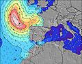 | |||||||||||||
Wave Height (m) Direction Period (s) | WNW 9 | NW 9 | WNW 9 | WNW 9 | NW 12 | NW 11 | NW 10 | NW 10 | WNW 9 | N 8 | N 7 | N 7 | N 7 | N 7 | N 6 | N 7 | N 6 | N 7 | WNW 9 | WNW 8 | WNW 7 |
Wave Graph | |||||||||||||||||||||
58 | 84 | 76 | 68 | 52 | 75 | 82 | 92 | 121 | 61 | 67 | 54 | 35 | 23 | 21 | 24 | 13 | 16 | 16 | 14 | 15 | |
Wind (km/h) | |||||||||||||||||||||
Wind State on-shore cross-onshore cross-shore cross-offshore off-shore glassy | cross | glassy | on | on | glassy | cross | cross | cross-on | on | on | cross | cross-on | cross-on | glassy | cross-off | cross | glassy | on | cross-on | glassy | glassy |
High Tide | 00:39AM3.25m | 1:21PM3.26m | 1:52AM3.30m | 2:29PM3.45m | 3:00AM3.42m | 3:30PM3.68m | 4:00AM3.57m | 4:25PM3.90m | 4:54AM3.70m | 5:15PM4.08m | 5:44AM3.79m | 6:03PM4.18m | 6:31AM3.81m | ||||||||
Low Tide | 6:22PM1.25m | 7:01AM1.14m | 7:37PM1.16m | 8:09AM1.04m | 8:47PM0.98m | 9:12AM0.89m | 9:49PM0.76m | 10:08AM0.73m | 10:45PM0.56m | 10:59AM0.59m | 11:36PM0.41m | 11:48AM0.51m | 00:23AM0.34m | 12:34PM0.49m | |||||||
— | — | 6:50 | — | — | 6:52 | — | — | 6:52 | — | — | 6:54 | — | — | 6:54 | — | — | 6:54 | — | — | 6:56 | |
— | 10:06 | — | — | 10:06 | — | — | 10:05 | — | — | 10:05 | — | — | 10:04 | — | — | 10:02 | — | — | 10:02 | 10:01 | |
mm | — | — | — | — | — | — | — | — | — | — | — | — | — | — | — | — | — | — | — | 1 | — |
Temp °C | 24 | 22 | 22 | 23 | 22 | 24 | 26 | 24 | 22 | 23 | 21 | 22 | 22 | 21 | 21 | 23 | 22 | 21 | 22 | 21 | 21 |
Feels °C | 25 | 24 | 23 | 24 | 24 | 25 | 27 | 25 | 22 | 24 | 22 | 23 | 22 | 22 | 21 | 23 | 23 | 22 | 22 | 22 | 22 |
Swell 1 Height (m) Direction Period (s) | WNW 9 | NW 9 | WNW 9 | WNW 9 | WNW 8 | NW 11 | NW 10 | NW 10 | NNE 5 | NW 5 | WNW 6 | N 7 | N 7 | N 7 | N 6 | N 7 | N 6 | N 7 | N 7 | N 5 | WNW 7 |
58 | 84 | 76 | 68 | 39 | 75 | 82 | 92 | 16 | 30 | 67 | 54 | 35 | 23 | 21 | 24 | 13 | 16 | 8 | 9 | 15 | |
Swell 2 Height (m) Direction Period (s) | NW 5 | N 5 | NNW 5 | NNW 5 | NW 12 | WNW 8 | WNW 8 | NNE 4 | N 9 | N 8 | N 7 | WNW 5 | N 9 | NNW 8 | W 7 | WNW 11 | WNW 10 | WNW 10 | WNW 9 | WNW 8 | N 5 |
4 | 2 | 5 | 5 | 52 | 25 | 20 | 13 | 2 | 61 | 62 | 10 | 14 | 11 | 4 | 12 | 10 | 9 | 16 | 14 | 4 | |
Swell 3 Height (m) Direction Period (s) | — | — | — | NW 14 | N 5 | N 5 | N 5 | E 4 | — | NW 9 | NW 9 | NW 8 | NW 8 | N 10 | N 10 | W 7 | N 10 | NW 9 | — | WNW 3 | WNW 8 |
— | — | — | 7 | 8 | 8 | 4 | 3 | — | 47 | 12 | 17 | 17 | 7 | 7 | 4 | 7 | 3 | — | 1 | 7 | |
Wind waves Height (m) Direction Period (s) | NNE 4 | — | — | — | — | — | NE 5 | — | WNW 9 | — | — | — | — | — | — | NE 2 | — | WNW 7 | NW 3 | — | — |
2 | — | — | — | — | — | 6 | — | 121 | — | — | — | — | — | — | 1 | — | 9 | 4 | — | — | |
Nearest Offshore or Glassy | |||||||||||||||||||||
Distance (km) | 141 | 0 | 81 | 154 | 0 | 6 | 6 | 7 | 14 | 14 | 14 | 154 | 546 | 0 | 101 | 141 | 141 | 187 | 211 | 141 | 199 |
Best forecast wave conditions in Asturias | |||||||||||||||||||||
Best forecast wave conditions in Spain (Europe) | |||||||||||||||||||||
Header Global | |||||||||||||||||||||
- Map Icons:
 Break
Break Live Wave Height (m)
 Live Wind Speed (km/h)
 Surf Rating (10 Max)
 Ocean Swells (m)
- Wind Speed (km/h)


FREE! Surf-Forecast.com widget for your website
The surf report / weather widget below is available to embed on third party websites free of charge and provides a summary of our Salinas surf forecast. Simply grab the html code snippet that we provide and paste it into your own site. You can choose your preferred language and metric/imperial units for the surf forecast feed to suit users of your site. Click here to get the code.
Information about the Salinas Surf forecast
The above surf forecast table for Salinas provides essential information for determining whether the surfing conditions will be good over the next 16 days. A general guide to surfing at Salinas can be found by selecting the local surf guide option on the grey menu. Our Salinas surf forecast is unique since it includes wave energy (power) that defines the real feel of the surf rather than just the height or the period. If you surf the same spot (Salinas) regularly then make a mental note of the wave energy from the surf forecast table each time you go. Very soon you may start to choose your surf days based on the wave energy alone combined with our forecast of favourable offshore wind conditions. Our star ratings will help here and of course you will also find the usual wave height and period predictions on our surf forecasts as well as a full break down of the swell components under our advanced users option (to reveal that, click the little Einstein character under the tide times).
Further information to help with frequently asked questions about our surf forecast for Salinas may be found under the help tab on the top menu and also by moving your mouse over the question marks on the surf forecast table itself. Please always bear in mind that the forecast is for near-shore open water and local factors at each surf break influence the actual breaking wave height, such as the beach / reef profile, water depths offshore and shelter.
Salinas is 5 km (3 miles) from Aviles. If you plan a holiday in Asturias, look for hotels and other accommodation in Aviles. Aviles has rooms for a wide range of budgets as well as car hire and transport links.
 Nearest