

Surf Forecasts:

Posties surf forecast from 13 Jul 2026:
- Best quality surf: Friday 17 Jul, 9AM (local time) - 11ft (3.5m), 17s period, SW swell with cross-offshore winds.
- Most powerful swell: Tuesday 14 Jul, 9AM (local time) - 18ft (5.5m), 15s period, SW swell with 14,964 kJ wave energy.
- Next surfable swell (1★+): Thursday 16 Jul, 9PM (local time) - 11ft (3.5m), 15s period with SW swell.
Best Forecast Surf Conditions for Posties this week:
The surf forecast for Posties over the next 16 days: The first swell (rated 1 star or higher) is forecast to arrive on Thursday (Jul 16) at 9PM. The primary swell is predicted to be 3.5m and 15s period. The wind is predicted to be cross-offshore as the swell arrives.
The most powerful waves expected at Posties in the next 16 days are 5.5m 15s and forecast to arrive on Tuesday (Jul 14) at 9AM. Winds are predicted to be cross-onshore at the time the swell arrives. The largest open ocean swell (not directed at the beach) is 0.9m 5s period and expected on Monday (Jul 20) at 9AM.
| Wave Type | Time (ACST) & Date | Wave Height & Period |
|---|---|---|
| Next good surf (1 star+) | 9PM (Thu 16th Jul) | 11ft (3.5m) 15s |
| Best Surf | 9AM (Fri 17th Jul) | 11ft (3.5m) 17s |
| Most Powerful | 9AM (Tue 14th Jul) | 18ft (5.5m) 15s |
Table - best surf conditions forecast for Posties over the next 16 days.
The Lowdown
Alright, mate, Rusty here. Let’s have a look at what’s coming our way.
We’ve got a solid run of surf ahead, but it’s not all smooth sailing. The first few days are a write-off – Tuesday morning, July 14th, kicks off with a massive 18ft SW groundswell, but it’s howling cross-on at 22 mph, and the water’s a mess. That’s not for paddling; that’s for kite surfers or staying home. The combined energy is insane at 14964, but it’s just too raw and windy. Tuesday afternoon is even worse. Wednesday and Thursday are still lumpy and marginal, with a thick 13ft to 12ft SW groundswell but cross-onshore winds chopping it up. Nothing to get excited about.
Then we hit Friday morning, July 17th, and that’s our standout. At Posties, a reef break, we’ve got an 12ft SW groundswell with a very long period of 17 seconds. The wind turns nice and clean, cross-off from the NNW at 9 mph. The combined energy is still hefty at 7678, and the description says "exceptional surf conditions for expert surfers." This is a big, powerful groundswell – with that period, it’ll be lining up perfectly at a reef like Posties, but it’s gonna be heavy. Only for the experienced crew. The water’s a touch warmer than usual at 60°, so the sting’s off a bit. Crowds are sometimes an issue here, but on a Friday morning with that size, you might get a window.
Saturday and Sunday, July 18th and 19th, drop off a bit in size – 8ft to 6ft – but stay clean with offshore N winds. Good for a more relaxed session, especially Saturday morning. The combined energy drops to 2394, still fun.
The next week, from July 20th onward, sees a lot of wind – mostly cross-off from the north, which keeps the surface clean, but the swell pulses up and down. Monday the 20th has a 10ft W swell, but the wind is strong at 19 mph. By Tuesday the 21st, it’s back to 8ft and clean in the morning. The real gem in the second week might be Tuesday morning, July 28th – a 7ft SSW groundswell with a 13-second period, light ESE cross-off, and the score says excellent for experienced surfers. The energy is moderate at 1632. That’s a promising morning, but it’s 14 days out, so treat it with a pinch of salt.
Overall, the first week’s best is Friday the 17th at Posties. The second week has a few clean mornings, but nothing that screams a must-do standout. There’s a run of marginal days, but it’s a fairly consistent stretch, so things can change.
Rusty.
Short Range ForecastMostly dry. Very mild (max 14°C on Tue morning, min 10°C on Thu night). Winds decreasing (fresh winds from the WSW on Tue morning, light winds from the WNW by Wed night). | Days 4-6 Weather SummaryMostly dry. Very mild (max 15°C on Sat afternoon, min 10°C on Fri morning). Wind will be generally light. | ||||||||||||||||||||
Tuesday 14 | Wednesday 15 | Thursday 16 | Friday 17 | Saturday 18 | Sunday 19 | Monday 20 | |||||||||||||||
AM | PM | Night | AM | PM | Night | AM | PM | Night | AM | PM | Night | AM | PM | Night | AM | PM | Night | AM | PM | Night | |
Swell Height Map | 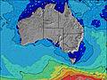 | 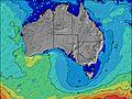 | 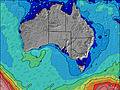 | 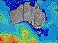 | 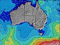 | 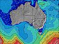 | 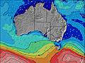 | ||||||||||||||
Wave Height (m) Direction Period (s) | SW 15 | SW 15 | SW 14 | SW 14 | SW 14 | SW 15 | SW 15 | SW 15 | SW 15 | SW 17 | SW 16 | SW 15 | WSW 14 | WSW 13 | WSW 13 | W 12 | SW 18 | WSW 16 | WSW 15 | W 14 | WSW 13 |
Wave Graph | |||||||||||||||||||||
14964 | 12277 | 8451 | 6083 | 4881 | 5224 | 5684 | 5450 | 4606 | 7661 | 5973 | 3820 | 2345 | 1780 | 1025 | 846 | 702 | 2084 | 2111 | 3249 | 2986 | |
Wind (km/h) | |||||||||||||||||||||
Wind State on-shore cross-onshore cross-shore cross-offshore off-shore glassy | cross-on | on | cross-on | cross-on | cross-on | cross-on | cross | cross-on | cross-off | cross-off | cross | cross-off | cross-off | cross-off | cross-off | cross-off | cross-off | cross-off | cross-off | cross-off | cross-off |
High Tide | 1:22PM1.21m | 1:51PM1.21m | 2:15PM1.18m | 00:27AM0.64m | 2:33PM1.13m | 1:25AM0.72m | 2:48PM1.07m | 2:16AM0.78m | 2:59PM1.01m | 3:06AM0.83m | 3:09PM0.96m | ||||||||||
Low Tide | 5:04AM0.28m | 6:02AM0.27m | 9:51PM0.61m | 6:51AM0.29m | 9:23PM0.60m | 7:35AM0.34m | 9:18PM0.55m | 8:14AM0.40m | 9:26PM0.49m | 8:50AM0.48m | 9:44PM0.42m | ||||||||||
7:20 | — | — | 7:20 | — | — | 7:18 | — | — | 7:18 | — | — | 7:18 | — | — | 7:18 | — | — | 7:16 | — | — | |
— | 5:04 | — | — | 5:05 | — | — | 5:06 | — | — | 5:06 | — | — | 5:07 | — | — | 5:07 | — | — | 5:08 | — | |
mm | — | — | — | — | — | — | — | — | — | — | — | — | — | — | — | — | — | — | — | — | — |
Temp °C | 14 | 13 | 12 | 12 | 14 | 13 | 13 | 13 | 12 | 11 | 13 | 12 | 13 | 15 | 13 | 13 | 14 | 13 | 14 | 15 | 13 |
Feels °C | 7 | 7 | 9 | 9 | 12 | 11 | 11 | 10 | 10 | 7 | 10 | 9 | 10 | 13 | 10 | 8 | 10 | 8 | 8 | 10 | 9 |
Swell 1 Height (m) Direction Period (s) | — | SW 15 | SW 14 | SW 14 | SW 14 | SW 15 | SW 15 | SW 15 | SW 15 | SW 17 | SW 16 | SW 15 | WSW 14 | WSW 13 | WSW 13 | W 12 | W 12 | WSW 16 | WSW 15 | W 14 | WSW 13 |
— | 12277 | 8451 | 6083 | 4881 | 5224 | 5684 | 5450 | 4606 | 7661 | 5973 | 3820 | 2345 | 1780 | 1025 | 846 | 638 | 2084 | 2111 | 2441 | 2986 | |
Swell 2 Height (m) Direction Period (s) | — | — | — | — | — | S 13 | S 11 | S 11 | — | S 10 | S 10 | — | SSW 16 | — | SSW 12 | SSW 11 | SW 18 | S 11 | SSW 10 | S 10 | — |
— | — | — | — | — | 82 | 61 | 37 | — | 17 | 7 | — | 49 | — | 254 | 167 | 702 | 59 | 20 | 8 | — | |
Swell 3 Height (m) Direction Period (s) | — | — | — | — | — | — | — | — | — | — | — | — | — | — | SSW 16 | SW 20 | SSW 11 | — | SE 16 | — | — |
— | — | — | — | — | — | — | — | — | — | — | — | — | — | 83 | 306 | 161 | — | 10 | — | — | |
Wind waves Height (m) Direction Period (s) | SW 15 | — | — | — | — | — | — | — | — | — | — | — | — | — | N 3 | N 3 | N 3 | N 4 | N 5 | W 14 | — |
14964 | — | — | — | — | — | — | — | — | — | — | — | — | — | 4 | 8 | 3 | 18 | 34 | 3249 | — | |
Nearest Offshore or Glassy | |||||||||||||||||||||
Distance (km) | 287 | 773 | 79 | 79 | 79 | 79 | 1 | 1 | 0 | 0 | 1 | 0 | 0 | 0 | 1 | 1 | 1 | 1 | 11 | 1 | 1 |
Best forecast wave conditions in South Australia - East Coast | |||||||||||||||||||||
Best forecast wave conditions in Australia | |||||||||||||||||||||
Header Global | |||||||||||||||||||||
- Map Icons:
 Break
Break Live Wave Height (m)
 Live Wind Speed (km/h)
 Surf Rating (10 Max)
 Ocean Swells (m)
- Wind Speed (km/h)


FREE! Surf-Forecast.com widget for your website
The surf report / weather widget below is available to embed on third party websites free of charge and provides a summary of our Posties surf forecast. Simply grab the html code snippet that we provide and paste it into your own site. You can choose your preferred language and metric/imperial units for the surf forecast feed to suit users of your site. Click here to get the code.
Information about the Posties Surf forecast
The above surf forecast table for Posties provides essential information for determining whether the surfing conditions will be good over the next 16 days. A general guide to surfing at Posties can be found by selecting the local surf guide option on the grey menu. Our Posties surf forecast is unique since it includes wave energy (power) that defines the real feel of the surf rather than just the height or the period. If you surf the same spot (Posties) regularly then make a mental note of the wave energy from the surf forecast table each time you go. Very soon you may start to choose your surf days based on the wave energy alone combined with our forecast of favourable offshore wind conditions. Our star ratings will help here and of course you will also find the usual wave height and period predictions on our surf forecasts as well as a full break down of the swell components under our advanced users option (to reveal that, click the little Einstein character under the tide times).
Further information to help with frequently asked questions about our surf forecast for Posties may be found under the help tab on the top menu and also by moving your mouse over the question marks on the surf forecast table itself. Please always bear in mind that the forecast is for near-shore open water and local factors at each surf break influence the actual breaking wave height, such as the beach / reef profile, water depths offshore and shelter.
Posties is 7 km (4 miles) from Allendale East. If you plan a holiday in South Australia - East Coast, look for hotels and other accommodation in Allendale East. Allendale East has rooms for a wide range of budgets as well as car hire and transport links.
 Nearest