

Surf Forecasts:

Pondalowie Bay surf forecast from 12 Jul 2026:
- Best quality surf: Tuesday 14 Jul, 9PM (local time) - 8ft (2.5m), 15s period, SW swell with cross-offshore winds.
- Most powerful swell: Monday 13 Jul, 9PM (local time) - 11ft (3.5m), 17s period, SW swell with 6,694 kJ wave energy.
- Next surfable swell (1★+): Tuesday 14 Jul, 9PM (local time) - 8ft (2.5m), 15s period with SW swell.
Best Forecast Surf Conditions for Pondalowie Bay this week:
The surf forecast for Pondalowie Bay over the next 16 days: The first swell (rated 1 star or higher) is forecast to arrive on Tuesday (Jul 14) at 9PM. The primary swell is predicted to be 2.5m and 15s period. The wind is predicted to be cross-offshore as the swell arrives.
The most powerful waves expected at Pondalowie Bay in the next 16 days are 3.5m 17s and forecast to arrive on Monday (Jul 13) at 9PM. Winds are predicted to be cross-onshore at the time the swell arrives. The largest open ocean swell (not directed at the beach) is 0.4m 4s period and expected on Friday (Jul 17) at 6PM.
| Wave Type | Time (ACST) & Date | Wave Height & Period |
|---|---|---|
| Next good surf (1 star+) | 9PM (Tue 14th Jul) | 8ft (2.5m) 15s |
| Best Surf | 9PM (Tue 14th Jul) | 8ft (2.5m) 15s |
| Most Powerful | 9PM (Mon 13th Jul) | 11ft (3.5m) 17s |
Table - best surf conditions forecast for Pondalowie Bay over the next 16 days.
G’day, Rusty here. Look, I’ll be straight with you – the first week is a bit of a write-off, but if you can wait, there’s a couple of proper windows coming up that’ll make it worth your while.
We’ve got a rough start at Pondalowie Bay. Sunday the 12th and Monday the 13th are a write-off with strong onshore winds and big, messy swell. Wave energy is massive – over 9000 on Monday morning – but it’s all for nothing with that wind. Tuesday the 14th is still choppy and cross-shore, barely surfable. The water temp is sitting around 60°, which is pretty average for this time of year, so nothing unusual there.
Then, Wednesday the 15th is where it gets interesting. The wind drops right out – glassy conditions, calm as a lake. You’ve got a solid 7ft groundswell rolling in from the southwest, with a long period of 15 seconds. That’s proper energy (1968) and the reef at Pondalowie Bay is the spot for it. This is for experienced surfers though – that size and period will be powerful. The morning is the pick, with the glassy conditions and light offshore from the ENE. This is a real standout.
Thursday the 16th and Friday the 17th are still rideable, but the wind starts to get a bit cross-shore and the quality drops off. Swell is still around 5ft to 6ft, but the bumps and chop will make it frustrating. The weekend of the 18th and 19th is a dud again – strong winds and dropping swell.
Now, here’s the second window. It’s a bit of a wait, but Tuesday the 21st of July looks magic. Glassy again, with a light NNE breeze. The swell is smaller at 5ft, but it’s clean and the reef will handle that long-period energy (13 seconds) beautifully. The energy is lower (878), but the conditions are perfect for a fun session.
The real prize, though, is Friday the 24th and Saturday the 25th. Friday afternoon has a 5ft southwest groundswell with a very long 18-second period, and it’s dead clean with offshore winds from the east. That’s the kind of day you’ll remember. Then Saturday morning the 25th bumps up to 8ft from the same direction, with a 16-second period (energy 3304). That’s big, powerful, and again, clean with cross-offshore winds. This is for experienced surfers only – too big for beginners. Crowds are common at Pondalowie Bay, so get there early.
From Sunday the 26th onward, it fades out again with onshore winds and choppy conditions. The 24th and 25th are your best bets – don’t sleep on them.
Rusty.
Short Range ForecastLight rain (total 5mm), mostly falling on Mon night. Very mild (max 15°C on Sun afternoon, min 13°C on Tue night). Winds decreasing (fresh winds from the WSW on Sun morning, light winds from the S by Tue night). | Days 4-6 Weather SummaryMostly dry. Very mild (max 14°C on Thu afternoon, min 12°C on Wed morning). Wind will be generally light. | ||||||||||||||||||||
Sunday 12 | Monday 13 | Tuesday 14 | Wednesday 15 | Thursday 16 | Friday 17 | Saturday 18 | |||||||||||||||
AM | PM | Night | AM | PM | Night | AM | PM | Night | AM | PM | Night | AM | PM | Night | AM | PM | Night | AM | PM | Night | |
Swell Height Map | 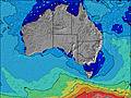 | 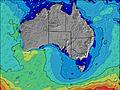 | 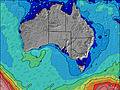 | 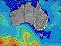 | 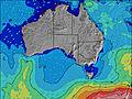 | 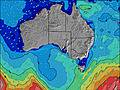 | 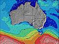 | ||||||||||||||
Wave Height (m) Direction Period (s) | SW 12 | SW 13 | SW 17 | SW 16 | SW 16 | SW 17 | SW 16 | SW 16 | SW 15 | SW 15 | SW 15 | SW 14 | SW 14 | SW 17 | SW 16 | SW 16 | SW 15 | SW 14 | SW 13 | SW 13 | SW 13 |
Wave Graph | |||||||||||||||||||||
2907 | 3010 | 6262 | 6029 | 5928 | 6433 | 5169 | 4136 | 2627 | 1968 | 1526 | 1290 | 1092 | 2140 | 1880 | 1643 | 1025 | 726 | 392 | 290 | 234 | |
Wind (km/h) | |||||||||||||||||||||
Wind State on-shore cross-onshore cross-shore cross-offshore off-shore glassy | cross-on | cross-on | on | on | cross-on | cross-on | cross-on | cross | cross-off | glassy | glassy | cross-off | cross | cross-on | cross-off | cross | cross | cross | cross | cross | cross-on |
High Tide | 12:45PM1.18m | 2:02AM0.43m | 1:33PM1.24m | 2:10AM0.44m | 2:14PM1.26m | 2:23AM0.48m | 2:49PM1.25m | 2:38AM0.53m | 3:19PM1.20m | 2:57AM0.59m | 3:43PM1.12m | 3:22AM0.66m | 4:00PM1.04m | ||||||||
Low Tide | 9:56PM0.39m | 4:34AM0.42m | 10:07PM0.38m | 5:55AM0.38m | 10:22PM0.40m | 6:50AM0.35m | 10:32PM0.43m | 7:35AM0.34m | 10:35PM0.47m | 8:16AM0.34m | 10:33PM0.49m | 8:54AM0.37m | 10:32PM0.48m | ||||||||
7:30 | — | — | 7:28 | — | — | 7:28 | — | — | 7:28 | — | — | 7:28 | — | — | 7:28 | — | — | 7:26 | — | — | |
— | 5:25 | — | — | 5:25 | — | — | 5:27 | — | — | 5:28 | — | — | 5:28 | — | — | 5:29 | — | — | 5:30 | — | |
mm | — | — | — | — | — | 4 | 1 | — | — | — | — | — | — | — | — | — | — | — | — | — | — |
Temp °C | 14 | 15 | 15 | 15 | 15 | 15 | 15 | 15 | 14 | 13 | 13 | 13 | 13 | 14 | 14 | 13 | 13 | 14 | 13 | 15 | 16 |
Feels °C | 6 | 8 | 9 | 8 | 9 | 9 | 11 | 11 | 12 | 13 | 13 | 12 | 11 | 12 | 11 | 9 | 9 | 9 | 7 | 9 | 10 |
Swell 1 Height (m) Direction Period (s) | SW 22 | SW 20 | SSW 17 | SW 16 | SW 16 | SSW 17 | SW 16 | SW 16 | SW 15 | SW 15 | SW 15 | SW 14 | SW 14 | SW 17 | SW 16 | SW 16 | SW 15 | SW 14 | SW 13 | SW 13 | SW 13 |
19 | 61 | 622 | 3098 | 2978 | 3301 | 5169 | 4136 | 2627 | 1968 | 1526 | 1290 | 1092 | 2140 | 1880 | 1643 | 1025 | 726 | 392 | 290 | 234 | |
Swell 2 Height (m) Direction Period (s) | — | — | SW 22 | — | — | — | — | — | — | — | — | SW 22 | SW 19 | SW 18 | — | — | — | — | WNW 7 | W 7 | SW 22 |
— | — | 163 | — | — | — | — | — | — | — | — | 18 | 296 | 252 | — | — | — | — | 15 | 14 | 163 | |
Swell 3 Height (m) Direction Period (s) | — | — | — | — | — | — | — | — | — | — | — | — | — | — | — | — | — | — | — | SW 24 | SW 22 |
— | — | — | — | — | — | — | — | — | — | — | — | — | — | — | — | — | — | — | 23 | 227 | |
Wind waves Height (m) Direction Period (s) | SW 12 | SW 13 | SW 17 | SW 16 | SW 16 | SW 17 | — | — | — | — | — | — | — | — | — | — | N 4 | NNE 3 | N 4 | N 4 | N 4 |
2907 | 3010 | 6262 | 6029 | 5928 | 6433 | — | — | — | — | — | — | — | — | — | — | 10 | 4 | 19 | 21 | 40 | |
Nearest Offshore or Glassy | |||||||||||||||||||||
Distance (km) | 1190 | 1277 | 722 | 1038 | 1440 | 734 | 165 | 165 | 0 | 0 | 0 | 0 | 3 | 3 | 0 | 88 | 12 | 5 | 88 | 88 | 153 |
Best forecast wave conditions in Yorke Peninsula | |||||||||||||||||||||
Best forecast wave conditions in Australia | |||||||||||||||||||||
Header Global | |||||||||||||||||||||
- Map Icons:
 Break
Break Live Wave Height (m)
 Live Wind Speed (km/h)
 Surf Rating (10 Max)
 Ocean Swells (m)
- Wind Speed (km/h)


FREE! Surf-Forecast.com widget for your website
The surf report / weather widget below is available to embed on third party websites free of charge and provides a summary of our Pondalowie Bay surf forecast. Simply grab the html code snippet that we provide and paste it into your own site. You can choose your preferred language and metric/imperial units for the surf forecast feed to suit users of your site. Click here to get the code.
Information about the Pondalowie Bay Surf forecast
The above surf forecast table for Pondalowie Bay provides essential information for determining whether the surfing conditions will be good over the next 16 days. A general guide to surfing at Pondalowie Bay can be found by selecting the local surf guide option on the grey menu. Our Pondalowie Bay surf forecast is unique since it includes wave energy (power) that defines the real feel of the surf rather than just the height or the period. If you surf the same spot (Pondalowie Bay) regularly then make a mental note of the wave energy from the surf forecast table each time you go. Very soon you may start to choose your surf days based on the wave energy alone combined with our forecast of favourable offshore wind conditions. Our star ratings will help here and of course you will also find the usual wave height and period predictions on our surf forecasts as well as a full break down of the swell components under our advanced users option (to reveal that, click the little Einstein character under the tide times).
Further information to help with frequently asked questions about our surf forecast for Pondalowie Bay may be found under the help tab on the top menu and also by moving your mouse over the question marks on the surf forecast table itself. Please always bear in mind that the forecast is for near-shore open water and local factors at each surf break influence the actual breaking wave height, such as the beach / reef profile, water depths offshore and shelter.
Are you planning a holiday in Yorke Peninsula? If you are looking for accommodation near Pondalowie Bay, camping, hotels and holiday cottages in Yorke Peninsula, consider staying in Kingscote which is 85 km (53 miles) away.
 Nearest