

Surf Forecasts:

Monument surf forecast from 3 Aug 2026:
- Best quality surf: Tuesday 4 Aug, 3AM (local time) - 5.5ft (1.7m), 12s period, SW swell with glassy winds.
- Most powerful swell: Sunday 9 Aug, 9PM (local time) - 15ft (4.5m), 17s period, SW swell with 11,787 kJ wave energy.
- Next surfable swell (1★+): Tuesday 4 Aug, 3AM (local time) - 5.5ft (1.7m), 12s period with SW swell.
Best Forecast Surf Conditions for Monument this week:
The surf forecast for Monument over the next 16 days: The first swell (rated 1 star or higher) is forecast to arrive on Tuesday (Aug 04) at 3AM. The primary swell is predicted to be 1.7m and 12s period with a secondary swell of 0.6m and 16s. The wind is predicted to be glassy as the swell arrives.
The most powerful waves expected at Monument in the next 16 days are 4.5m 17s and forecast to arrive on Sunday (Aug 09) at 9PM. Winds are predicted to be onshore at the time the swell arrives. The largest open ocean swell (not directed at the beach) is 0.8m 4s period and expected on Friday (Aug 07) at 9AM.
| Wave Type | Time (ACST) & Date | Wave Height & Period |
|---|---|---|
| Next good surf (1 star+) | 3AM (Tue 4th Aug) | 5.5ft (1.7m) 12s |
| Best Surf | 3AM (Tue 4th Aug) | 5.5ft (1.7m) 12s |
| Most Powerful | 9PM (Sun 9th Aug) | 15ft (4.5m) 17s |
Table - best surf conditions forecast for Monument over the next 16 days.
The Lowdown
Alright, let’s get into it. The next couple of days are a bit of a write-off. Monday’s got a decent 8ft swell, but the wind is onshore and it’s going to be a choppy mess. We’re looking at a slow start, so don’t rush out there. The real action starts to build from Tuesday.
Tuesday, August 4th is where it starts to get interesting. The swell drops to a cleaner 6ft, but the wind swings offshore and it’s looking glassy by the afternoon with the swell dropping to 5ft. The energy is moderate (868-910), but the conditions will be clean and lined up. This is your best bet for the first part of the week.
Wednesday morning sees a smaller 3ft swell but with a super long 19-second period. For a point break like Monument, that’s going to be fun and lined up, but it might be a bit fat and slow. The wind is cross-offshore, so it should be clean.
The standout, though, is Friday, August 7th. The swell bumps back up to a solid 7ft in the morning, and the wind is cross-offshore and clean. By the afternoon, it’s 7ft with a 17-second period, and the energy is cranking (2250-2297). This is the best combination of size, power, and clean conditions we’re going to see for a while. This is a call for experienced surfers – it’ll be pushing it for a beginner.
This good window closes fast. Saturday gets blown out with strong offshore winds, and then things turn ugly from Sunday, August 9th through to at least Wednesday, August 12th. The swell jumps to 13ft and bigger, but it’s accompanied by onshore gales, rain, and generally poor, unsurfable conditions. The energy readings are huge (over 5000), but it’s all for nothing. The beach looks like it will be more setup for kite surfing than paddling.
After that stormy spell, we get a reprieve. Thursday, August 13th morning looks interesting. The swell is a solid 10ft, the wind is light and cross-offshore, and the forecast says “excellent surf conditions for experienced surfers.” It’s big, powerful, and clean. This is another one for the core crew only.
The period from the 14th to the 16th stays sizeable, but the wind swings cross-shore, bringing in some chop. It’s not going to be clean, but there’s plenty of energy in the water.
For the long-range, keep an eye on Monday, August 17th. The morning sees clean, offshore wind with a 8ft SW swell. It looks promising, but it’s a week out, so treat it with a bit of caution.
The big one for the end of the run is Tuesday, August 18th. The forecast is for a massive 16ft SW swell with 9745 energy in the morning. The wind is light and cross-onshore, but with that much juice, it could be a monster. This is not for the faint of heart. Only experts should even think about it. It’s a long way off, so we’ll see how it plays out.
Overall, the first week is a story of a slow start, one clean day Tuesday, and the standout being Friday. The second week is a mix of heavy storm surf and a few glassy windows for the experienced.
Stay safe out there.
Rusty.
Short Range ForecastMostly dry. Very mild (max 16°C on Wed morning, min 9°C on Tue morning). Wind will be generally light. | Days 4-6 Weather SummaryModerate rain (total 19mm), heaviest on Sat afternoon. Warm (max 21°C on Fri afternoon, min 10°C on Sat night). Winds increasing (calm on Thu morning, near gales from the W by Sat night). | ||||||||||||||||||||
Monday 3 | Tuesday 4 | Wednesday 5 | Thursday 6 | Friday 7 | Saturday 8 | Sunday 9 | |||||||||||||||
AM | PM | Night | AM | PM | Night | AM | PM | Night | AM | PM | Night | AM | PM | Night | AM | PM | Night | AM | PM | Night | |
Swell Height Map | 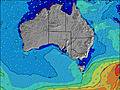 | 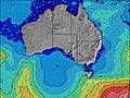 | 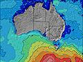 | 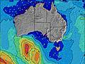 | 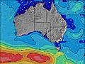 | 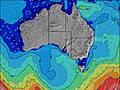 | 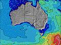 | ||||||||||||||
Wave Height (m) Direction Period (s) | SW 14 | SW 13 | SW 13 | SW 12 | SW 14 | SW 14 | SW 19 | SW 18 | SW 16 | SW 16 | SW 16 | SW 15 | SW 16 | SW 17 | SW 16 | SW 16 | SW 15 | WSW 14 | WSW 13 | SW 16 | SW 16 |
Wave Graph | |||||||||||||||||||||
2326 | 1810 | 1210 | 868 | 837 | 471 | 520 | 602 | 931 | 719 | 1347 | 2179 | 2185 | 2259 | 1631 | 1402 | 1212 | 4334 | 4939 | 8265 | 9358 | |
Wind (km/h) | |||||||||||||||||||||
Wind State on-shore cross-onshore cross-shore cross-offshore off-shore glassy | cross-on | on | cross | off | cross-on | off | cross-off | cross-on | glassy | off | cross-on | off | cross-off | cross-off | cross-off | cross-off | cross-off | on | on | on | cross-on |
High Tide | 3:20PM0.93m | 3:46AM0.84m | 3:38PM0.81m | 4:21AM0.84m | 3:45PM0.68m | 5:03AM0.82m | 3:17PM0.57m | 6:10AM0.77m | 10:53AM0.81m | 11:55AM0.96m | 2:57AM0.35m | ||||||||||
Low Tide | 9:41PM0.08m | 9:46AM0.20m | 9:55PM0.10m | 10:25AM0.32m | 10:02PM0.13m | 11:16AM0.47m | 9:58PM0.14m | 9:33PM0.14m | 8:51PM0.12m | 8:26PM0.09m | |||||||||||
7:20 | — | — | 7:18 | — | — | 7:18 | — | — | 7:18 | — | — | 7:16 | — | — | 7:16 | — | — | 7:15 | — | — | |
— | 5:50 | — | — | 5:50 | — | — | 5:51 | — | — | 5:52 | — | — | 5:52 | — | — | 5:52 | — | — | 5:53 | — | |
mm | — | — | — | — | — | — | — | — | — | — | — | — | — | — | 1 | 3 | 4 | 11 | — | — | — |
Temp °C | 13 | 14 | 13 | 12 | 13 | 12 | 16 | 16 | 15 | 15 | 15 | 14 | 19 | 21 | 18 | 12 | 16 | 13 | 13 | 14 | 14 |
Feels °C | 9 | 10 | 9 | 10 | 10 | 7 | 11 | 12 | 12 | 15 | 13 | 11 | 13 | 15 | 12 | 3 | 11 | 3 | 4 | 8 | 10 |
Swell 1 Height (m) Direction Period (s) | SW 14 | SW 13 | SW 13 | SW 12 | SW 14 | SW 14 | SW 14 | SW 18 | SW 16 | SW 16 | SW 16 | SW 15 | SW 16 | SW 17 | SW 16 | SW 16 | SW 15 | — | — | — | SW 16 |
2326 | 1810 | 1210 | 868 | 837 | 471 | 393 | 602 | 931 | 719 | 1347 | 2179 | 2185 | 2259 | 1631 | 1402 | 1212 | — | — | — | 9358 | |
Swell 2 Height (m) Direction Period (s) | — | — | — | — | SW 22 | SW 20 | SW 19 | SW 13 | SW 8 | SW 20 | — | — | — | — | WNW 6 | — | — | — | — | — | — |
— | — | — | — | 73 | 264 | 520 | 208 | 20 | 63 | — | — | — | — | 78 | — | — | — | — | — | — | |
Swell 3 Height (m) Direction Period (s) | — | — | — | — | — | — | — | SSW 8 | — | SSW 7 | — | — | — | — | — | — | — | — | — | — | — |
— | — | — | — | — | — | — | 26 | — | 5 | — | — | — | — | — | — | — | — | — | — | — | |
Wind waves Height (m) Direction Period (s) | — | — | — | — | — | ENE 3 | — | NW 5 | — | — | — | — | N 4 | NW 5 | — | NW 6 | NW 6 | WSW 14 | WSW 13 | SW 16 | WSW 17 |
— | — | — | — | — | 3 | — | 14 | — | — | — | — | 17 | 28 | — | 328 | 228 | 4334 | 4939 | 8265 | 3123 | |
Nearest Offshore or Glassy | |||||||||||||||||||||
Distance (km) | 301 | 930 | 59 | 0 | 16 | 0 | 0 | 104 | 0 | 0 | 59 | 0 | 104 | 266 | 266 | 865 | 865 | 1109 | 743 | 944 | 302 |
Best forecast wave conditions in Eyre Peninsula | |||||||||||||||||||||
Best forecast wave conditions in Australia | |||||||||||||||||||||
Header Global | |||||||||||||||||||||
- Map Icons:
 Break
Break Live Wave Height (m)
 Live Wind Speed (km/h)
 Surf Rating (10 Max)
 Ocean Swells (m)
- Wind Speed (km/h)
Latest Updates


FREE! Surf-Forecast.com widget for your website
The surf report / weather widget below is available to embed on third party websites free of charge and provides a summary of our Monument surf forecast. Simply grab the html code snippet that we provide and paste it into your own site. You can choose your preferred language and metric/imperial units for the surf forecast feed to suit users of your site. Click here to get the code.
Information about the Monument Surf forecast
The above surf forecast table for Monument provides essential information for determining whether the surfing conditions will be good over the next 16 days. A general guide to surfing at Monument can be found by selecting the local surf guide option on the grey menu. Our Monument surf forecast is unique since it includes wave energy (power) that defines the real feel of the surf rather than just the height or the period. If you surf the same spot (Monument) regularly then make a mental note of the wave energy from the surf forecast table each time you go. Very soon you may start to choose your surf days based on the wave energy alone combined with our forecast of favourable offshore wind conditions. Our star ratings will help here and of course you will also find the usual wave height and period predictions on our surf forecasts as well as a full break down of the swell components under our advanced users option (to reveal that, click the little Einstein character under the tide times).
Further information to help with frequently asked questions about our surf forecast for Monument may be found under the help tab on the top menu and also by moving your mouse over the question marks on the surf forecast table itself. Please always bear in mind that the forecast is for near-shore open water and local factors at each surf break influence the actual breaking wave height, such as the beach / reef profile, water depths offshore and shelter.
 Nearest