

Surf Forecasts:

Point de Pecheurs (Sapunis) surf forecast from 25 Jul 2026:
- Best quality surf: Monday 27 Jul, 5AM (local time) - 6.5ft (2.0m), 12s period, SSW swell with cross-offshore winds.
- Most powerful swell: Wednesday 29 Jul, 11AM (local time) - 8ft (2.4m), 14s period, SW swell with 2,229 kJ wave energy.
- Next surfable swell (1★+): Monday 27 Jul, 5AM (local time) - 6.5ft (2.0m), 12s period with SSW swell.
Best Forecast Surf Conditions for Point de Pecheurs (Sapunis) this week:
The surf forecast for Point de Pecheurs (Sapunis) over the next 16 days: The first swell (rated 1 star or higher) is forecast to arrive on Monday (Jul 27) at 5AM. The primary swell is predicted to be 2.0m and 12s period with a secondary swell of 0.2m and 11s. The wind is predicted to be cross-offshore as the swell arrives.
The most powerful waves expected at Point de Pecheurs (Sapunis) in the next 16 days are 2.4m 14s and forecast to arrive on Wednesday (Jul 29) at 11AM. Winds are predicted to be glassy at the time the swell arrives. The largest open ocean swell (not directed at the beach) is 0.9m 5s period and expected on Friday (Jul 31) at 2PM.
| Wave Type | Time (-10) & Date | Wave Height & Period |
|---|---|---|
| Next good surf (1 star+) | 5AM (Mon 27th Jul) | 6.5ft (2.0m) 12s |
| Best Surf | 5AM (Mon 27th Jul) | 6.5ft (2.0m) 12s |
| Most Powerful | 11AM (Wed 29th Jul) | 8ft (2.4m) 14s |
Table - best surf conditions forecast for Point de Pecheurs (Sapunis) over the next 16 days.
The Lowdown
Alright, Rusty here, let’s talk about what’s coming for Point de Pecheurs (Sapunis). It’s a reef break, exposed to the swell, and it’s only for advanced surfers.
Friday 24th and Saturday 25th are nothing special. The swell is there, but the wind is all over the place – cross-off and cross-on – so the waves will be messy. The energy is moderate (947 to 1475), but the scores are low. Leave it.
Sunday 26th has a 8ft SSW swell with a 13-second period in the morning, but it’s cross-shore all day, so you’ll be dealing with chop. The energy is picking up (1937), but it’s not worth it.
Monday 27th is a turning point. Clean cross-off winds in the morning, turning offshore by the afternoon. Swell is a solid 6ft to 5ft from the SSW, period is 12 seconds, and the energy is good (899). Light winds make it clean. Get out there.
Tuesday 28th early has offshore winds at 25 km/h, but the swell drops to 4ft with a 16-second period in the afternoon. That long period (over 15 seconds) is a proper groundswell, but it can be tricky on a reef.
The big standout is Wednesday 29th. The morning is glassy – zero wind – with a 8ft SSW swell and a 14-second period. The energy is strong (2299). It’s excellent for experienced surfers. That glassy surface with that much power is a rare treat. The afternoon stays glassy with a 8ft swell. This is the best on offer.
Thursday 30th gets messy with onshore winds and choppy conditions.
From Friday 31st all the way through to Tuesday 5th of August, it’s a long, bleak stretch. Strong winds from the SSE and SE, mostly cross-shore, with nasty chop. The swell is small to moderate (3ft to 6ft), but the energy is weak to moderate (265 to 810) and the conditions are poor. A solid week of junk.
Wednesday 5th of August is interesting but tricky. A very long-period SSW swell arrives – 3ft to 5ft with a period of 19 to 20 seconds. The energy is very strong for the size (1351 to 2218), but that much period on a small wave can be fat. Winds are clean cross-off.
Another standout: Thursday 6th of August. Morning sees 6ft SSW at 17 seconds, with clean cross-off winds, turning offshore by the afternoon with 5ft at 17 seconds. The energy is high (1868 to 1589), and the offshore wind will groom it. This is excellent for experienced surfers.
Friday 7th of August holds some decent offshore swell (5ft to 5ft, 16 seconds), but the wind is fresh at 35 km/h. Still rideable for the experienced crew.
The final standout is Saturday 8th of August. Glassy morning, light winds all day, 7ft SSW swell with a 15-second period. The energy is strong (1988 to 2037). It’s clean, it’s powerful, and it’s a great way to wrap up the 16-day window.
Water temp is 79°, which is about average for this time of year.
Bottom line: skip the first few days and the entire first week of August. Hit Wednesday 29th July, Thursday 6th August, or Saturday 8th August. Those are the ones.
Rusty.
Short Range ForecastLight rain (total 2mm), mostly falling on Fri afternoon. Warm (max 26°C on Fri morning, min 24°C on Sat night). Wind will be generally light. | Days 4-6 Weather SummarySome drizzle, heaviest during Tue morning. Warm (max 26°C on Mon afternoon, min 24°C on Wed night). Wind will be generally light. | ||||||||||||||||||||
Friday 24 | Saturday 25 | Sunday 26 | Monday 27 | Tuesday 28 | Wednesday 29 | Thursday 30 | |||||||||||||||
AM | PM | Night | AM | PM | Night | AM | PM | Night | AM | PM | Night | AM | PM | Night | AM | PM | Night | AM | PM | Night | |
Swell Height Map |  |  | 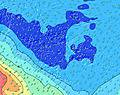 | 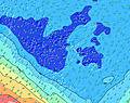 |  | 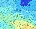 | 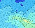 | ||||||||||||||
Wave Height (m) Direction Period (s) | SSW 15 | SSW 14 | SSW 14 | SW 14 | SW 14 | SW 13 | SSW 13 | SSW 13 | SSW 12 | SSW 12 | SSW 12 | SSW 11 | SSW 11 | SW 16 | SW 13 | SW 14 | SW 12 | SW 12 | SW 12 | SW 12 | SSW 11 |
Wave Graph | |||||||||||||||||||||
924 | 789 | 659 | 934 | 1429 | 2036 | 1915 | 1699 | 1258 | 889 | 686 | 443 | 334 | 361 | 784 | 2229 | 1575 | 1319 | 1048 | 1202 | 845 | |
Wind (km/h) | |||||||||||||||||||||
Wind State on-shore cross-onshore cross-shore cross-offshore off-shore glassy | cross-off | cross | cross-on | cross-on | on | cross-on | cross | cross-on | cross-off | cross-off | off | off | off | cross-off | cross-off | glassy | glassy | cross-on | on | cross-on | cross-on |
High Tide | 10:36AM0.19m | 11:32PM0.22m | 11:09AM0.22m | 11:51PM0.23m | 11:36AM0.24m | 00:10AM0.25m | 12:01PM0.26m | 00:30AM0.26m | 12:26PM0.28m | 00:49AM0.27m | 12:50PM0.29m | 1:08AM0.28m | 1:14PM0.30m | 1:26AM0.29m | |||||||
Low Tide | 5:21PM0.08m | 5:44AM0.10m | 5:43PM0.05m | 5:58AM0.08m | 6:03PM0.03m | 6:13AM0.06m | 6:24PM0.01m | 6:30AM0.04m | 6:44PM0.01m | 6:48AM0.03m | 7:06PM0.01m | 7:08AM0.02m | 7:27PM0.02m | ||||||||
6:26 | — | — | 6:26 | — | — | 6:26 | — | — | 6:26 | — | — | 6:26 | — | — | 6:24 | — | — | 6:24 | — | — | |
— | 5:42 | — | — | 5:42 | — | — | 5:42 | — | — | 5:43 | — | — | 5:43 | — | — | 5:43 | — | — | 5:44 | — | |
mm | — | 2 | — | — | — | — | — | — | — | — | — | — | 1 | — | — | — | — | — | — | — | 2 |
Temp °C | 26 | 26 | 26 | 25 | 25 | 24 | 24 | 24 | 25 | 25 | 26 | 26 | 26 | 26 | 26 | 26 | 26 | 25 | 24 | 24 | 23 |
Feels °C | 26 | 26 | 27 | 29 | 28 | 28 | 27 | 27 | 27 | 27 | 29 | 28 | 28 | 27 | 27 | 30 | 30 | 28 | 26 | 25 | 22 |
Swell 1 Height (m) Direction Period (s) | SSW 15 | SSW 14 | SSW 14 | SW 14 | SW 14 | SW 13 | SSW 13 | SSW 13 | SSW 12 | SSW 12 | SSW 12 | SSW 11 | SSW 11 | SSW 10 | SW 13 | SW 14 | SW 12 | SW 12 | SW 12 | SW 12 | SSW 11 |
924 | 789 | 659 | 934 | 1429 | 2036 | 1915 | 1699 | 1258 | 889 | 686 | 443 | 334 | 272 | 784 | 2229 | 1575 | 1319 | 1048 | 1202 | 845 | |
Swell 2 Height (m) Direction Period (s) | ESE 6 | SSE 13 | N 5 | SSE 12 | SSE 12 | SSE 11 | NE 11 | NNE 10 | SSE 11 | NNE 10 | SW 19 | SW 18 | SW 16 | SW 16 | SW 15 | SSE 12 | S 12 | NNE 12 | SSE 12 | NNE 12 | NNE 12 |
4 | 16 | 7 | 48 | 46 | 24 | 29 | 20 | 22 | 9 | 92 | 154 | 219 | 361 | 453 | 29 | 25 | 56 | 46 | 55 | 55 | |
Swell 3 Height (m) Direction Period (s) | SSE 14 | ENE 11 | SSE 12 | NE 10 | NNE 9 | NE 9 | SSE 11 | SSE 10 | NNE 10 | SSE 10 | NNE 10 | SSE 12 | SSE 12 | S 14 | SSE 13 | SSE 14 | NNE 7 | SSE 12 | NNE 11 | SSE 11 | S 11 |
19 | 12 | 29 | 15 | 33 | 21 | 22 | 20 | 10 | 10 | 9 | 15 | 14 | 37 | 59 | 41 | 9 | 52 | 47 | 24 | 21 | |
Wind waves Height (m) Direction Period (s) | N 4 | N 4 | — | — | — | — | — | — | — | — | — | ENE 8 | NNE 9 | NNE 3 | NNE 6 | NNE 13 | — | — | — | — | — |
10 | 8 | — | — | — | — | — | — | — | — | — | 13 | 8 | 4 | 18 | 66 | — | — | — | — | — | |
Nearest Offshore or Glassy | |||||||||||||||||||||
Distance (km) | 175 | 26 | 26 | 26 | 23 | 25 | 17 | 17 | 9 | 0 | 0 | 0 | 0 | 9 | 0 | 0 | 0 | 23 | 23 | 31 | 2624 |
Best forecast wave conditions in Tahiti | |||||||||||||||||||||
Best forecast wave conditions in French Polynesia | |||||||||||||||||||||
Header Global | |||||||||||||||||||||
- Map Icons:
 Break
Break Live Wave Height (m)
 Live Wind Speed (km/h)
 Surf Rating (10 Max)
 Ocean Swells (m)
- Wind Speed (km/h)


FREE! Surf-Forecast.com widget for your website
The surf report / weather widget below is available to embed on third party websites free of charge and provides a summary of our Point de Pecheurs (Sapunis) surf forecast. Simply grab the html code snippet that we provide and paste it into your own site. You can choose your preferred language and metric/imperial units for the surf forecast feed to suit users of your site. Click here to get the code.
Information about the Point de Pecheurs (Sapunis) Surf forecast
The above surf forecast table for Point de Pecheurs (Sapunis) provides essential information for determining whether the surfing conditions will be good over the next 16 days. A general guide to surfing at Point de Pecheurs (Sapunis) can be found by selecting the local surf guide option on the grey menu. Our Point de Pecheurs (Sapunis) surf forecast is unique since it includes wave energy (power) that defines the real feel of the surf rather than just the height or the period. If you surf the same spot (Point de Pecheurs (Sapunis)) regularly then make a mental note of the wave energy from the surf forecast table each time you go. Very soon you may start to choose your surf days based on the wave energy alone combined with our forecast of favourable offshore wind conditions. Our star ratings will help here and of course you will also find the usual wave height and period predictions on our surf forecasts as well as a full break down of the swell components under our advanced users option (to reveal that, click the little Einstein character under the tide times).
Further information to help with frequently asked questions about our surf forecast for Point de Pecheurs (Sapunis) may be found under the help tab on the top menu and also by moving your mouse over the question marks on the surf forecast table itself. Please always bear in mind that the forecast is for near-shore open water and local factors at each surf break influence the actual breaking wave height, such as the beach / reef profile, water depths offshore and shelter.
Point de Pecheurs (Sapunis) is 5 km (3 miles) from Punaauia. If you plan a holiday in Tahiti, look for hotels and other accommodation in Punaauia. Punaauia has rooms for a wide range of budgets as well as car hire and transport links.
 Nearest