

Surf Forecasts:

Ombak Tujuh surf forecast from 24 Jul 2026:
- Best quality surf: Sunday 26 Jul, 4AM (local time) - 8ft (2.5m), 9s period, SE swell with offshore winds.
- Most powerful swell: Saturday 1 Aug, 7AM (local time) - 5.5ft (1.7m), 18s period, SSW swell with 1,837 kJ wave energy.
- Next surfable swell (1★+): Sunday 26 Jul, 4AM (local time) - 8ft (2.5m), 9s period with SE swell.
Best Forecast Surf Conditions for Ombak Tujuh this week:
The surf forecast for Ombak Tujuh over the next 16 days: The first swell (rated 1 star or higher) is forecast to arrive on Sunday (Jul 26) at 4AM. The primary swell is predicted to be 2.5m and 9s period with a secondary swell of 1.7m and 9s. Another secondary swell of 0.5m and 13s is also forecast. The wind is predicted to be offshore as the swell arrives.
The most powerful waves expected at Ombak Tujuh in the next 16 days are 1.7m 18s and forecast to arrive on Saturday (Aug 01) at 7AM. Winds are predicted to be offshore at the time the swell arrives.
| Wave Type | Time (WIB) & Date | Wave Height & Period |
|---|---|---|
| Next good surf (1 star+) | 4AM (Sun 26th Jul) | 8ft (2.5m) 9s |
| Best Surf | 4AM (Sun 26th Jul) | 8ft (2.5m) 9s |
| Most Powerful | 7AM (Sat 1st Aug) | 5.5ft (1.7m) 18s |
Table - best surf conditions forecast for Ombak Tujuh over the next 16 days.
The Lowdown
Alright, Rusty here, and I’ve got the goods for the next couple of weeks for Ombak Tujuh. This is a reef and point break that loves a solid SW swell, and we’ve got plenty of energy coming down the pipe.
The opening weekend is a bit of a write-off, if I’m being honest. Saturday the 25th has some size at 6 ft, but the wind is pumping at 19-22 mph from the ESE and SE, and the combined energy is still decent (996) but it’s just messy. The scores are poor, so don’t bother. Sunday the 26th is similar—wind stays on the cross-off and the swell drops to 5 ft with moderate energy (618) in the morning, but it’s not great.
Now, Monday the 27th is where we start to see a glimmer. Morning brings a clean 6 ft swell from the SSE with a gentle 9 mph breeze, and the combined energy is moderate (839). The conditions are listed as very good, so you might snag a few if you’re keen, but the afternoon wind picks up again.
The real standout window begins Tuesday the 28th morning. We’ve got 7 ft of SE swell with a period of 9 seconds, a light breeze at 6 mph, and the combined energy is solid at 1207. The report calls it excellent for experienced surfers—this is the kind of clean, punchy surf that Ombak Tujuh was made for. The wind is light enough to keep the surface glassy, and the direction is nicely aligned with the optimum SW. Crowds are only sometimes an issue here, so you might get some space.
Skip the afternoons—the wind cranks up again. But then look at Thursday the 30th morning: a tiny 3 ft swell but a very long 19-second period from the SSW, and the energy is through the roof at 1655. That’s a lot of grunt for a small wave, meaning it’ll be clean and super fun on the point with a gentle 9 mph breeze. This is the sneaky good session for those who can read a groundswell.
Heading into the first week of August, Saturday the 1st is another highlight. Morning brings a 7 ft SSW swell with a whopping 18-second period and light winds at 6 mph, and the combined energy is massive at 2745. This is proper groundswell, and for a reef/point like Ombak Tujuh, that’s premium. The waves will have shape and power, and the light wind will keep it clean for hours. This is your best bet for the whole forecast, but remember, it’s over a week away, so lock it in but keep an eye on the wind.
Sunday the 2nd through Tuesday the 5th is a mixed bag. The swell stays in the 5 ft to 7 ft range, but the wind is mostly moderate to fresh, and the scores drop. The energy is still strong (around 1500-2000), but you’ll be battling the breeze. It’s not terrible, just not the magic of that first Saturday of August.
Then, as we push into the second week, the swell really builds. Friday the 7th afternoon shows 8 ft from the SSW with an 18-second period and energy at a whopping 4342—that’s getting into serious territory. And Saturday the 8th morning looks 10 ft with a 17-second period and energy at 5224. That’s big and powerful. For most surfers, that’s expert-only territory, especially with a fresh breeze at 22 mph. It’ll be raw and heavy, not for the faint of heart. The point might offer some shelter, but the beach sections could be thumping closeouts.
The best of the best for a good paddler is that Saturday, August 1st morning. For the brave, the August 8th morning is the big dog, but it comes with a caveat: a huge, long-period SW swell this size needs an expert hand to handle the power and the wind.
So, in short: the first few days are dodgy. From Tuesday the 28th morning, the quality lifts. The absolute standout is Saturday, August 1st morning. A close second is Thursday the 30th morning for the clean, long-period magic. The final weekend is for the big-wave crew only. Keep your wetsuit warm and your wax fresh—there’s some proper surf coming.
Rusty.
Short Range ForecastMostly dry. Warm (max 27°C on Sat morning, min 23°C on Fri night). Winds decreasing (strong winds from the ESE on Fri night, light winds from the E by Sun night). | Days 4-6 Weather SummaryLight rain (total 2mm), mostly falling on Mon night. Warm (max 28°C on Tue morning, min 23°C on Mon night). Mainly fresh winds. | ||||||||||||||||||||
Saturday 25 | Sunday 26 | Monday 27 | Tuesday 28 | Wednesday 29 | Thursday 30 | Friday 31 | |||||||||||||||
AM | PM | Night | AM | PM | Night | AM | PM | Night | AM | PM | Night | AM | PM | Night | AM | PM | Night | AM | PM | Night | |
Swell Height Map |  |  |  | 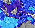 | 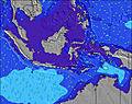 | 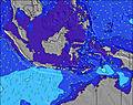 | 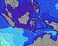 | ||||||||||||||
Wave Height (m) Direction Period (s) | SSE 9 | SSE 9 | SE 9 | SSE 9 | SE 10 | SE 9 | SSE 10 | SSE 10 | SE 10 | SE 9 | SSW 15 | SSW 15 | SE 8 | SSW 14 | SW 20 | SSW 19 | SSW 15 | SW 18 | SSW 17 | SSW 16 | SSW 16 |
Wave Graph | |||||||||||||||||||||
575 | 588 | 1096 | 402 | 940 | 1198 | 590 | 600 | 1092 | 702 | 287 | 282 | 640 | 239 | 309 | 637 | 573 | 895 | 1206 | 981 | 969 | |
Wind (km/h) | |||||||||||||||||||||
Wind State on-shore cross-onshore cross-shore cross-offshore off-shore glassy | cross-off | cross-off | cross-off | cross-off | cross-off | off | cross-off | cross-off | off | cross-off | cross-off | cross-off | cross-off | cross-off | cross-off | cross-off | cross-off | cross-off | cross-off | cross-off | cross-off |
High Tide | 5:28PM0.60m | 4:42AM1.11m | 6:54PM0.65m | 5:46AM1.15m | 7:33PM0.72m | 6:38AM1.21m | 8:03PM0.79m | 7:21AM1.27m | 8:31PM0.88m | 7:58AM1.32m | 8:58PM0.97m | 8:32AM1.34m | 9:25PM1.05m | ||||||||
Low Tide | 11:47AM0.41m | 8:38PM0.56m | 12:46PM0.34m | 10:32PM0.58m | 1:25PM0.27m | 11:52PM0.55m | 1:57PM0.21m | 00:48AM0.50m | 2:25PM0.16m | 1:33AM0.46m | 2:50PM0.13m | 2:14AM0.42m | 3:14PM0.12m | 2:52AM0.38m | |||||||
6:07 | — | — | 6:07 | — | — | 6:07 | — | — | 6:07 | — | — | 6:07 | — | — | 6:07 | — | — | 6:07 | — | — | |
— | 5:53 | — | — | 5:53 | — | — | 5:53 | — | — | 5:53 | — | — | 5:53 | — | — | 5:53 | — | — | 5:53 | — | |
mm | — | — | — | — | — | — | — | — | 1 | — | — | — | — | — | — | — | 1 | — | — | 1 | — |
Temp °C | 27 | 26 | 24 | 27 | 26 | 24 | 27 | 26 | 25 | 28 | 26 | 25 | 28 | 26 | 25 | 27 | 27 | 25 | 28 | 27 | 25 |
Feels °C | 23 | 22 | 21 | 26 | 24 | 23 | 26 | 24 | 24 | 27 | 24 | 24 | 27 | 24 | 24 | 29 | 26 | 25 | 28 | 26 | 25 |
Swell 1 Height (m) Direction Period (s) | SSW 15 | SSW 14 | SSE 9 | SSE 9 | SSE 10 | SSE 9 | SSE 10 | SW 13 | SE 9 | SSE 9 | SSW 15 | SSW 15 | SSE 8 | SSW 14 | SSW 14 | SSW 15 | SSW 15 | SW 18 | SSW 17 | SSW 16 | SSW 16 |
288 | 213 | 535 | 402 | 506 | 490 | 590 | 78 | 353 | 233 | 287 | 272 | 235 | 239 | 253 | 491 | 573 | 895 | 1206 | 981 | 969 | |
Swell 2 Height (m) Direction Period (s) | SW 15 | SW 15 | SSW 14 | SW 13 | SW 14 | SW 13 | SSW 17 | SSW 16 | SW 16 | SW 15 | S 18 | S 16 | SSW 14 | S 14 | SW 20 | SE 8 | SW 18 | SE 7 | SSE 7 | SW 20 | SE 7 |
78 | 134 | 145 | 111 | 116 | 140 | 170 | 105 | 255 | 239 | 57 | 127 | 307 | 89 | 309 | 129 | 470 | 126 | 96 | 408 | 126 | |
Swell 3 Height (m) Direction Period (s) | S 18 | W 10 | SW 14 | SSW 14 | SSW 12 | SSW 12 | SW 13 | S 12 | SW 12 | SW 11 | — | SW 11 | S 15 | SSW 18 | S 16 | SSW 19 | NW 12 | SSW 14 | SW 22 | WNW 11 | SSW 20 |
55 | 2 | 99 | 105 | 51 | 29 | 79 | 11 | 53 | 33 | — | 19 | 150 | 102 | 137 | 637 | 6 | 390 | 229 | 12 | 490 | |
Wind waves Height (m) Direction Period (s) | SSE 9 | SSE 9 | SE 9 | — | SE 10 | SE 9 | — | SSE 10 | SE 10 | SE 9 | SE 8 | SE 8 | SE 8 | SSE 8 | SE 7 | SE 8 | SE 8 | SE 8 | SE 8 | SE 8 | SE 7 |
575 | 588 | 1096 | — | 940 | 1198 | — | 600 | 1092 | 702 | 255 | 282 | 640 | 213 | 156 | 398 | 182 | 350 | 337 | 182 | 340 | |
Nearest Offshore or Glassy | |||||||||||||||||||||
Distance (km) | 38 | 292 | 33 | 33 | 37 | 0 | 0 | 292 | 0 | 0 | 292 | 33 | 33 | 292 | 33 | 0 | 33 | 33 | 0 | 37 | 33 |
Best forecast wave conditions in West Java | |||||||||||||||||||||
Best forecast wave conditions in Indonesia | |||||||||||||||||||||
Header Global | |||||||||||||||||||||
- Map Icons:
 Break
Break Live Wave Height (m)
 Live Wind Speed (km/h)
 Surf Rating (10 Max)
 Ocean Swells (m)
- Wind Speed (km/h)


FREE! Surf-Forecast.com widget for your website
The surf report / weather widget below is available to embed on third party websites free of charge and provides a summary of our Ombak Tujuh surf forecast. Simply grab the html code snippet that we provide and paste it into your own site. You can choose your preferred language and metric/imperial units for the surf forecast feed to suit users of your site. Click here to get the code.
Information about the Ombak Tujuh Surf forecast
The above surf forecast table for Ombak Tujuh provides essential information for determining whether the surfing conditions will be good over the next 16 days. A general guide to surfing at Ombak Tujuh can be found by selecting the local surf guide option on the grey menu. Our Ombak Tujuh surf forecast is unique since it includes wave energy (power) that defines the real feel of the surf rather than just the height or the period. If you surf the same spot (Ombak Tujuh) regularly then make a mental note of the wave energy from the surf forecast table each time you go. Very soon you may start to choose your surf days based on the wave energy alone combined with our forecast of favourable offshore wind conditions. Our star ratings will help here and of course you will also find the usual wave height and period predictions on our surf forecasts as well as a full break down of the swell components under our advanced users option (to reveal that, click the little Einstein character under the tide times).
Further information to help with frequently asked questions about our surf forecast for Ombak Tujuh may be found under the help tab on the top menu and also by moving your mouse over the question marks on the surf forecast table itself. Please always bear in mind that the forecast is for near-shore open water and local factors at each surf break influence the actual breaking wave height, such as the beach / reef profile, water depths offshore and shelter.
Ombak Tujuh is 37 km (23 miles) from the city of Pelabuhanratu. If you plan a holiday in West Java, look for hotels and other accommodation in Pelabuhanratu. Pelabuhanratu has rooms for a wide range of budgets as well as car hire and transport links.
 Nearest