

Surf Forecasts:

Turtles surf forecast from 2 Aug 2026:
- Best quality surf: Monday 3 Aug, 4AM (local time) - 6ft (1.8m), 15s period, SSW swell with offshore winds.
- Most powerful swell: Friday 7 Aug, 4PM (local time) - 10ft (3.0m), 16s period, SSW swell with 4,319 kJ wave energy.
- Next surfable swell (1★+): Monday 3 Aug, 4AM (local time) - 6ft (1.8m), 15s period with SSW swell.
Best Forecast Surf Conditions for Turtles this week:
The surf forecast for Turtles over the next 16 days: The first swell (rated 1 star or higher) is forecast to arrive on Monday (Aug 03) at 4AM. The primary swell is predicted to be 1.8m and 15s period with a secondary swell of 0.5m and 6s. Another secondary swell of 0.8m and 6s is also forecast. The wind is predicted to be offshore as the swell arrives.
The most powerful waves expected at Turtles in the next 16 days are 3.0m 16s and forecast to arrive on Friday (Aug 07) at 4PM. Winds are predicted to be cross-offshore at the time the swell arrives. The largest open ocean swell (not directed at the beach) is 1.3m 6s period and expected on Wednesday (Aug 05) at 7AM.
| Wave Type | Time (WIB) & Date | Wave Height & Period |
|---|---|---|
| Next good surf (1 star+) | 4AM (Mon 3rd Aug) | 6ft (1.8m) 15s |
| Best Surf | 4AM (Mon 3rd Aug) | 6ft (1.8m) 15s |
| Most Powerful | 4PM (Fri 7th Aug) | 10ft (3.0m) 16s |
Table - best surf conditions forecast for Turtles over the next 16 days.
The Lowdown
Alright folks, Rusty here. Let’s have a look at what’s shaping up for Turtles over the next couple of weeks.
We’ve got a solid run of south-west groundswell on the way, and it’s a consistent reef set-up that’s going to see plenty of action. The water temp is sitting about average for this time of year, so no surprises there.
The first real standout lands on Tuesday, August 4th. The morning session is the pick of the entire outlook. We’re looking at a clean 5 ft swell from the SSW with a long 16-second period, and the wind is a gentle cross-off breeze from the SE. The combined energy is pumping at a solid 1607 (moderate energy), and the report flags it as excellent for experienced surfers. This is the one to circle – it’s got the right size, the right wind, and the reef handles that long period beautifully.
The surf dips a little after that, but we’ve got another cracker on Thursday, August 6th in the morning. That’s a 7 ft SSW swell, again with a 16-second period and gentle cross-off wind. The energy jumps to 2378 (moderate energy), and it’s another “excellent” call for experienced surfers. That’s a good-sized wave, so it’s not for the groms, but for the crew who know what they’re doing, it’s going to be firing.
By Friday, August 7th, things get serious. The morning swell is 8 ft from the SSW, and the combined energy is 4126 (strong energy). That’s big, powerful, and the wind is still a cross-off, but it’s up to 15 mph. This one is for the experts only – over 8 ft and strong. Same story on Monday, August 10th afternoon, with a 8 ft S swell and energy at 4157 (strong energy). The wind is a fresh 18 mph cross-off, so it’ll be clean but heavy.
The second week has some promise, but it’s less certain. Saturday, August 15th morning offers a 6 ft SSW swell with a 15-second period and gentle cross-off wind. The energy is 1753 (moderate energy), and it’s rated excellent for experienced surfers. That’s a solid, clean morning session, but with the date being a week and a half out, keep an eye on it.
The rest of the fortnight is a mix of cross-off wind and consistent SSW groundswell, but the quality takes a hit with stronger winds or questionable tides. You’ll see plenty of surfable waves, but nothing that screams “drop everything” except the mornings I’ve called out. The Turtles reef is a very consistent wave, so crowds are possible – especially on those clean mornings.
If you’re a strong surfer, get on the morning of August 4th. If you want a bit more size, August 6th morning is your second best. The big stuff on the 7th and 10th is for the hardcore crew only.
Rusty.
Short Range ForecastMostly dry. Warm (max 28°C on Tue morning, min 23°C on Sat night). Wind will be generally light. | Days 4-6 Weather SummaryMostly dry. Warm (max 27°C on Wed morning, min 23°C on Wed night). Winds increasing (light winds from the SE on Thu morning, fresh winds from the SE by Fri afternoon). | ||||||||||||||||||||
Sunday 2 | Monday 3 | Tuesday 4 | Wednesday 5 | Thursday 6 | Friday 7 | Saturday 8 | |||||||||||||||
AM | PM | Night | AM | PM | Night | AM | PM | Night | AM | PM | Night | AM | PM | Night | AM | PM | Night | AM | PM | Night | |
Swell Height Map |  |  |  | 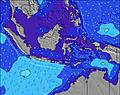 | 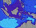 | 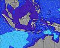 | 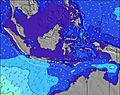 | ||||||||||||||
Wave Height (m) Direction Period (s) | SSW 17 | SSW 16 | SSW 15 | SSW 14 | SSW 15 | SSW 14 | SSW 16 | SSW 16 | SSW 15 | SSW 15 | SSW 19 | SSW 17 | SSW 16 | SSW 16 | SSW 17 | SSW 17 | SSW 16 | SSW 16 | SSW 16 | SSW 16 | SSW 16 |
Wave Graph | |||||||||||||||||||||
2303 | 1772 | 1374 | 1319 | 1145 | 1301 | 945 | 875 | 1279 | 1288 | 1274 | 2404 | 2155 | 2164 | 3427 | 4012 | 4319 | 3197 | 2648 | 2109 | 2080 | |
Wind (km/h) | |||||||||||||||||||||
Wind State on-shore cross-onshore cross-shore cross-offshore off-shore glassy | cross-off | cross-off | cross-off | cross-off | cross-off | cross-off | cross-off | cross-off | cross-off | cross-off | cross-off | cross-off | cross-off | cross-off | cross-off | cross-off | cross-off | cross-off | cross-off | cross-off | cross-off |
High Tide | 9:36AM1.29m | 10:18PM1.20m | 10:07AM1.22m | 10:46PM1.25m | 10:40AM1.12m | 11:16PM1.29m | 11:15AM1.01m | 11:52PM1.31m | 11:56AM0.88m | 00:35AM1.30m | 12:47PM0.74m | 1:32AM1.28m | 2:08PM0.63m | 2:47AM1.26m | |||||||
Low Tide | 3:59PM0.13m | 4:08AM0.34m | 4:22PM0.16m | 4:48AM0.33m | 4:45PM0.20m | 5:32AM0.34m | 5:10PM0.24m | 6:24AM0.36m | 5:38PM0.29m | 7:31AM0.38m | 6:12PM0.35m | 9:05AM0.39m | 6:58PM0.42m | ||||||||
6:05 | — | — | 6:05 | — | — | 6:05 | — | — | 6:05 | — | — | 6:05 | — | — | 6:05 | — | — | 6:05 | — | — | |
— | 5:53 | — | — | 5:54 | — | — | 5:54 | — | — | 5:54 | — | — | 5:54 | — | — | 5:54 | — | — | 5:54 | — | |
mm | — | — | — | — | — | — | — | — | — | — | — | — | — | — | — | — | — | — | — | — | — |
Temp °C | 26 | 26 | 24 | 27 | 27 | 24 | 28 | 26 | 24 | 27 | 26 | 24 | 27 | 26 | 24 | 27 | 26 | 24 | 27 | 26 | 24 |
Feels °C | 26 | 25 | 25 | 27 | 27 | 25 | 27 | 25 | 23 | 26 | 24 | 23 | 29 | 25 | 24 | 26 | 24 | 23 | 23 | 23 | 22 |
Swell 1 Height (m) Direction Period (s) | SSW 17 | SSW 16 | SSW 15 | SSW 14 | SSW 15 | SSW 14 | SSW 16 | SSW 13 | SSW 15 | SSW 15 | SSW 19 | SSW 17 | SSW 16 | SSW 16 | SSW 17 | SSW 17 | SSW 16 | SSW 16 | SSW 16 | SSW 16 | SSW 16 |
2303 | 1772 | 1374 | 1319 | 1145 | 1301 | 945 | 735 | 1279 | 1288 | 1274 | 2404 | 2155 | 2164 | 3427 | 4012 | 4319 | 3197 | 2648 | 2109 | 2080 | |
Swell 2 Height (m) Direction Period (s) | WNW 12 | S 11 | SSE 6 | SSE 6 | S 10 | W 10 | SSW 13 | SSW 16 | SW 22 | SSW 20 | SSW 14 | WNW 10 | SSE 11 | WNW 10 | WNW 10 | WNW 10 | WNW 11 | NW 10 | WNW 10 | WNW 10 | WNW 10 |
13 | 9 | 24 | 20 | 8 | 2 | 653 | 875 | 121 | 609 | 701 | 34 | 99 | 35 | 20 | 21 | 23 | 28 | 20 | 20 | 10 | |
Swell 3 Height (m) Direction Period (s) | — | — | S 11 | WNW 11 | W 11 | — | WNW 10 | WNW 9 | WNW 9 | WNW 12 | S 12 | — | WNW 10 | WNW 10 | — | — | — | — | — | — | — |
— | — | 9 | 12 | 2 | — | 9 | 9 | 8 | 14 | 44 | — | 33 | 63 | — | — | — | — | — | — | — | |
Wind waves Height (m) Direction Period (s) | SE 6 | SSE 6 | SE 6 | SE 6 | SSE 6 | SSE 6 | SE 6 | SE 7 | SE 6 | SE 6 | SE 6 | SE 6 | SE 6 | SE 6 | SE 6 | SE 7 | SE 7 | SE 6 | SE 6 | SE 6 | SE 7 |
102 | 41 | 64 | 56 | 19 | 12 | 39 | 89 | 27 | 92 | 47 | 31 | 91 | 28 | 30 | 93 | 114 | 56 | 75 | 128 | 183 | |
Nearest Offshore or Glassy | |||||||||||||||||||||
Distance (km) | 294 | 294 | 5 | 3 | 294 | 36 | 0 | 40 | 36 | 36 | 294 | 36 | 0 | 830 | 36 | 294 | 294 | 36 | 294 | 240 | 36 |
Best forecast wave conditions in West Java | |||||||||||||||||||||
Best forecast wave conditions in Indonesia | |||||||||||||||||||||
Header Global | |||||||||||||||||||||
- Map Icons:
 Break
Break Live Wave Height (m)
 Live Wind Speed (km/h)
 Surf Rating (10 Max)
 Ocean Swells (m)
- Wind Speed (km/h)
Latest Updates


FREE! Surf-Forecast.com widget for your website
The surf report / weather widget below is available to embed on third party websites free of charge and provides a summary of our Turtles surf forecast. Simply grab the html code snippet that we provide and paste it into your own site. You can choose your preferred language and metric/imperial units for the surf forecast feed to suit users of your site. Click here to get the code.
Information about the Turtles Surf forecast
The above surf forecast table for Turtles provides essential information for determining whether the surfing conditions will be good over the next 16 days. A general guide to surfing at Turtles can be found by selecting the local surf guide option on the grey menu. Our Turtles surf forecast is unique since it includes wave energy (power) that defines the real feel of the surf rather than just the height or the period. If you surf the same spot (Turtles) regularly then make a mental note of the wave energy from the surf forecast table each time you go. Very soon you may start to choose your surf days based on the wave energy alone combined with our forecast of favourable offshore wind conditions. Our star ratings will help here and of course you will also find the usual wave height and period predictions on our surf forecasts as well as a full break down of the swell components under our advanced users option (to reveal that, click the little Einstein character under the tide times).
Further information to help with frequently asked questions about our surf forecast for Turtles may be found under the help tab on the top menu and also by moving your mouse over the question marks on the surf forecast table itself. Please always bear in mind that the forecast is for near-shore open water and local factors at each surf break influence the actual breaking wave height, such as the beach / reef profile, water depths offshore and shelter.
Turtles is 40 km (25 miles) from the city of Pelabuhanratu. If you plan a holiday in West Java, look for hotels and other accommodation in Pelabuhanratu. Pelabuhanratu has rooms for a wide range of budgets as well as car hire and transport links.
 Nearest