

Surf Forecasts:

Liencres surf forecast from 3 Aug 2026:
- Best quality surf: Thursday 6 Aug, 11PM (local time) - 3ft (0.9m), 9s period, NNW swell with cross-offshore winds.
- Most powerful swell: Thursday 6 Aug, 11AM (local time) - 3.5ft (1.1m), 9s period, NW swell with 211 kJ wave energy.
- Next surfable swell (1★+): Thursday 6 Aug, 11PM (local time) - 3ft (0.9m), 9s period with NNW swell.
Best Forecast Surf Conditions for Liencres this week:
The surf forecast for Liencres over the next 16 days: The first swell (rated 1 star or higher) is forecast to arrive on Thursday (Aug 06) at 11PM. The primary swell is predicted to be 0.9m and 9s period with a secondary swell of 0.2m and 10s. Another secondary swell of 0.6m and 4s is also forecast. The wind is predicted to be cross-offshore as the swell arrives.
The most powerful waves expected at Liencres in the next 16 days are 1.1m 9s and forecast to arrive on Thursday (Aug 06) at 11AM. Winds are predicted to be cross-offshore at the time the swell arrives. The largest open ocean swell (not directed at the beach) is 0.6m 4s period and expected on Thursday (Aug 06) at 5PM.
| Wave Type | Time (CEST) & Date | Wave Height & Period |
|---|---|---|
| Next good surf (1 star+) | 11PM (Thu 6th Aug) | 3ft (0.9m) 9s |
| Best Surf | 11PM (Thu 6th Aug) | 3ft (0.9m) 9s |
| Most Powerful | 11AM (Thu 6th Aug) | 3.5ft (1.1m) 9s |
Table - best surf conditions forecast for Liencres over the next 16 days.
The Lowdown
Alright folks, Rusty here. Let’s take a look at what’s on offer for Liencres over the next couple of weeks.
To be straight with you, the first week and a half is looking pretty flat. We’ve got a long quiet spell from now until around the 10th of August where the swell is mostly under 1ft, with a few days bumping up to 2ft or 4ft, but the wind is all over the shop and the conditions are just ordinary. The water is sitting at 72°F, which is a touch warmer than normal for this time of year, so at least a dip won’t be a shock.
The first real pulse of energy shows up on the morning of Monday, 6th August. Swell comes in at 4ft from the NW with a period of 9 seconds, and the combined energy hits 222 (moderate). The wind is cross-off from the ENE at 12 mph, so it’ll be clean. It’s only a marginal surf call, but it’s the best we’ve seen. That afternoon the wind picks up a little but stays cross-off, and the swell holds at 4ft with energy at 204. This is a beginner-friendly break, so take it easy out there.
The real standout for the whole outlook is Thursday, 14th August. The morning brings 5ft from the N with a period of 7 seconds, and energy at 184. The wind is light and cross from the NE at 3 mph, so it’s glassy. By the afternoon, the swell pushes up to 5ft from the N, still 7 seconds, with energy at 214. The wind stays cross from the NE at 9 mph, which will keep it fairly clean. Now, 5ft is pushing the limit for beginners, but for anyone with a bit of experience, this is the best run of the forecast. The N swell direction isn’t the optimum for Liencres, but the size and clean conditions make it worth a paddle.
After that, the swell drops off again. The 15th and 16th have some 3ft to 4ft waves, but the wind turns messy and the energy is weak. From the 17th onward, it’s back to tiny, gutless surf with onshore wind.
So, bottom line: if you’re itching for a wave, head out on the 6th of August for a clean, small session, but the real highlight is the 14th of August. That’s the day to call in sick if you can.
Rusty.
Short Range ForecastLight rain (total 2mm), mostly falling on Wed night. Warm (max 22°C on Mon afternoon, min 19°C on Mon morning). Wind will be generally light. | Days 4-6 Weather SummaryLight rain (total 4mm), mostly falling on Sat night. Warm (max 21°C on Thu afternoon, min 17°C on Fri morning). Wind will be generally light. | ||||||||||||||||||||
Monday 3 | Tuesday 4 | Wednesday 5 | Thursday 6 | Friday 7 | Saturday 8 | Sunday 9 | |||||||||||||||
AM | PM | Night | AM | PM | Night | AM | PM | Night | AM | PM | Night | AM | PM | Night | AM | PM | Night | AM | PM | Night | |
Swell Height Map |  |  |  | 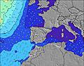 | 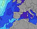 | 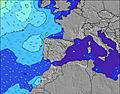 | 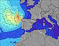 | ||||||||||||||
Wave Height (m) Direction Period (s) | NW 7 | NW 7 | WNW 9 | WNW 8 | WNW 9 | WNW 8 | NW 11 | NW 10 | NW 9 | NW 9 | NW 9 | NNW 9 | NNW 8 | NNW 8 | NNW 7 | NNW 7 | NW 7 | NW 11 | NW 10 | NW 9 | NW 8 |
Wave Graph | |||||||||||||||||||||
9 | 9 | 16 | 26 | 15 | 26 | 19 | 104 | 188 | 211 | 190 | 135 | 92 | 56 | 26 | 17 | 11 | 30 | 96 | 65 | 57 | |
Wind (km/h) | |||||||||||||||||||||
Wind State on-shore cross-onshore cross-shore cross-offshore off-shore glassy | cross-on | cross-on | glassy | on | cross-on | cross-off | cross-on | cross-on | cross | cross-off | cross-off | cross-off | cross | cross | cross-off | glassy | cross-on | off | cross-on | on | cross |
High Tide | 8:09AM3.34m | 8:24PM3.51m | 8:47AM3.25m | 9:04PM3.35m | 9:31AM3.13m | 9:53PM3.17m | 10:26AM3.00m | 10:57PM2.98m | 11:37AM2.91m | 00:20AM2.88m | 1:04PM2.94m | 1:51AM2.94m | 2:25PM3.13m | 3:06AM3.13m | |||||||
Low Tide | 2:10PM0.48m | 2:37AM0.46m | 2:50PM0.60m | 3:19AM0.61m | 3:38PM0.76m | 4:10AM0.79m | 4:38PM0.91m | 5:16AM0.96m | 5:55PM1.00m | 6:36AM1.03m | 7:22PM0.94m | 7:57AM0.93m | 8:40PM0.72m | ||||||||
7:05 | — | — | 7:07 | — | — | 7:07 | — | — | 7:09 | — | — | 7:11 | — | — | 7:11 | — | — | 7:13 | — | — | |
— | — | 9:36 | — | — | 9:35 | — | — | 9:34 | — | — | 9:31 | — | — | 9:30 | — | — | 9:30 | — | — | 9:28 | |
mm | — | — | — | — | — | — | — | — | 2 | 2 | — | — | — | — | — | — | — | 2 | — | — | — |
Temp °C | 21 | 22 | 22 | 21 | 22 | 22 | 21 | 21 | 21 | 20 | 21 | 20 | 19 | 20 | 20 | 19 | 21 | 21 | 20 | 22 | 22 |
Feels °C | 23 | 23 | 24 | 22 | 22 | 23 | 22 | 22 | 22 | 20 | 19 | 18 | 19 | 18 | 20 | 20 | 20 | 21 | 20 | 22 | 22 |
Swell 1 Height (m) Direction Period (s) | N 5 | NW 7 | WNW 9 | WNW 8 | WNW 9 | WNW 8 | NW 5 | NW 10 | NW 9 | NW 9 | NW 9 | NNW 9 | NNW 8 | NNW 8 | NNW 7 | NNW 7 | NW 7 | NNW 6 | NW 10 | NW 9 | NW 8 |
7 | 8 | 16 | 26 | 15 | 26 | 7 | 104 | 188 | 211 | 190 | 135 | 92 | 56 | 26 | 17 | 11 | 12 | 96 | 65 | 57 | |
Swell 2 Height (m) Direction Period (s) | NW 7 | N 4 | NNW 7 | NNW 8 | NNW 7 | NW 11 | NW 11 | NW 5 | N 8 | WNW 10 | WNW 10 | NE 4 | NE 4 | W 9 | NNE 6 | NNE 5 | NNE 4 | NW 11 | W 8 | W 9 | N 8 |
7 | 1 | 5 | 6 | 5 | 5 | 19 | 6 | 13 | 10 | 10 | 8 | 5 | 2 | 12 | 5 | 2 | 30 | 1 | 2 | 1 | |
Swell 3 Height (m) Direction Period (s) | WNW 10 | WNW 10 | N 4 | — | — | N 8 | WNW 8 | — | — | — | NW 11 | W 10 | NW 10 | NW 9 | NNW 8 | W 9 | NW 12 | W 9 | N 10 | N 9 | — |
9 | 9 | 1 | — | — | 1 | 6 | — | — | — | 4 | 2 | 4 | 3 | 7 | 2 | 5 | 2 | 2 | 2 | — | |
Wind waves Height (m) Direction Period (s) | — | — | — | — | — | — | — | — | — | NE 3 | NE 4 | — | — | NE 5 | — | — | — | — | — | N 4 | — |
— | — | — | — | — | — | — | — | — | 1 | 12 | — | — | 7 | — | — | — | — | — | 1 | — | |
Nearest Offshore or Glassy | |||||||||||||||||||||
Distance (km) | 188 | 297 | 125 | 156 | 420 | 159 | 102 | 9 | 9 | 9 | 9 | 0 | 2 | 9 | 0 | 442 | 741 | 0 | 8 | 303 | 2 |
Best forecast wave conditions in Spain - Cantabria | |||||||||||||||||||||
Best forecast wave conditions in Spain (Europe) | |||||||||||||||||||||
Header Global | |||||||||||||||||||||
- Map Icons:
 Break
Break Live Wave Height (m)
 Live Wind Speed (km/h)
 Surf Rating (10 Max)
 Ocean Swells (m)
- Wind Speed (km/h)
Latest Updates


FREE! Surf-Forecast.com widget for your website
The surf report / weather widget below is available to embed on third party websites free of charge and provides a summary of our Liencres surf forecast. Simply grab the html code snippet that we provide and paste it into your own site. You can choose your preferred language and metric/imperial units for the surf forecast feed to suit users of your site. Click here to get the code.
Information about the Liencres Surf forecast
The above surf forecast table for Liencres provides essential information for determining whether the surfing conditions will be good over the next 16 days. A general guide to surfing at Liencres can be found by selecting the local surf guide option on the grey menu. Our Liencres surf forecast is unique since it includes wave energy (power) that defines the real feel of the surf rather than just the height or the period. If you surf the same spot (Liencres) regularly then make a mental note of the wave energy from the surf forecast table each time you go. Very soon you may start to choose your surf days based on the wave energy alone combined with our forecast of favourable offshore wind conditions. Our star ratings will help here and of course you will also find the usual wave height and period predictions on our surf forecasts as well as a full break down of the swell components under our advanced users option (to reveal that, click the little Einstein character under the tide times).
Further information to help with frequently asked questions about our surf forecast for Liencres may be found under the help tab on the top menu and also by moving your mouse over the question marks on the surf forecast table itself. Please always bear in mind that the forecast is for near-shore open water and local factors at each surf break influence the actual breaking wave height, such as the beach / reef profile, water depths offshore and shelter.
Liencres is 8 km (5 miles) from Camargo. If you plan a holiday in Spain - Cantabria, look for hotels and other accommodation in Camargo. Camargo has rooms for a wide range of budgets as well as car hire and transport links.
 Nearest