

Surf Forecasts:

La Chocolatera surf forecast from 3 Aug 2026:
- Most powerful swell: Friday 7 Aug, 1PM (local time) - 4.5ft (1.3m), 16s period, SW swell with 813 kJ wave energy.
Best Forecast Surf Conditions for La Chocolatera this week:
The most powerful waves expected at La Chocolatera in the next 16 days are 1.3m 16s and forecast to arrive on Friday (Aug 07) at 1PM. Winds are predicted to be onshore at the time the swell arrives.
| Wave Type | Time (-05) & Date | Wave Height & Period |
|---|---|---|
| Next good surf (1 star+) | - | - |
| Best Surf | - | - |
| Most Powerful | 1PM (Fri 7th Aug) | 4.5ft (1.3m) 16s |
Table - best surf conditions forecast for La Chocolatera over the next 16 days.
The Lowdown
Alright, Rusty here, giving you the same story in feet and Fahrenheit.
Honestly, looking at the next 16 days, it’s a bit of a tough stretch for La Chocolatera. There’s a real gap of good surf at the start. We’re lookin’ at a whole lot of poor surf conditions and marginal forecasts for the first several days, from Sunday the 2nd right through to the end of the first week. The wind is mostly onshore or cross-onshore, and the swell is small and messy. You’ll be fighting a moderate breeze most afternoons, making it choppy and uninviting.
The water’s a warm 79°, with a massive anomaly of 10° warmer than normal. That’s *very* unusual for this time of year, so if you do get in, it’ll feel like a bath.
The first real glimmer of hope shows up around the morning of Friday the 7th. We’ve got a 3 ft swell from the SW, with a period of 16 seconds—that’s proper long-period groundswell from the southwest. The energy readings jump up to 706 (moderate wave energy), and the wind is light and onshore, so it’ll be clean enough. But it’s still a marginal call, and the combined energy isn’t enough to get my heart racing. The morning of Friday the 14th looks a bit better: 4 ft of SW swell, 17-second period, and light winds. The energy is up to 731. Still, all these are flagged as marginal due to tide or just poor conditions overall.
The standout window, if you can call it that, is the morning of Saturday the 15th. We’ve got 4 ft of SW swell at 15 seconds, with light winds from the SSW. The energy hits 701. It’s not a big swell, but for La Chocolatera, that’s about as good as it gets in this run. The break is a point, so it’ll handle that long-period swell better than a beach break, but it’s inconsistent, and crowds are possible. The wind is light and onshore, so it’ll be clean-ish. This is the best you’ll see, but it’s still a weak option.
After that, the second week fades out with smaller swell and moderate winds, nothing to write home about.
So, to be straight with you: the best on offer is the morning of Saturday the 15th, with clean 4 ft SW groundswell at La Chocolatera. It’s not a classic, but it’s the only window that’s worth a look. Keep your expectations low.
Rusty.
Short Range ForecastMostly dry. Warm (max 23°C on Sun afternoon, min 23°C on Sun afternoon). Wind will be generally light. | Days 5-7 Weather SummaryMostly dry. Warm (max 24°C on Wed afternoon, min 23°C on Wed afternoon). Wind will be generally light. | |||||||||||||||||||
Sun 2 | Monday 3 | Tuesday 4 | Wednesday 5 | Thursday 6 | Friday 7 | Saturday 8 | ||||||||||||||
PM | Night | AM | PM | Night | AM | PM | Night | AM | PM | Night | AM | PM | Night | AM | PM | Night | AM | PM | Night | |
Swell Height Map |  | 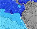 | 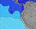 | 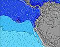 | 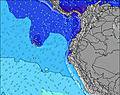 | 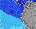 | 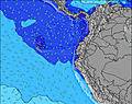 | |||||||||||||
Wave Height (m) Direction Period (s) | WSW 14 | SW 13 | WSW 13 | SW 12 | SW 9 | SW 12 | SW 12 | SW 13 | SW 12 | SW 12 | SW 13 | SW 13 | SW 13 | SW 17 | SW 16 | SW 16 | SW 14 | SW 14 | SW 14 | SW 13 |
Wave Graph | ||||||||||||||||||||
168 | 180 | 123 | 159 | 138 | 71 | 67 | 140 | 146 | 224 | 212 | 282 | 265 | 403 | 492 | 710 | 536 | 459 | 440 | 286 | |
Wind (km/h) | ||||||||||||||||||||
Wind State on-shore cross-onshore cross-shore cross-offshore off-shore glassy | on | on | on | cross-on | cross-on | on | on | on | on | cross-on | on | cross-on | on | cross-on | on | on | on | on | on | on |
High Tide | 6:16PM1.97m | 6:40AM2.15m | 6:55PM1.92m | 7:15AM2.11m | 7:39PM1.86m | 7:56AM2.04m | 8:30PM1.79m | 8:45AM1.95m | 9:34PM1.72m | 9:46AM1.87m | 10:51PM1.70m | 11:01AM1.83m | 00:13AM1.76m | |||||||
Low Tide | 00:22AM0.34m | 12:56PM0.42m | 00:58AM0.42m | 1:35PM0.42m | 1:39AM0.51m | 2:21PM0.45m | 2:28AM0.61m | 3:17PM0.48m | 3:30AM0.70m | 4:24PM0.49m | 4:47AM0.76m | 5:40PM0.46m | ||||||||
— | — | 6:28 | — | — | 6:28 | — | — | 6:28 | — | — | 6:28 | — | — | 6:28 | — | — | 6:28 | — | — | |
6:30 | — | — | 6:30 | — | — | 6:30 | — | — | 6:30 | — | — | 6:30 | — | — | 6:30 | — | — | 6:30 | — | |
mm | — | — | — | — | — | — | — | — | — | — | — | — | — | — | — | — | — | — | — | — |
Temp °C | 23 | 23 | 23 | 23 | 23 | 23 | 23 | 23 | 23 | 24 | 23 | 23 | 24 | 23 | 23 | 23 | 23 | 23 | 24 | 23 |
Feels °C | 23 | 23 | 25 | 23 | 24 | 24 | 23 | 23 | 25 | 25 | 24 | 24 | 25 | 24 | 25 | 24 | 23 | 24 | 24 | 24 |
Swell 1 Height (m) Direction Period (s) | SW 11 | SW 13 | SW 6 | SW 12 | WSW 12 | SW 6 | SW 12 | SW 13 | SSW 6 | SW 12 | SW 13 | SW 13 | SW 13 | SW 12 | SW 16 | SW 16 | SW 14 | SW 14 | SW 14 | SW 13 |
90 | 180 | 123 | 159 | 101 | 31 | 67 | 140 | 40 | 224 | 212 | 282 | 265 | 240 | 492 | 710 | 536 | 459 | 440 | 286 | |
Swell 2 Height (m) Direction Period (s) | WSW 14 | SW 10 | WSW 13 | SW 9 | NW 11 | SW 12 | SW 9 | SW 9 | SW 12 | SW 14 | SW 10 | SW 19 | SW 18 | SW 17 | SW 12 | SW 12 | — | — | SW 19 | SW 18 |
168 | 46 | 114 | 21 | 4 | 71 | 21 | 20 | 146 | 130 | 108 | 125 | 194 | 403 | 209 | 23 | — | — | 14 | 49 | |
Swell 3 Height (m) Direction Period (s) | NW 11 | NW 11 | SW 10 | NW 10 | SW 12 | SW 9 | SW 15 | NW 10 | SW 15 | SW 21 | SW 18 | — | W 9 | — | SW 4 | — | — | W 24 | W 24 | SW 22 |
5 | 4 | 37 | 4 | 38 | 29 | 33 | 4 | 35 | 17 | 53 | — | 2 | — | 5 | — | — | 11 | 11 | 18 | |
Wind waves Height (m) Direction Period (s) | SW 6 | SSW 6 | — | SW 6 | SW 9 | — | SW 5 | SW 5 | — | SW 5 | — | SSW 5 | SSW 4 | SW 4 | — | SW 3 | SSW 4 | SSW 5 | SW 5 | SW 5 |
94 | 106 | — | 64 | 138 | — | 29 | 39 | — | 21 | — | 14 | 13 | 10 | — | 6 | 16 | 31 | 28 | 28 | |
Nearest Offshore or Glassy | ||||||||||||||||||||
Distance (km) | 1051 | 40 | 7 | 1176 | 10 | 7 | 1148 | 311 | 7 | 687 | 277 | 7 | 7 | 7 | 7 | 970 | 21 | 7 | 938 | 7 |
Best forecast wave conditions in Guayas | ||||||||||||||||||||
Best forecast wave conditions in Ecuador | ||||||||||||||||||||
Header Global | ||||||||||||||||||||
- Map Icons:
 Break
Break Live Wave Height (m)
 Live Wind Speed (km/h)
 Surf Rating (10 Max)
 Ocean Swells (m)
- Wind Speed (km/h)
Latest Updates


FREE! Surf-Forecast.com widget for your website
The surf report / weather widget below is available to embed on third party websites free of charge and provides a summary of our La Chocolatera surf forecast. Simply grab the html code snippet that we provide and paste it into your own site. You can choose your preferred language and metric/imperial units for the surf forecast feed to suit users of your site. Click here to get the code.
Information about the La Chocolatera Surf forecast
The above surf forecast table for La Chocolatera provides essential information for determining whether the surfing conditions will be good over the next 16 days. A general guide to surfing at La Chocolatera can be found by selecting the local surf guide option on the grey menu. Our La Chocolatera surf forecast is unique since it includes wave energy (power) that defines the real feel of the surf rather than just the height or the period. If you surf the same spot (La Chocolatera) regularly then make a mental note of the wave energy from the surf forecast table each time you go. Very soon you may start to choose your surf days based on the wave energy alone combined with our forecast of favourable offshore wind conditions. Our star ratings will help here and of course you will also find the usual wave height and period predictions on our surf forecasts as well as a full break down of the swell components under our advanced users option (to reveal that, click the little Einstein character under the tide times).
Further information to help with frequently asked questions about our surf forecast for La Chocolatera may be found under the help tab on the top menu and also by moving your mouse over the question marks on the surf forecast table itself. Please always bear in mind that the forecast is for near-shore open water and local factors at each surf break influence the actual breaking wave height, such as the beach / reef profile, water depths offshore and shelter.
La Chocolatera is 4 km (2 miles) from the city of Salinas. If you plan a holiday in Guayas, look for hotels and other accommodation in Salinas. Salinas has rooms for a wide range of budgets as well as car hire and transport links.
 Nearest