

Surf Forecasts:

Halfway surf forecast from 2 Aug 2026:
- Best quality surf: Friday 7 Aug, 8AM (local time) - 8ft (2.4m), 17s period, SSW swell with offshore winds.
- Most powerful swell: Friday 7 Aug, 11PM (local time) - 8ft (2.5m), 16s period, SSW swell with 3,751 kJ wave energy.
- Next surfable swell (1★+): Monday 3 Aug, 2AM (local time) - 6.5ft (2.0m), 16s period with SSW swell.
Best Forecast Surf Conditions for Halfway this week:
The surf forecast for Halfway over the next 16 days: The first swell (rated 1 star or higher) is forecast to arrive on Monday (Aug 03) at 2AM. The primary swell is predicted to be 2.0m and 16s period with a secondary swell of 0.8m and 7s. The wind is predicted to be offshore as the swell arrives.
The most powerful waves expected at Halfway in the next 16 days are 2.5m 16s and forecast to arrive on Friday (Aug 07) at 11PM. Winds are predicted to be cross-offshore at the time the swell arrives. The largest open ocean swell (not directed at the beach) is 1.3m 7s period and expected on Monday (Aug 03) at 8AM.
| Wave Type | Time (WITA) & Date | Wave Height & Period |
|---|---|---|
| Next good surf (1 star+) | 2AM (Mon 3rd Aug) | 6.5ft (2.0m) 16s |
| Best Surf | 8AM (Fri 7th Aug) | 8ft (2.4m) 17s |
| Most Powerful | 11PM (Fri 7th Aug) | 8ft (2.5m) 16s |
Table - best surf conditions forecast for Halfway over the next 16 days.
The Lowdown
Alright, let’s get down to it. The forecast is showing a nice long run of SSW groundswell working its way through the period, with Halfway the main focus for most of it. It's not going to be perfect the whole way through, but there are a couple of windows that are going to be well worth the wait. Water temp is pretty much where you’d expect it for this time of year, so no major surprises there.
We kick things off on Monday the 3rd. There’s some surf, but it's a bit of a wash. Swell is pushing 5.9ft from the SSW with a long 15-second period. The energy is strong, sitting at 1465. But the wind is a cross-off from the SE at 9 mph. It’s clean, but the call is marginal. The afternoon drops a touch in size to 5.2ft, but the SE breeze picks up to 16 mph, making it a bit more of a fight. It’s surfable, but you’ll be putting in the work.
Through Tuesday and Wednesday, we’re in a similar groove. The swell holds around that 4.6ft to 5.6ft mark, still from the SSW with a decent 14-15 second period. The cross-off wind sticks around from the ESE at 12 mph, keeping the surface clean. But the energy, while moderate at 1320 to 1629, just isn’t quite firing. It’s consistent and clean, but nothing is really lighting up.
Now, Thursday the 6th is where things start to get interesting. The swell bumps up to 6.9ft, and the period stretches out to 17 seconds. The wind is more true offshore from the ESE at 19 mph. This is fresh and clean, and the energy jumps to 2534. The size is getting up there, but it’s still manageable. This is where the more experienced surfers will be having a much better time.
Friday the 7th is a step up again. We’re looking at 8.2ft of SSW swell with that long 16-17 second period. The energy is powerful now, at 3504 to 3633. The wind is cross-off from the SE, but still clean. This is proper surf. It’s solid, it’s powerful, and it’s pushing well overhead. This is the first real standout of the period.
Saturday and Sunday, the 8th and 9th, see the swell ease back a little to 6.9ft to 7.9ft, but it remains consistent and clean. The energy is still strong, but the quality takes a slight back seat. The wind stays cross-off, and the waves are still well worth a paddle out.
Now, keep your eye on Monday the 10th. The morning is okay, around 6.2ft, but the afternoon is a proper spike. The swell jumps back up to 8.2ft with a 17-second period, and the energy goes through the roof to 4314. The wind drops to a gentle 9 mph cross-off from the SE. This is setting up to be something special.
But the real winner is Tuesday the 11th. This is the one to circle. Both morning and afternoon are looking excellent. The swell is a solid 8.2ft in the morning, easing slightly to 7.5ft by the afternoon, but the period stays at a very long 16 seconds. The wind is a light 9 mph cross-off, keeping everything clean. The energy is strong at 3216 to 3636. This is the pick of the week. Big, powerful, clean groundswell. If you can only surf one day, this is it.
Wednesday the 12th through Friday the 14th keeps the quality high. The swell hangs in that 6.2ft to 8.2ft range, and the period stays long. The energy is still strong, and the cross-off wind remains favourable. There’s a lot of good surf on offer here. On Thursday the 13th, the afternoon is another standout, with 8.2ft and a 17-second period, pushing energy up to 3458.
Now, here’s where things take a turn. Saturday the 15th and Sunday the 16th are for the big dogs only. The swell is predicted to blow out. We’re talking 9.8ft to 11.5ft of SSW groundswell. The period is still long, but the energy readings are monstrous. 8815, 7660, 7014. This is well into the ‘too big for this break’ territory. The wind is still cross-off and clean, but this is not the day for a casual paddle. This is expert-only, and even then, it might be a paddle out just to watch. It carries into Monday the 17th with 9.8ft before easing back down. The window is short, but if you’re a serious charger, this is your lottery ticket. It settles back to 8.2ft on the Monday afternoon.
Tuesday the 18th sees it all wind down. The swell drops to 6.2ft with a shorter 14-second period. The energy is back to moderate at 1660. It’s a bit of an anticlimax after the weekend, but it’s still clean.
So, to sum it up: the first few days are fun but nothing crazy. The true standouts are
Short Range ForecastMostly dry. Warm (max 26°C on Sun night, min 25°C on Sun night). Wind will be generally light. | Days 5-7 Weather SummaryLight rain (total 3mm), mostly falling on Thu night. Warm (max 25°C on Wed night, min 25°C on Wed night). Mainly fresh winds. | ||||||||||||||||||
Monday 3 | Tuesday 4 | Wednesday 5 | Thursday 6 | Friday 7 | Saturday 8 | ||||||||||||||
Night | AM | PM | Night | AM | PM | Night | AM | PM | Night | AM | PM | Night | AM | PM | Night | AM | PM | Night | |
Swell Height Map |  |  |  |  | 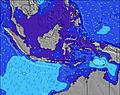 | 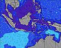 | 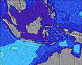 | ||||||||||||
Wave Height (m) Direction Period (s) | SSW 16 | SSW 15 | SSW 14 | SSW 15 | SW 15 | SSW 14 | SSW 14 | SSW 15 | SSW 15 | SSW 18 | SSW 17 | SSW 16 | SSW 16 | SSW 17 | SSW 16 | SSW 16 | SSW 16 | SSW 16 | SSW 16 |
Wave Graph | |||||||||||||||||||
1982 | 1337 | 1072 | 1258 | 905 | 1064 | 690 | 1158 | 1014 | 2554 | 2460 | 2318 | 2257 | 3428 | 3549 | 3463 | 2786 | 2550 | 2257 | |
Wind (km/h) | |||||||||||||||||||
Wind State on-shore cross-onshore cross-shore cross-offshore off-shore glassy | off | cross-off | cross-off | cross-off | cross-off | cross-off | cross-off | cross-off | cross-off | off | off | cross-off | off | cross-off | cross-off | cross-off | cross-off | cross-off | cross-off |
High Tide | 00:40AM2.40m | 12:36PM2.36m | 1:06AM2.44m | 1:08PM2.21m | 1:34AM2.45m | 1:43PM2.01m | 2:06AM2.41m | 2:23PM1.78m | 2:45AM2.34m | 3:17PM1.53m | 3:39AM2.24m | 4:58PM1.32m | |||||||
Low Tide | 6:38AM0.54m | 6:48PM0.30m | 7:13AM0.53m | 7:13PM0.41m | 7:52AM0.56m | 7:39PM0.55m | 8:37AM0.62m | 8:08PM0.71m | 9:37AM0.72m | 8:42PM0.89m | 11:07AM0.80m | 9:34PM1.08m | |||||||
— | 6:33 | — | — | 6:33 | — | — | 6:31 | — | — | 6:31 | — | — | 6:31 | — | — | 6:31 | — | — | |
6:16 | — | 6:16 | — | — | 6:17 | — | — | 6:17 | — | — | 6:17 | — | — | 6:17 | — | — | 6:17 | — | |
mm | — | — | — | — | — | — | — | — | — | — | — | — | 1 | — | — | 1 | 1 | — | 3 |
Temp °C | 26 | 25 | 26 | 25 | 25 | 25 | 25 | 26 | 25 | 25 | 25 | 25 | 25 | 25 | 25 | 25 | 25 | 25 | 25 |
Feels °C | 25 | 26 | 27 | 25 | 25 | 25 | 26 | 27 | 25 | 25 | 24 | 24 | 24 | 25 | 24 | 24 | 24 | 23 | 25 |
Swell 1 Height (m) Direction Period (s) | SSW 16 | SSW 15 | SSW 14 | SSW 15 | SW 15 | SSW 14 | SSW 14 | SSW 15 | SSW 15 | SSW 18 | SSW 17 | SSW 16 | SSW 16 | SSW 17 | SSW 16 | SSW 16 | SSW 16 | SSW 16 | SSW 16 |
1982 | 1337 | 1072 | 1258 | 905 | 1064 | 690 | 1158 | 1014 | 2554 | 2460 | 2318 | 2257 | 3428 | 3549 | 3463 | 2786 | 2550 | 2257 | |
Swell 2 Height (m) Direction Period (s) | — | SE 7 | SSW 17 | SE 7 | SSW 14 | NE 8 | SSW 16 | SSW 21 | SSW 20 | — | — | SSW 21 | S 20 | — | — | — | WSW 20 | — | — |
— | 62 | 307 | 86 | 336 | 10 | 469 | 258 | 615 | — | — | 45 | 198 | — | — | — | 38 | — | — | |
Swell 3 Height (m) Direction Period (s) | — | S 19 | NE 8 | — | NE 7 | — | SW 24 | — | — | — | — | — | — | — | — | — | — | — | — |
— | 66 | 10 | — | 8 | — | 22 | — | — | — | — | — | — | — | — | — | — | — | — | |
Wind waves Height (m) Direction Period (s) | SE 7 | — | SE 7 | — | SE 7 | SE 7 | SE 7 | SE 6 | SE 6 | SE 6 | SE 6 | SE 6 | SE 6 | SE 6 | SE 7 | SE 6 | SE 6 | SE 6 | SE 6 |
59 | — | 102 | — | 79 | 79 | 54 | 47 | 67 | 62 | 74 | 106 | 109 | 76 | 84 | 51 | 102 | 85 | 49 | |
Nearest Offshore or Glassy | |||||||||||||||||||
Distance (km) | 0 | 0 | 4 | 6 | 7 | 7 | 2 | 7 | 7 | 0 | 30 | 30 | 0 | 30 | 7 | 30 | 30 | 7 | 6 |
Best forecast wave conditions in Kuta - Bali | |||||||||||||||||||
Best forecast wave conditions in Indonesia | |||||||||||||||||||
Header Global | |||||||||||||||||||
- Map Icons:
 Break
Break Live Wave Height (m)
 Live Wind Speed (km/h)
 Surf Rating (10 Max)
 Ocean Swells (m)
- Wind Speed (km/h)
Latest Updates


FREE! Surf-Forecast.com widget for your website
The surf report / weather widget below is available to embed on third party websites free of charge and provides a summary of our Halfway surf forecast. Simply grab the html code snippet that we provide and paste it into your own site. You can choose your preferred language and metric/imperial units for the surf forecast feed to suit users of your site. Click here to get the code.
Information about the Halfway Surf forecast
The above surf forecast table for Halfway provides essential information for determining whether the surfing conditions will be good over the next 16 days. A general guide to surfing at Halfway can be found by selecting the local surf guide option on the grey menu. Our Halfway surf forecast is unique since it includes wave energy (power) that defines the real feel of the surf rather than just the height or the period. If you surf the same spot (Halfway) regularly then make a mental note of the wave energy from the surf forecast table each time you go. Very soon you may start to choose your surf days based on the wave energy alone combined with our forecast of favourable offshore wind conditions. Our star ratings will help here and of course you will also find the usual wave height and period predictions on our surf forecasts as well as a full break down of the swell components under our advanced users option (to reveal that, click the little Einstein character under the tide times).
Further information to help with frequently asked questions about our surf forecast for Halfway may be found under the help tab on the top menu and also by moving your mouse over the question marks on the surf forecast table itself. Please always bear in mind that the forecast is for near-shore open water and local factors at each surf break influence the actual breaking wave height, such as the beach / reef profile, water depths offshore and shelter.
Halfway is 2 km (1 miles) from the city of Kuta. If you plan a holiday in Kuta - Bali, look for hotels and other accommodation in Kuta. Kuta has rooms for a wide range of budgets as well as car hire and transport links.
 Nearest