
Surf Forecasts:

Furnas surf forecast from 1 Aug 2026:
- Best quality surf: Tuesday 4 Aug, 4AM (local time) - 2.5ft (0.7m), 9s period, WNW swell with glassy winds.
- Most powerful swell: Thursday 6 Aug, 10AM (local time) - 4.5ft (1.3m), 10s period, NNW swell with 325 kJ wave energy.
- Next surfable swell (1★+): Tuesday 4 Aug, 4AM (local time) - 2.5ft (0.7m), 9s period with WNW swell.
Best Forecast Surf Conditions for Furnas this week:
The surf forecast for Furnas over the next 16 days: The first swell (rated 1 star or higher) is forecast to arrive on Tuesday (Aug 04) at 4AM. The primary swell is predicted to be 0.7m and 9s period with a secondary swell of 0.7m and 6s. The wind is predicted to be glassy as the swell arrives.
The most powerful waves expected at Furnas in the next 16 days are 1.3m 10s and forecast to arrive on Thursday (Aug 06) at 10AM. Winds are predicted to be cross-shore at the time the swell arrives. The largest open ocean swell (not directed at the beach) is 0.1m 12s period and expected on Thursday (Aug 06) at 4PM.
| Wave Type | Time (WEST) & Date | Wave Height & Period |
|---|---|---|
| Next good surf (1 star+) | 4AM (Tue 4th Aug) | 2.5ft (0.7m) 9s |
| Best Surf | 4AM (Tue 4th Aug) | 2.5ft (0.7m) 9s |
| Most Powerful | 10AM (Thu 6th Aug) | 4.5ft (1.3m) 10s |
Table - best surf conditions forecast for Furnas over the next 16 days.
The Lowdown
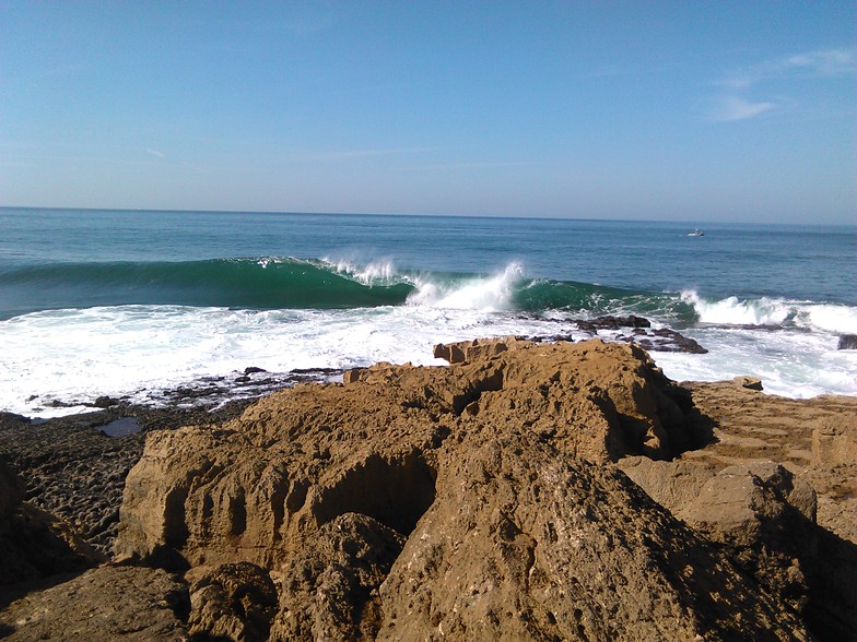
Alright, Rusty here. Let's get straight into it, yeah? The whole 16-day window is a bit of a tough one for us. The only spot with any sort of whisper of a wave is Furnas, and even that's a proper struggle. It's a reef break that's inconsistent as it is, and this run just doesn't line up for clean, rideable surf.
The water temp is sitting at 68°, which is pretty much normal for this time of year, so that's not the issue.
The first session that even gets a mention isn't until the 12th of August. That's a full 11-day gap of nothing. On the Wednesday morning of the 12th, we're looking at a 4 ft swell from the NNW at a short period of 6 seconds. The combined energy is moderate at 210, but the wind is cross-shore and the call is marginal. It's not firing, but it's the first thing that's not completely hopeless.
The 13th of August sees a bit more size – 6 ft from the NNW with a still-short 7-second period. The energy is strong now, around 513. But again, the wind is cross-shore, and it's still only a marginal call. The wave quality is just not there.
The 15th of August Saturday morning bumps up to 10 ft from the NNW, with a combined energy of 998. That's a big wall of water, but the period is still only 8 seconds. At 10 ft, that's big, messy, expert-only territory, and with cross-onshore winds it's going to be a washing machine. Not a good look for a standard paddle.
Then on the 16th of August, Sunday morning, we've got 8 ft from the NNW, a bit better period at 9 seconds, and light cross-onshore winds. The energy is very strong at 976. It's the best-looking swell of the whole run, but it's still a marginal call with the wind angle. For a reef break, that size and direction might make it a bit too straight and fast, but it's the only window where the numbers aren't screaming "don't bother."
Honestly, for the whole 16 days, the 16th of August is the one to watch, but it's a long way off and the wind is a worry. The 12th and 13th are just small windows of opportunity in an otherwise flat or messy period. Keep an eye on the charts, but don't hold your breath.
Rusty.
Short Range ForecastMostly dry. Warm (max 22°C on Sat morning, min 19°C on Sat night). Winds decreasing (fresh winds from the NNW on Sat afternoon, calm by Mon night). | Days 4-6 Weather SummaryMostly dry. Warm (max 23°C on Tue morning, min 18°C on Wed night). Mainly fresh winds. | ||||||||||||||||||||
Saturday 1 | Sunday 2 | Monday 3 | Tuesday 4 | Wednesday 5 | Thursday 6 | Friday 7 | |||||||||||||||
AM | PM | Night | AM | PM | Night | AM | PM | Night | AM | PM | Night | AM | PM | Night | AM | PM | Night | AM | PM | Night | |
Swell Height Map |  |  |  |  |  |  |  | ||||||||||||||
Wave Height (m) Direction Period (s) | W 9 | W 9 | NNW 6 | NNW 6 | W 10 | W 10 | W 9 | W 9 | W 7 | W 9 | W 8 | W 8 | W 8 | NNW 9 | NNW 9 | NNW 10 | NNW 9 | NNW 9 | NNW 8 | NNW 8 | NNW 8 |
Wave Graph | |||||||||||||||||||||
78 | 73 | 66 | 57 | 70 | 67 | 60 | 181 | 62 | 125 | 90 | 86 | 76 | 68 | 94 | 325 | 248 | 176 | 122 | 116 | 70 | |
Wind (km/h) | |||||||||||||||||||||
Wind State on-shore cross-onshore cross-shore cross-offshore off-shore glassy | cross | cross-on | cross | cross-on | cross-on | cross-on | cross-on | cross-on | cross-on | cross-on | on | cross-on | cross | cross | cross | cross | cross | cross | cross-on | cross-on | cross |
High Tide | 5:13PM2.86m | 5:34AM2.60m | 5:47PM2.81m | 6:09AM2.56m | 6:23PM2.71m | 6:48AM2.49m | 7:05PM2.58m | 7:34AM2.40m | 7:56PM2.42m | 8:32AM2.30m | 9:03PM2.27m | 9:46AM2.25m | 10:28PM2.20m | ||||||||
Low Tide | 10:57AM0.31m | 11:26PM0.25m | 11:31AM0.34m | 00:00AM0.29m | 12:07PM0.41m | 00:36AM0.37m | 12:48PM0.51m | 1:18AM0.49m | 1:37PM0.63m | 2:10AM0.63m | 2:40PM0.75m | 3:18AM0.76m | 4:03PM0.81m | ||||||||
6:37 | — | — | 6:39 | — | — | 6:39 | — | — | 6:39 | — | — | 6:41 | — | — | 6:41 | — | — | 6:43 | — | — | |
— | 8:49 | — | — | 8:47 | — | — | 8:46 | — | — | 8:45 | — | — | 8:45 | — | — | 8:44 | — | — | 8:43 | — | |
mm | — | — | — | — | — | — | — | — | — | — | — | — | — | — | — | — | — | — | — | — | — |
Temp °C | 22 | 22 | 19 | 21 | 21 | 20 | 22 | 22 | 21 | 23 | 23 | 21 | 22 | 22 | 19 | 21 | 21 | 19 | 21 | 21 | 19 |
Feels °C | 21 | 20 | 17 | 20 | 20 | 20 | 21 | 22 | 22 | 23 | 22 | 22 | 21 | 20 | 16 | 18 | 18 | 17 | 20 | 20 | 18 |
Swell 1 Height (m) Direction Period (s) | W 9 | W 9 | W 9 | W 9 | W 10 | W 10 | W 9 | W 9 | W 7 | W 9 | W 8 | W 8 | W 8 | NNW 9 | NNW 9 | W 10 | W 10 | NNW 9 | NNW 8 | NNW 8 | NNW 8 |
78 | 73 | 57 | 57 | 70 | 67 | 60 | 181 | 57 | 125 | 90 | 86 | 76 | 68 | 94 | 49 | 68 | 176 | 122 | 116 | 70 | |
Swell 2 Height (m) Direction Period (s) | NNW 10 | NNW 9 | NNW 8 | NNW 8 | NNW 8 | NNW 6 | NNW 7 | N 7 | WNW 9 | NNW 8 | NW 11 | NNW 11 | NNW 9 | WNW 10 | W 7 | W 7 | S 12 | W 10 | WNW 9 | WNW 9 | W 9 |
20 | 26 | 23 | 20 | 19 | 12 | 11 | 4 | 62 | 6 | 5 | 45 | 59 | 36 | 26 | 14 | 3 | 46 | 28 | 28 | 55 | |
Swell 3 Height (m) Direction Period (s) | NNW 8 | — | NNW 8 | W 8 | — | NNW 7 | NW 5 | — | N 8 | S 13 | N 8 | SW 12 | WNW 11 | SW 12 | WNW 10 | SW 12 | — | SW 13 | S 13 | S 12 | W 3 |
7 | — | 6 | 1 | — | 11 | 3 | — | 5 | 3 | 1 | 6 | 23 | 6 | 34 | 5 | — | 7 | 3 | 3 | 1 | |
Wind waves Height (m) Direction Period (s) | NNW 6 | NNW 6 | NNW 6 | NNW 6 | NNW 6 | — | — | — | — | — | — | — | — | WNW 7 | N 4 | NNW 10 | NNW 9 | — | — | — | — |
61 | 70 | 66 | 56 | 41 | — | — | — | — | — | — | — | — | 55 | 7 | 325 | 248 | — | — | — | — | |
Nearest Offshore or Glassy | |||||||||||||||||||||
Distance (km) | 23 | 27 | 23 | 48 | 414 | 23 | 9 | 52 | 23 | 52 | 212 | 23 | 23 | 376 | 23 | 228 | 439 | 23 | 48 | 414 | 136 |
Best forecast wave conditions in Ericeira | |||||||||||||||||||||
Best forecast wave conditions in Portugal | |||||||||||||||||||||
Header Global | |||||||||||||||||||||
- Map Icons:
 Break
Break Live Wave Height (m)
 Live Wind Speed (km/h)
 Surf Rating (10 Max)
 Ocean Swells (m)
- Wind Speed (km/h)
Latest Updates


FREE! Surf-Forecast.com widget for your website
The surf report / weather widget below is available to embed on third party websites free of charge and provides a summary of our Furnas surf forecast. Simply grab the html code snippet that we provide and paste it into your own site. You can choose your preferred language and metric/imperial units for the surf forecast feed to suit users of your site. Click here to get the code.
Information about the Furnas Surf forecast
The above surf forecast table for Furnas provides essential information for determining whether the surfing conditions will be good over the next 16 days. A general guide to surfing at Furnas can be found by selecting the local surf guide option on the grey menu. Our Furnas surf forecast is unique since it includes wave energy (power) that defines the real feel of the surf rather than just the height or the period. If you surf the same spot (Furnas) regularly then make a mental note of the wave energy from the surf forecast table each time you go. Very soon you may start to choose your surf days based on the wave energy alone combined with our forecast of favourable offshore wind conditions. Our star ratings will help here and of course you will also find the usual wave height and period predictions on our surf forecasts as well as a full break down of the swell components under our advanced users option (to reveal that, click the little Einstein character under the tide times).
Further information to help with frequently asked questions about our surf forecast for Furnas may be found under the help tab on the top menu and also by moving your mouse over the question marks on the surf forecast table itself. Please always bear in mind that the forecast is for near-shore open water and local factors at each surf break influence the actual breaking wave height, such as the beach / reef profile, water depths offshore and shelter.
Furnas is 12 km (7 miles) from the city of Sintra. If you plan a holiday in Ericeira, look for hotels and other accommodation in Sintra. Sintra has rooms for a wide range of budgets as well as car hire and transport links.
 Nearest