

Surf Forecasts:

Carolles surf forecast from 16 Jul 2026:
- Most powerful swell: Tuesday 21 Jul, 5PM (local time) - 2.5ft (0.7m), 4s period, N swell with 12 kJ wave energy.
Best Forecast Surf Conditions for Carolles this week:
The most powerful waves expected at Carolles in the next 16 days are 0.7m 4s and forecast to arrive on Tuesday (Jul 21) at 5PM. Winds are predicted to be cross-shore at the time the swell arrives. The largest open ocean swell (not directed at the beach) is 0.6m 4s period and expected on Sunday (Jul 19) at 11PM.
| Wave Type | Time (CEST) & Date | Wave Height & Period |
|---|---|---|
| Next good surf (1 star+) | - | - |
| Best Surf | - | - |
| Most Powerful | 5PM (Tue 21st Jul) | 2.5ft (0.7m) 4s |
Table - best surf conditions forecast for Carolles over the next 16 days.
The Lowdown
Alright, this is Rusty checkin' in from Carolles. Bit of a tough outlook this one, I gotta be straight with you. Lookin' at the whole 16-day window, there's just not much on the cards. The first proper chance at anything rideable doesn't really show up until the very end. We're talking about a long dry spell with a lot of tiny, gutless waves and messy wind for the first couple of weeks.
Right from Thursday the 16th of July, it's a non-starter. Tiny 0.3ft to 2ft slop with periods as short as 3 seconds, and the wind is all over the shop – cross, cross-on, and even a 16 mph N wind on Thursday afternoon. That's just a choppy mess, with wave energy barely registering (6). The weekend's no better. Saturday the 18th has a bit of an onshore W wind but only 0.7ft on offer, and Sunday the 19th is clear but with a 16 mph cross-off wind and 0.3ft. It's a complete flat spell.
This poor run of tiny surf carries right on through the next week. We're seeing days of 0.3ft with 12 mph to 19 mph cross-off and cross winds. The combined wave energy is often as low as 1 or 2 – truly weak. The water temp is about average for this time of year, so no strange anomalies to report, just a lot of nothing.
Now, the real interesting part comes at the very tail end of the forecast. On Wednesday, the 29th of July, the swell finally shows a pulse of life. We start seeing a 2ft to 3ft W swell with a period bumping up to 8 or 9 seconds. The combined energy jumps to 52 and then 101 by Wednesday afternoon! That's moderate wave energy kicking in, but the catch is a fresh 22 mph NNW cross-on wind. It'll be lumpy and messy, but there's power there. Thursday the 30th stays similar, with a 2ft W swell, 9-second period, and moderate energy (81), but still a cross-shore north wind. Friday the 31st is maybe the best bet of the entire run: a 3ft W swell from the WNW with an 8-second period, combined energy of 85, and a lighter NW cross-on breeze at 9 mph. It's clean-ish, but the direction isn't ideal for Carolles which likes a WNW swell, and it's a beach and reef setup, so onshore winds bring chop. For a beach break, this set-up with that much cross-swell in the water and onshore winds looks more interesting for kite surfing than paddle surfing. But for a dedicated surfer, it's the only window where you might find a few lumpy, workable waves.
So, honestly, there's no standout. If you're desperate, the 29th to 31st of July offers the most power, but don't expect perfection. The rest of the time, leave the board in the car. Forecasts can change, but this looks like a long stretch of flat for Carolles.
Rusty.
Short Range ForecastLight rain (total 9mm), mostly falling on Thu night. Warm (max 27°C on Thu afternoon, min 17°C on Thu night). Wind will be generally light. | Days 5-7 Weather SummaryMostly dry. Warm (max 25°C on Mon afternoon, min 15°C on Mon morning). Wind will be generally light. | ||||||||||||||||||||
Thursday 16 | Friday 17 | Saturday 18 | Sunday 19 | Monday 20 | Tuesday 21 | Wed 22 | |||||||||||||||
Night | AM | PM | Night | AM | PM | Night | AM | PM | Night | AM | PM | Night | AM | PM | Night | AM | PM | Night | AM | PM | |
Swell Height Map |  |  |  |  |  |  |  | 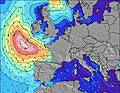 | |||||||||||||
Wave Height (m) Direction Period (s) | W 9 | W 9 | N 3 | W 9 | NNE 3 | N 4 | NW 3 | W 8 | NW 4 | WNW 4 | W 8 | W 8 | W 7 | W 9 | N 3 | W 11 | W 11 | N 4 | W 10 | W 9 | NNW 3 |
Wave Graph | |||||||||||||||||||||
2 | 2 | 4 | 2 | 3 | 9 | 3 | 1 | 2 | 1 | 1 | 1 | 1 | 2 | 8 | 2 | 2 | 12 | 2 | 2 | 8 | |
Wind (km/h) | |||||||||||||||||||||
Wind State on-shore cross-onshore cross-shore cross-offshore off-shore glassy | cross-off | cross-off | cross | cross-off | cross-off | cross-on | cross-off | on | cross-on | cross-off | cross-off | cross-off | cross-off | cross-off | cross | cross-off | cross-off | cross | cross-off | cross-off | cross |
High Tide | 9:09PM12.12m | 9:34AM11.76m | 9:55PM12.17m | 10:20AM11.64m | 10:40PM11.93m | 11:05AM11.28m | 11:25PM11.41m | 11:51AM10.72m | 00:11AM10.68m | 12:38PM10.02m | 1:00AM9.83m | 1:30PM9.28m | 1:58AM8.98m | 2:35PM8.62m | |||||||
Low Tide | 4:42AM-0.47m | 5:02PM-0.08m | 5:25AM-0.52m | 5:43PM0.05m | 6:06AM-0.20m | 6:23PM0.48m | 6:45AM0.42m | 7:02PM1.13m | 7:22AM1.24m | 7:38PM1.91m | 7:58AM2.13m | 8:14PM2.72m | 8:32AM2.99m | ||||||||
— | 6:18 | — | — | 6:20 | — | — | 6:20 | — | — | 6:22 | — | — | 6:24 | — | — | 6:24 | — | — | 6:26 | — | |
10:05 | — | — | 10:04 | — | — | 10:02 | — | — | 10:01 | — | — | 10:00 | — | — | 10:00 | — | — | 9:59 | — | 9:58 | |
mm | 2 | 1 | 3 | 3 | — | — | — | — | — | — | — | — | — | — | — | — | — | — | — | — | — |
Temp °C | 23 | 22 | 27 | 21 | 22 | 27 | 25 | 21 | 25 | 24 | 21 | 24 | 22 | 20 | 25 | 23 | 22 | 25 | 22 | 21 | 24 |
Feels °C | 23 | 22 | 23 | 20 | 19 | 22 | 20 | 20 | 21 | 21 | 16 | 18 | 15 | 15 | 18 | 17 | 19 | 21 | 17 | 17 | 19 |
Swell 1 Height (m) Direction Period (s) | N 4 | — | W 10 | W 9 | W 9 | W 8 | NW 3 | WNW 3 | W 9 | WNW 4 | W 8 | NW 5 | — | W 9 | W 9 | W 11 | W 11 | W 10 | W 10 | W 9 | W 9 |
1 | — | 2 | 2 | 2 | 1 | 3 | 1 | 2 | 1 | 1 | 1 | — | 2 | 2 | 2 | 2 | 2 | 2 | 2 | 2 | |
Swell 2 Height (m) Direction Period (s) | W 9 | — | — | — | — | — | W 8 | W 8 | — | W 8 | — | W 8 | W 7 | — | — | W 8 | — | — | NW 4 | — | — |
2 | — | — | — | — | — | 1 | 1 | — | 1 | — | 1 | 1 | — | — | 1 | — | — | 1 | — | — | |
Swell 3 Height (m) Direction Period (s) | — | W 9 | — | — | — | — | — | — | — | — | — | — | — | — | — | — | — | — | — | — | — |
— | 2 | — | — | — | — | — | — | — | — | — | — | — | — | — | — | — | — | — | — | — | |
Wind waves Height (m) Direction Period (s) | NE 3 | — | N 3 | NNE 3 | NNE 3 | N 4 | — | — | NW 4 | — | — | NNE 2 | NE 3 | NE 3 | N 3 | N 3 | NNE 2 | N 4 | NE 3 | NNE 2 | NNW 3 |
2 | — | 4 | 2 | 3 | 9 | — | — | 2 | — | — | 1 | 4 | 3 | 8 | 2 | 1 | 12 | 2 | 1 | 8 | |
Nearest Offshore or Glassy | |||||||||||||||||||||
Distance (km) | 236 | 551 | 543 | 174 | 595 | 595 | 881 | 697 | 696 | 653 | 231 | 315 | 333 | 401 | 513 | 506 | 228 | 313 | 313 | 318 | 333 |
Best forecast wave conditions in Normandy | |||||||||||||||||||||
Best forecast wave conditions in France | |||||||||||||||||||||
Header Global | |||||||||||||||||||||
- Map Icons:
 Break
Break Live Wave Height (m)
 Live Wind Speed (km/h)
 Surf Rating (10 Max)
 Ocean Swells (m)
- Wind Speed (km/h)


FREE! Surf-Forecast.com widget for your website
The surf report / weather widget below is available to embed on third party websites free of charge and provides a summary of our Carolles surf forecast. Simply grab the html code snippet that we provide and paste it into your own site. You can choose your preferred language and metric/imperial units for the surf forecast feed to suit users of your site. Click here to get the code.
Information about the Carolles Surf forecast
The above surf forecast table for Carolles provides essential information for determining whether the surfing conditions will be good over the next 16 days. A general guide to surfing at Carolles can be found by selecting the local surf guide option on the grey menu. Our Carolles surf forecast is unique since it includes wave energy (power) that defines the real feel of the surf rather than just the height or the period. If you surf the same spot (Carolles) regularly then make a mental note of the wave energy from the surf forecast table each time you go. Very soon you may start to choose your surf days based on the wave energy alone combined with our forecast of favourable offshore wind conditions. Our star ratings will help here and of course you will also find the usual wave height and period predictions on our surf forecasts as well as a full break down of the swell components under our advanced users option (to reveal that, click the little Einstein character under the tide times).
Further information to help with frequently asked questions about our surf forecast for Carolles may be found under the help tab on the top menu and also by moving your mouse over the question marks on the surf forecast table itself. Please always bear in mind that the forecast is for near-shore open water and local factors at each surf break influence the actual breaking wave height, such as the beach / reef profile, water depths offshore and shelter.
Are you planning a holiday in Normandy? If you are looking for accommodation near Carolles, camping, hotels and holiday cottages in Normandy, consider staying in Granville which is 10 km (6 miles) away. Other places in and around Normandy where you can find information about places to rent, and car hire include Cancale which is 23 km (14 miles) away, Saint Malo, Fougeres and Saint-Lo.
 Nearest