

Surf Forecasts:

Bouznika Plage surf forecast from 3 Aug 2026:
- Best quality surf: Friday 7 Aug, 4AM (local time) - 4.5ft (1.3m), 8s period, NW swell with glassy winds.
- Most powerful swell: Friday 7 Aug, 1PM (local time) - 5ft (1.6m), 8s period, NW swell with 322 kJ wave energy.
- Next surfable swell (1★+): Friday 7 Aug, 4AM (local time) - 4.5ft (1.3m), 8s period with NW swell.
Best Forecast Surf Conditions for Bouznika Plage this week:
The surf forecast for Bouznika Plage over the next 16 days: The first swell (rated 1 star or higher) is forecast to arrive on Friday (Aug 07) at 4AM. The primary swell is predicted to be 1.3m and 8s period with a secondary swell of 0.3m and 9s. The wind is predicted to be glassy as the swell arrives.
The most powerful waves expected at Bouznika Plage in the next 16 days are 1.6m 8s and forecast to arrive on Friday (Aug 07) at 1PM. Winds are predicted to be cross-onshore at the time the swell arrives.
| Wave Type | Time (+01) & Date | Wave Height & Period |
|---|---|---|
| Next good surf (1 star+) | 4AM (Fri 7th Aug) | 4.5ft (1.3m) 8s |
| Best Surf | 4AM (Fri 7th Aug) | 4.5ft (1.3m) 8s |
| Most Powerful | 1PM (Fri 7th Aug) | 5ft (1.6m) 8s |
Table - best surf conditions forecast for Bouznika Plage over the next 16 days.
The Lowdown
Alright folks, Rusty here. Let's have a look at what's on the cards for the next couple of weeks. To be honest, it's a pretty quiet stretch ahead. The only spot on the radar is Bouznika Plage, a reef and point setup that's consistent, but it's sheltered and the swell just isn't playing ball for a proper paddle session.
Right from the start of August, we're looking at tiny, weak waves. On Monday the 3rd, we've got a combined swell energy of just 60 and 1ft of swell from the WNW with a period of 10 seconds, but it's all cross-onshore and messy. That pattern basically holds through the first week – small, choppy, and poor. The swell does try to build a little, but the wind just won't let up. By Thursday the 6th, the energy is up to a moderate 122 in the morning, but it's still cross-onshore, and the swell is a short-period 6 seconds from the NNW. It's just not clean.
The weekend of the 9th and 10th is more of the same – small, wind-affected waves. The best we see is a brief moment on Friday morning, the 7th, where the swell hits 5ft from the NW, with a combined energy of 306 (moderate wave energy). Even then, it's cross-shore, and for a sheltered spot, that's not ideal. The period is only 8 seconds, so it's not got that punchy groundswell feel. This is still a "poor surf conditions" call.
There's a long gap of basically nothing worthwhile. We get a bit of a pulse on the 13th of August, with the swell from the NW at 4ft and a period of 9 seconds, giving a combined energy of 210. The morning has a light breeze, but it's cross-onshore, so it's still going to be a bit bumpy. 1ft of that is just not enough to overcome the wind.
Honestly, for the entire 16-day window, it's a bust for decent surf. The setup looks more interesting for kite surfing than paddle surfing, given the persistent cross and cross-onshore winds and the small, choppy conditions. The water temp is about average for the time of year, but that's small comfort when there's nothing to ride.
Keep an eye on it, but I wouldn't be waxing the board just yet.
Rusty.
Short Range ForecastMostly dry. Warm (max 25°C on Mon morning, min 21°C on Mon night). Wind will be generally light. | Days 4-6 Weather SummaryMostly dry. Warm (max 26°C on Fri morning, min 22°C on Thu night). Wind will be generally light. | ||||||||||||||||||||
Monday 3 | Tuesday 4 | Wednesday 5 | Thursday 6 | Friday 7 | Saturday 8 | Sunday 9 | |||||||||||||||
AM | PM | Night | AM | PM | Night | AM | PM | Night | AM | PM | Night | AM | PM | Night | AM | PM | Night | AM | PM | Night | |
Swell Height Map | 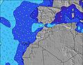 | 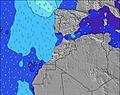 | 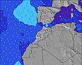 | 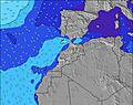 | 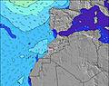 | 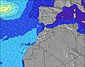 | 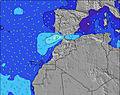 | ||||||||||||||
Wave Height (m) Direction Period (s) | WNW 10 | WNW 10 | WNW 9 | WNW 9 | WNW 9 | WNW 9 | WNW 8 | WNW 8 | NW 8 | NW 6 | NW 7 | NW 7 | NW 8 | NW 8 | NW 8 | NW 8 | NW 7 | NW 7 | NW 7 | NNW 6 | NW 6 |
Wave Graph | |||||||||||||||||||||
38 | 37 | 34 | 34 | 54 | 65 | 88 | 59 | 95 | 91 | 119 | 156 | 306 | 322 | 229 | 262 | 160 | 103 | 106 | 67 | 47 | |
Wind (km/h) | |||||||||||||||||||||
Wind State on-shore cross-onshore cross-shore cross-offshore off-shore glassy | cross-on | cross-on | cross-on | cross | cross-on | cross-on | cross-on | cross-on | cross-on | cross-on | cross-on | cross-on | cross-on | cross-on | cross-on | cross-on | cross-on | cross-on | cross-on | on | cross-on |
High Tide | 5:56PM2.71m | 6:21AM2.49m | 6:38PM2.58m | 7:07AM2.39m | 7:29PM2.42m | 8:04AM2.29m | 8:36PM2.27m | 9:19AM2.22m | 10:03PM2.19m | 10:46AM2.27m | 11:32PM2.26m | 12:05PM2.44m | 00:45AM2.43m | ||||||||
Low Tide | 11:44AM0.41m | 00:13AM0.38m | 12:25PM0.51m | 00:56AM0.51m | 1:14PM0.64m | 1:48AM0.65m | 2:18PM0.76m | 2:58AM0.78m | 3:41PM0.81m | 4:23AM0.81m | 5:13PM0.73m | 5:46AM0.72m | 6:29PM0.53m | ||||||||
6:41 | — | — | 6:41 | — | — | 6:41 | — | — | 6:43 | — | — | 6:43 | — | — | 6:45 | — | — | 6:45 | — | — | |
— | 8:27 | — | — | 8:27 | — | — | 8:25 | — | — | 8:24 | — | — | 8:23 | — | — | 8:22 | — | — | 8:22 | — | |
mm | — | — | — | — | — | — | — | — | — | — | — | — | — | — | — | — | — | — | — | — | — |
Temp °C | 25 | 25 | 22 | 24 | 24 | 22 | 24 | 24 | 22 | 24 | 24 | 22 | 26 | 25 | 23 | 26 | 26 | 24 | 25 | 25 | 23 |
Feels °C | 25 | 24 | 24 | 24 | 23 | 23 | 24 | 24 | 24 | 24 | 23 | 23 | 26 | 25 | 24 | 26 | 26 | 25 | 25 | 25 | 26 |
Swell 1 Height (m) Direction Period (s) | NNW 6 | WNW 10 | NNW 5 | WNW 9 | WNW 9 | WNW 9 | WNW 8 | WNW 8 | NW 8 | NW 6 | NNW 10 | NW 7 | NW 8 | NW 8 | NW 8 | NW 8 | NW 7 | NW 7 | NW 7 | NNW 6 | NW 6 |
21 | 37 | 12 | 34 | 54 | 65 | 88 | 59 | 95 | 91 | 36 | 156 | 306 | 322 | 229 | 262 | 160 | 103 | 106 | 67 | 47 | |
Swell 2 Height (m) Direction Period (s) | WNW 10 | N 8 | WNW 9 | NNW 5 | — | NNW 4 | N 5 | NNW 11 | NW 10 | WNW 10 | WNW 10 | WNW 10 | — | — | — | — | WNW 9 | WNW 8 | WNW 8 | WNW 8 | WNW 7 |
38 | 1 | 34 | 8 | — | 7 | 15 | 12 | 25 | 34 | 33 | 30 | — | — | — | — | 16 | 14 | 14 | 13 | 21 | |
Swell 3 Height (m) Direction Period (s) | N 8 | — | N 7 | N 7 | — | — | NW 12 | — | WNW 10 | NW 9 | — | NNW 9 | — | — | — | — | — | — | N 13 | NW 12 | NNW 11 |
1 | — | 1 | 1 | — | — | 6 | — | 21 | 20 | — | 17 | — | — | — | — | — | — | 3 | 6 | 12 | |
Wind waves Height (m) Direction Period (s) | — | NNW 6 | — | — | N 5 | N 4 | — | NNW 5 | — | — | NW 7 | — | — | — | — | — | — | — | — | — | — |
— | 17 | — | — | 12 | 9 | — | 21 | — | — | 119 | — | — | — | — | — | — | — | — | — | — | |
Nearest Offshore or Glassy | |||||||||||||||||||||
Distance (km) | 5 | 5 | 412 | 389 | 5 | 321 | 390 | 5 | 297 | 19 | 5 | 283 | 40 | 5 | 931 | 40 | 40 | 40 | 28 | 40 | 993 |
Best forecast wave conditions in Rabat to Casblanca | |||||||||||||||||||||
Best forecast wave conditions in Morocco | |||||||||||||||||||||
Header Global | |||||||||||||||||||||
- Map Icons:
 Break
Break Live Wave Height (m)
 Live Wind Speed (km/h)
 Surf Rating (10 Max)
 Ocean Swells (m)
- Wind Speed (km/h)
Latest Updates


FREE! Surf-Forecast.com widget for your website
The surf report / weather widget below is available to embed on third party websites free of charge and provides a summary of our Bouznika Plage surf forecast. Simply grab the html code snippet that we provide and paste it into your own site. You can choose your preferred language and metric/imperial units for the surf forecast feed to suit users of your site. Click here to get the code.
Information about the Bouznika Plage Surf forecast
The above surf forecast table for Bouznika Plage provides essential information for determining whether the surfing conditions will be good over the next 16 days. A general guide to surfing at Bouznika Plage can be found by selecting the local surf guide option on the grey menu. Our Bouznika Plage surf forecast is unique since it includes wave energy (power) that defines the real feel of the surf rather than just the height or the period. If you surf the same spot (Bouznika Plage) regularly then make a mental note of the wave energy from the surf forecast table each time you go. Very soon you may start to choose your surf days based on the wave energy alone combined with our forecast of favourable offshore wind conditions. Our star ratings will help here and of course you will also find the usual wave height and period predictions on our surf forecasts as well as a full break down of the swell components under our advanced users option (to reveal that, click the little Einstein character under the tide times).
Further information to help with frequently asked questions about our surf forecast for Bouznika Plage may be found under the help tab on the top menu and also by moving your mouse over the question marks on the surf forecast table itself. Please always bear in mind that the forecast is for near-shore open water and local factors at each surf break influence the actual breaking wave height, such as the beach / reef profile, water depths offshore and shelter.
Bouznika Plage is 5 km (3 miles) from Bouznika. If you plan a holiday in Rabat to Casblanca, look for hotels and other accommodation in Bouznika. Bouznika has rooms for a wide range of budgets as well as car hire and transport links.
 Nearest