

Surf Forecasts:

Back Beach surf forecast from 2 Aug 2026:
- Best quality surf: Tuesday 4 Aug, 2PM (local time) - 10ft (3.0m), 18s period, WSW swell with onshore winds.
- Most powerful swell: Sunday 9 Aug, 2AM (local time) - 15ft (4.5m), 16s period, WSW swell with 10,405 kJ wave energy.
- Next surfable swell (1★+): Monday 3 Aug, 8AM (local time) - 6ft (1.9m), 14s period with WSW swell.
Best Forecast Surf Conditions for Back Beach this week:
The surf forecast for Back Beach over the next 16 days: The first swell (rated 1 star or higher) is forecast to arrive on Monday (Aug 03) at 8AM. The primary swell is predicted to be 1.9m and 14s period. The wind is predicted to be cross-offshore as the swell arrives.
The most powerful waves expected at Back Beach in the next 16 days are 4.5m 16s and forecast to arrive on Sunday (Aug 09) at 2AM. Winds are predicted to be cross-offshore at the time the swell arrives. The largest open ocean swell (not directed at the beach) is 0.4m 3s period and expected on Monday (Aug 03) at 8AM.
| Wave Type | Time (AWST) & Date | Wave Height & Period |
|---|---|---|
| Next good surf (1 star+) | 8AM (Mon 3rd Aug) | 6ft (1.9m) 14s |
| Best Surf | 2PM (Tue 4th Aug) | 10ft (3.0m) 18s |
| Most Powerful | 2AM (Sun 9th Aug) | 15ft (4.5m) 16s |
Table - best surf conditions forecast for Back Beach over the next 16 days.
The Lowdown
Alright folks, Rusty here with a look at what's coming up for Back Beach. We've got a solid run of swell on the way, but the size is going to be the main talking point for a lot of this period.
The core of the action kicks off from Monday, August 3rd, with a solid building trend. The water temp is sitting at 67°F, which is pretty much bang on average for the time of year, so no need to dig out the 5/4 just yet.
Monday morning, August 3rd, is a real standout. The swell is coming in at 6ft from the WSW, with a long period of 14 seconds. That's proper groundswell energy, and the combined energy is a strong 1389. The wind is a clean cross-off from the N at 9 mph, meaning the lineup will be well groomed. The waves will have some punch, but at this size, it's still manageable for experienced surfers, and the crowds are just “sometimes” which is a good sign. This is shaping up to be a classic winter session.
By Monday afternoon, the wind goes a bit funky and the tide might be an issue, so the morning is the clear winner here.
The swell builds rapidly through Tuesday and Wednesday, August 4th and 5th. By Wednesday morning, we're looking at 10ft from the WSW with a 16-second period and a combined energy of 4173. The wind is glassy from the ESE at 3 mph. It's a beautiful forecast, but the size is a big caveat. Over 8ft, this is strictly for experts only. The long period, combined with an exposed beach setup, will mean the waves will be heavy and a bit too straight. It’s a true big-wave day if you have the experience.
The rest of the first week, and right through to the end of the second week, is a story of monster swell and onshore wind. From Thursday, August 6th, through to the weekend, we're seeing 10ft to 15ft waves, with the energy peaking at a massive 14787 on Saturday, August 8th. The wind is a messy cross-on, making it choppy and lumpy. For a beach break like Back Beach, this is less about surfing and more about a kite session, if you're into that.
There is a silver lining in the second week. On Monday, August 17th, we’ve got a 10ft WSW swell with a 16-second period, and the wind is glassy from the SSW at 3 mph. The energy is a strong 5220. That's a very promising outlook for a Monday afternoon, though it's a long way off, so keep an eye on it. The other days in the second week are similar: big, powerful swells with clean offshore winds, but the size will keep it for the experienced crew only.
Rusty.
Short Range ForecastModerate rain (total 13mm), heaviest on Mon night. Warm (max 20°C on Mon afternoon, min 12°C on Wed night). Winds decreasing (fresh winds from the NW on Mon night, calm by Wed morning). | Days 4-6 Weather SummaryLight rain (total 3mm), mostly falling on Fri night. Very mild (max 18°C on Fri afternoon, min 11°C on Sat night). Winds increasing (light winds from the ENE on Thu morning, strong winds from the S by Sat morning). | ||||||||||||||||||||
Monday 3 | Tuesday 4 | Wednesday 5 | Thursday 6 | Friday 7 | Saturday 8 | Sunday 9 | |||||||||||||||
AM | PM | Night | AM | PM | Night | AM | PM | Night | AM | PM | Night | AM | PM | Night | AM | PM | Night | AM | PM | Night | |
Swell Height Map | 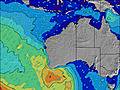 | 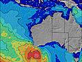 | 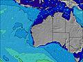 | 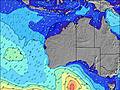 | 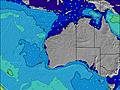 | 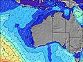 | 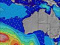 | ||||||||||||||
Wave Height (m) Direction Period (s) | WSW 14 | WSW 15 | WSW 16 | WSW 19 | WSW 17 | WSW 16 | WSW 16 | WSW 16 | WSW 16 | WSW 16 | WSW 16 | WSW 16 | WSW 16 | WSW 15 | WSW 16 | SW 15 | WSW 15 | WSW 16 | WSW 16 | WSW 16 | WSW 15 |
Wave Graph | |||||||||||||||||||||
1389 | 1132 | 1067 | 3936 | 5491 | 4086 | 4173 | 6766 | 7004 | 6587 | 5418 | 3986 | 4285 | 4897 | 5587 | 7824 | 8712 | 10405 | 8218 | 5958 | 3939 | |
Wind (km/h) | |||||||||||||||||||||
Wind State on-shore cross-onshore cross-shore cross-offshore off-shore glassy | cross-off | cross | cross-off | on | on | on | glassy | cross-on | cross-off | cross | on | cross | cross-on | cross-on | on | cross-on | cross-on | cross-off | cross-off | cross-on | on |
High Tide | 10:43AM0.44m | 1:31AM0.45m | 10:27AM0.36m | 2:01AM0.50m | 2:48AM0.56m | 3:52AM0.60m | 5:02AM0.65m | 6:09AM0.69m | |||||||||||||
Low Tide | 6:03PM0.19m | 7:10AM0.33m | 5:54PM0.21m | 5:01PM0.20m | 2:54PM0.14m | 3:03PM0.06m | 3:32PM-0.01m | 4:07PM-0.05m | |||||||||||||
7:05 | — | — | 7:03 | — | — | 7:03 | — | — | 7:01 | — | — | 7:01 | — | — | 7:01 | — | — | 7:00 | — | — | |
— | 5:45 | — | — | 5:45 | — | — | 5:45 | — | — | 5:46 | — | — | 5:46 | — | — | 5:47 | — | — | 5:49 | — | |
mm | — | — | 12 | 1 | — | — | — | — | — | — | — | — | — | — | 2 | 1 | — | — | — | — | 1 |
Temp °C | 18 | 20 | 19 | 17 | 17 | 16 | 16 | 17 | 16 | 16 | 17 | 16 | 17 | 18 | 17 | 15 | 15 | 14 | 12 | 14 | 16 |
Feels °C | 14 | 15 | 16 | 16 | 13 | 13 | 14 | 15 | 13 | 14 | 15 | 15 | 11 | 13 | 13 | 7 | 9 | 8 | 9 | 11 | 13 |
Swell 1 Height (m) Direction Period (s) | WSW 14 | WSW 15 | WSW 16 | WSW 19 | WSW 17 | WSW 16 | WSW 16 | WSW 16 | WSW 16 | WSW 16 | WSW 16 | WSW 16 | WSW 16 | WSW 15 | — | SW 15 | WSW 15 | WSW 16 | WSW 16 | WSW 16 | WSW 15 |
1389 | 1132 | 1067 | 3936 | 5491 | 4086 | 4173 | 6766 | 7004 | 6587 | 5418 | 3986 | 4285 | 4897 | — | 7824 | 8712 | 10405 | 8218 | 5958 | 3939 | |
Swell 2 Height (m) Direction Period (s) | — | — | WSW 21 | W 6 | — | — | — | — | — | — | — | — | — | — | — | — | — | — | — | WSW 21 | WSW 20 |
— | — | 302 | 78 | — | — | — | — | — | — | — | — | — | — | — | — | — | — | — | 718 | 596 | |
Swell 3 Height (m) Direction Period (s) | — | — | WSW 6 | — | — | — | — | — | — | — | — | — | — | — | — | — | — | — | — | — | — |
— | — | 27 | — | — | — | — | — | — | — | — | — | — | — | — | — | — | — | — | — | — | |
Wind waves Height (m) Direction Period (s) | — | NW 3 | W 4 | — | — | — | — | — | — | — | — | — | — | — | WSW 16 | WSW 15 | — | — | — | — | — |
— | 3 | 31 | — | — | — | — | — | — | — | — | — | — | — | 5587 | 6963 | — | — | — | — | — | |
Nearest Offshore or Glassy | |||||||||||||||||||||
Distance (km) | 0 | 377 | 225 | 251 | 240 | 178 | 3 | 479 | 3 | 85 | 167 | 173 | 274 | 374 | 2074 | 1680 | 2363 | 3 | 3 | 251 | 189 |
Best forecast wave conditions in Perth City Coast | |||||||||||||||||||||
Best forecast wave conditions in Australia | |||||||||||||||||||||
Header Global | |||||||||||||||||||||
- Map Icons:
 Break
Break Live Wave Height (m)
 Live Wind Speed (km/h)
 Surf Rating (10 Max)
 Ocean Swells (m)
- Wind Speed (km/h)
Latest Updates


FREE! Surf-Forecast.com widget for your website
The surf report / weather widget below is available to embed on third party websites free of charge and provides a summary of our Back Beach surf forecast. Simply grab the html code snippet that we provide and paste it into your own site. You can choose your preferred language and metric/imperial units for the surf forecast feed to suit users of your site. Click here to get the code.
Information about the Back Beach Surf forecast
The above surf forecast table for Back Beach provides essential information for determining whether the surfing conditions will be good over the next 16 days. A general guide to surfing at Back Beach can be found by selecting the local surf guide option on the grey menu. Our Back Beach surf forecast is unique since it includes wave energy (power) that defines the real feel of the surf rather than just the height or the period. If you surf the same spot (Back Beach) regularly then make a mental note of the wave energy from the surf forecast table each time you go. Very soon you may start to choose your surf days based on the wave energy alone combined with our forecast of favourable offshore wind conditions. Our star ratings will help here and of course you will also find the usual wave height and period predictions on our surf forecasts as well as a full break down of the swell components under our advanced users option (to reveal that, click the little Einstein character under the tide times).
Further information to help with frequently asked questions about our surf forecast for Back Beach may be found under the help tab on the top menu and also by moving your mouse over the question marks on the surf forecast table itself. Please always bear in mind that the forecast is for near-shore open water and local factors at each surf break influence the actual breaking wave height, such as the beach / reef profile, water depths offshore and shelter.
Are you planning a holiday in Perth City Coast? If you are looking for accommodation near Back Beach, camping, hotels and holiday cottages in Perth City Coast, consider staying in Perth which is 125 km (78 miles) away.
 Nearest