

Surf Forecasts:

Lancelin surf forecast from 2 Aug 2026:
- Best quality surf: Sunday 9 Aug, 2AM (local time) - 13ft (4.0m), 16s period, WSW swell with offshore winds.
- Most powerful swell: Saturday 8 Aug, 8PM (local time) - 15ft (4.5m), 16s period, WSW swell with 9,047 kJ wave energy.
- Next surfable swell (1★+): Monday 3 Aug, 8AM (local time) - 6ft (1.9m), 14s period with WSW swell.
Best Forecast Surf Conditions for Lancelin this week:
The surf forecast for Lancelin over the next 16 days: The first swell (rated 1 star or higher) is forecast to arrive on Monday (Aug 03) at 8AM. The primary swell is predicted to be 1.9m and 14s period. The wind is predicted to be cross-offshore as the swell arrives.
The most powerful waves expected at Lancelin in the next 16 days are 4.5m 16s and forecast to arrive on Saturday (Aug 08) at 8PM. Winds are predicted to be cross-offshore at the time the swell arrives. The largest open ocean swell (not directed at the beach) is 0.5m 3s period and expected on Monday (Aug 03) at 5AM.
| Wave Type | Time (AWST) & Date | Wave Height & Period |
|---|---|---|
| Next good surf (1 star+) | 8AM (Mon 3rd Aug) | 6ft (1.9m) 14s |
| Best Surf | 2AM (Sun 9th Aug) | 13ft (4.0m) 16s |
| Most Powerful | 8PM (Sat 8th Aug) | 15ft (4.5m) 16s |
Table - best surf conditions forecast for Lancelin over the next 16 days.
The Lowdown
G’day, Rusty here. Let’s talk about what’s coming down the pipe at Lancelin (Perth). There’s a big run of groundswell building, but the first couple days are a bit of a struggle. Monday the 3rd has a 6ft WSW swell but it’s cross-shore and lumpy – not worth the hassle. Tuesday the 4th picks up to 8ft in the morning and 10ft by the afternoon, but the wind is still cross-onshore, so it’s bumpy and fairly chopped up.
Then Wednesday the 5th – the wind switches to a light offshore from the ESE at 3 mph. That 10ft of WSW groundswell (16-second period) cleans right up. The energy is moderate (4225) and the surf is going to be proper – clean and punchy. This is your first standout. It’s big enough for experienced surfers, but don’t take it lightly. Thursday the 6th goes back to onshore winds (WNW at 9 mph) and it’s messy – not worth paddling out. Friday the 7th has rain showers and a cross-onshore SW wind at 16 mph, so it’s poor.
But hold on. Saturday the 8th is the second major standout. The morning has a cross-offshore SSE breeze at 16 mph, and the swell is already 13ft. By the afternoon, the wind drops to 9 mph, the sea state is clean, and you’ve got 15ft of WSW groundswell at a 16-second period. The energy is strong (8933). This is big, powerful surf – only for the experienced crowd. Sunday the 9th stays excellent, with a gentle offshore ENE wind in the morning, 12ft of swell, and exceptional conditions for experts. The energy is still strong (6662). Saturday and Sunday are the heart of the run.
Monday the 10th and Tuesday the 11th see the swell back off a bit to 8-10ft, but Tuesday the 11th is a sneaky one – a fresh offshore E wind at 22 mph, with 16ft of SW groundswell and a period of 15-16 seconds. The energy is huge (11798). It’s big, clean, and powerful, but it’s a heavy day at the reef – experts only. Wednesday the 12th and Thursday the 13th ease off, with cross-offshore winds and 8-10ft swells, but there’s still plenty of energy in the water.
Now, the big one. Friday the 14th – the swell jumps to a massive 20ft from the WSW with a very long 19-second period. The energy reading is a monstrous 25570 – that’s off the charts. But here’s the catch: it’s predicted to be too big for this break. The wind and tide will be fine, but at that size, it’s going to be closing out and dangerous. Stay off the reef unless you’re a pro.
Saturday the 15th is another exceptional day – a moderate offshore E wind, 15ft of WSW groundswell, and clean conditions. The energy is strong (11744). This is a proper day out. The rest of the window, right up to Tuesday the 18th, shows a mix of 7ft to 13ft swells with offshore and cross-offshore winds, so there’s plenty of rideable surf, but nothing will top that 14th-15th stretch. Tuesday the 18th brings a 13ft swell with a cross-offshore wind – worth a look.
Overall, the standout days are Saturday the 8th and Sunday the 9th – clean, big, and powerful. After that, Tuesday the 11th and Saturday the 15th are the next big hitters. Lancelin is exposed and a reef, so you want those offshore winds. The water temp is about average for this time of year, nothing unusual. Expect some crowds on the clean days, so get in early. This is a serious stretch of surf – make your plans.
Rusty.
Short Range ForecastModerate rain (total 16mm), heaviest on Mon night. Warm (max 20°C on Mon afternoon, min 13°C on Sun night). Winds decreasing (fresh winds from the NW on Mon night, calm by Wed morning). | Days 5-7 Weather SummaryLight rain (total 7mm), mostly falling on Fri morning. Very mild (max 17°C on Thu afternoon, min 13°C on Wed night). Wind will be generally light. | ||||||||||||||||||
Monday 3 | Tuesday 4 | Wednesday 5 | Thursday 6 | Friday 7 | Saturday 8 | ||||||||||||||
Night | AM | PM | Night | AM | PM | Night | AM | PM | Night | AM | PM | Night | AM | PM | Night | AM | PM | Night | |
Swell Height Map |  |  |  |  | 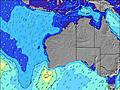 | 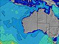 | 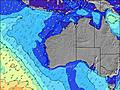 | ||||||||||||
Wave Height (m) Direction Period (s) | WSW 13 | WSW 14 | WSW 15 | WSW 16 | WSW 19 | WSW 17 | WSW 16 | WSW 16 | WSW 16 | WSW 16 | WSW 16 | WSW 16 | WSW 16 | WSW 16 | WSW 16 | WSW 15 | WSW 15 | WSW 16 | WSW 16 |
Wave Graph | |||||||||||||||||||
1349 | 1389 | 1132 | 1067 | 3936 | 5491 | 4086 | 4225 | 7182 | 7091 | 6263 | 4981 | 4432 | 5022 | 5218 | 5168 | 6571 | 8933 | 8794 | |
Wind (km/h) | |||||||||||||||||||
Wind State on-shore cross-onshore cross-shore cross-offshore off-shore glassy | cross-off | cross | cross-on | cross-on | cross-on | cross-on | cross-on | off | cross | off | on | on | on | cross-on | cross-on | cross-on | cross-off | cross-off | off |
High Tide | 1:12AM0.40m | 10:43AM0.44m | 1:31AM0.45m | 10:27AM0.36m | 2:01AM0.50m | 2:48AM0.56m | 3:52AM0.60m | 5:02AM0.65m | |||||||||||
Low Tide | 5:36AM0.33m | 6:03PM0.19m | 7:10AM0.33m | 5:54PM0.21m | 5:01PM0.20m | 2:54PM0.14m | 3:03PM0.06m | 3:32PM-0.01m | |||||||||||
— | 7:05 | — | — | 7:03 | — | — | 7:03 | — | — | 7:01 | — | — | 7:01 | — | — | 7:01 | — | — | |
5:45 | — | 5:45 | — | — | 5:45 | — | — | 5:45 | — | — | 5:46 | — | — | 5:47 | — | — | 5:47 | — | |
mm | — | — | — | 15 | 1 | — | — | — | — | — | — | — | — | 5 | 1 | — | 1 | — | — |
Temp °C | 16 | 18 | 20 | 19 | 17 | 18 | 16 | 16 | 17 | 16 | 16 | 17 | 17 | 16 | 17 | 16 | 15 | 14 | 14 |
Feels °C | 12 | 14 | 15 | 16 | 14 | 13 | 13 | 14 | 15 | 13 | 14 | 13 | 12 | 13 | 12 | 11 | 10 | 9 | 9 |
Swell 1 Height (m) Direction Period (s) | WSW 13 | WSW 14 | WSW 15 | WSW 16 | WSW 19 | WSW 17 | WSW 16 | WSW 16 | WSW 16 | WSW 16 | WSW 16 | WSW 16 | WSW 16 | WSW 16 | WSW 16 | — | WSW 15 | WSW 16 | WSW 16 |
1349 | 1389 | 1132 | 1067 | 3936 | 5491 | 4086 | 4225 | 7182 | 7091 | 6263 | 4981 | 4432 | 5022 | 5218 | — | 6571 | 8933 | 8794 | |
Swell 2 Height (m) Direction Period (s) | WSW 18 | — | — | WSW 5 | WSW 6 | — | — | — | — | — | — | — | — | — | — | — | — | — | — |
390 | — | — | 44 | 66 | — | — | — | — | — | — | — | — | — | — | — | — | — | — | |
Swell 3 Height (m) Direction Period (s) | — | — | — | WSW 21 | — | — | — | — | — | — | — | — | — | — | — | — | — | — | — |
— | — | — | 302 | — | — | — | — | — | — | — | — | — | — | — | — | — | — | — | |
Wind waves Height (m) Direction Period (s) | ENE 3 | — | NW 3 | NW 5 | — | — | — | — | — | — | — | — | — | — | — | WSW 15 | — | — | — |
3 | — | 5 | 22 | — | — | — | — | — | — | — | — | — | — | — | 5168 | — | — | — | |
Nearest Offshore or Glassy | |||||||||||||||||||
Distance (km) | 4 | 4 | 380 | 185 | 236 | 251 | 175 | 0 | 478 | 0 | 125 | 497 | 329 | 813 | 520 | 2078 | 251 | 268 | 0 |
Best forecast wave conditions in Perth City Coast | |||||||||||||||||||
Best forecast wave conditions in Australia | |||||||||||||||||||
Header Global | |||||||||||||||||||
- Map Icons:
 Break
Break Live Wave Height (m)
 Live Wind Speed (km/h)
 Surf Rating (10 Max)
 Ocean Swells (m)
- Wind Speed (km/h)
Latest Updates


FREE! Surf-Forecast.com widget for your website
The surf report / weather widget below is available to embed on third party websites free of charge and provides a summary of our Lancelin surf forecast. Simply grab the html code snippet that we provide and paste it into your own site. You can choose your preferred language and metric/imperial units for the surf forecast feed to suit users of your site. Click here to get the code.
Information about the Lancelin Surf forecast
The above surf forecast table for Lancelin provides essential information for determining whether the surfing conditions will be good over the next 16 days. A general guide to surfing at Lancelin can be found by selecting the local surf guide option on the grey menu. Our Lancelin surf forecast is unique since it includes wave energy (power) that defines the real feel of the surf rather than just the height or the period. If you surf the same spot (Lancelin) regularly then make a mental note of the wave energy from the surf forecast table each time you go. Very soon you may start to choose your surf days based on the wave energy alone combined with our forecast of favourable offshore wind conditions. Our star ratings will help here and of course you will also find the usual wave height and period predictions on our surf forecasts as well as a full break down of the swell components under our advanced users option (to reveal that, click the little Einstein character under the tide times).
Further information to help with frequently asked questions about our surf forecast for Lancelin may be found under the help tab on the top menu and also by moving your mouse over the question marks on the surf forecast table itself. Please always bear in mind that the forecast is for near-shore open water and local factors at each surf break influence the actual breaking wave height, such as the beach / reef profile, water depths offshore and shelter.
Are you planning a holiday in Perth City Coast? If you are looking for accommodation near Lancelin, camping, hotels and holiday cottages in Perth City Coast, consider staying in Perth which is 129 km (80 miles) away.
 Nearest