

Surf Forecasts:

Aldinga Beach surf forecast from 3 Aug 2026:
- Most powerful swell: Sunday 9 Aug, 6AM (local time) - 8ft (2.5m), 7s period, W swell with 639 kJ wave energy.
Best Forecast Surf Conditions for Aldinga Beach this week:
The most powerful waves expected at Aldinga Beach in the next 16 days are 2.5m 7s and forecast to arrive on Sunday (Aug 09) at 6AM. Winds are predicted to be onshore at the time the swell arrives. The largest open ocean swell (not directed at the beach) is 2.4m 6s period and expected on Saturday (Aug 08) at 3PM.
| Wave Type | Time (ACST) & Date | Wave Height & Period |
|---|---|---|
| Next good surf (1 star+) | - | - |
| Best Surf | - | - |
| Most Powerful | 6AM (Sun 9th Aug) | 8ft (2.5m) 7s |
Table - best surf conditions forecast for Aldinga Beach over the next 16 days.
The Lowdown
G’day, Rusty here. Look, I’ve gotta be straight with you – the next 16 days at Aldinga Beach are a tough watch. The finder says there’s nothing worth paddling out for; every single entry is flagged as poor surf conditions. So, let’s just call it what it is: a flat spell with a few little bumps that won’t really get you going.
The first bit of the outlook is a long gap. We’ve got nothing on offer from Monday 3 August right through to the end of the first week. The wind is mostly onshore or cross-shore, and the swell heights are tiny – like 0.7 ft to 1 ft – with periods all over the place, from a short 4 seconds up to a long 14 seconds early on, but it’s all too small to matter. The combined energy is weak, barely hitting double digits (57 on Monday morning, dropping to single digits fast). Water temperature is sitting at 58°, which is about average for this time of year – nothing unusual there.
There’s a bit of a flare-up on Sunday 9 August. The swell jumps to 8 ft from the W, with a period of 7 seconds, and the combined energy hits 595 (moderate). But here’s the catch: it’s blown out by a strong 25 mph onshore wind from the WSW. That’s messy, choppy, and not worth your time. The wave comment says “poor surf conditions” – and it’s true. For anyone thinking of a paddle, that’s a no-go. Honestly, with that much wind and swell on a beach break, it’s more interesting for kite surfing than paddle surfing.
The rest of the second week shows a few tiny pulses – 2 ft to 5 ft – but always with cross or onshore winds, and the combined energy never gets high enough to excite. There’s a glassy moment on Tuesday 18 August morning with a 1.0 ft swell from the W and a period of 4 seconds, but the energy is a measly 3. It’s flat, mate.
Because Aldinga Beach is an inconsistent spot to begin with, a blank run like this isn’t unusual. It’s a stretch of beach that needs a proper SW swell and clean wind to light up, and we’re not getting that here. Stay optimistic – forecasts can change, but for now, leave the board in the car.
Rusty.
Short Range ForecastMostly dry. Very mild (max 13°C on Mon morning, min 7°C on Tue night). Wind will be generally light. | Days 4-6 Weather SummaryHeavy rain (total 24mm), heaviest during Sat afternoon. Very mild (max 16°C on Fri afternoon, min 10°C on Sat morning). Winds increasing (calm on Thu afternoon, strong winds from the N by Sat afternoon). | ||||||||||||||||||||
Monday 3 | Tuesday 4 | Wednesday 5 | Thursday 6 | Friday 7 | Saturday 8 | Sunday 9 | |||||||||||||||
AM | PM | Night | AM | PM | Night | AM | PM | Night | AM | PM | Night | AM | PM | Night | AM | PM | Night | AM | PM | Night | |
Swell Height Map | 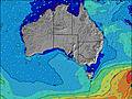 | 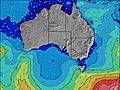 | 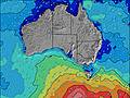 | 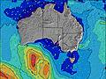 | 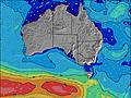 | 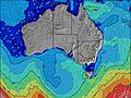 | 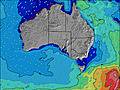 | ||||||||||||||
Wave Height (m) Direction Period (s) | WSW 9 | WSW 9 | WSW 4 | WSW 8 | WSW 8 | WSW 8 | W 7 | W 7 | W 7 | W 6 | W 4 | SW 15 | SW 14 | SW 14 | SW 14 | W 9 | NNW 6 | W 6 | W 7 | W 6 | W 6 |
Wave Graph | |||||||||||||||||||||
30 | 15 | 10 | 6 | 12 | 6 | 4 | 1 | 1 | 1 | 1 | 9 | 8 | 8 | 8 | 6 | 0 | 205 | 595 | 321 | 221 | |
Wind (km/h) | |||||||||||||||||||||
Wind State on-shore cross-onshore cross-shore cross-offshore off-shore glassy | on | on | on | on | on | off | cross-off | cross | cross-off | cross | glassy | cross-off | cross-off | cross-off | cross-off | cross-off | cross-off | cross | on | on | cross-on |
High Tide | 6:44PM1.78m | 7:11AM1.72m | 7:08PM1.57m | 7:36AM1.71m | 7:29PM1.32m | 8:03AM1.65m | 7:37PM1.06m | 8:33AM1.56m | 6:49PM0.85m | 9:17AM1.43m | 1:48PM1.38m | ||||||||||
Low Tide | 12:41PM0.19m | 00:58AM0.06m | 1:14PM0.27m | 1:14AM0.18m | 1:50PM0.40m | 1:24AM0.30m | 2:31PM0.58m | 1:23AM0.41m | 3:42PM0.79m | 00:53AM0.47m | 11:36PM0.42m | 10:57PM0.29m | |||||||||
7:09 | — | — | 7:09 | — | — | 7:07 | — | — | 7:07 | — | — | 7:05 | — | — | 7:05 | — | — | 7:03 | — | — | |
— | 5:34 | — | — | 5:35 | — | — | 5:36 | — | — | 5:37 | — | — | 5:37 | — | — | 5:37 | — | — | 5:38 | — | |
mm | — | — | — | — | — | — | — | — | — | — | — | — | — | — | — | 7 | 9 | 8 | 1 | — | — |
Temp °C | 13 | 13 | 11 | 12 | 11 | 9 | 11 | 12 | 12 | 12 | 13 | 12 | 14 | 16 | 15 | 10 | 11 | 13 | 12 | 13 | 12 |
Feels °C | 8 | 9 | 7 | 8 | 8 | 7 | 8 | 9 | 9 | 11 | 12 | 10 | 11 | 13 | 11 | 3 | 2 | 6 | 4 | 6 | 9 |
Swell 1 Height (m) Direction Period (s) | WSW 9 | WSW 9 | WSW 8 | WSW 8 | WSW 8 | WSW 8 | W 7 | W 7 | W 7 | W 6 | W 4 | W 4 | SW 14 | SW 10 | SW 10 | W 9 | S 15 | N 5 | — | — | — |
30 | 15 | 7 | 6 | 12 | 6 | 4 | 1 | 1 | 1 | 1 | 1 | 8 | 4 | 4 | 6 | 4 | 21 | — | — | — | |
Swell 2 Height (m) Direction Period (s) | — | — | — | SW 11 | — | — | — | — | — | — | — | SW 15 | — | SW 14 | SW 14 | W 6 | — | — | — | — | — |
— | — | — | 5 | — | — | — | — | — | — | — | 9 | — | 8 | 8 | 1 | — | — | — | — | — | |
Swell 3 Height (m) Direction Period (s) | — | — | — | — | — | — | — | — | — | — | — | — | — | — | — | — | — | — | — | — | — |
— | — | — | — | — | — | — | — | — | — | — | — | — | — | — | — | — | — | — | — | — | |
Wind waves Height (m) Direction Period (s) | WSW 5 | WSW 5 | WSW 4 | WSW 4 | — | — | — | N 3 | — | N 3 | N 3 | — | N 3 | NNW 3 | N 3 | N 4 | NNW 6 | W 6 | W 7 | W 6 | W 6 |
27 | 12 | 10 | 4 | — | — | — | 1 | — | 1 | 1 | — | 2 | 4 | 7 | 19 | 464 | 205 | 595 | 321 | 221 | |
Nearest Offshore or Glassy | |||||||||||||||||||||
Distance (km) | 603 | 611 | 122 | 122 | 133 | 33 | 33 | 33 | 33 | 33 | 133 | 33 | 33 | 33 | 33 | 552 | 552 | 787 | 439 | 623 | 34 |
Best forecast wave conditions in Adelaide | |||||||||||||||||||||
Best forecast wave conditions in Australia | |||||||||||||||||||||
Header Global | |||||||||||||||||||||
- Map Icons:
 Break
Break Live Wave Height (m)
 Live Wind Speed (km/h)
 Surf Rating (10 Max)
 Ocean Swells (m)
- Wind Speed (km/h)
Latest Updates


FREE! Surf-Forecast.com widget for your website
The surf report / weather widget below is available to embed on third party websites free of charge and provides a summary of our Aldinga Beach surf forecast. Simply grab the html code snippet that we provide and paste it into your own site. You can choose your preferred language and metric/imperial units for the surf forecast feed to suit users of your site. Click here to get the code.
Information about the Aldinga Beach Surf forecast
The above surf forecast table for Aldinga Beach provides essential information for determining whether the surfing conditions will be good over the next 16 days. A general guide to surfing at Aldinga Beach can be found by selecting the local surf guide option on the grey menu. Our Aldinga Beach surf forecast is unique since it includes wave energy (power) that defines the real feel of the surf rather than just the height or the period. If you surf the same spot (Aldinga Beach) regularly then make a mental note of the wave energy from the surf forecast table each time you go. Very soon you may start to choose your surf days based on the wave energy alone combined with our forecast of favourable offshore wind conditions. Our star ratings will help here and of course you will also find the usual wave height and period predictions on our surf forecasts as well as a full break down of the swell components under our advanced users option (to reveal that, click the little Einstein character under the tide times).
Further information to help with frequently asked questions about our surf forecast for Aldinga Beach may be found under the help tab on the top menu and also by moving your mouse over the question marks on the surf forecast table itself. Please always bear in mind that the forecast is for near-shore open water and local factors at each surf break influence the actual breaking wave height, such as the beach / reef profile, water depths offshore and shelter.
Are you planning a holiday in Adelaide? If you are looking for accommodation near Aldinga Beach, camping, hotels and holiday cottages in Adelaide, consider staying in Morphett Vale which is 19 km (12 miles) away. Other places in and around Adelaide where you can find information about places to rent, and car hire include Rapid Bay which is 36 km (22 miles) away, Adelaide, Adelaide Hills and Port Adelaide.
 Nearest