

Surf Forecasts:

Agate Beach surf forecast from 27 Jul 2026:
- Best quality surf: Monday 27 Jul, 8PM (local time) - 3ft (0.9m), 18s period, SW swell with glassy winds.
- Most powerful swell: Wednesday 29 Jul, 5AM (local time) - 3.5ft (1.0m), 17s period, SW swell with 587 kJ wave energy.
- Next surfable swell (1★+): Monday 27 Jul, 8PM (local time) - 3ft (0.9m), 18s period with SW swell.
Best Forecast Surf Conditions for Agate Beach this week:
The surf forecast for Agate Beach over the next 16 days: The first swell (rated 1 star or higher) is forecast to arrive on Monday (Jul 27) at 8PM. The primary swell is predicted to be 0.9m and 18s period with a secondary swell of 0.8m and 9s. The wind is predicted to be glassy as the swell arrives.
The most powerful waves expected at Agate Beach in the next 16 days are 1.0m 17s and forecast to arrive on Wednesday (Jul 29) at 5AM. Winds are predicted to be cross-offshore at the time the swell arrives.
| Wave Type | Time (PDT) & Date | Wave Height & Period |
|---|---|---|
| Next good surf (1 star+) | 8PM (Mon 27th Jul) | 3ft (0.9m) 18s |
| Best Surf | 8PM (Mon 27th Jul) | 3ft (0.9m) 18s |
| Most Powerful | 5AM (Wed 29th Jul) | 3.5ft (1.0m) 17s |
Table - best surf conditions forecast for Agate Beach over the next 16 days.
The Lowdown
Alright, Rusty here. Let’s have a look at what’s cooking.
Honestly, the next couple of weeks are a tough watch. We’ve got a little bump of swell early in the week – Monday the 27th and Tuesday the 28th – at Agate Beach, but it’s tagged as marginal. We’re looking at a 3 ft swell from the SW with a very long 18-second period. That kind of period on a point break like this could actually shape up alright, but the conditions are the letdown. Monday morning has light offshore wind from the WSW at 6 mph, which is a positive, and the wave energy is moderate (605). But the water is running at just 54°, which is 4° colder than normal for this time of year – that’s a notable chill, so suit up.
The real story here is the lack of quality. After Tuesday the 28th, the swell drops off and the wind goes onshore or cross-shore for days. You’re looking at a long, blank run of poor to marginal conditions from Wednesday the 29th all the way through to Tuesday the 11th of August. The wind just won’t play ball – it’s mostly cross-on from the NNW at 9-15 mph, making everything choppy and messy. The swell gets a bit stronger later on, with 6 ft to 7 ft from the NW around the 7th and 8th of August, but with short-period, wind-affected waves and that persistent cross wind, it’s a messy, lumpy ocean. Not worth paddling out for a clean ride. Even the bigger days, like Wednesday the 5th of August with 7 ft and moderate energy (586), are blown out. That’s more of a kite-surfing setup than a paddle-surfing one, especially on a point break with cross-shore wind.
There’s no standout here. The best on offer would be Monday morning the 27th of July, if you can handle the cold water and the low score. After that, you’re waiting nearly two weeks until the 10th of August might show a faint pulse of improvement, but it’s still marginal at best. The area is just stuck in a stubborn, windy pattern.
Stay patient. Forecasts can change.
Rusty.
Short Range ForecastMostly dry. Very mild (max 19°C on Tue morning, min 11°C on Wed night). Wind will be generally light. | Days 4-6 Weather SummaryMostly dry. Very mild (max 19°C on Fri morning, min 12°C on Thu morning). Wind will be generally light. | ||||||||||||||||||||
Monday 27 | Tuesday 28 | Wednesday 29 | Thursday 30 | Friday 31 | Saturday 1 | Sunday 2 | |||||||||||||||
AM | PM | Night | AM | PM | Night | AM | PM | Night | AM | PM | Night | AM | PM | Night | AM | PM | Night | AM | PM | Night | |
Swell Height Map |  |  | 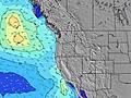 | 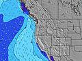 | 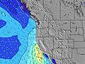 | 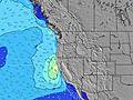 | 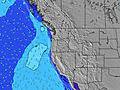 | ||||||||||||||
Wave Height (m) Direction Period (s) | SW 18 | WSW 18 | WSW 18 | SW 16 | SW 16 | SW 17 | SW 17 | SW 16 | SW 16 | SW 16 | SW 16 | SW 15 | SW 15 | SW 14 | SW 14 | SW 14 | SW 14 | SW 14 | WNW 8 | WNW 8 | WNW 8 |
Wave Graph | |||||||||||||||||||||
455 | 547 | 584 | 274 | 395 | 434 | 493 | 318 | 310 | 302 | 295 | 233 | 209 | 206 | 203 | 127 | 121 | 125 | 91 | 115 | 184 | |
Wind (km/h) | |||||||||||||||||||||
Wind State on-shore cross-onshore cross-shore cross-offshore off-shore glassy | on | on | cross-off | on | cross-on | cross | cross-on | cross-on | glassy | cross-on | cross-on | glassy | cross-on | cross-on | glassy | cross-on | cross-on | cross-off | cross-on | cross | cross-off |
High Tide | 1:08PM1.84m | 11:36PM2.44m | 1:37PM1.91m | 00:16AM2.48m | 2:06PM1.98m | 00:54AM2.49m | 2:33PM2.05m | 1:32AM2.45m | 3:00PM2.13m | 2:12AM2.36m | 3:28PM2.21m | 2:54AM2.23m | 3:57PM2.28m | 3:42AM2.05m | |||||||
Low Tide | 5:44PM1.14m | 6:49AM-0.17m | 6:24PM1.06m | 7:22AM-0.20m | 7:03PM0.99m | 7:53AM-0.20m | 7:43PM0.91m | 8:23AM-0.15m | 8:24PM0.83m | 8:52AM-0.05m | 9:07PM0.73m | 9:22AM0.10m | 9:55PM0.63m | ||||||||
5:56 | — | — | 5:56 | — | — | 5:58 | — | — | 5:58 | — | — | 6:01 | — | — | 6:01 | — | — | 6:03 | — | — | |
— | 8:47 | — | — | 8:46 | — | — | 8:45 | — | — | 8:44 | — | — | 8:43 | — | — | 8:42 | — | — | 8:40 | — | |
mm | — | — | — | — | — | — | — | — | — | — | — | — | — | — | — | — | — | — | — | — | — |
Temp °C | 17 | 18 | 16 | 19 | 19 | 16 | 17 | 17 | 14 | 15 | 17 | 14 | 19 | 19 | 15 | 16 | 17 | 15 | 17 | 16 | 15 |
Feels °C | 15 | 17 | 17 | 19 | 18 | 16 | 15 | 14 | 12 | 14 | 14 | 13 | 16 | 16 | 13 | 16 | 15 | 14 | 14 | 12 | 12 |
Swell 1 Height (m) Direction Period (s) | NW 9 | WSW 18 | WSW 18 | WNW 8 | W 8 | SW 17 | WNW 9 | WNW 9 | WNW 8 | WNW 8 | WNW 8 | SW 15 | WNW 8 | WNW 8 | WNW 8 | WNW 8 | WNW 8 | WNW 8 | WNW 8 | WNW 8 | WNW 8 |
135 | 547 | 584 | 94 | 137 | 434 | 249 | 217 | 165 | 103 | 84 | 233 | 78 | 87 | 85 | 81 | 60 | 81 | 89 | 115 | 184 | |
Swell 2 Height (m) Direction Period (s) | SW 18 | NW 9 | WNW 9 | SW 16 | SW 16 | WNW 7 | SW 17 | SW 16 | SW 16 | SW 16 | SW 16 | WNW 8 | SW 15 | SW 14 | SW 14 | SW 14 | SW 14 | SW 14 | SW 14 | SW 14 | SW 13 |
455 | 95 | 106 | 274 | 395 | 71 | 493 | 318 | 310 | 302 | 295 | 55 | 209 | 206 | 203 | 127 | 121 | 125 | 91 | 64 | 62 | |
Swell 3 Height (m) Direction Period (s) | W 6 | WSW 5 | SSW 11 | SW 20 | SW 12 | WNW 9 | — | SW 12 | SSW 11 | SW 11 | SSW 11 | SSW 11 | — | SW 8 | SW 8 | W 21 | W 20 | WSW 19 | W 19 | SW 18 | WSW 18 |
15 | 10 | 12 | 186 | 38 | 84 | — | 35 | 24 | 18 | 11 | 11 | — | 3 | 3 | 9 | 8 | 37 | 7 | 13 | 61 | |
Wind waves Height (m) Direction Period (s) | — | — | — | — | — | — | — | NNW 4 | — | — | — | — | — | NW 3 | NNW 3 | — | NW 3 | — | — | NNW 4 | N 5 |
— | — | — | — | — | — | — | 10 | — | — | — | — | — | 2 | 1 | — | 7 | — | — | 16 | 44 | |
Nearest Offshore or Glassy | |||||||||||||||||||||
Distance (km) | 251 | 251 | 31 | 251 | 872 | 11 | 181 | 873 | 11 | 320 | 872 | 11 | 320 | 499 | 11 | 759 | 416 | 11 | 181 | 873 | 11 |
Best forecast wave conditions in South Oregon | |||||||||||||||||||||
Best forecast wave conditions in United States | |||||||||||||||||||||
Header Global | |||||||||||||||||||||
- Map Icons:
 Break
Break Live Wave Height (m)
 Live Wind Speed (km/h)
 Surf Rating (10 Max)
 Ocean Swells (m)
- Wind Speed (km/h)


FREE! Surf-Forecast.com widget for your website
The surf report / weather widget below is available to embed on third party websites free of charge and provides a summary of our Agate Beach surf forecast. Simply grab the html code snippet that we provide and paste it into your own site. You can choose your preferred language and metric/imperial units for the surf forecast feed to suit users of your site. Click here to get the code.
Information about the Agate Beach Surf forecast
The above surf forecast table for Agate Beach provides essential information for determining whether the surfing conditions will be good over the next 16 days. A general guide to surfing at Agate Beach can be found by selecting the local surf guide option on the grey menu. Our Agate Beach surf forecast is unique since it includes wave energy (power) that defines the real feel of the surf rather than just the height or the period. If you surf the same spot (Agate Beach) regularly then make a mental note of the wave energy from the surf forecast table each time you go. Very soon you may start to choose your surf days based on the wave energy alone combined with our forecast of favourable offshore wind conditions. Our star ratings will help here and of course you will also find the usual wave height and period predictions on our surf forecasts as well as a full break down of the swell components under our advanced users option (to reveal that, click the little Einstein character under the tide times).
Further information to help with frequently asked questions about our surf forecast for Agate Beach may be found under the help tab on the top menu and also by moving your mouse over the question marks on the surf forecast table itself. Please always bear in mind that the forecast is for near-shore open water and local factors at each surf break influence the actual breaking wave height, such as the beach / reef profile, water depths offshore and shelter.
Agate Beach is 64 km (40 miles) from Corvallis. If you plan a vacation in South Oregon, look for hotels and other accommodation in Corvallis. Corvallis has rooms for a wide range of budgets as well as car hire and transport links.
 Nearest