

Surf Forecasts:

Wests and Seconds surf forecast from 31 Jul 2026:
- Best quality surf: Wednesday 5 Aug, 5PM (local time) - 6.5ft (2.0m), 16s period, SSW swell with glassy winds.
- Most powerful swell: Saturday 8 Aug, 2AM (local time) - 15ft (4.5m), 14s period, SW swell with 7,346 kJ wave energy.
- Next surfable swell (1★+): Monday 3 Aug, 2PM (local time) - 4.5ft (1.3m), 15s period with SSW swell.
Best Forecast Surf Conditions for Wests and Seconds this week:
The surf forecast for Wests and Seconds over the next 16 days: The first swell (rated 1 star or higher) is forecast to arrive on Monday (Aug 03) at 2PM. The primary swell is predicted to be 1.3m and 15s period. The wind is predicted to be offshore as the swell arrives.
The most powerful waves expected at Wests and Seconds in the next 16 days are 4.5m 14s and forecast to arrive on Saturday (Aug 08) at 2AM. Winds are predicted to be cross-offshore at the time the swell arrives. The largest open ocean swell (not directed at the beach) is 1.4m 5s period and expected on Friday (Aug 07) at 2PM.
| Wave Type | Time (AWST) & Date | Wave Height & Period |
|---|---|---|
| Next good surf (1 star+) | 2PM (Mon 3rd Aug) | 4.5ft (1.3m) 15s |
| Best Surf | 5PM (Wed 5th Aug) | 6.5ft (2.0m) 16s |
| Most Powerful | 2AM (Sat 8th Aug) | 15ft (4.5m) 14s |
Table - best surf conditions forecast for Wests and Seconds over the next 16 days.
The Lowdown
Right, cobber, pull up a seat. Rusty here. Let’s have a look at what’s cookin’ for Wests and Seconds over the next couple of weeks.
Overall Pattern & First Week
Alright, the outlook is a bit of a mixed bag, but there’s some serious firepower on the way. The first week is a slow burn, with a couple of real gems tucked in there. The water is sitting at 62°, which is pretty much spot on for this time of year, so don't expect any surprises there.
We kick off on Saturday, August 1st, with a solid 10ft SSW swell rolling in, but a stiff 30 km/h cross-on-shore wind has it all chopped up and messy. Sunday the 2nd isn't much better – the swell drops to 8ft, but the wind is cross-shore, leaving it lumpy. You’d be mad to paddle out those first few days.
Now, the first real standout comes on Wednesday, August 5th. The morning brings a clean 6ft SSW swell with a nice cross-offshore breeze. But the arvo session? That’s the one. The wind goes glassy, the swell bumps up to 7ft from the SSW, and the wave energy is pumping (2,084). The conditions are described as excellent for experienced surfers. This is a genuine window of clean, punchy waves.
Thursday, August 6th, keeps the dream alive. The morning sees a 7ft SSW swell with a clean, moderate offshore wind from the N. The wave energy is kicking (2,669). This is proper, clean, offshore surf. The afternoon holds up similar size but the wind swings a bit cross-off, still very rideable.
From Friday the 7th through to Saturday the 8th, it all goes to custard. The wind cranks up to gale force, and the swell becomes a messy, blown-out 8ft closeout. Kite surfers would be having a field day, but for a paddle surfer, it’s a write-off.
Second Week & The Big One
Things settle down again on Sunday, August 9th. The morning is a clean 10ft SSW swell, but it’s a tad rough. The real standout of the whole period is the Sunday afternoon session. You’ve got an 8ft SSW swell, a clean 17-second period groundswell, a light cross-offshore breeze, and the wave energy is massive at 4,274. That is a serious, long-period groundswell hitting an exposed reef setup. It’s a big, powerful, clean swell for experienced surfers. The only downside is that it’s a long period swell, so at a beach break it might be a bit too straight, but at a reef like this, it’s the perfect recipe for deep, hollow waves.
Monday, August 10th, keeps the size up with a 10ft SSW swell, but the wind is a bit stronger, keeping it from being a perfect standout. The rest of the week has some solid pulses, but the wind is often onshore or cross-shore.
The last real standout to circle is Thursday, August 13th. The morning is clean with an 8ft SSW swell, but the afternoon is where it’s at. The swell is still 8ft from the SSW, a 19-second period, light cross-on breeze, and the wave energy is absolutely pumping at 9,660. This is a massive, powerful, long-period swell. It’s a crowd-puller for sure, and at this break, crowds are sometimes an issue, so get there early.
The Wrap-Up
So, the standout days are the afternoon of Wednesday, August 5th for a clean, glassy 7ft swell, and the afternoon of Sunday, August 9th for a powerful, clean 8ft groundswell. The absolute biggest, most powerful session will be the afternoon of Thursday, August 13th, but that’s a big, powerful swell for experts only. The rest of the time is a mix of clean windows and blown-out slop. Keep your eyes on the long-range forecast.
Rusty.
Short Range ForecastLight rain (total 5mm), mostly falling on Sat morning. Warm (max 20°C on Mon afternoon, min 9°C on Sun night). Winds increasing (light winds from the ESE on Sun morning, strong winds from the N by Mon night). | Days 4-6 Weather SummaryLight rain (total 5mm), mostly falling on Tue morning. Warm (max 21°C on Thu afternoon, min 12°C on Wed morning). Winds decreasing (fresh winds from the NNW on Tue morning, calm by Wed afternoon). | ||||||||||||||||||||
Saturday 1 | Sunday 2 | Monday 3 | Tuesday 4 | Wednesday 5 | Thursday 6 | Friday 7 | |||||||||||||||
AM | PM | Night | AM | PM | Night | AM | PM | Night | AM | PM | Night | AM | PM | Night | AM | PM | Night | AM | PM | Night | |
Swell Height Map | 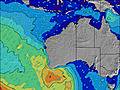 | 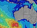 | 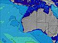 | 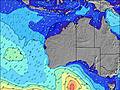 | 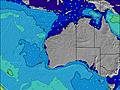 | 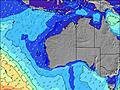 | 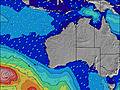 | ||||||||||||||
Wave Height (m) Direction Period (s) | SSW 15 | SSW 15 | SSW 16 | SSW 14 | SSW 14 | SSW 13 | SSW 17 | SSW 15 | SSW 16 | SSW 20 | SSW 19 | SSW 17 | SSW 16 | SSW 16 | SSW 16 | SSW 16 | SSW 17 | SSW 16 | SSW 16 | SW 15 | SW 14 |
Wave Graph | |||||||||||||||||||||
3543 | 2563 | 6094 | 2152 | 1564 | 769 | 1086 | 604 | 568 | 723 | 1247 | 1749 | 1536 | 2084 | 2682 | 2669 | 2900 | 1839 | 1150 | 2794 | 7346 | |
Wind (km/h) | |||||||||||||||||||||
Wind State on-shore cross-onshore cross-shore cross-offshore off-shore glassy | cross-on | cross-on | cross-on | cross | cross-on | cross-off | cross-off | cross-off | off | cross-off | cross-on | cross-off | cross-off | glassy | off | off | cross-off | cross-off | cross-off | cross-on | cross-off |
High Tide | 12:05PM1.07m | 00:45AM0.69m | 12:28PM0.99m | 1:03AM0.74m | 12:46PM0.89m | 1:27AM0.80m | 12:52PM0.78m | 2:02AM0.85m | 12:14PM0.68m | 3:00AM0.87m | 5:31AM0.90m | ||||||||||
Low Tide | 7:06PM0.33m | 5:52AM0.43m | 7:15PM0.38m | 6:31AM0.47m | 7:19PM0.43m | 7:17AM0.53m | 7:12PM0.45m | 8:25AM0.61m | 6:46PM0.45m | 5:58PM0.40m | 5:16PM0.32m | ||||||||||
6:45 | — | — | 6:43 | — | — | 6:43 | — | — | 6:43 | — | — | 6:41 | — | — | 6:41 | — | — | 6:39 | — | — | |
— | 5:12 | — | — | 5:13 | — | — | 5:13 | — | — | 5:14 | — | — | 5:15 | — | — | 5:15 | — | — | 5:15 | — | |
mm | 3 | 1 | — | — | — | — | — | — | 1 | 3 | 1 | — | — | — | — | — | — | 1 | — | 9 | 2 |
Temp °C | 13 | 14 | 13 | 14 | 14 | 13 | 14 | 20 | 19 | 15 | 16 | 16 | 14 | 16 | 16 | 17 | 21 | 20 | 16 | 13 | 12 |
Feels °C | 6 | 6 | 5 | 11 | 11 | 9 | 7 | 15 | 12 | 10 | 10 | 13 | 10 | 13 | 12 | 12 | 17 | 16 | 8 | 7 | 3 |
Swell 1 Height (m) Direction Period (s) | SSW 15 | SE 15 | SSW 16 | SSW 14 | SSW 14 | SSW 13 | SSW 17 | SSW 15 | SSW 16 | SSW 20 | SSW 19 | SSW 17 | SSW 16 | SSW 16 | SSW 16 | SSW 16 | SSW 17 | SSW 16 | SSW 16 | SSW 15 | SW 14 |
3543 | 8 | 6094 | 2152 | 1564 | 769 | 1086 | 604 | 568 | 723 | 1247 | 1749 | 1536 | 2084 | 2682 | 2669 | 2900 | 1839 | 1150 | 1133 | 2704 | |
Swell 2 Height (m) Direction Period (s) | — | — | — | — | SE 13 | SSW 18 | E 4 | E 4 | SSW 21 | SSW 14 | SSW 13 | SSE 8 | SE 8 | — | — | — | — | — | E 7 | E 8 | — |
— | — | — | — | 7 | 246 | 1 | 1 | 86 | 389 | 368 | 7 | 3 | — | — | — | — | — | 27 | 10 | — | |
Swell 3 Height (m) Direction Period (s) | — | — | — | — | — | — | — | NW 4 | SE 6 | SSE 9 | SSE 9 | SSE 8 | SSE 8 | — | — | — | — | — | — | — | — |
— | — | — | — | — | — | — | 1 | 1 | 15 | 7 | 7 | 7 | — | — | — | — | — | — | — | — | |
Wind waves Height (m) Direction Period (s) | SSW 16 | SSW 15 | SSW 16 | — | — | NE 4 | NNE 4 | NNE 3 | ENE 4 | NNW 4 | — | SW 5 | — | — | — | — | — | ENE 6 | WNW 4 | SW 15 | SW 14 |
2647 | 2563 | 3460 | — | — | 13 | 12 | 2 | 1 | 22 | — | 21 | — | — | — | — | — | 62 | 31 | 2794 | 7346 | |
Nearest Offshore or Glassy | |||||||||||||||||||||
Distance (km) | 581 | 581 | 292 | 26 | 376 | 117 | 393 | 2 | 376 | 885 | 292 | 235 | 163 | 0 | 0 | 0 | 2 | 7 | 1160 | 1385 | 1543 |
Best forecast wave conditions in Far South of Western Australia | |||||||||||||||||||||
Best forecast wave conditions in Australia | |||||||||||||||||||||
Header Global | |||||||||||||||||||||
- Map Icons:
 Break
Break Live Wave Height (m)
 Live Wind Speed (km/h)
 Surf Rating (10 Max)
 Ocean Swells (m)
- Wind Speed (km/h)
Latest Updates


FREE! Surf-Forecast.com widget for your website
The surf report / weather widget below is available to embed on third party websites free of charge and provides a summary of our Wests and Seconds surf forecast. Simply grab the html code snippet that we provide and paste it into your own site. You can choose your preferred language and metric/imperial units for the surf forecast feed to suit users of your site. Click here to get the code.
Information about the Wests and Seconds Surf forecast
The above surf forecast table for Wests and Seconds provides essential information for determining whether the surfing conditions will be good over the next 16 days. A general guide to surfing at Wests and Seconds can be found by selecting the local surf guide option on the grey menu. Our Wests and Seconds surf forecast is unique since it includes wave energy (power) that defines the real feel of the surf rather than just the height or the period. If you surf the same spot (Wests and Seconds) regularly then make a mental note of the wave energy from the surf forecast table each time you go. Very soon you may start to choose your surf days based on the wave energy alone combined with our forecast of favourable offshore wind conditions. Our star ratings will help here and of course you will also find the usual wave height and period predictions on our surf forecasts as well as a full break down of the swell components under our advanced users option (to reveal that, click the little Einstein character under the tide times).
Further information to help with frequently asked questions about our surf forecast for Wests and Seconds may be found under the help tab on the top menu and also by moving your mouse over the question marks on the surf forecast table itself. Please always bear in mind that the forecast is for near-shore open water and local factors at each surf break influence the actual breaking wave height, such as the beach / reef profile, water depths offshore and shelter.
Are you planning a holiday in Far South of Western Australia? If you are looking for accommodation near Wests and Seconds, camping, hotels and holiday cottages in Far South of Western Australia, consider staying in Esperance which is 2 km (1 miles) away.
 Nearest