

Surf Forecasts:

Wanjapu surf forecast from 3 Aug 2026:
- Best quality surf: Friday 7 Aug, 2PM (local time) - 8ft (2.5m), 16s period, SSW swell with glassy winds.
- Most powerful swell: Saturday 8 Aug, 2AM (local time) - 8ft (2.5m), 16s period, SSW swell with 3,636 kJ wave energy.
- Next surfable swell (1★+): Tuesday 4 Aug, 2AM (local time) - 5ft (1.6m), 15s period with SW swell.
Best Forecast Surf Conditions for Wanjapu this week:
The surf forecast for Wanjapu over the next 16 days: The first swell (rated 1 star or higher) is forecast to arrive on Tuesday (Aug 04) at 2AM. The primary swell is predicted to be 1.6m and 15s period with a secondary swell of 0.7m and 6s. The wind is predicted to be cross-offshore as the swell arrives.
The most powerful waves expected at Wanjapu in the next 16 days are 2.5m 16s and forecast to arrive on Saturday (Aug 08) at 2AM. Winds are predicted to be cross-offshore at the time the swell arrives. The largest open ocean swell (not directed at the beach) is 1.5m 6s period and expected on Friday (Aug 07) at 11PM.
| Wave Type | Time (WITA) & Date | Wave Height & Period |
|---|---|---|
| Next good surf (1 star+) | 2AM (Tue 4th Aug) | 5ft (1.6m) 15s |
| Best Surf | 2PM (Fri 7th Aug) | 8ft (2.5m) 16s |
| Most Powerful | 2AM (Sat 8th Aug) | 8ft (2.5m) 16s |
Table - best surf conditions forecast for Wanjapu over the next 16 days.
The Lowdown
Alright, Rusty here, let’s have a look at what’s coming our way.
Right off the bat, we’ve got a solid run of surf on the cards, but it’s a bit of a mixed bag with the conditions. The main event is a consistent, long-period SW groundswell that hangs around for most of the forecast period. The combined energy is serious, with values sitting in the thousands at times, so there’s plenty of power in the water. But the winds are a bit fickle, and the tide is mentioned as a factor, so you’ll need to pick your moments.
We’re looking at Wanjapu (a reef setup) as the main break. The swell direction is from the SW, which is the optimum direction for this spot, so that’s a good start. The water temp is about average for the time of year here, so no surprises on that front.
The first couple of days, Tuesday the 4th and Wednesday the 5th, are a bit of a tease. We’ve got about 5ft of swell, but the winds are cross or cross-on, and the conditions are described as marginal. It’s not unsurfable, but it’s not the pick of the window.
Things start to look more interesting from Thursday the 6th into the weekend. The swell bumps up to around 7ft, with a very long period of 16 to 18 seconds. This is proper groundswell, so it’ll have plenty of shape and push, but at a beach break or a spot like this, that long period can make the waves a bit top-to-bottom. The winds are still light cross-shore, so the surface will be okay, but not perfect. The energy is high, so it’s solid. The standout session for the first week is looking like Thursday morning, August 6th. The swell is 7ft from the SSW, period at 18 seconds, and the wind is light cross-shore. That’s clean, powerful, and has good shape. It’s a bit much for beginners, but for the experienced crew, it’s one of the best on offer.
The surf keeps pumping through the next week, with the swell staying in the 6ft to 8ft range. The wind is still a bit of a lottery, but there’s a proper window of calm on Thursday, August 13th. The morning is glassy, with a 6ft SSW swell and a 16-second period. This is the absolute standout. The conditions are described as "excellent" for experienced surfers, and the wind is glassy. That’s a rare treat. The afternoon is clean with a light cross-offshore breeze. This is the day to clear the calendar.
After that, the winds start to freshen up from the SE, making it choppier, and by the 15th and 16th, it’s getting messy. There’s a bit of a pulse of bigger swell around the 18th and 19th, with waves hitting 8ft to 10ft, but the wind is cross-on or moderate cross-shore, so it’s going to be a bumpy, powerful beast. That’s more for the experts or the kite surfers, to be honest.
So, the overall picture: solid groundswell for the whole run. The best windows are Thursday morning, August 6th for a powerful, clean session, and the absolute pick is Thursday, August 13th, with glassy conditions and a quality 6ft swell. The later part of the second week is promising but less certain, with more wind and bigger, messier waves.
Rusty.
Short Range ForecastMostly dry. Warm (max 26°C on Wed afternoon, min 23°C on Mon night). Wind will be generally light. | Days 5-7 Weather SummaryMostly dry. Warm (max 26°C on Fri afternoon, min 23°C on Thu night). Wind will be generally light. | ||||||||||||||||||
Tuesday 4 | Wednesday 5 | Thursday 6 | Friday 7 | Saturday 8 | Sunday 9 | ||||||||||||||
Night | AM | PM | Night | AM | PM | Night | AM | PM | Night | AM | PM | Night | AM | PM | Night | AM | PM | Night | |
Swell Height Map |  |  |  |  | 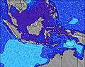 | 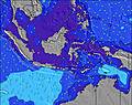 | 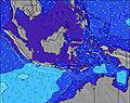 | ||||||||||||
Wave Height (m) Direction Period (s) | SW 15 | SW 14 | SW 14 | SW 16 | SW 14 | SW 15 | SW 19 | SSW 18 | SW 17 | SW 16 | SSW 16 | SSW 16 | SSW 16 | SSW 16 | SSW 16 | SW 16 | SSW 16 | SSW 15 | SSW 15 |
Wave Graph | |||||||||||||||||||
1059 | 1031 | 1002 | 525 | 928 | 966 | 2501 | 2672 | 2454 | 2146 | 2869 | 3506 | 3636 | 3062 | 2900 | 2291 | 2330 | 1907 | 1809 | |
Wind (km/h) | |||||||||||||||||||
Wind State on-shore cross-onshore cross-shore cross-offshore off-shore glassy | cross-off | cross | cross | cross-off | cross-on | cross-on | cross-off | cross | cross | cross-off | cross-on | cross | cross-off | cross-on | cross | cross-off | cross | cross | cross-off |
High Tide | 1:17AM2.72m | 1:21PM2.47m | 1:46AM2.72m | 1:56PM2.25m | 2:18AM2.67m | 2:38PM2.00m | 2:59AM2.58m | 3:35PM1.72m | 3:56AM2.45m | 5:28PM1.51m | 5:27AM2.35m | 8:08PM1.58m | |||||||
Low Tide | 7:28AM0.56m | 7:29PM0.46m | 8:07AM0.60m | 7:56PM0.62m | 8:52AM0.69m | 8:26PM0.81m | 9:51AM0.81m | 9:01PM1.02m | 11:22AM0.90m | 9:58PM1.24m | 1:29PM0.82m | 00:15AM1.38m | |||||||
— | 6:18 | — | — | 6:18 | — | — | 6:18 | — | — | 6:16 | — | — | 6:16 | — | — | 6:16 | — | — | |
6:00 | — | 6:00 | — | — | 6:00 | — | — | 6:00 | — | — | 6:00 | — | — | 6:00 | — | — | 6:00 | — | |
mm | — | — | — | — | — | — | — | — | — | — | — | — | — | — | — | — | — | — | — |
Temp °C | 25 | 25 | 25 | 25 | 25 | 26 | 25 | 25 | 26 | 25 | 25 | 26 | 25 | 25 | 26 | 25 | 25 | 25 | 25 |
Feels °C | 27 | 27 | 28 | 28 | 26 | 28 | 26 | 26 | 27 | 26 | 26 | 27 | 27 | 27 | 27 | 26 | 27 | 26 | 25 |
Swell 1 Height (m) Direction Period (s) | SW 15 | SW 14 | SW 14 | SW 13 | SW 14 | SW 15 | SW 19 | SSW 18 | SW 17 | SW 16 | SSW 16 | SSW 16 | SSW 16 | SSW 16 | SSW 16 | SW 16 | SSW 16 | SSW 15 | SSW 15 |
1059 | 1031 | 1002 | 525 | 928 | 966 | 2501 | 2672 | 2454 | 2146 | 2869 | 3506 | 3636 | 3062 | 2900 | 2291 | 2330 | 1907 | 1809 | |
Swell 2 Height (m) Direction Period (s) | SE 6 | SSE 6 | SE 6 | SW 16 | SW 22 | SW 21 | SE 6 | — | — | SE 5 | SE 5 | — | SE 5 | — | WSW 20 | — | — | — | SE 5 |
39 | 26 | 19 | 521 | 120 | 358 | 32 | — | — | 29 | 35 | — | 37 | — | 39 | — | — | — | 21 | |
Swell 3 Height (m) Direction Period (s) | — | — | — | SE 6 | — | — | — | — | — | — | — | — | — | — | — | — | — | — | — |
— | — | — | 34 | — | — | — | — | — | — | — | — | — | — | — | — | — | — | — | |
Wind waves Height (m) Direction Period (s) | — | SE 7 | SE 6 | SE 6 | SE 5 | SSE 5 | SE 6 | SE 6 | SE 5 | SE 5 | — | SE 5 | — | — | — | SE 5 | SE 5 | SE 4 | SE 5 |
— | 85 | 85 | 102 | 14 | 19 | 92 | 50 | 45 | 55 | — | 94 | — | — | — | 35 | 31 | 21 | 60 | |
Nearest Offshore or Glassy | |||||||||||||||||||
Distance (km) | 0 | 2 | 116 | 0 | 116 | 118 | 0 | 119 | 262 | 0 | 118 | 118 | 2 | 2 | 119 | 108 | 119 | 118 | 0 |
Best forecast wave conditions in Sumba | |||||||||||||||||||
Best forecast wave conditions in Indonesia | |||||||||||||||||||
Header Global | |||||||||||||||||||
- Map Icons:
 Break
Break Live Wave Height (m)
 Live Wind Speed (km/h)
 Surf Rating (10 Max)
 Ocean Swells (m)
- Wind Speed (km/h)
Latest Updates


FREE! Surf-Forecast.com widget for your website
The surf report / weather widget below is available to embed on third party websites free of charge and provides a summary of our Wanjapu surf forecast. Simply grab the html code snippet that we provide and paste it into your own site. You can choose your preferred language and metric/imperial units for the surf forecast feed to suit users of your site. Click here to get the code.
Information about the Wanjapu Surf forecast
The above surf forecast table for Wanjapu provides essential information for determining whether the surfing conditions will be good over the next 16 days. A general guide to surfing at Wanjapu can be found by selecting the local surf guide option on the grey menu. Our Wanjapu surf forecast is unique since it includes wave energy (power) that defines the real feel of the surf rather than just the height or the period. If you surf the same spot (Wanjapu) regularly then make a mental note of the wave energy from the surf forecast table each time you go. Very soon you may start to choose your surf days based on the wave energy alone combined with our forecast of favourable offshore wind conditions. Our star ratings will help here and of course you will also find the usual wave height and period predictions on our surf forecasts as well as a full break down of the swell components under our advanced users option (to reveal that, click the little Einstein character under the tide times).
Further information to help with frequently asked questions about our surf forecast for Wanjapu may be found under the help tab on the top menu and also by moving your mouse over the question marks on the surf forecast table itself. Please always bear in mind that the forecast is for near-shore open water and local factors at each surf break influence the actual breaking wave height, such as the beach / reef profile, water depths offshore and shelter.
Wanjapu is 24 km (15 miles) from the city of Adalara. If you plan a holiday in Sumba, look for hotels and other accommodation in Adalara. Adalara has rooms for a wide range of budgets as well as car hire and transport links.
 Nearest