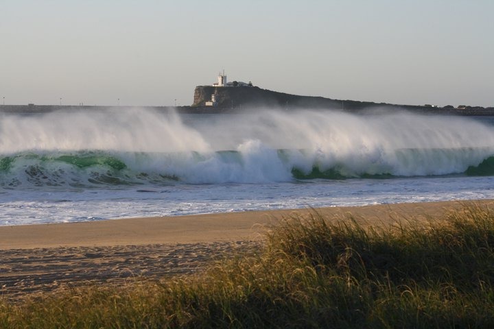

Surf Forecasts:

Stockton Beach surf forecast from 3 Aug 2026:
- Best quality surf: Monday 3 Aug, 7PM (local time) - 2.5ft (0.8m), 11s period, SE swell with cross-offshore winds.
- Most powerful swell: Monday 3 Aug, 4PM (local time) - 3ft (0.9m), 11s period, SE swell with 187 kJ wave energy.
- Next surfable swell (1★+): Monday 3 Aug, 7PM (local time) - 2.5ft (0.8m), 11s period with SE swell.
Best Forecast Surf Conditions for Stockton Beach this week:
The surf forecast for Stockton Beach over the next 16 days: The first swell (rated 1 star or higher) is forecast to arrive on Monday (Aug 03) at 7PM. The primary swell is predicted to be 0.8m and 11s period with a secondary swell of 0.1m and 15s. The wind is predicted to be cross-offshore as the swell arrives.
The most powerful waves expected at Stockton Beach in the next 16 days are 0.9m 11s and forecast to arrive on Monday (Aug 03) at 4PM. Winds are predicted to be cross-offshore at the time the swell arrives. The largest open ocean swell (not directed at the beach) is 0.7m 3s period and expected on Monday (Aug 10) at 1AM.
| Wave Type | Time (AEST) & Date | Wave Height & Period |
|---|---|---|
| Next good surf (1 star+) | 7PM (Mon 3rd Aug) | 2.5ft (0.8m) 11s |
| Best Surf | 7PM (Mon 3rd Aug) | 2.5ft (0.8m) 11s |
| Most Powerful | 4PM (Mon 3rd Aug) | 3ft (0.9m) 11s |
Table - best surf conditions forecast for Stockton Beach over the next 16 days.
The Lowdown
Alright, Rusty here. Let’s have a look at what’s coming down the line for our local stretch.
To be straight with you, the next week or so is looking pretty flat and quiet. We’ve got a long gap with barely a wave worth paddling for. The real action, if you can call it that, is tucked away at the very end of the forecast. Hang tight, because the good stuff is a long way off.
Monday 3rd August morning is your best early bet. Stockton Beach is showing a clean 4 ft wave from the SE with a solid 11-second period. Winds are light cross-off from the NNW, so it’ll be tidy. The combined energy reading is 311, so there’s some moderate grunt in the water. Water temp is 64°, which is about normal for this time of year. Looks okay, but it’s only a brief window – the arvo goes downhill with more wind.
After that, the surf drops right off. From Tuesday 4th right through to Monday 10th August, we’re looking at tiny, poor conditions. Most mornings have some offshore or clean wind, but the swell is just too small – mostly under 2 ft and weak energy readings (often under 100). Not worth getting the wetsuit wet for.
We get a little bump on Tuesday 11th August morning – 3 ft from the S, 9 seconds, clean offshore from the WNW. Still only moderate energy (184), but it’s the best of a pretty mediocre spell. The rest of that week stays small and ordinary.
Now, here’s the standout if you’ve got patience: Friday 14th August morning. Stockton Beach is looking at 10 ft of S swell. That’s a massive jump. The combined energy hits 2078 – that’s very strong. But this is a heads-up: at 10 ft, this is expert territory. The winds are light from the NNW, keeping it clean, but this break is exposed and that size will be too much for most. Not beginner friendly at all. The afternoon drops to 8 ft, still big and powerful.
Saturday 15th August morning is the best all-round option for stronger surfers. We get 5 ft from the SSE, moderate offshore wind from the W at 12 mph, and a combined energy of 396 – solid moderate energy. It’s still a bit big for beginners, but for anyone comfortable in that range, this is clean and punchy.
After that, it fades again into small stuff through to the end of the window.
So, the only real standout window is Friday 14th and Saturday 15th August. Friday is massive and for experts only; Saturday is the pick for strong intermediates and above. Everything else is a write-off. Crowds are possible at Stockton when it’s good, so expect company if you head out.
Stay patient.
- Rusty
Short Range ForecastMostly dry. Warm (max 20°C on Mon morning, min 8°C on Tue night). Wind will be generally light. | Days 4-6 Weather SummaryMostly dry. Very mild (max 16°C on Sat afternoon, min 10°C on Thu night). Wind will be generally light. | ||||||||||||||||||||
Monday 3 | Tuesday 4 | Wednesday 5 | Thursday 6 | Friday 7 | Saturday 8 | Sunday 9 | |||||||||||||||
AM | PM | Night | AM | PM | Night | AM | PM | Night | AM | PM | Night | AM | PM | Night | AM | PM | Night | AM | PM | Night | |
Swell Height Map |  |  |  |  |  |  |  | ||||||||||||||
Wave Height (m) Direction Period (s) | SE 11 | SE 11 | SE 10 | SE 10 | ESE 7 | ESE 7 | E 10 | E 9 | S 8 | S 8 | S 8 | S 9 | S 9 | S 9 | S 9 | S 8 | S 8 | NE 6 | E 7 | ENE 8 | E 8 |
Wave Graph | |||||||||||||||||||||
292 | 187 | 108 | 25 | 9 | 4 | 31 | 26 | 45 | 63 | 69 | 130 | 80 | 74 | 101 | 33 | 51 | 120 | 52 | 58 | 46 | |
Wind (km/h) | |||||||||||||||||||||
Wind State on-shore cross-onshore cross-shore cross-offshore off-shore glassy | cross-off | cross-off | off | off | cross-off | off | off | cross-on | off | off | on | cross-off | cross-off | cross-on | cross-off | glassy | on | cross | cross | cross-off | off |
High Tide | 11:20AM1.38m | 11:20PM1.46m | 12:03PM1.40m | 00:08AM1.34m | 12:54PM1.43m | 1:05AM1.22m | 1:53PM1.46m | 2:17AM1.12m | 3:00PM1.52m | 3:41AM1.07m | 4:12PM1.60m | 5:05AM1.09m | 5:19PM1.69m | ||||||||
Low Tide | 5:14PM0.45m | 5:44AM0.30m | 6:09PM0.48m | 6:25AM0.36m | 7:14PM0.50m | 7:13AM0.42m | 8:30PM0.51m | 8:12AM0.47m | 9:54PM0.46m | 9:20AM0.49m | 11:13PM0.37m | 10:32AM0.48m | 00:18AM0.26m | ||||||||
6:41 | — | — | 6:41 | — | — | 6:39 | — | — | 6:39 | — | — | 6:39 | — | — | 6:37 | — | — | 6:37 | — | — | |
— | 5:15 | — | — | 5:15 | — | — | 5:16 | — | — | 5:16 | — | — | 5:17 | — | — | 5:19 | — | — | 5:19 | — | |
mm | — | — | — | — | — | — | — | — | — | — | — | — | — | — | — | — | — | — | — | 1 | — |
Temp °C | 20 | 20 | 16 | 17 | 19 | 14 | 15 | 16 | 14 | 14 | 15 | 13 | 13 | 15 | 14 | 15 | 16 | 15 | 19 | 19 | 15 |
Feels °C | 16 | 15 | 13 | 13 | 14 | 10 | 12 | 13 | 9 | 12 | 12 | 9 | 10 | 12 | 13 | 14 | 13 | 11 | 16 | 15 | 9 |
Swell 1 Height (m) Direction Period (s) | SE 11 | SE 11 | SE 10 | ESE 7 | S 6 | SSW 4 | SSW 6 | SSW 6 | S 8 | S 8 | S 8 | S 9 | S 9 | S 9 | S 9 | S 8 | S 8 | ENE 7 | E 7 | ENE 8 | E 8 |
292 | 187 | 108 | 18 | 6 | 3 | 10 | 12 | 45 | 63 | 69 | 130 | 80 | 74 | 101 | 33 | 51 | 99 | 52 | 58 | 46 | |
Swell 2 Height (m) Direction Period (s) | S 21 | S 20 | S 19 | SE 10 | ESE 7 | ESE 7 | E 10 | E 9 | E 8 | E 10 | E 9 | E 10 | SE 10 | SSE 10 | E 10 | E 8 | SSE 9 | S 8 | S 8 | S 8 | ENE 10 |
9 | 8 | 7 | 25 | 9 | 4 | 31 | 26 | 12 | 16 | 15 | 17 | 26 | 38 | 29 | 29 | 17 | 32 | 10 | 5 | 20 | |
Swell 3 Height (m) Direction Period (s) | E 16 | E 15 | E 15 | S 5 | SSE 10 | S 6 | SE 8 | S 9 | SSE 12 | E 17 | E 16 | E 16 | E 11 | E 10 | E 15 | SE 9 | E 16 | E 15 | SE 9 | E 14 | E 14 |
5 | 4 | 4 | 2 | 9 | 3 | 2 | 2 | 15 | 5 | 5 | 5 | 36 | 18 | 4 | 22 | 5 | 4 | 3 | 4 | 4 | |
Wind waves Height (m) Direction Period (s) | NE 4 | NNE 3 | NW 2 | — | NW 2 | W 3 | WNW 3 | — | W 3 | — | — | NNE 3 | — | — | — | — | E 8 | NE 6 | — | NW 3 | WNW 3 |
5 | 6 | 1 | — | 1 | 1 | 1 | — | 1 | — | — | 1 | — | — | — | — | 41 | 120 | — | 4 | 10 | |
Nearest Offshore or Glassy | |||||||||||||||||||||
Distance (km) | 0 | 2 | 0 | 2 | 73 | 99 | 2 | 42 | 2 | 0 | 138 | 0 | 0 | 11 | 0 | 0 | 292 | 73 | 2 | 14 | 124 |
Best forecast wave conditions in Newcastle | |||||||||||||||||||||
Best forecast wave conditions in Australia | |||||||||||||||||||||
Header Global | |||||||||||||||||||||
- Map Icons:
 Break
Break Live Wave Height (m)
 Live Wind Speed (km/h)
 Surf Rating (10 Max)
 Ocean Swells (m)
- Wind Speed (km/h)
Latest Updates


FREE! Surf-Forecast.com widget for your website
The surf report / weather widget below is available to embed on third party websites free of charge and provides a summary of our Stockton Beach surf forecast. Simply grab the html code snippet that we provide and paste it into your own site. You can choose your preferred language and metric/imperial units for the surf forecast feed to suit users of your site. Click here to get the code.
Information about the Stockton Beach Surf forecast
The above surf forecast table for Stockton Beach provides essential information for determining whether the surfing conditions will be good over the next 16 days. A general guide to surfing at Stockton Beach can be found by selecting the local surf guide option on the grey menu. Our Stockton Beach surf forecast is unique since it includes wave energy (power) that defines the real feel of the surf rather than just the height or the period. If you surf the same spot (Stockton Beach) regularly then make a mental note of the wave energy from the surf forecast table each time you go. Very soon you may start to choose your surf days based on the wave energy alone combined with our forecast of favourable offshore wind conditions. Our star ratings will help here and of course you will also find the usual wave height and period predictions on our surf forecasts as well as a full break down of the swell components under our advanced users option (to reveal that, click the little Einstein character under the tide times).
Further information to help with frequently asked questions about our surf forecast for Stockton Beach may be found under the help tab on the top menu and also by moving your mouse over the question marks on the surf forecast table itself. Please always bear in mind that the forecast is for near-shore open water and local factors at each surf break influence the actual breaking wave height, such as the beach / reef profile, water depths offshore and shelter.
Are you planning a holiday in Newcastle? If you are looking for accommodation near Stockton Beach, camping, hotels and holiday cottages in Newcastle, consider staying in Newcastle which is 3 km (2 miles) away. Other places in and around Newcastle where you can find information about places to rent, and car hire include Catherine Hill Bay which is 33 km (20 miles) away, Port Stephens, Cessnock and Central Coast.
 Nearest