

Surf Forecasts:

Punta Higuero surf forecast from 6 Jul 2026:
- Best quality surf: Tuesday 7 Jul, 2PM (local time) - 3ft (0.9m), 6s period, NE swell with cross-offshore winds.
- Most powerful swell: Wednesday 8 Jul, 8PM (local time) - 3.5ft (1.1m), 7s period, NE swell with 118 kJ wave energy.
- Next surfable swell (1★+): Tuesday 7 Jul, 2PM (local time) - 3ft (0.9m), 6s period with NE swell.
Best Forecast Surf Conditions for Punta Higuero this week:
The surf forecast for Punta Higuero over the next 16 days: The first swell (rated 1 star or higher) is forecast to arrive on Tuesday (Jul 07) at 2PM. The primary swell is predicted to be 0.9m and 6s period with a secondary swell of 0.1m and 10s. The wind is predicted to be cross-offshore as the swell arrives.
The most powerful waves expected at Punta Higuero in the next 16 days are 1.1m 7s and forecast to arrive on Wednesday (Jul 08) at 8PM. Winds are predicted to be cross-offshore at the time the swell arrives. The largest open ocean swell (not directed at the beach) is 1.1m 5s period and expected on Saturday (Jul 11) at 5PM.
| Wave Type | Time (AST) & Date | Wave Height & Period |
|---|---|---|
| Next good surf (1 star+) | 2PM (Tue 7th Jul) | 3ft (0.9m) 6s |
| Best Surf | 2PM (Tue 7th Jul) | 3ft (0.9m) 6s |
| Most Powerful | 8PM (Wed 8th Jul) | 3.5ft (1.1m) 7s |
Table - best surf conditions forecast for Punta Higuero over the next 16 days.
Updates in hr min s Forecast update imminent
Alright folks, Rusty here. Gotta be straight with you – this stretch coming up is a tough one for us around Punta Higuero. We're looking at a real flat spell with barely a ripple worth paddling for over the next couple of weeks.
The whole forecast window is a sea of calm. The combined energy readings are almost all in the weak zone, with values like 25, 64, even dropping down to single digits. Even the strongest pulse only hits 115 (moderate) on Friday the 10th, but the swell is tiny and the energy just isn't there to make anything happen. Wind conditions aren't helping either – we get a mix of cross-onshore breezes and some clean-offshore looks, but there's simply no swell to work with. The period is short too, mostly 6 to 7 seconds, which means no push.
A couple of afternoons, like Tuesday the 20th, show a little bump of 1.0m from the NE and a clean offshore wind, but the score is still poor. It's just not enough to get excited about. For a break that's consistent and exposed to the north, this is a rare quiet period. You'd be better off leaving the board in the car and enjoying the beach. Don't hold your breath; forecasts can change, but as it stands, there's nothing to recommend for paddle surfing here.
Rusty
Short Range ForecastModerate rain (total 17mm), heaviest on Tue afternoon. Warm (max 30°C on Mon afternoon, min 26°C on Sun night). Wind will be generally light. | Days 5-7 Weather SummaryLight rain (total 2mm), mostly falling on Wed night. Warm (max 31°C on Thu afternoon, min 25°C on Thu night). Wind will be generally light. | ||||||||||||||||||||
Monday 6 | Tuesday 7 | Wednesday 8 | Thursday 9 | Friday 10 | Saturday 11 | Sun 12 | |||||||||||||||
Night | AM | PM | Night | AM | PM | Night | AM | PM | Night | AM | PM | Night | AM | PM | Night | AM | PM | Night | AM | PM | |
Swell Height Map |  |  |  |  |  |  |  | 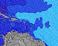 | |||||||||||||
Wave Height (m) Direction Period (s) | ENE 5 | NE 6 | NE 6 | E 10 | E 10 | NE 6 | NE 7 | NE 7 | NE 6 | NE 7 | NE 6 | NE 7 | NE 10 | NE 7 | NE 7 | NE 10 | NE 6 | N 13 | NE 9 | NE 5 | N 11 |
Wave Graph | |||||||||||||||||||||
0 | 24 | 64 | 2 | 2 | 80 | 52 | 55 | 68 | 63 | 43 | 105 | 4 | 69 | 112 | 4 | 23 | 3 | 3 | 17 | 3 | |
Wind (km/h) | |||||||||||||||||||||
Wind State on-shore cross-onshore cross-shore cross-offshore off-shore glassy | cross-off | cross-on | cross-off | cross-off | cross | cross-off | cross-off | cross | cross-off | cross-off | cross-on | cross-off | cross-off | cross-on | cross | cross-off | cross-on | cross | cross-off | cross-on | cross-off |
High Tide | 00:43AM0.46m | 1:39PM0.41m | 1:17AM0.43m | 2:35PM0.45m | 1:56AM0.39m | 3:34PM0.48m | 2:40AM0.35m | 4:34PM0.52m | 3:33AM0.31m | 5:34PM0.56m | 4:33AM0.29m | 6:33PM0.60m | 5:37AM0.28m | 7:31PM0.62m | |||||||
Low Tide | 7:19AM0.14m | 7:23PM0.21m | 7:51AM0.11m | 8:35PM0.23m | 8:28AM0.08m | 9:55PM0.23m | 9:12AM0.05m | 11:15PM0.22m | 10:02AM0.02m | 00:27AM0.20m | 10:57AM-0.01m | 1:29AM0.19m | 11:57AM-0.03m | ||||||||
— | 5:56 | — | — | 5:58 | — | — | 5:58 | — | — | 5:58 | — | — | 5:58 | — | — | 5:58 | — | — | 5:58 | — | |
7:08 | — | 7:08 | — | — | 7:08 | — | — | 7:08 | — | — | 7:08 | — | — | 7:08 | — | — | 7:08 | — | — | 7:08 | |
mm | — | — | 3 | — | — | 6 | 1 | — | 7 | 1 | — | 1 | — | — | — | — | — | — | — | — | — |
Temp °C | 29 | 29 | 30 | 28 | 29 | 29 | 28 | 28 | 30 | 29 | 28 | 31 | 29 | 27 | 29 | 28 | 28 | 28 | 28 | 27 | 29 |
Feels °C | 30 | 32 | 33 | 30 | 32 | 32 | 28 | 31 | 33 | 30 | 30 | 32 | 29 | 29 | 32 | 31 | 31 | 32 | 29 | 29 | 31 |
Swell 1 Height (m) Direction Period (s) | S 5 | — | S 5 | S 5 | S 5 | S 5 | NE 7 | S 6 | S 5 | S 5 | NE 6 | S 6 | S 5 | S 6 | S 10 | S 6 | NE 6 | S 6 | S 6 | S 6 | S 6 |
2 | — | 2 | 2 | 2 | 2 | 52 | 2 | 2 | 2 | 43 | 5 | 5 | 2 | 8 | 3 | 23 | 3 | 2 | 3 | 1 | |
Swell 2 Height (m) Direction Period (s) | S 5 | N 8 | S 10 | E 10 | E 10 | S 9 | S 5 | — | NE 13 | S 9 | S 6 | S 10 | NE 10 | S 10 | S 5 | S 10 | S 6 | S 10 | NE 9 | NE 9 | N 11 |
4 | 1 | 2 | 2 | 2 | 2 | 2 | — | 6 | 2 | 2 | 2 | 4 | 8 | 2 | 8 | 3 | 8 | 3 | 3 | 2 | |
Swell 3 Height (m) Direction Period (s) | SE 6 | S 10 | — | S 10 | S 10 | NE 7 | S 9 | — | S 9 | NE 12 | S 10 | NE 11 | S 10 | — | NE 8 | NE 10 | S 10 | N 13 | S 10 | N 12 | NE 9 |
1 | 2 | — | 2 | 2 | 2 | 2 | — | 2 | 6 | 2 | 5 | 2 | — | 3 | 4 | 8 | 3 | 2 | 3 | 3 | |
Wind waves Height (m) Direction Period (s) | ENE 5 | NE 6 | NE 6 | NE 6 | NE 6 | NE 6 | — | NE 7 | NE 6 | NE 7 | — | NE 7 | NE 6 | NE 7 | NE 7 | NE 6 | — | NE 5 | ENE 4 | NE 5 | NE 5 |
28 | 24 | 64 | 47 | 37 | 80 | — | 55 | 68 | 63 | — | 105 | 37 | 69 | 112 | 51 | — | 74 | 22 | 17 | 55 | |
Nearest Offshore or Glassy | |||||||||||||||||||||
Distance (km) | 224 | 863 | 643 | 283 | 864 | 0 | 283 | 143 | 864 | 143 | 864 | 3 | 283 | 864 | 864 | 283 | 864 | 864 | 248 | 863 | 864 |
Best forecast wave conditions in Puerto Rico | |||||||||||||||||||||
Best forecast wave conditions in Puerto Rico | |||||||||||||||||||||
Header Global | |||||||||||||||||||||
- Map Icons:
 Break
Break Live Wave Height (m)
 Live Wind Speed (km/h)
 Surf Rating (10 Max)
 Ocean Swells (m)
- Wind Speed (km/h)


FREE! Surf-Forecast.com widget for your website
The surf report / weather widget below is available to embed on third party websites free of charge and provides a summary of our Punta Higuero surf forecast. Simply grab the html code snippet that we provide and paste it into your own site. You can choose your preferred language and metric/imperial units for the surf forecast feed to suit users of your site. Click here to get the code.
Information about the Punta Higuero Surf forecast
The above surf forecast table for Punta Higuero provides essential information for determining whether the surfing conditions will be good over the next 16 days. A general guide to surfing at Punta Higuero can be found by selecting the local surf guide option on the grey menu. Our Punta Higuero surf forecast is unique since it includes wave energy (power) that defines the real feel of the surf rather than just the height or the period. If you surf the same spot (Punta Higuero) regularly then make a mental note of the wave energy from the surf forecast table each time you go. Very soon you may start to choose your surf days based on the wave energy alone combined with our forecast of favourable offshore wind conditions. Our star ratings will help here and of course you will also find the usual wave height and period predictions on our surf forecasts as well as a full break down of the swell components under our advanced users option (to reveal that, click the little Einstein character under the tide times).
Further information to help with frequently asked questions about our surf forecast for Punta Higuero may be found under the help tab on the top menu and also by moving your mouse over the question marks on the surf forecast table itself. Please always bear in mind that the forecast is for near-shore open water and local factors at each surf break influence the actual breaking wave height, such as the beach / reef profile, water depths offshore and shelter.
Punta Higuero is 15 km (9 miles) from the city of Aguadilla. If you plan a holiday in Puerto Rico, look for hotels and other accommodation in Aguadilla. Aguadilla has rooms for a wide range of budgets as well as car hire and transport links.
 Nearest