

Surf Forecasts:

Domes (Rincon) surf forecast from 3 Aug 2026:
- Best quality surf: Thursday 6 Aug, 11PM (local time) - 2.5ft (0.8m), 6s period, NE swell with cross-offshore winds.
- Most powerful swell: Friday 7 Aug, 2PM (local time) - 3.5ft (1.0m), 8s period, NE swell with 136 kJ wave energy.
- Next surfable swell (1★+): Thursday 6 Aug, 11PM (local time) - 2.5ft (0.8m), 6s period with NE swell.
Best Forecast Surf Conditions for Domes (Rincon) this week:
The surf forecast for Domes (Rincon) over the next 16 days: The first swell (rated 1 star or higher) is forecast to arrive on Thursday (Aug 06) at 11PM. The primary swell is predicted to be 0.8m and 6s period. The wind is predicted to be cross-offshore as the swell arrives.
The most powerful waves expected at Domes (Rincon) in the next 16 days are 1.0m 8s and forecast to arrive on Friday (Aug 07) at 2PM. Winds are predicted to be cross-offshore at the time the swell arrives. The largest open ocean swell (not directed at the beach) is 1.5m 5s period and expected on Sunday (Aug 09) at 5PM.
| Wave Type | Time (AST) & Date | Wave Height & Period |
|---|---|---|
| Next good surf (1 star+) | 11PM (Thu 6th Aug) | 2.5ft (0.8m) 6s |
| Best Surf | 11PM (Thu 6th Aug) | 2.5ft (0.8m) 6s |
| Most Powerful | 2PM (Fri 7th Aug) | 3.5ft (1.0m) 8s |
Table - best surf conditions forecast for Domes (Rincon) over the next 16 days.
The Lowdown
Alright folks, Rusty here. Let’s be straight with you – this 16-day window for the region is a bit of a quiet one. We’re looking at a long stretch of small, weak energy and pretty ordinary conditions. The first real chance to even wet a line comes up on Friday the 7th of August, and even then, it’s nothing to write home about for the most part.
The overall pattern is dominated by tiny NE windswell. The water temperature is sitting at a warm 84°, which is about normal for this time of year, so at least you won’t need a winter suit.
We start with a big gap. From now until the morning of Thursday the 6th of August, there’s nothing worth paddling out for. The energy is just too low, with combined swell energy barely cracking double digits (18), and waves are tiny – 2 ft or less. Glassy conditions on a few mornings are beautiful to look at, but there’s no push.
The first faint glimmer of hope comes on Friday morning, August 7th. Domes (Rincon) will see a bump in energy to 3 ft from the NE, with a period of 9 seconds. The combined energy hits 109 (moderate), which is the first real sign of life. The wind is light and cross-offshore, keeping things clean. It’s surfable, but it’s very ordinary. If you’re desperate, you’ll get a few grovelly ones.
The rest of the first week stays flat and weak, with a few glassy mornings but nothing with any punch. The afternoon of Thursday the 13th of August sees a little bump in size to 5 ft from the NE, with energy at 144 (moderate). But the period is only 6 seconds, so it’s a bit of a messy, short-period windswell. Still, it’s the biggest wave height of the whole outlook.
The real standout, if you can call it that, is the Saturday morning of August 15th. Domes will have 2 ft of NE swell with a 7-second period, and while the energy is only 46 (weak), the wind is a light cross-onshore. It’s not clean, but it’s the most consistent option in a very quiet run. The bigger swell on the 13th is a one-off spike, but the 15th offers a slightly better chance of a few little runners.
For the second week, things stay small. The morning of Tuesday the 18th of August brings a little 2 ft NE swell with a gentle offshore wind from the SE. That’s clean and could be fun for a beginner on a longboard, but it’s tiny. Overall, this is a flat spell, and the best advice is to keep an eye on the forecasts – it tends not to stay this poor for long.
Rusty.
Short Range ForecastModerate rain (total 10mm), heaviest on Wed afternoon. Warm (max 29°C on Mon afternoon, min 26°C on Mon night). Wind will be generally light. | Days 4-6 Weather SummaryLight rain (total 4mm), mostly falling on Thu afternoon. Warm (max 29°C on Thu afternoon, min 26°C on Thu morning). Wind will be generally light. | ||||||||||||||||||||
Monday 3 | Tuesday 4 | Wednesday 5 | Thursday 6 | Friday 7 | Saturday 8 | Sunday 9 | |||||||||||||||
AM | PM | Night | AM | PM | Night | AM | PM | Night | AM | PM | Night | AM | PM | Night | AM | PM | Night | AM | PM | Night | |
Swell Height Map |  |  |  | 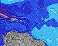 | 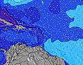 | 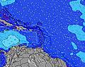 | 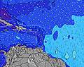 | ||||||||||||||
Wave Height (m) Direction Period (s) | NE 6 | NE 6 | NE 6 | NE 5 | NE 4 | NNE 4 | NE 5 | NE 4 | NE 6 | NE 7 | NE 10 | NE 6 | NE 9 | NNE 9 | NE 7 | NE 9 | NE 5 | NNE 9 | NE 9 | NE 9 | NE 9 |
Wave Graph | |||||||||||||||||||||
18 | 51 | 21 | 10 | 0 | 1 | 9 | 9 | 15 | 21 | 4 | 38 | 93 | 9 | 53 | 20 | 73 | 7 | 12 | 3 | 12 | |
Wind (km/h) | |||||||||||||||||||||
Wind State on-shore cross-onshore cross-shore cross-offshore off-shore glassy | glassy | cross-off | cross-off | cross | cross-off | cross-off | glassy | glassy | cross-off | glassy | cross | cross-off | cross-off | cross | cross-off | glassy | cross | cross-off | cross-on | cross-off | cross-off |
High Tide | 12:17PM0.45m | 00:03AM0.42m | 1:11PM0.47m | 00:39AM0.38m | 2:09PM0.49m | 1:20AM0.34m | 3:11PM0.51m | 2:09AM0.31m | 4:16PM0.53m | 3:10AM0.29m | 5:20PM0.56m | 4:20AM0.28m | 6:21PM0.58m | ||||||||
Low Tide | 6:15PM0.19m | 6:26AM0.10m | 7:18PM0.21m | 7:03AM0.07m | 8:31PM0.22m | 7:47AM0.05m | 9:51PM0.22m | 8:39AM0.03m | 11:10PM0.22m | 9:39AM0.01m | 00:17AM0.20m | 10:44AM-0.00m | 1:12AM0.19m | ||||||||
6:07 | — | — | 6:07 | — | — | 6:07 | — | — | 6:07 | — | — | 6:07 | — | — | 6:07 | — | — | 6:09 | — | — | |
— | 7:01 | — | — | 7:01 | — | — | 7:00 | — | — | 7:00 | — | — | 7:00 | — | — | 7:00 | — | — | 6:59 | — | |
mm | — | — | — | — | 4 | 1 | — | 5 | — | — | 1 | — | — | — | 1 | 1 | — | 1 | — | 1 | — |
Temp °C | 28 | 29 | 28 | 28 | 29 | 27 | 28 | 28 | 28 | 28 | 29 | 28 | 28 | 28 | 27 | 28 | 29 | 28 | 28 | 29 | 28 |
Feels °C | 32 | 31 | 30 | 32 | 33 | 28 | 33 | 32 | 31 | 32 | 31 | 31 | 32 | 32 | 29 | 32 | 31 | 31 | 31 | 32 | 29 |
Swell 1 Height (m) Direction Period (s) | NE 6 | S 5 | NE 6 | S 5 | S 5 | S 5 | S 5 | S 5 | NE 6 | NE 7 | S 6 | NE 6 | S 8 | NNE 9 | NE 9 | NE 6 | S 5 | NNE 9 | NE 9 | — | NE 9 |
18 | 2 | 21 | 2 | 2 | 2 | 2 | 2 | 15 | 21 | 2 | 38 | 5 | 9 | 12 | 18 | 1 | 7 | 12 | — | 12 | |
Swell 2 Height (m) Direction Period (s) | S 6 | NNE 4 | S 5 | S 9 | S 9 | NNE 4 | N 9 | N 9 | S 5 | S 5 | NE 10 | NNE 9 | NNE 9 | S 8 | S 5 | NE 9 | S 8 | S 5 | — | S 9 | S 5 |
2 | 3 | 2 | 2 | 2 | 1 | 2 | 2 | 2 | 2 | 4 | 8 | 16 | 5 | 2 | 20 | 1 | 2 | — | 2 | 2 | |
Swell 3 Height (m) Direction Period (s) | — | — | — | S 8 | — | SE 6 | SSE 6 | N 11 | NE 8 | NE 10 | NE 8 | S 5 | — | NNE 9 | S 8 | S 5 | NNE 6 | S 8 | N 12 | NE 9 | S 9 |
— | — | — | 1 | — | 2 | 3 | 3 | 3 | 4 | 3 | 2 | — | 8 | 1 | 2 | 3 | 1 | 3 | 3 | 2 | |
Wind waves Height (m) Direction Period (s) | — | NE 6 | — | NE 5 | NE 4 | ENE 5 | NE 5 | NE 4 | — | — | NE 6 | — | NE 9 | NE 4 | NE 7 | — | NE 5 | NE 6 | NE 6 | NE 5 | NE 6 |
— | 51 | — | 10 | 26 | 15 | 9 | 9 | — | — | 52 | — | 93 | 45 | 53 | — | 73 | 35 | 29 | 129 | 32 | |
Nearest Offshore or Glassy | |||||||||||||||||||||
Distance (km) | 20 | 2 | 44 | 754 | 475 | 126 | 304 | 20 | 27 | 20 | 274 | 58 | 0 | 863 | 58 | 20 | 475 | 58 | 645 | 645 | 216 |
Best forecast wave conditions in Puerto Rico | |||||||||||||||||||||
Best forecast wave conditions in Puerto Rico | |||||||||||||||||||||
Header Global | |||||||||||||||||||||
- Map Icons:
 Break
Break Live Wave Height (m)
 Live Wind Speed (km/h)
 Surf Rating (10 Max)
 Ocean Swells (m)
- Wind Speed (km/h)
Latest Updates


FREE! Surf-Forecast.com widget for your website
The surf report / weather widget below is available to embed on third party websites free of charge and provides a summary of our Domes (Rincon) surf forecast. Simply grab the html code snippet that we provide and paste it into your own site. You can choose your preferred language and metric/imperial units for the surf forecast feed to suit users of your site. Click here to get the code.
Information about the Domes (Rincon) Surf forecast
The above surf forecast table for Domes (Rincon) provides essential information for determining whether the surfing conditions will be good over the next 16 days. A general guide to surfing at Domes (Rincon) can be found by selecting the local surf guide option on the grey menu. Our Domes (Rincon) surf forecast is unique since it includes wave energy (power) that defines the real feel of the surf rather than just the height or the period. If you surf the same spot (Domes (Rincon)) regularly then make a mental note of the wave energy from the surf forecast table each time you go. Very soon you may start to choose your surf days based on the wave energy alone combined with our forecast of favourable offshore wind conditions. Our star ratings will help here and of course you will also find the usual wave height and period predictions on our surf forecasts as well as a full break down of the swell components under our advanced users option (to reveal that, click the little Einstein character under the tide times).
Further information to help with frequently asked questions about our surf forecast for Domes (Rincon) may be found under the help tab on the top menu and also by moving your mouse over the question marks on the surf forecast table itself. Please always bear in mind that the forecast is for near-shore open water and local factors at each surf break influence the actual breaking wave height, such as the beach / reef profile, water depths offshore and shelter.
Domes is 18 km (11 miles) from the city of Aguadilla. If you plan a holiday in Puerto Rico, look for hotels and other accommodation in Aguadilla. Aguadilla has rooms for a wide range of budgets as well as car hire and transport links.
 Nearest