

Surf Forecasts:

Duppys surf forecast from 3 Aug 2026:
- Best quality surf: Sunday 9 Aug, 2AM (local time) - 2.5ft (0.8m), 6s period, NNE swell with offshore winds.
- Most powerful swell: Friday 7 Aug, 5PM (local time) - 4ft (1.2m), 7s period, ENE swell with 138 kJ wave energy.
- Next surfable swell (1★+): Sunday 9 Aug, 2AM (local time) - 2.5ft (0.8m), 6s period with NNE swell.
Best Forecast Surf Conditions for Duppys this week:
The surf forecast for Duppys over the next 16 days: The first swell (rated 1 star or higher) is forecast to arrive on Sunday (Aug 09) at 2AM. The primary swell is predicted to be 0.8m and 6s period with a secondary swell of 0.4m and 9s. The wind is predicted to be offshore as the swell arrives.
The most powerful waves expected at Duppys in the next 16 days are 1.2m 7s and forecast to arrive on Friday (Aug 07) at 5PM. Winds are predicted to be cross-offshore at the time the swell arrives. The largest open ocean swell (not directed at the beach) is 1.8m 7s period and expected on Saturday (Aug 08) at 8AM.
| Wave Type | Time (AST) & Date | Wave Height & Period |
|---|---|---|
| Next good surf (1 star+) | 2AM (Sun 9th Aug) | 2.5ft (0.8m) 6s |
| Best Surf | 2AM (Sun 9th Aug) | 2.5ft (0.8m) 6s |
| Most Powerful | 5PM (Fri 7th Aug) | 4ft (1.2m) 7s |
Table - best surf conditions forecast for Duppys over the next 16 days.
The Lowdown
Alright folks, Rusty here. Let’s have a look at what’s on offer for Duppys over the next couple of weeks.
First up, the water temperature is sitting at 84°F, which is about average for this time of year, so no surprises there.
Right off the bat, there’s a gap. We’re looking at Monday, the 3rd of August, and there’s just nothing doing. We’re talking about a run of tiny, weak surf with almost no energy (energy values of just 2) for the first few days. The wind is mostly cross-off or cross, but with swell barely registering at 0.3ft out of the north, it’s a flat spell. That carries on through Tuesday, Wednesday, and into Thursday the 6th. Honestly, it’s a tough start.
The first time we see anything that might get you out of bed is Sunday morning, the 9th of August. There’s a little bump of 3ft from the northeast, with a short period of 6 seconds, and the wind is offshore from the east at 12 mph. The energy is still weak (59), and the notes say "surfable waves but very ordinary conditions." It’s not a standout, but it’s the first real chance to get wet. The afternoon sees a similar height but the wind goes cross-off, and the energy edges up to 99, but it’s still not firing.
The best of the lot, and the only real standout in this whole window, is Saturday afternoon, the 15th of August. Now, this is a long way out, so take it with a pinch of salt, but the models are showing a solid 8ft swell from the east-northeast with a period of 8 seconds. That’s a big jump in energy (834), and it’s a moderate wave energy. However, that size is only for experts – 8ft is pushing it for most. The wind is a cross-off from the east at 19 mph, so it’ll be a bit lumpy, but the power is there. Because Duppys is a reef break, the longer period (8 secs is decent) should give it some shape, but that east-northeast direction is a bit off from the optimum north swell direction, so it might not be perfect. Still, it’s the biggest, most energetic day by a long shot.
Before that, there’s a brief moment on Tuesday afternoon, the 11th of August, with 3ft from the east-northeast and a 10-second period, giving energy of 156. That’s a moderate energy, but the wind is cross-off, and the overall surf quality is rated as poor. It’s a maybe, but not a top pick.
After the 15th, it drops right back down to tiny waves and weak energy for the rest of the window. Monday the 17th has a small offshore wind, but the swell is a measly 0.7ft.
So, here’s the summary: The first week is virtually flat. The one day that looks worth circling on the calendar is Saturday, August 15th, with that 8ft east-northeast swell. It’s an expert-only day, and the wind is a bit messy, but it’s the only real power in the whole 16 days. Everything else is a long stretch of small, weak, or poor quality surf.
Until next time, keep your eyes on the horizon.
Rusty.
Short Range ForecastMostly dry. Warm (max 28°C on Mon morning, min 26°C on Mon night). Mainly fresh winds. | Days 4-6 Weather SummaryMostly dry. Warm (max 28°C on Fri morning, min 26°C on Thu morning). Mainly fresh winds. | ||||||||||||||||||||
Monday 3 | Tuesday 4 | Wednesday 5 | Thursday 6 | Friday 7 | Saturday 8 | Sunday 9 | |||||||||||||||
AM | PM | Night | AM | PM | Night | AM | PM | Night | AM | PM | Night | AM | PM | Night | AM | PM | Night | AM | PM | Night | |
Swell Height Map |  |  |  | 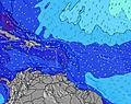 | 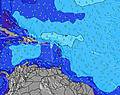 | 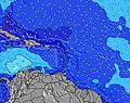 | 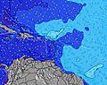 | ||||||||||||||
Wave Height (m) Direction Period (s) | N 11 | N 11 | N 10 | N 10 | N 10 | NE 6 | NE 7 | E 6 | N 8 | NE 11 | NE 7 | NE 7 | NE 8 | ENE 7 | NNE 10 | NNE 9 | NE 9 | NNE 6 | NE 6 | NE 6 | NE 9 |
Wave Graph | |||||||||||||||||||||
2 | 2 | 2 | 2 | 2 | 14 | 23 | 0 | 1 | 5 | 25 | 14 | 14 | 138 | 18 | 17 | 20 | 42 | 40 | 66 | 19 | |
Wind (km/h) | |||||||||||||||||||||
Wind State on-shore cross-onshore cross-shore cross-offshore off-shore glassy | cross-off | cross-off | cross-off | off | cross-off | off | off | cross-off | off | off | cross-off | cross-off | cross-off | cross-off | cross-off | cross-off | cross-off | off | off | cross-off | off |
High Tide | 6:40PM0.71m | 7:01AM0.62m | 7:17PM0.71m | 8:02AM0.56m | 8:02PM0.70m | 9:24AM0.51m | 9:00PM0.70m | 11:13AM0.49m | 10:13PM0.70m | 12:49PM0.52m | 11:32PM0.72m | 1:52PM0.56m | 00:45AM0.76m | ||||||||
Low Tide | 12:23PM0.24m | 1:03AM0.25m | 12:55PM0.29m | 2:02AM0.24m | 1:34PM0.33m | 3:13AM0.22m | 2:26PM0.37m | 4:36AM0.18m | 3:44PM0.40m | 5:56AM0.13m | 5:16PM0.41m | 7:03AM0.08m | 6:36PM0.39m | ||||||||
5:43 | — | — | 5:43 | — | — | 5:43 | — | — | 5:43 | — | — | 5:43 | — | — | 5:43 | — | — | 5:45 | — | — | |
— | 6:24 | — | — | 6:24 | — | — | 6:23 | — | — | 6:23 | — | — | 6:22 | — | — | 6:22 | — | — | 6:22 | — | |
mm | — | — | — | — | — | — | — | — | — | — | — | — | — | — | — | — | — | — | — | — | — |
Temp °C | 28 | 28 | 27 | 27 | 27 | 26 | 27 | 27 | 27 | 27 | 27 | 27 | 28 | 28 | 27 | 27 | 28 | 28 | 28 | 28 | 27 |
Feels °C | 27 | 28 | 27 | 27 | 27 | 26 | 27 | 27 | 26 | 25 | 26 | 25 | 26 | 27 | 26 | 25 | 27 | 29 | 28 | 28 | 28 |
Swell 1 Height (m) Direction Period (s) | N 11 | N 11 | E 11 | SE 8 | SE 7 | NE 6 | NE 7 | ENE 10 | ENE 9 | SE 9 | NE 7 | NNE 10 | NE 8 | ESE 7 | NNE 10 | NNE 9 | NE 9 | NE 9 | ESE 7 | ESE 7 | NE 9 |
2 | 2 | 2 | 2 | 2 | 14 | 23 | 18 | 17 | 22 | 25 | 10 | 14 | 61 | 18 | 17 | 20 | 20 | 79 | 64 | 19 | |
Swell 2 Height (m) Direction Period (s) | — | — | N 10 | N 10 | E 12 | E 11 | ENE 10 | ESE 7 | ESE 9 | NE 11 | NNE 11 | NE 7 | NNE 10 | NNE 10 | ESE 9 | E 12 | — | NNE 6 | NE 6 | NNE 8 | NE 12 |
— | — | 2 | 2 | 3 | 2 | 10 | 5 | 8 | 5 | 11 | 14 | 10 | 10 | 7 | 3 | — | 42 | 40 | 28 | 5 | |
Swell 3 Height (m) Direction Period (s) | — | — | — | — | N 10 | E 10 | ESE 7 | SE 10 | N 8 | NE 11 | — | NNE 10 | NNE 10 | NNE 10 | E 12 | — | — | NE 9 | NE 9 | NE 12 | E 11 |
— | — | — | — | 2 | 2 | 5 | 4 | 1 | 5 | — | 10 | 10 | 10 | 3 | — | — | 19 | 19 | 5 | 2 | |
Wind waves Height (m) Direction Period (s) | E 7 | E 7 | E 7 | E 7 | E 6 | E 6 | ESE 5 | E 6 | E 6 | E 6 | E 6 | E 7 | E 7 | ENE 7 | ENE 7 | E 7 | E 7 | E 7 | E 7 | NE 6 | E 7 |
243 | 187 | 134 | 104 | 79 | 79 | 29 | 71 | 89 | 167 | 170 | 199 | 193 | 138 | 239 | 302 | 282 | 218 | 38 | 66 | 110 | |
Nearest Offshore or Glassy | |||||||||||||||||||||
Distance (km) | 771 | 32 | 32 | 240 | 272 | 333 | 614 | 614 | 771 | 614 | 781 | 771 | 614 | 269 | 269 | 781 | 272 | 0 | 0 | 333 | 402 |
Best forecast wave conditions in Barbados | |||||||||||||||||||||
Best forecast wave conditions in Barbados | |||||||||||||||||||||
Header Global | |||||||||||||||||||||
- Map Icons:
 Break
Break Live Wave Height (m)
 Live Wind Speed (km/h)
 Surf Rating (10 Max)
 Ocean Swells (m)
- Wind Speed (km/h)
Latest Updates


FREE! Surf-Forecast.com widget for your website
The surf report / weather widget below is available to embed on third party websites free of charge and provides a summary of our Duppys surf forecast. Simply grab the html code snippet that we provide and paste it into your own site. You can choose your preferred language and metric/imperial units for the surf forecast feed to suit users of your site. Click here to get the code.
Information about the Duppys Surf forecast
The above surf forecast table for Duppys provides essential information for determining whether the surfing conditions will be good over the next 16 days. A general guide to surfing at Duppys can be found by selecting the local surf guide option on the grey menu. Our Duppys surf forecast is unique since it includes wave energy (power) that defines the real feel of the surf rather than just the height or the period. If you surf the same spot (Duppys) regularly then make a mental note of the wave energy from the surf forecast table each time you go. Very soon you may start to choose your surf days based on the wave energy alone combined with our forecast of favourable offshore wind conditions. Our star ratings will help here and of course you will also find the usual wave height and period predictions on our surf forecasts as well as a full break down of the swell components under our advanced users option (to reveal that, click the little Einstein character under the tide times).
Further information to help with frequently asked questions about our surf forecast for Duppys may be found under the help tab on the top menu and also by moving your mouse over the question marks on the surf forecast table itself. Please always bear in mind that the forecast is for near-shore open water and local factors at each surf break influence the actual breaking wave height, such as the beach / reef profile, water depths offshore and shelter.
Are you planning a holiday in Barbados? If you are looking for accommodation near Duppys, camping, hotels and holiday cottages in Barbados, consider staying in Bridgetown which is 24 km (15 miles) away.
 Nearest