

Surf Forecasts:

Chatarras surf forecast from 7 Jul 2026:
- Most powerful swell: Wednesday 8 Jul, 8AM (local time) - 6ft (1.8m), 7s period, E swell with 295 kJ wave energy.
Best Forecast Surf Conditions for Chatarras this week:
The most powerful waves expected at Chatarras in the next 16 days are 1.8m 7s and forecast to arrive on Wednesday (Jul 08) at 8AM. Winds are predicted to be cross-offshore at the time the swell arrives.
| Wave Type | Time (AST) & Date | Wave Height & Period |
|---|---|---|
| Next good surf (1 star+) | - | - |
| Best Surf | - | - |
| Most Powerful | 8AM (Wed 8th Jul) | 6ft (1.8m) 7s |
Table - best surf conditions forecast for Chatarras over the next 16 days.
Alright folks, Rusty here. Let's have a proper look at what's on the table for Chatarras.
The next 16 days are looking like a bit of a mixed bag, but to be honest, there's not a whole lot to get excited about. We've got a moderate wave energy (267) peaking on the 9th of July, but the wind is the main problem throughout the entire period. That persistent easterly breeze is going to keep things messy. The water temp is sitting at about 84°F with a 1°F anomaly, so pretty typical for this time of year, nothing wild there.
The first real sniff of action comes on the 8th of July, Wednesday morning, where the wind turns just enough to go cross-offshore, cleaning things up a bit. It's still only 5ft of swell from the ENE with a short 7-second period, but that clean face is the best we'll see for a while. The energy is moderate at 261. The rest of that week and into the next is a write-off, with that cross-shore wind churning up a lumpy cross-chop.
There's a bit of a gap there with nothing decent, but keep an eye on the 17th of July, Friday morning. Another brief moment of cleaner conditions with a cross-offshore wind and 4ft of swell from the East, this time with a slightly longer 8-second period, pushing the energy up to 240. It's not pumping, but it's the cleanest option in a pretty ragged forecast. After that, it's back to the same old cross-shore chop for the rest of the run.
Everything here is labelled "poor surf conditions" for a reason. The swell is small, the period is short, and the wind just won't cooperate for any length of time. If you're desperate for a paddle, the 8th and 17th of July mornings are the only windows where it might be worth a look. Otherwise, this is a stretch where the kites might have more fun than the surfers.
Rusty.
Short Range ForecastLight rain (total 5mm), mostly falling on Tue night. Warm (max 29°C on Tue afternoon, min 26°C on Thu night). Mainly fresh winds. | Days 5-7 Weather SummaryMostly dry. Warm (max 29°C on Sun afternoon, min 26°C on Fri night). Mainly fresh winds. | ||||||||||||||||||||
Tue 7 | Wednesday 8 | Thursday 9 | Friday 10 | Saturday 11 | Sunday 12 | Monday 13 | |||||||||||||||
PM | Night | AM | PM | Night | AM | PM | Night | AM | PM | Night | AM | PM | Night | AM | PM | Night | AM | PM | Night | AM | |
Swell Height Map |  |  |  |  |  |  |  | 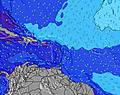 | |||||||||||||
Wave Height (m) Direction Period (s) | E 6 | E 7 | ENE 7 | E 7 | ENE 7 | E 7 | E 7 | ENE 6 | ENE 7 | ENE 7 | ENE 7 | E 6 | E 7 | E 8 | ENE 6 | E 6 | ENE 5 | E 6 | ENE 6 | E 6 | E 6 |
Wave Graph | |||||||||||||||||||||
194 | 250 | 254 | 247 | 198 | 255 | 198 | 147 | 175 | 197 | 139 | 123 | 124 | 51 | 72 | 71 | 50 | 62 | 52 | 129 | 98 | |
Wind (km/h) | |||||||||||||||||||||
Wind State on-shore cross-onshore cross-shore cross-offshore off-shore glassy | cross | cross-off | cross-off | cross | cross-off | cross | cross | cross | cross | cross | cross | cross | cross | cross | cross | cross | cross-off | cross | cross | cross-off | cross |
High Tide | 3:25PM0.35m | 2:24AM0.29m | 4:38PM0.39m | 3:00AM0.27m | 5:48PM0.43m | 3:44AM0.25m | 6:50PM0.47m | 4:39AM0.23m | 7:46PM0.50m | 5:46AM0.23m | 8:37PM0.52m | 6:57AM0.23m | 9:23PM0.52m | 8:05AM0.25m | |||||||
Low Tide | 9:19PM0.17m | 9:12AM-0.01m | 10:47PM0.20m | 10:01AM-0.04m | 00:19AM0.21m | 10:53AM-0.07m | 1:39AM0.21m | 11:49AM-0.09m | 2:38AM0.20m | 12:45PM-0.11m | 3:23AM0.18m | 1:42PM-0.11m | 4:01AM0.16m | ||||||||
— | — | 5:52 | — | — | 5:52 | — | — | 5:52 | — | — | 5:54 | — | — | 5:54 | — | — | 5:54 | — | — | 5:54 | |
7:04 | — | — | 7:04 | — | — | 7:04 | — | — | 7:04 | — | — | 7:04 | — | — | 7:04 | — | — | 7:04 | — | 7:02 | |
mm | — | 2 | 2 | 1 | — | — | — | — | — | — | — | — | — | — | — | — | — | — | — | 3 | 2 |
Temp °C | 29 | 27 | 28 | 28 | 27 | 29 | 29 | 27 | 28 | 28 | 26 | 28 | 28 | 27 | 28 | 29 | 27 | 28 | 28 | 27 | 28 |
Feels °C | 28 | 27 | 28 | 27 | 27 | 28 | 28 | 28 | 27 | 27 | 26 | 27 | 27 | 27 | 27 | 28 | 27 | 27 | 26 | 27 | 28 |
Swell 1 Height (m) Direction Period (s) | — | ENE 7 | NE 13 | NE 12 | NE 12 | ENE 11 | NE 11 | NE 10 | NE 10 | NE 10 | NE 10 | ENE 10 | ENE 9 | E 8 | E 8 | N 9 | E 8 | E 8 | E 8 | E 6 | NNE 11 |
— | 187 | 7 | 6 | 6 | 12 | 29 | 16 | 17 | 16 | 15 | 9 | 9 | 40 | 12 | 23 | 21 | 12 | 12 | 85 | 11 | |
Swell 2 Height (m) Direction Period (s) | — | — | — | — | — | — | — | — | — | — | — | N 14 | N 13 | ENE 9 | N 9 | NE 9 | N 8 | N 8 | N 8 | NNE 11 | N 7 |
— | — | — | — | — | — | — | — | — | — | — | 4 | 3 | 8 | 15 | 3 | 12 | 12 | 5 | 11 | 1 | |
Swell 3 Height (m) Direction Period (s) | — | — | — | — | — | — | — | — | — | — | — | — | N 11 | N 10 | NE 9 | NE 9 | NNE 11 | NNE 11 | NNE 11 | N 7 | N 9 |
— | — | — | — | — | — | — | — | — | — | — | — | 3 | 8 | 3 | 3 | 12 | 12 | 12 | 4 | 1 | |
Wind waves Height (m) Direction Period (s) | E 6 | E 7 | ENE 7 | E 7 | ENE 7 | E 7 | E 7 | ENE 6 | ENE 7 | ENE 7 | ENE 7 | E 6 | E 7 | ENE 5 | ENE 6 | E 6 | ENE 5 | E 6 | ENE 6 | E 6 | E 6 |
194 | 250 | 254 | 247 | 198 | 255 | 198 | 147 | 175 | 197 | 139 | 123 | 124 | 51 | 72 | 71 | 50 | 62 | 52 | 129 | 98 | |
Nearest Offshore or Glassy | |||||||||||||||||||||
Distance (km) | 842 | 127 | 54 | 879 | 419 | 872 | 875 | 361 | 879 | 879 | 419 | 879 | 520 | 383 | 419 | 339 | 31 | 873 | 879 | 354 | 54 |
Best forecast wave conditions in Puerto Rico | |||||||||||||||||||||
Best forecast wave conditions in Puerto Rico | |||||||||||||||||||||
Header Global | |||||||||||||||||||||
- Map Icons:
 Break
Break Live Wave Height (m)
 Live Wind Speed (km/h)
 Surf Rating (10 Max)
 Ocean Swells (m)
- Wind Speed (km/h)


FREE! Surf-Forecast.com widget for your website
The surf report / weather widget below is available to embed on third party websites free of charge and provides a summary of our Chatarras surf forecast. Simply grab the html code snippet that we provide and paste it into your own site. You can choose your preferred language and metric/imperial units for the surf forecast feed to suit users of your site. Click here to get the code.
Information about the Chatarras Surf forecast
The above surf forecast table for Chatarras provides essential information for determining whether the surfing conditions will be good over the next 16 days. A general guide to surfing at Chatarras can be found by selecting the local surf guide option on the grey menu. Our Chatarras surf forecast is unique since it includes wave energy (power) that defines the real feel of the surf rather than just the height or the period. If you surf the same spot (Chatarras) regularly then make a mental note of the wave energy from the surf forecast table each time you go. Very soon you may start to choose your surf days based on the wave energy alone combined with our forecast of favourable offshore wind conditions. Our star ratings will help here and of course you will also find the usual wave height and period predictions on our surf forecasts as well as a full break down of the swell components under our advanced users option (to reveal that, click the little Einstein character under the tide times).
Further information to help with frequently asked questions about our surf forecast for Chatarras may be found under the help tab on the top menu and also by moving your mouse over the question marks on the surf forecast table itself. Please always bear in mind that the forecast is for near-shore open water and local factors at each surf break influence the actual breaking wave height, such as the beach / reef profile, water depths offshore and shelter.
 Nearest