

Surf Forecasts:

Chirere surf forecast from 2 Aug 2026:
- Best quality surf: Friday 7 Aug, 5AM (local time) - 6.5ft (2.0m), 7s period, ENE swell with cross-offshore winds.
- Most powerful swell: Friday 7 Aug, 5AM (local time) - 6.5ft (2.0m), 7s period, ENE swell with 405 kJ wave energy.
- Next surfable swell (1★+): Sunday 2 Aug, 11PM (local time) - 3.5ft (1.1m), 5s period with NE swell.
Best Forecast Surf Conditions for Chirere this week:
The surf forecast for Chirere over the next 16 days: The first swell (rated 1 star or higher) is forecast to arrive on Sunday (Aug 02) at 11PM. The primary swell is predicted to be 1.1m and 5s period with a secondary swell of 0.2m and 8s. The wind is predicted to be cross-offshore as the swell arrives.
The most powerful waves expected at Chirere in the next 16 days are 2.0m 7s and forecast to arrive on Friday (Aug 07) at 5AM. Winds are predicted to be cross-offshore at the time the swell arrives.
| Wave Type | Time (-04) & Date | Wave Height & Period |
|---|---|---|
| Next good surf (1 star+) | 11PM (Sun 2nd Aug) | 3.5ft (1.1m) 5s |
| Best Surf | 5AM (Fri 7th Aug) | 6.5ft (2.0m) 7s |
| Most Powerful | 5AM (Fri 7th Aug) | 6.5ft (2.0m) 7s |
Table - best surf conditions forecast for Chirere over the next 16 days.
The Lowdown
Alright, this is Rusty. I've been staring at the charts for Chirere for the next 16 days, and it's a tough one to call.
The water is warm, sitting right around 82°F, which is about normal for this time of year. But the surf? Man, it's a struggle. There's a long stretch of nothing good.
From Sunday, August 2nd all the way through Friday, August 14th, it's a real desert. The wind is a constant problem—mostly cross or cross-onshore—keeping the surface all choppy and messy. The swell is tiny, bouncing between 3ft and 5ft, with a short, weak period of 6-7 seconds, so the waves just don't have any push. The wave energy is generally low to moderate (anywhere from 94 to 250 on the scale), but it doesn't matter because the conditions are just poor.
You get a couple of mornings where the wind goes cross-offshore and the ocean looks clean, like Tuesday, August 4th and Wednesday, August 5th. But the swell is still puny (4ft to 4ft, period 6-7 seconds, energy around 98 to 159). It's clean, but there's nothing to ride.
The first real hint of a pulse comes on Saturday, August 16th, but it's still a score of 1. The morning of Monday, August 17th might be the best of the bunch. The swell bumps up to 6ft from the ENE, with a period of 8 seconds, and the energy hits a solid 306, which is a moderate, decent pulse. The wind is light from the E at 10 km/h, just a light cross-shore, so it might be the cleanest we see. But it's still just "marginal" in the forecast and it's a long way out.
This reef at Chirere really needs a clean NNE swell, and we're just not getting the right combo of size, period, and wind. It's shaping up to be a waiting game.
Rusty.
Short Range ForecastLight rain (total 9mm), mostly falling on Mon night. Warm (max 30°C on Tue afternoon, min 24°C on Tue night). Wind will be generally light. | Days 4-6 Weather SummaryModerate rain (total 10mm), heaviest on Thu night. Warm (max 30°C on Thu afternoon, min 25°C on Wed morning). Wind will be generally light. | ||||||||||||||||||||
Sunday 2 | Monday 3 | Tuesday 4 | Wednesday 5 | Thursday 6 | Friday 7 | Saturday 8 | |||||||||||||||
AM | PM | Night | AM | PM | Night | AM | PM | Night | AM | PM | Night | AM | PM | Night | AM | PM | Night | AM | PM | Night | |
Swell Height Map |  |  | 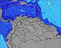 | 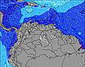 | 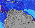 | 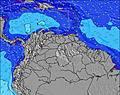 | 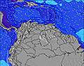 | ||||||||||||||
Wave Height (m) Direction Period (s) | NE 6 | NE 6 | NE 6 | ENE 7 | NE 7 | ENE 7 | ENE 7 | NE 7 | NE 6 | NE 6 | ENE 6 | NE 6 | ENE 7 | ENE 7 | ENE 7 | ENE 7 | ENE 7 | NE 6 | ENE 6 | ENE 6 | NE 7 |
Wave Graph | |||||||||||||||||||||
94 | 91 | 59 | 145 | 139 | 159 | 159 | 77 | 149 | 98 | 99 | 139 | 180 | 209 | 333 | 229 | 175 | 116 | 118 | 103 | 183 | |
Wind (km/h) | |||||||||||||||||||||
Wind State on-shore cross-onshore cross-shore cross-offshore off-shore glassy | cross | cross-on | off | cross | cross | off | cross-off | cross-on | cross-off | cross-off | cross-on | cross-off | cross | cross-on | cross-off | cross | cross-on | cross-off | cross | cross-on | cross-off |
High Tide | 5:38PM0.27m | 1:43AM0.25m | 6:01PM0.30m | 00:57AM0.21m | 5:28AM0.20m | 6:32PM0.34m | 6:53AM0.15m | 7:08PM0.37m | 8:05AM0.11m | 7:48PM0.40m | 9:14AM0.09m | 8:33PM0.42m | 9:20PM0.44m | ||||||||
Low Tide | 9:43AM0.13m | 9:36PM0.22m | 9:48AM0.13m | 11:09PM0.20m | 10:02AM0.12m | 4:24AM0.14m | 10:20AM0.11m | 4:56AM0.09m | 10:40AM0.09m | 5:31AM0.04m | 6:07AM0.01m | ||||||||||
6:13 | — | — | 6:13 | — | — | 6:13 | — | — | 6:13 | — | — | 6:13 | — | — | 6:13 | — | — | 6:13 | — | — | |
— | 6:47 | — | — | 6:47 | — | — | 6:46 | — | — | 6:46 | — | — | 6:46 | — | — | 6:45 | — | — | 6:45 | — | |
mm | — | — | 1 | — | — | 5 | — | — | 3 | — | — | 1 | 1 | — | 5 | 2 | — | 1 | — | — | 1 |
Temp °C | 29 | 29 | 26 | 29 | 29 | 27 | 29 | 30 | 26 | 29 | 29 | 26 | 29 | 30 | 26 | 27 | 28 | 26 | 28 | 28 | 26 |
Feels °C | 30 | 29 | 30 | 32 | 30 | 29 | 30 | 31 | 29 | 30 | 30 | 29 | 31 | 30 | 30 | 29 | 30 | 29 | 30 | 29 | 30 |
Swell 1 Height (m) Direction Period (s) | NE 6 | — | NE 6 | ENE 7 | NE 7 | ENE 7 | ENE 7 | NE 7 | NE 6 | NE 6 | — | NE 6 | E 10 | E 10 | ENE 7 | — | ENE 7 | NE 6 | NE 10 | NE 6 | NE 7 |
94 | — | 59 | 145 | 139 | 159 | 159 | 77 | 149 | 98 | — | 139 | 2 | 2 | 333 | — | 175 | 116 | 4 | 80 | 183 | |
Swell 2 Height (m) Direction Period (s) | — | — | ENE 8 | — | — | — | — | — | NNE 6 | — | — | — | — | — | — | — | — | — | — | — | — |
— | — | 7 | — | — | — | — | — | 34 | — | — | — | — | — | — | — | — | — | — | — | — | |
Swell 3 Height (m) Direction Period (s) | — | — | — | — | — | — | — | — | — | — | — | — | — | — | — | — | — | — | — | — | — |
— | — | — | — | — | — | — | — | — | — | — | — | — | — | — | — | — | — | — | — | — | |
Wind waves Height (m) Direction Period (s) | — | NE 6 | — | — | — | — | — | — | — | — | ENE 6 | — | ENE 7 | ENE 7 | — | ENE 7 | — | — | ENE 6 | ENE 6 | — |
— | 91 | — | — | — | — | — | — | — | — | 99 | — | 180 | 209 | — | 229 | — | — | 118 | 103 | — | |
Nearest Offshore or Glassy | |||||||||||||||||||||
Distance (km) | 86 | 86 | 0 | 86 | 58 | 0 | 58 | 58 | 0 | 3 | 86 | 0 | 86 | 86 | 0 | 86 | 86 | 0 | 1019 | 86 | 0 |
Best forecast wave conditions in Caracas | |||||||||||||||||||||
Best forecast wave conditions in Venezuela | |||||||||||||||||||||
Header Global | |||||||||||||||||||||
- Map Icons:
 Break
Break Live Wave Height (m)
 Live Wind Speed (km/h)
 Surf Rating (10 Max)
 Ocean Swells (m)
- Wind Speed (km/h)
Latest Updates


FREE! Surf-Forecast.com widget for your website
The surf report / weather widget below is available to embed on third party websites free of charge and provides a summary of our Chirere surf forecast. Simply grab the html code snippet that we provide and paste it into your own site. You can choose your preferred language and metric/imperial units for the surf forecast feed to suit users of your site. Click here to get the code.
Information about the Chirere Surf forecast
The above surf forecast table for Chirere provides essential information for determining whether the surfing conditions will be good over the next 16 days. A general guide to surfing at Chirere can be found by selecting the local surf guide option on the grey menu. Our Chirere surf forecast is unique since it includes wave energy (power) that defines the real feel of the surf rather than just the height or the period. If you surf the same spot (Chirere) regularly then make a mental note of the wave energy from the surf forecast table each time you go. Very soon you may start to choose your surf days based on the wave energy alone combined with our forecast of favourable offshore wind conditions. Our star ratings will help here and of course you will also find the usual wave height and period predictions on our surf forecasts as well as a full break down of the swell components under our advanced users option (to reveal that, click the little Einstein character under the tide times).
Further information to help with frequently asked questions about our surf forecast for Chirere may be found under the help tab on the top menu and also by moving your mouse over the question marks on the surf forecast table itself. Please always bear in mind that the forecast is for near-shore open water and local factors at each surf break influence the actual breaking wave height, such as the beach / reef profile, water depths offshore and shelter.
Chirere is 41 km (25 miles) from the city of Guatire. If you plan a holiday in Caracas, look for hotels and other accommodation in Guatire. Guatire has rooms for a wide range of budgets as well as car hire and transport links.
 Nearest