

Surf Forecasts:

Embassy Beach surf forecast from 13 Jul 2026:
- Best quality surf: Thursday 16 Jul, 2AM (local time) - 4.5ft (1.4m), 7s period, ESE swell with cross-offshore winds.
- Most powerful swell: Friday 17 Jul, 8AM (local time) - 5.5ft (1.7m), 7s period, ESE swell with 256 kJ wave energy.
- Next surfable swell (1★+): Thursday 16 Jul, 2AM (local time) - 4.5ft (1.4m), 7s period with ESE swell.
Best Forecast Surf Conditions for Embassy Beach this week:
The surf forecast for Embassy Beach over the next 16 days: The first swell (rated 1 star or higher) is forecast to arrive on Thursday (Jul 16) at 2AM. The primary swell is predicted to be 1.4m and 7s period with a secondary swell of 1.2m and 7s. The wind is predicted to be cross-offshore as the swell arrives.
The most powerful waves expected at Embassy Beach in the next 16 days are 1.7m 7s and forecast to arrive on Friday (Jul 17) at 8AM. Winds are predicted to be cross-shore at the time the swell arrives. The largest open ocean swell (not directed at the beach) is 0.2m 3s period and expected on Thursday (Jul 16) at 8AM.
| Wave Type | Time (AST) & Date | Wave Height & Period |
|---|---|---|
| Next good surf (1 star+) | 2AM (Thu 16th Jul) | 4.5ft (1.4m) 7s |
| Best Surf | 2AM (Thu 16th Jul) | 4.5ft (1.4m) 7s |
| Most Powerful | 8AM (Fri 17th Jul) | 5.5ft (1.7m) 7s |
Table - best surf conditions forecast for Embassy Beach over the next 16 days.
The Lowdown
Alright, let's get into it.
It's a tough stretch ahead for Embassy Beach. We've got a solid two-week run with nothing really worth paddling out for. The wind is the main culprit here – for days on end it's coming from the side or onshore, mostly out of the ESE or SE, kicking up a chop that just kills any chance of a clean wave. The swell is there, but it's weak and messy, with a short period of 6 to 8 seconds, so the waves are just gonna be lumpy and lacking any real push. The combined energy is mostly in the moderate range, bouncing around (103 to 366), but that energy doesn't mean much when the wind is trashing the surface.
Water temp is sitting at 83°, with an anomaly of 0.9°, so it's pretty average for this time of year. Not a factor here.
The first real chance of anything decent doesn't appear until the 20th of July, Monday morning – but even then, it's marked as "poor surf conditions". The swell height is 5 ft from the ESE, with a period of 7 seconds, and the wind is still a gentle cross-onshore. It's just not going to be any good. This poor quality pattern keeps repeating right through the entire forecast period.
Even the highlight – if you can call it that – is a bit of a downer. The 25th of July (Saturday morning) sees a shift to a cross-shore wind from the E at 12 mph, with a slightly longer period swell of 4 ft and 7 seconds from the ESE. The combined energy jumps to 206, which is the highest we see. But it's still "poor surf conditions" – that cross-shore wind is going to create a cross-chop, and the swell is just too weak and short to do anything with. Given the consistent poor conditions, if you're looking for something to ride, this setup honestly looks more interesting for kite surfing than paddle surfing.
So, the honest truth: there's no standout session here. The first recommendation doesn't even show up until the 13th of July, and it's a zero. It's a blank run of poor quality that stretches for the entire 16-day period. The area is just locked into a bad pattern.
-Rusty
Short Range ForecastMostly dry. Warm (max 30°C on Mon afternoon, min 25°C on Wed night). Wind will be generally light. | Days 5-7 Weather SummaryLight rain (total 3mm), mostly falling on Thu night. Warm (max 30°C on Thu afternoon, min 25°C on Thu night). Wind will be generally light. | ||||||||||||||||||||
Mon 13 | Tuesday 14 | Wednesday 15 | Thursday 16 | Friday 17 | Saturday 18 | Sunday 19 | |||||||||||||||
PM | Night | AM | PM | Night | AM | PM | Night | AM | PM | Night | AM | PM | Night | AM | PM | Night | AM | PM | Night | AM | |
Swell Height Map |  |  |  |  |  |  |  | 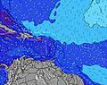 | |||||||||||||
Wave Height (m) Direction Period (s) | ESE 7 | ESE 5 | ESE 6 | ESE 7 | SE 7 | SE 7 | SE 7 | ESE 7 | SE 7 | SE 7 | ESE 7 | SE 7 | SE 7 | ESE 7 | SE 7 | SE 8 | ESE 8 | SE 8 | SE 8 | ESE 8 | ESE 7 |
Wave Graph | |||||||||||||||||||||
77 | 27 | 103 | 116 | 109 | 183 | 171 | 214 | 132 | 167 | 134 | 139 | 139 | 215 | 176 | 191 | 226 | 210 | 186 | 187 | 220 | |
Wind (km/h) | |||||||||||||||||||||
Wind State on-shore cross-onshore cross-shore cross-offshore off-shore glassy | cross-on | cross | cross-on | cross-on | cross-on | cross-on | cross-on | cross-off | cross-on | cross-on | cross-off | cross-on | cross-on | cross | cross-on | on | cross-off | cross-on | on | cross-off | cross-on |
High Tide | 10:41PM0.35m | 11:25PM0.34m | 00:04AM0.31m | 00:36AM0.28m | 12:47PM0.10m | 00:55AM0.24m | 00:50AM0.20m | 6:53PM0.20m | |||||||||||||
Low Tide | 1:06PM-0.02m | 1:43PM0.01m | 2:03PM0.05m | 10:05AM0.09m | 9:53AM0.10m | 9:46AM0.10m | 9:36AM0.09m | ||||||||||||||
— | — | 6:09 | — | — | 6:09 | — | — | 6:09 | — | — | 6:09 | — | — | 6:09 | — | — | 6:09 | — | — | 6:11 | |
7:16 | — | — | 7:16 | — | — | 7:16 | — | — | 7:16 | — | — | 7:16 | — | — | 7:15 | — | — | 7:15 | — | 7:15 | |
mm | — | — | — | — | — | — | — | — | — | — | 2 | 1 | — | — | — | — | — | — | — | — | — |
Temp °C | 30 | 28 | 29 | 30 | 28 | 29 | 30 | 28 | 29 | 30 | 28 | 28 | 30 | 28 | 29 | 30 | 28 | 29 | 29 | 28 | 29 |
Feels °C | 31 | 29 | 29 | 29 | 29 | 30 | 29 | 28 | 29 | 28 | 28 | 27 | 29 | 29 | 30 | 29 | 29 | 29 | 28 | 29 | 30 |
Swell 1 Height (m) Direction Period (s) | — | ESE 7 | — | — | — | — | — | ESE 7 | SE 7 | — | ESE 7 | — | — | SE 7 | SE 7 | — | SE 8 | — | SE 8 | ESE 8 | ESE 7 |
— | 18 | — | — | — | — | — | 142 | 132 | — | 134 | — | — | 128 | 176 | — | 94 | — | 186 | 187 | 146 | |
Swell 2 Height (m) Direction Period (s) | — | — | — | — | — | — | — | — | — | — | — | — | — | — | — | — | — | — | — | — | — |
— | — | — | — | — | — | — | — | — | — | — | — | — | — | — | — | — | — | — | — | — | |
Swell 3 Height (m) Direction Period (s) | — | — | — | — | — | — | — | — | — | — | — | — | — | — | — | — | — | — | — | — | — |
— | — | — | — | — | — | — | — | — | — | — | — | — | — | — | — | — | — | — | — | — | |
Wind waves Height (m) Direction Period (s) | ESE 7 | ESE 5 | ESE 6 | ESE 7 | SE 7 | SE 7 | SE 7 | ESE 7 | — | SE 7 | — | SE 7 | SE 7 | ESE 7 | — | SE 8 | ESE 8 | SE 8 | — | — | ESE 7 |
77 | 27 | 103 | 116 | 109 | 183 | 171 | 214 | — | 167 | — | 139 | 139 | 215 | — | 191 | 226 | 210 | — | — | 220 | |
Nearest Offshore or Glassy | |||||||||||||||||||||
Distance (km) | 907 | 58 | 334 | 862 | 58 | 366 | 862 | 0 | 766 | 907 | 0 | 366 | 862 | 58 | 766 | 698 | 0 | 766 | 907 | 0 | 766 |
Best forecast wave conditions in Caribbean Coast - Dominican Republic | |||||||||||||||||||||
Best forecast wave conditions in Dominican Republic | |||||||||||||||||||||
Header Global | |||||||||||||||||||||
- Map Icons:
 Break
Break Live Wave Height (m)
 Live Wind Speed (km/h)
 Surf Rating (10 Max)
 Ocean Swells (m)
- Wind Speed (km/h)


FREE! Surf-Forecast.com widget for your website
The surf report / weather widget below is available to embed on third party websites free of charge and provides a summary of our Embassy Beach surf forecast. Simply grab the html code snippet that we provide and paste it into your own site. You can choose your preferred language and metric/imperial units for the surf forecast feed to suit users of your site. Click here to get the code.
Information about the Embassy Beach Surf forecast
The above surf forecast table for Embassy Beach provides essential information for determining whether the surfing conditions will be good over the next 16 days. A general guide to surfing at Embassy Beach can be found by selecting the local surf guide option on the grey menu. Our Embassy Beach surf forecast is unique since it includes wave energy (power) that defines the real feel of the surf rather than just the height or the period. If you surf the same spot (Embassy Beach) regularly then make a mental note of the wave energy from the surf forecast table each time you go. Very soon you may start to choose your surf days based on the wave energy alone combined with our forecast of favourable offshore wind conditions. Our star ratings will help here and of course you will also find the usual wave height and period predictions on our surf forecasts as well as a full break down of the swell components under our advanced users option (to reveal that, click the little Einstein character under the tide times).
Further information to help with frequently asked questions about our surf forecast for Embassy Beach may be found under the help tab on the top menu and also by moving your mouse over the question marks on the surf forecast table itself. Please always bear in mind that the forecast is for near-shore open water and local factors at each surf break influence the actual breaking wave height, such as the beach / reef profile, water depths offshore and shelter.
Embassy Beach is 9 km (6 miles) from San Pedro de Macoris. If you plan a holiday in Caribbean Coast - Dominican Republic, look for hotels and other accommodation in San Pedro de Macoris. San Pedro de Macoris has rooms for a wide range of budgets as well as car hire and transport links.
 Nearest