

Surf Forecasts:

How big are the waves at Mullaloo today (20 Jun):
- Morning surf: Morning surf (20 Jun, local time) - 4.5ft (1.3m), 14s period with WSW swell.
- Afternoon surf: Afternoon surf (20 Jun, local time) - 4.5ft (1.3m), 14s period with WSW swell.
- Evening surf: Evening surf (20 Jun, local time) - 4.5ft (1.3m), 14s period with WSW swell.
The current surf forecast for Mullaloo at 3PM is: 1.3m 14s primary swell from a West-southwest direction (forecast issued at 07:00am June 20). An open ocean swell of 0.6m 4s is not directed at the surf break. The wind direction is predicted to be cross-offshore.
| Time (AWST) & Date | Wave Height | Wave Period |
|---|---|---|
| Morning (20 Jun) | 4.5ft (1.3m) | 14s |
| Afternoon (20 Jun) | 4.5ft (1.3m) | 14s |
| Evening (20 Jun) | 4.5ft (1.3m) | 14s |
Table - waves today at Mullaloo. (Swell directed towards the surf break)
Updates in hr min s Forecast update imminent
Short Range ForecastLight rain (total 5mm), mostly falling on Mon morning. Very mild (max 19°C on Sun afternoon, min 12°C on Sat morning). Wind will be generally light. | ||||||||||||||||||||||||
Saturday 20 | Sunday 21 | Monday 22 | Tue 23 | |||||||||||||||||||||
5 AM | 8 AM | 11 AM | 2 PM | 5 PM | 8 PM | 11 PM | 2 AM | 5 AM | 8 AM | 11 AM | 2 PM | 5 PM | 8 PM | 11 PM | 2 AM | 5 AM | 8 AM | 11 AM | 2 PM | 5 PM | 8 PM | 11 PM | 2 AM | |
Swell Height Map |  |  | 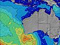 | 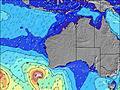 |  |  | 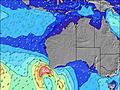 |  | 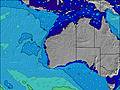 | |||||||||||||||
Wave Height (m) Direction Period (s) | WSW 15 | WSW 14 | WSW 14 | WSW 14 | WSW 14 | WSW 14 | WSW 16 | WSW 15 | WSW 15 | WSW 15 | WSW 15 | WSW 15 | WSW 15 | WSW 14 | WSW 14 | WSW 14 | WSW 14 | WSW 14 | WSW 14 | WSW 14 | WSW 14 | WSW 14 | WSW 14 | WSW 14 |
Wave Graph | ||||||||||||||||||||||||
752 | 732 | 712 | 682 | 672 | 672 | 740 | 730 | 693 | 600 | 600 | 665 | 656 | 796 | 796 | 899 | 996 | 1042 | 1159 | 1143 | 1127 | 985 | 1095 | 1028 | |
Wind (km/h) | ||||||||||||||||||||||||
Wind State on-shore cross-onshore cross-shore cross-offshore off-shore glassy | off | off | cross-off | cross-off | cross-off | cross-off | cross-off | cross-off | cross-off | cross-off | cross-off | cross-off | cross | cross | glassy | cross-off | glassy | glassy | cross-off | cross | cross-on | on | glassy | glassy |
High Tide | 10:50AM0.51m | 10:02AM0.45m | 5:19AM0.45m | |||||||||||||||||||||
Low Tide | 8:29PM0.22m | 7:39PM0.24m | 7:21PM0.23m | |||||||||||||||||||||
7:16 | — | — | — | — | — | — | — | 7:16 | — | — | — | — | — | — | — | 7:16 | — | — | — | — | — | — | 7:16 | |
— | — | — | — | 5:20 | — | — | — | — | — | — | — | 5:20 | — | — | — | — | — | — | — | 5:21 | — | — | 5:21 | |
mm | — | — | — | — | — | — | — | — | — | — | — | — | — | — | — | — | — | 1 | 2 | — | — | 1 | — | 1 |
Temp °C | 12 | 12 | 14 | 17 | 17 | 16 | 15 | 15 | 15 | 15 | 16 | 18 | 19 | 18 | 18 | 17 | 16 | 15 | 15 | 16 | 16 | 16 | 16 | 16 |
Feels °C | 8 | 8 | 9 | 13 | 14 | 12 | 11 | 11 | 13 | 12 | 13 | 15 | 17 | 17 | 18 | 16 | 15 | 14 | 14 | 14 | 15 | 15 | 16 | 16 |
Swell 1 Height (m) Direction Period (s) | WSW 15 | WSW 14 | WSW 14 | WSW 14 | WSW 14 | WSW 14 | WSW 16 | WSW 15 | WSW 15 | WSW 15 | WSW 15 | WSW 15 | WSW 15 | WSW 14 | WSW 14 | WSW 14 | WSW 14 | WSW 14 | WSW 14 | WSW 14 | WSW 14 | WSW 14 | WSW 14 | WSW 14 |
752 | 732 | 712 | 682 | 672 | 672 | 740 | 730 | 693 | 600 | 600 | 665 | 656 | 796 | 796 | 899 | 996 | 1042 | 1159 | 1143 | 1127 | 985 | 1095 | 1028 | |
Swell 2 Height (m) Direction Period (s) | — | — | — | — | — | — | — | — | — | — | — | — | — | W 4 | SW 6 | NW 4 | SW 7 | — | — | — | — | SW 16 | — | — |
— | — | — | — | — | — | — | — | — | — | — | — | — | 12 | 8 | 2 | 56 | — | — | — | — | 208 | — | — | |
Swell 3 Height (m) Direction Period (s) | — | — | — | — | — | — | — | — | — | — | — | — | — | — | NW 4 | — | — | — | — | — | — | — | — | — |
— | — | — | — | — | — | — | — | — | — | — | — | — | — | 4 | — | — | — | — | — | — | — | — | — | |
Wind waves Height (m) Direction Period (s) | NE 3 | NE 3 | NNE 3 | N 4 | NNW 4 | NNW 5 | N 3 | NNW 4 | NNW 4 | NNW 4 | NNW 4 | NW 4 | NW 4 | NW 4 | — | — | — | — | — | — | — | — | — | — |
4 | 4 | 5 | 12 | 11 | 14 | 7 | 10 | 10 | 13 | 12 | 9 | 7 | 7 | — | — | — | — | — | — | — | — | — | — | |
Nearest Offshore or Glassy | ||||||||||||||||||||||||
Distance (km) | 0 | 0 | 104 | 286 | 0 | 281 | 14 | 0 | 0 | 0 | 0 | 0 | 167 | 101 | 0 | 0 | 0 | 0 | 0 | 20 | 33 | 4 | 0 | 0 |
Best forecast wave conditions in Perth City Coast | ||||||||||||||||||||||||
Best forecast wave conditions in Australia | ||||||||||||||||||||||||
Header Global | ||||||||||||||||||||||||
- Map Icons:
 Break
Break Live Wave Height (m)
 Live Wind Speed (km/h)
 Surf Rating (10 Max)
 Ocean Swells (m)
- Wind Speed (km/h)


FREE! Surf-Forecast.com widget for your website
The surf report / weather widget below is available to embed on third party websites free of charge and provides a summary of our Mullaloo surf forecast. Simply grab the html code snippet that we provide and paste it into your own site. You can choose your preferred language and metric/imperial units for the surf forecast feed to suit users of your site. Click here to get the code.
 Nearest