

Surf Forecasts:

Mousetraps surf forecast from 23 Jul 2026:
- Best quality surf: Tuesday 28 Jul, 2AM (local time) - 10ft (3.0m), 14s period, SW swell with cross-offshore winds.
- Most powerful swell: Monday 27 Jul, 2AM (local time) - 20ft (6.0m), 14s period, WSW swell with 14,250 kJ wave energy.
- Next surfable swell (1★+): Friday 24 Jul, 5PM (local time) - 5ft (1.6m), 12s period with SW swell.
Best Forecast Surf Conditions for Mousetraps this week:
The surf forecast for Mousetraps over the next 16 days: The first swell (rated 1 star or higher) is forecast to arrive on Friday (Jul 24) at 5PM. The primary swell is predicted to be 1.6m and 12s period with a secondary swell of 0.5m and 16s. Another secondary swell of 0.7m and 5s is also forecast. The wind is predicted to be cross-offshore as the swell arrives.
The most powerful waves expected at Mousetraps in the next 16 days are 6.0m 14s and forecast to arrive on Monday (Jul 27) at 2AM. Winds are predicted to be cross-onshore at the time the swell arrives. The largest open ocean swell (not directed at the beach) is 0.7m 4s period and expected on Friday (Jul 24) at 2PM.
| Wave Type | Time (AWST) & Date | Wave Height & Period |
|---|---|---|
| Next good surf (1 star+) | 5PM (Fri 24th Jul) | 5ft (1.6m) 12s |
| Best Surf | 2AM (Tue 28th Jul) | 10ft (3.0m) 14s |
| Most Powerful | 2AM (Mon 27th Jul) | 20ft (6.0m) 14s |
Table - best surf conditions forecast for Mousetraps over the next 16 days.
The Lowdown
Alright, let’s get into it. The swell window is open but it’s a bit of a wild ride ahead. We’ve got a solid run of groundswell from the southwest, but the wind is going to be the main character for much of this stretch. The standout day is way out there, but worth the wait.
The week kicks off Friday, July 24th, with a 5ft SW swell rolling in at 12 seconds, and a moderate NNE breeze keeping it cross-off. The water temp is about average for this time of year, nothing wild. The combo energy is moderate at 859. It’s clean but the tide looks a bit tricky. Saturday morning, July 25th, the swell bumps up to 6ft from the WSW, period still 12 seconds, but the wind picks up to 16 mph from the NNE, staying cross-off. Energy steps into moderate-high territory at 1058, but the surf is still a bit marginal. Saturday afternoon goes downhill quickly with a cross wind and shorter period, so don’t bother.
Sunday, July 26th, is a write-off. The wind swings onshore and howls, swell jumps to 10-13ft but it’s junky, short-period windswell. That trend continues through Monday, July 27th, with a massive 15ft WSW swell and a strong cross-onshore. The combined energy hits 6890 (strong) but it’s lumpy and messy. Not for the faint of heart.
Then we get a little window. Tuesday, July 28th, is a nice surprise. Morning brings a 10ft SW groundswell, 14-second period, with a light offshore from the east at 9 mph. The energy is strong at 3103, and it’s clean. That’s excellent for experienced surfers only – this is big, powerful stuff. The afternoon glass off with an 8ft swell and a 3 mph NNE breeze will be butter smooth, but still only for the crew who can handle it.
Wednesday, July 29th, holds an 8ft SW swell with a very long 17-second period. That’s proper groundswell. The wind is cross-off in the morning, clean, but the energy is strong at 3515. The crowd factor is “sometimes” at Mousetraps, so you might have some company. That long period will make it wall up nicely on this reef, but it might be a bit straight for the beach.
Thursday, July 30th, gets messy again with onshore winds. Not worth it.
Now, here’s the one you’ve been waiting for. Friday, July 31st. The morning session is an absolute banger. A 15ft SW swell, 17-second period, 9 mph NNE cross-off breeze, and the combined energy is through the roof at 10792 (very strong). The forecast is exceptional for expert surfers, but it’s huge and powerful. This is a world-class day at Mousetraps if you’ve got the guts. The afternoon the wind turns cross-on, so go early. Saturday, August 1st, is still pumping with a 16ft SW swell, but the wind is cross-off from the SSE at 22 mph, making it clean but a bit wild. Strong energy continues. Sunday, August 2nd, drops slightly to 13ft, still clean with cross-off winds, but the breeze is strong.
From Monday, August 3rd, it’s a slow decline. The swell hangs around 8-10ft but the wind is relentless, either howling cross-off or onshore, and the quality drops fast. The last few days of the outlook, from August 6th onward, are a lost cause – huge onshore swell, massive wind, and just plain dangerous. The final record on Saturday, August 8th, shows a 20ft swell with a near gale onshore, which is just too big and blown out for this break.
So, the big winner is the morning of Friday, July 31st. That’s your standout. Second best is Tuesday, July 28th, with the offshore and glassy conditions. Everything else is either a fight with the wind or just too big for comfort.
Rusty.
Short Range ForecastLight rain (total 4mm), mostly falling on Sun afternoon. Very mild (max 19°C on Sat night, min 13°C on Thu night). Winds increasing (light winds from the NE on Fri night, near gales from the W by Sun afternoon). | Days 5-7 Weather SummaryLight rain (total 5mm), mostly falling on Sun night. Very mild (max 17°C on Wed afternoon, min 12°C on Tue night). Winds decreasing (near gales from the W on Sun night, calm by Tue afternoon). | ||||||||||||||||||
Friday 24 | Saturday 25 | Sunday 26 | Monday 27 | Tuesday 28 | Wednesday 29 | ||||||||||||||
Night | AM | PM | Night | AM | PM | Night | AM | PM | Night | AM | PM | Night | AM | PM | Night | AM | PM | Night | |
Swell Height Map |  |  |  |  | 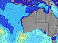 | 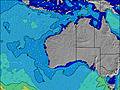 | 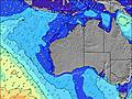 | ||||||||||||
Wave Height (m) Direction Period (s) | SW 13 | SW 12 | SW 12 | SW 14 | WSW 12 | WSW 13 | WSW 12 | WNW 8 | W 9 | WSW 14 | WSW 14 | SW 13 | SW 14 | SW 14 | SW 13 | SW 13 | SW 17 | SW 16 | SW 16 |
Wave Graph | |||||||||||||||||||
1326 | 773 | 683 | 1073 | 923 | 390 | 443 | 1113 | 2682 | 14250 | 6890 | 4862 | 3949 | 2883 | 2288 | 1619 | 3515 | 2634 | 2484 | |
Wind (km/h) | |||||||||||||||||||
Wind State on-shore cross-onshore cross-shore cross-offshore off-shore glassy | cross-off | cross-off | cross-off | cross-off | cross-off | cross | cross-on | on | on | cross-on | cross-on | cross | cross-off | off | glassy | cross-off | cross-off | cross | cross-on |
High Tide | 6:02AM0.65m | 6:45AM0.68m | 7:27AM0.71m | 8:05AM0.73m | 8:40AM0.74m | 9:11AM0.74m | |||||||||||||
Low Tide | 4:30PM0.09m | 4:50PM0.07m | 5:13PM0.06m | 5:36PM0.06m | 5:57PM0.07m | 6:13PM0.09m | |||||||||||||
— | 7:18 | — | — | 7:16 | — | — | 7:16 | — | — | 7:16 | — | — | 7:15 | — | — | 7:13 | — | — | |
5:34 | — | 5:35 | — | — | 5:35 | — | — | 5:36 | — | — | 5:37 | — | — | 5:37 | — | — | 5:37 | — | |
mm | — | — | — | — | — | — | — | 2 | 2 | 4 | 1 | — | — | — | — | — | — | — | 2 |
Temp °C | 14 | 14 | 14 | 15 | 15 | 17 | 19 | 18 | 16 | 15 | 16 | 15 | 14 | 14 | 14 | 14 | 14 | 17 | 18 |
Feels °C | 11 | 9 | 10 | 13 | 10 | 12 | 11 | 10 | 6 | 5 | 10 | 9 | 9 | 10 | 11 | 11 | 8 | 12 | 13 |
Swell 1 Height (m) Direction Period (s) | SW 13 | SW 12 | SW 12 | SW 14 | WSW 12 | SW 11 | WSW 12 | SW 15 | WSW 16 | — | WSW 14 | SW 13 | SW 14 | SW 14 | SW 13 | SW 13 | SW 17 | SW 16 | SW 16 |
1326 | 773 | 683 | 1073 | 923 | 341 | 443 | 429 | 425 | — | 6890 | 4862 | 3949 | 2883 | 2288 | 1619 | 3515 | 2634 | 2484 | |
Swell 2 Height (m) Direction Period (s) | WSW 18 | WSW 16 | W 16 | — | SW 17 | WSW 13 | SW 16 | S 10 | — | — | — | — | WSW 23 | SW 21 | SW 19 | SW 17 | — | — | SW 21 |
60 | 86 | 122 | — | 106 | 390 | 400 | 2 | — | — | — | — | 53 | 220 | 621 | 962 | — | — | 368 | |
Swell 3 Height (m) Direction Period (s) | — | — | — | — | — | SW 16 | — | — | — | — | — | — | — | — | — | — | — | — | N 4 |
— | — | — | — | — | 219 | — | — | — | — | — | — | — | — | — | — | — | — | 3 | |
Wind waves Height (m) Direction Period (s) | — | N 4 | N 5 | N 5 | N 4 | N 5 | NNW 6 | WNW 8 | W 9 | WSW 14 | — | — | — | — | — | — | — | N 5 | — |
— | 13 | 22 | 19 | 29 | 62 | 201 | 1113 | 2682 | 14250 | — | — | — | — | — | — | — | 15 | — | |
Nearest Offshore or Glassy | |||||||||||||||||||
Distance (km) | 1 | 66 | 0 | 1 | 71 | 71 | 177 | 1684 | 639 | 1312 | 68 | 9 | 0 | 0 | 0 | 1 | 66 | 71 | 66 |
Best forecast wave conditions in Margaret River | |||||||||||||||||||
Best forecast wave conditions in Australia | |||||||||||||||||||
Header Global | |||||||||||||||||||
- Map Icons:
 Break
Break Live Wave Height (m)
 Live Wind Speed (km/h)
 Surf Rating (10 Max)
 Ocean Swells (m)
- Wind Speed (km/h)


FREE! Surf-Forecast.com widget for your website
The surf report / weather widget below is available to embed on third party websites free of charge and provides a summary of our Mousetraps surf forecast. Simply grab the html code snippet that we provide and paste it into your own site. You can choose your preferred language and metric/imperial units for the surf forecast feed to suit users of your site. Click here to get the code.
Information about the Mousetraps Surf forecast
The above surf forecast table for Mousetraps provides essential information for determining whether the surfing conditions will be good over the next 16 days. A general guide to surfing at Mousetraps can be found by selecting the local surf guide option on the grey menu. Our Mousetraps surf forecast is unique since it includes wave energy (power) that defines the real feel of the surf rather than just the height or the period. If you surf the same spot (Mousetraps) regularly then make a mental note of the wave energy from the surf forecast table each time you go. Very soon you may start to choose your surf days based on the wave energy alone combined with our forecast of favourable offshore wind conditions. Our star ratings will help here and of course you will also find the usual wave height and period predictions on our surf forecasts as well as a full break down of the swell components under our advanced users option (to reveal that, click the little Einstein character under the tide times).
Further information to help with frequently asked questions about our surf forecast for Mousetraps may be found under the help tab on the top menu and also by moving your mouse over the question marks on the surf forecast table itself. Please always bear in mind that the forecast is for near-shore open water and local factors at each surf break influence the actual breaking wave height, such as the beach / reef profile, water depths offshore and shelter.
Mousetraps is 66 km (41 miles) from the city of Bunbury. If you plan a holiday in Margaret River, look for hotels and other accommodation in Bunbury. Bunbury has rooms for a wide range of budgets as well as car hire and transport links.
 Nearest