

Surf Forecasts:

Venus Bay surf forecast from 3 Aug 2026:
- Best quality surf: Monday 10 Aug, 9PM (local time) - 7ft (2.1m), 17s period, SW swell with cross-offshore winds.
- Most powerful swell: Monday 10 Aug, 12AM (local time) - 10ft (3.0m), 17s period, WSW swell with 4,731 kJ wave energy.
- Next surfable swell (1★+): Tuesday 4 Aug, 12AM (local time) - 4.5ft (1.3m), 13s period with SW swell.
Best Forecast Surf Conditions for Venus Bay this week:
The surf forecast for Venus Bay over the next 16 days: The first swell (rated 1 star or higher) is forecast to arrive on Tuesday (Aug 04) at 12AM. The primary swell is predicted to be 1.3m and 13s period with a secondary swell of 0.4m and 18s. The wind is predicted to be cross-offshore as the swell arrives.
The most powerful waves expected at Venus Bay in the next 16 days are 3.0m 17s and forecast to arrive on Monday (Aug 10) at 12AM. Winds are predicted to be cross-onshore at the time the swell arrives. The largest open ocean swell (not directed at the beach) is 1.0m 4s period and expected on Saturday (Aug 08) at 3AM.
| Wave Type | Time (ACST) & Date | Wave Height & Period |
|---|---|---|
| Next good surf (1 star+) | 12AM (Tue 4th Aug) | 4.5ft (1.3m) 13s |
| Best Surf | 9PM (Mon 10th Aug) | 7ft (2.1m) 17s |
| Most Powerful | 12AM (Mon 10th Aug) | 10ft (3.0m) 17s |
Table - best surf conditions forecast for Venus Bay over the next 16 days.
The Lowdown
Alright, Rusty here for Venus Bay. This reef set-up is a consistent spot, and we’ve got a mixed bag over the next 16 days. Some clean, glassy moments, a big rough stretch in the middle, and a decent finish.
Water temp is 59°F, which is about 1°F cooler than average for this time of year – nothing crazy, just a little cool.
The first real standout is Tuesday morning, August 4th. We’ve got a light offshore wind from the NE at 9 mph, and a clean 4 ft swell out of the SW with a long 16-second period. That’s proper groundswell with a moderate combined energy of 775. The reef will be glassy, the waves will be shapely, and it’s perfect for a beginner-plus session. Just know it can get a little crowded here sometimes.
The second standout is further out, but it’s a good one. Sunday morning, August 16th is looking excellent for experienced surfers. A 6 ft SW swell, also with a 16-second period, and a cross-offshore breeze from the ESE at 9 mph. The combined energy is a strong 3173. This is a bigger, more powerful swell, but clean conditions will make for some excellent waves on the reef. You’ll want to be confident in the water.
Monday morning, August 17th is another solid option. Offshore wind from the ENE at 9 mph, a 5 ft SW swell, and a 15-second period. The energy is moderate at 1272, and the surf will be clean and well-shaped.
The middle of the window, from around August 8th through the 15th, is a total loss. Strong winds, messy conditions, and big, ugly swell from 7 ft up to 12 ft with onshore winds. That’s kite-surfing stuff, not for a paddle board. The reef will be a bumpy mess, and the poor quality scores tell the story. There’s a solid week-long gap where you’ll want to sit it out.
Then it calms down. The 18th of August offers a final clean morning with a 4 ft SW swell and offshore wind – a nice, gentle way to finish.
So, for the best of it, hit Tuesday morning, August 4th for the clean, fun session, and keep an eye on Sunday morning, August 16th for the bigger, cleaner pulse. The long-range stuff is promising but not set in stone.
Rusty.
Short Range ForecastMostly dry. Very mild (max 17°C on Wed morning, min 9°C on Tue morning). Wind will be generally light. | Days 5-7 Weather SummaryModerate rain (total 11mm), heaviest on Sat morning. Warm (max 21°C on Fri afternoon, min 11°C on Sat night). Winds increasing (light winds from the ESE on Thu night, near gales from the W by Sat night). | |||||||||||||||||||
Mon 3 | Tuesday 4 | Wednesday 5 | Thursday 6 | Friday 7 | Saturday 8 | Sunday 9 | ||||||||||||||
PM | Night | AM | PM | Night | AM | PM | Night | AM | PM | Night | AM | PM | Night | AM | PM | Night | AM | PM | Night | |
Swell Height Map |  | 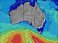 | 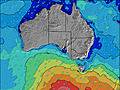 | 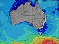 | 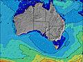 | 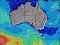 | 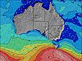 | |||||||||||||
Wave Height (m) Direction Period (s) | SW 14 | SW 13 | SW 16 | SW 15 | SW 21 | SW 19 | SW 18 | SW 16 | SW 16 | SW 16 | SW 16 | SW 16 | SW 17 | SW 17 | SW 16 | WSW 16 | SW 15 | SW 14 | SW 16 | WSW 17 |
Wave Graph | ||||||||||||||||||||
769 | 552 | 612 | 375 | 208 | 376 | 621 | 527 | 421 | 737 | 1155 | 1137 | 1038 | 802 | 897 | 1866 | 3622 | 2390 | 3118 | 4731 | |
Wind (km/h) | ||||||||||||||||||||
Wind State on-shore cross-onshore cross-shore cross-offshore off-shore glassy | cross-on | cross-off | off | cross-on | cross-off | cross-off | cross | glassy | off | cross-on | off | cross-off | cross-off | cross-off | cross-off | cross-on | on | on | on | cross-on |
High Tide | 3:09AM0.92m | 3:15PM0.89m | 3:41AM0.90m | 3:21PM0.75m | 4:17AM0.86m | 2:55PM0.63m | 5:10AM0.79m | 11:14AM0.83m | 11:48AM0.98m | 1:36AM0.43m | ||||||||||
Low Tide | 9:08PM0.14m | 9:11AM0.17m | 9:22PM0.16m | 9:45AM0.30m | 9:31PM0.19m | 10:19AM0.47m | 9:26PM0.21m | 11:10AM0.65m | 8:59PM0.22m | 8:16PM0.19m | 7:55PM0.17m | |||||||||
— | — | 7:20 | — | — | 7:18 | — | — | 7:18 | — | — | 7:18 | — | — | 7:16 | — | — | 7:16 | — | — | |
5:52 | — | — | 5:53 | — | — | 5:54 | — | — | 5:54 | — | — | 5:55 | — | — | 5:57 | — | — | 5:57 | — | |
mm | — | — | — | — | — | — | — | — | — | — | — | — | — | — | 3 | 2 | 6 | — | — | 1 |
Temp °C | 13 | 13 | 13 | 15 | 15 | 17 | 16 | 16 | 17 | 17 | 16 | 20 | 21 | 17 | 16 | 16 | 13 | 13 | 14 | 14 |
Feels °C | 10 | 10 | 11 | 13 | 10 | 11 | 11 | 14 | 15 | 13 | 12 | 14 | 15 | 12 | 7 | 9 | 3 | 5 | 7 | 9 |
Swell 1 Height (m) Direction Period (s) | SW 14 | SW 13 | SW 16 | SW 15 | SW 14 | SW 19 | SW 18 | SW 16 | SW 16 | SW 16 | SW 16 | SW 16 | SW 17 | SW 17 | SW 16 | SSW 16 | — | SSW 14 | SSW 16 | SW 18 |
769 | 552 | 612 | 375 | 162 | 376 | 621 | 527 | 421 | 737 | 1155 | 1137 | 1038 | 802 | 897 | 337 | — | 350 | 432 | 3297 | |
Swell 2 Height (m) Direction Period (s) | S 14 | SW 18 | S 10 | S 11 | SW 21 | WSW 14 | S 18 | S 8 | W 6 | SSW 16 | SSW 17 | SSW 16 | SSW 17 | S 17 | W 6 | — | — | — | — | — |
99 | 80 | 80 | 20 | 208 | 136 | 162 | 5 | 1 | 269 | 367 | 363 | 307 | 287 | 7 | — | — | — | — | — | |
Swell 3 Height (m) Direction Period (s) | S 18 | SSW 17 | SSW 16 | SSW 16 | SSE 10 | SSE 9 | NW 5 | S 8 | W 6 | — | — | — | NW 4 | — | — | — | — | — | — | — |
26 | 59 | 83 | 80 | 34 | 16 | 5 | 5 | 3 | — | — | — | 3 | — | — | — | — | — | — | — | |
Wind waves Height (m) Direction Period (s) | — | — | — | — | E 2 | NNW 3 | — | — | — | — | — | NNW 4 | N 3 | N 4 | NNW 4 | WSW 16 | SW 15 | SW 14 | SW 16 | WSW 17 |
— | — | — | — | 1 | 4 | — | — | — | — | — | 4 | 2 | 12 | 24 | 1866 | 3622 | 2390 | 3118 | 4731 | |
Nearest Offshore or Glassy | ||||||||||||||||||||
Distance (km) | 1026 | 0 | 0 | 28 | 56 | 203 | 28 | 0 | 0 | 46 | 0 | 28 | 28 | 203 | 447 | 1025 | 1203 | 1415 | 1473 | 1446 |
Best forecast wave conditions in Eyre Peninsula | ||||||||||||||||||||
Best forecast wave conditions in Australia | ||||||||||||||||||||
Header Global | ||||||||||||||||||||
- Map Icons:
 Break
Break Live Wave Height (m)
 Live Wind Speed (km/h)
 Surf Rating (10 Max)
 Ocean Swells (m)
- Wind Speed (km/h)
Latest Updates


FREE! Surf-Forecast.com widget for your website
The surf report / weather widget below is available to embed on third party websites free of charge and provides a summary of our Venus Bay surf forecast. Simply grab the html code snippet that we provide and paste it into your own site. You can choose your preferred language and metric/imperial units for the surf forecast feed to suit users of your site. Click here to get the code.
Information about the Venus Bay Surf forecast
The above surf forecast table for Venus Bay provides essential information for determining whether the surfing conditions will be good over the next 16 days. A general guide to surfing at Venus Bay can be found by selecting the local surf guide option on the grey menu. Our Venus Bay surf forecast is unique since it includes wave energy (power) that defines the real feel of the surf rather than just the height or the period. If you surf the same spot (Venus Bay) regularly then make a mental note of the wave energy from the surf forecast table each time you go. Very soon you may start to choose your surf days based on the wave energy alone combined with our forecast of favourable offshore wind conditions. Our star ratings will help here and of course you will also find the usual wave height and period predictions on our surf forecasts as well as a full break down of the swell components under our advanced users option (to reveal that, click the little Einstein character under the tide times).
Further information to help with frequently asked questions about our surf forecast for Venus Bay may be found under the help tab on the top menu and also by moving your mouse over the question marks on the surf forecast table itself. Please always bear in mind that the forecast is for near-shore open water and local factors at each surf break influence the actual breaking wave height, such as the beach / reef profile, water depths offshore and shelter.
Are you planning a holiday in Eyre Peninsula? If you are looking for accommodation near Venus Bay, camping, hotels and holiday cottages in Eyre Peninsula, consider staying in Thevenard which is 153 km (95 miles) away.
 Nearest