

Surf Forecasts:

Mona Vale-The Basin surf forecast from 12 Jul 2026:
- Best quality surf: Sunday 19 Jul, 10AM (local time) - 3.5ft (1.1m), 9s period, ENE swell with glassy winds.
- Most powerful swell: Monday 20 Jul, 4AM (local time) - 4.5ft (1.3m), 10s period, ENE swell with 305 kJ wave energy.
- Next surfable swell (1★+): Sunday 19 Jul, 1AM (local time) - 3ft (0.9m), 8s period with E swell.
Best Forecast Surf Conditions for Mona Vale-The Basin this week:
The surf forecast for Mona Vale-The Basin over the next 16 days: The first swell (rated 1 star or higher) is forecast to arrive on Sunday (Jul 19) at 1AM. The primary swell is predicted to be 0.9m and 8s period. The wind is predicted to be glassy as the swell arrives.
The most powerful waves expected at Mona Vale-The Basin in the next 16 days are 1.3m 10s and forecast to arrive on Monday (Jul 20) at 4AM. Winds are predicted to be cross-offshore at the time the swell arrives. The largest open ocean swell (not directed at the beach) is 2.5m 10s period and expected on Wednesday (Jul 15) at 10AM.
| Wave Type | Time (AEST) & Date | Wave Height & Period |
|---|---|---|
| Next good surf (1 star+) | 1AM (Sun 19th Jul) | 3ft (0.9m) 8s |
| Best Surf | 10AM (Sun 19th Jul) | 3.5ft (1.1m) 9s |
| Most Powerful | 4AM (Mon 20th Jul) | 4.5ft (1.3m) 10s |
Table - best surf conditions forecast for Mona Vale-The Basin over the next 16 days.
Alright folks, Rusty here. Let’s have a proper look at what Mona Vale – The Basin has in store for us.
First up, it’s going to be a pretty quiet start. We’re looking at a solid run of tiny, poor surf through the early part of the week, and honestly, there’s nothing worth paddling out for from Monday the 13th through to Saturday morning the 18th. The Basin is an inconsistent reef break at the best of times, and with combined swell energy sitting below 100 (just weak little numbers), it’s a flat spell you can safely sleep in for.
Now, here’s where things get interesting. Sunday morning the 19th of July – that’s our first real window. The Basin will kick into life with a 4ft swell out of the ENE with a period of 9 seconds. The combined energy bumps up to 206 (moderate). But the real story here is the wind: glassy. Absolute perfection. That’s a major positive for a break that can be tidy when it’s clean. Crowds are possible here, so get in early. It’s not huge, but for the conditions, it’s the standout of the whole run.
Moving into Monday the 20th, we’ve got a similar 4ft ENE swell, period at 10 seconds, and a clean offshore WNW breeze in the morning. The energy is climbing up to 299 (moderate). It’s solid, clean surf for an intermediate. The afternoon gets a bit messy with a cross-shore, so make the most of the morning.
Tuesday the 21st holds up well again in the morning: 4ft ENE swell, 10-second period, and a light cross-offshore breeze keeping things clean. Energy sits at 332 (moderate). Another good session for the confident surfer.
Wednesday the 22nd looks like a cracker, too. Early, we’ve got a 3ft ENE swell with a 10-second period and glassy conditions again – light offshore from the SSW. Combined energy is 204 (moderate). This is your second proper glassy window, and it’s a beauty.
We get a bit of a drop-off through Thursday the 23rd and Friday the 24th. The swell drops to 3–3ft, and conditions are only ordinary. Not bad, not great. The Basin is inconsistent, so you might sit there waiting.
Then we get a nice little spike to close out the outlook. Sunday the 26th of July brings a 3ft E swell but with a longer 12-second period. This is groundswell, and the combined energy is back up to 204 (moderate). Winds are offshore from the NW in the afternoon, keeping it clean. This is a classic Basin setup – if it’s a touch slow, the quality of the wave will make up for it.
Monday the 27th and Tuesday the 28th fade out quickly as strong winds kick up and swell energy drops back into the weak zone below 100.
All in all, the best windows are Sunday morning the 19th and Wednesday morning the 22nd, with glassy conditions and clean swell. Tuesday the 21st morning and Sunday the 26th are also worth a look. Don’t bother with the first week – it’s a write-off.
Rusty.
Short Range ForecastMostly dry. Very mild (max 19°C on Mon morning, min 11°C on Sun night). Wind will be generally light. | Days 5-7 Weather SummaryLight rain (total 6mm), mostly falling on Thu night. Very mild (max 17°C on Sat afternoon, min 12°C on Wed night). Wind will be generally light. | ||||||||||||||||||||
Monday 13 | Tuesday 14 | Wednesday 15 | Thursday 16 | Friday 17 | Saturday 18 | Sun 19 | |||||||||||||||
Night | AM | PM | Night | AM | PM | Night | AM | PM | Night | AM | PM | Night | AM | PM | Night | AM | PM | Night | AM | PM | |
Swell Height Map |  |  |  |  |  |  |  | 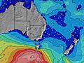 | |||||||||||||
Wave Height (m) Direction Period (s) | ESE 9 | ESE 8 | SE 8 | S 10 | S 10 | E 11 | SSW 5 | S 10 | S 10 | E 11 | S 8 | E 11 | E 10 | S 6 | S 6 | SSE 5 | E 8 | E 8 | E 8 | ENE 9 | ENE 9 |
Wave Graph | |||||||||||||||||||||
16 | 7 | 3 | 0 | 0 | 2 | 33 | 0 | 0 | 2 | 0 | 2 | 2 | 122 | 78 | 49 | 71 | 89 | 93 | 206 | 222 | |
Wind (km/h) | |||||||||||||||||||||
Wind State on-shore cross-onshore cross-shore cross-offshore off-shore glassy | cross-off | off | off | off | off | cross-off | cross-off | cross | cross-on | cross | cross | cross-on | cross-on | cross-on | cross-on | cross-on | cross-on | on | glassy | glassy | cross |
High Tide | 7:08AM1.09m | 7:13PM1.80m | 8:04AM1.13m | 8:04PM1.84m | 8:56AM1.16m | 8:54PM1.83m | 9:45AM1.19m | 9:42PM1.77m | 10:33AM1.22m | 10:29PM1.65m | 11:21AM1.24m | 11:16PM1.49m | 12:10PM1.26m | ||||||||
Low Tide | 1:13AM0.05m | 12:36PM0.26m | 2:06AM-0.02m | 1:30PM0.24m | 2:56AM-0.06m | 2:23PM0.23m | 3:43AM-0.06m | 3:16PM0.24m | 4:28AM-0.03m | 4:08PM0.28m | 5:11AM0.04m | 5:02PM0.34m | 5:51AM0.13m | 6:00PM0.41m | |||||||
— | 6:58 | — | — | 6:56 | — | — | 6:56 | — | — | 6:56 | — | — | 6:56 | — | — | 6:56 | — | — | 6:54 | — | |
— | — | 5:01 | — | — | 5:02 | — | — | 5:02 | — | — | 5:04 | — | — | 5:05 | — | — | 5:05 | — | — | 5:06 | |
mm | — | — | — | — | — | — | — | — | — | — | — | — | 4 | 1 | — | 1 | — | — | — | — | — |
Temp °C | 11 | 19 | 19 | 13 | 19 | 19 | 15 | 15 | 15 | 14 | 15 | 15 | 15 | 16 | 16 | 16 | 16 | 17 | 16 | 17 | 16 |
Feels °C | 6 | 15 | 15 | 9 | 15 | 14 | 11 | 11 | 11 | 11 | 10 | 11 | 12 | 12 | 12 | 13 | 13 | 15 | 14 | 14 | 13 |
Swell 1 Height (m) Direction Period (s) | SSW 6 | SSW 6 | SSW 11 | S 8 | SSW 7 | S 12 | SSW 11 | S 10 | S 10 | S 8 | S 14 | S 13 | S 12 | S 12 | E 5 | ENE 8 | E 8 | E 8 | E 8 | ENE 9 | ENE 9 |
12 | 14 | 25 | 5 | 5 | 25 | 37 | 938 | 753 | 270 | 16 | 30 | 25 | 11 | 8 | 19 | 71 | 89 | 93 | 206 | 222 | |
Swell 2 Height (m) Direction Period (s) | ESE 9 | SSW 11 | SSW 7 | S 10 | S 10 | S 7 | E 10 | — | S 17 | E 11 | — | E 11 | E 10 | S 17 | S 11 | S 10 | S 10 | S 10 | S 9 | S 8 | S 16 |
16 | 25 | 4 | 9 | 8 | 3 | 2 | — | 5 | 2 | — | 2 | 2 | 6 | 21 | 35 | 92 | 64 | 37 | 19 | 82 | |
Swell 3 Height (m) Direction Period (s) | S 11 | ESE 8 | SE 8 | — | S 20 | E 11 | E 10 | — | — | — | — | — | — | N 9 | E 7 | S 18 | S 21 | S 16 | S 18 | S 17 | S 7 |
3 | 7 | 3 | — | 8 | 2 | 2 | — | — | — | — | — | — | 2 | 4 | 24 | 8 | 5 | 25 | 52 | 10 | |
Wind waves Height (m) Direction Period (s) | W 4 | NW 3 | NW 3 | NW 3 | NW 3 | WNW 3 | SSW 5 | S 10 | — | — | S 8 | S 8 | S 7 | S 6 | S 6 | SSE 5 | — | — | — | — | — |
10 | 6 | 2 | 3 | 5 | 1 | 33 | 1325 | — | — | 505 | 302 | 212 | 122 | 78 | 49 | — | — | — | — | — | |
Nearest Offshore or Glassy | |||||||||||||||||||||
Distance (km) | 188 | 7 | 59 | 509 | 555 | 327 | 13 | 2 | 51 | 2 | 2 | 2 | 2 | 50 | 50 | 2 | 2 | 2 | 0 | 0 | 4 |
Best forecast wave conditions in Sydney North Coast | |||||||||||||||||||||
Best forecast wave conditions in Australia | |||||||||||||||||||||
Header Global | |||||||||||||||||||||
- Map Icons:
 Break
Break Live Wave Height (m)
 Live Wind Speed (km/h)
 Surf Rating (10 Max)
 Ocean Swells (m)
- Wind Speed (km/h)


FREE! Surf-Forecast.com widget for your website
The surf report / weather widget below is available to embed on third party websites free of charge and provides a summary of our Mona Vale-The Basin surf forecast. Simply grab the html code snippet that we provide and paste it into your own site. You can choose your preferred language and metric/imperial units for the surf forecast feed to suit users of your site. Click here to get the code.
Information about the Mona Vale-The Basin Surf forecast
The above surf forecast table for Mona Vale-The Basin provides essential information for determining whether the surfing conditions will be good over the next 16 days. A general guide to surfing at Mona Vale-The Basin can be found by selecting the local surf guide option on the grey menu. Our Mona Vale-The Basin surf forecast is unique since it includes wave energy (power) that defines the real feel of the surf rather than just the height or the period. If you surf the same spot (Mona Vale-The Basin) regularly then make a mental note of the wave energy from the surf forecast table each time you go. Very soon you may start to choose your surf days based on the wave energy alone combined with our forecast of favourable offshore wind conditions. Our star ratings will help here and of course you will also find the usual wave height and period predictions on our surf forecasts as well as a full break down of the swell components under our advanced users option (to reveal that, click the little Einstein character under the tide times).
Further information to help with frequently asked questions about our surf forecast for Mona Vale-The Basin may be found under the help tab on the top menu and also by moving your mouse over the question marks on the surf forecast table itself. Please always bear in mind that the forecast is for near-shore open water and local factors at each surf break influence the actual breaking wave height, such as the beach / reef profile, water depths offshore and shelter.
Mona Vale-The Basin is 8 km (5 miles) from Dee Why. If you plan a holiday in Sydney North Coast, look for hotels and other accommodation in Dee Why. Dee Why has rooms for a wide range of budgets as well as car hire and transport links.
 Nearest