

Surf Forecasts:

Southport Main Beach surf forecast from 3 Aug 2026:
- Best quality surf: Sunday 9 Aug, 4AM (local time) - 3.5ft (1.1m), 9s period, E swell with cross-offshore winds.
- Most powerful swell: Sunday 9 Aug, 7AM (local time) - 4ft (1.2m), 9s period, E swell with 230 kJ wave energy.
- Next surfable swell (1★+): Monday 3 Aug, 10PM (local time) - 2.5ft (0.7m), 10s period with SE swell.
Best Forecast Surf Conditions for Southport Main Beach this week:
The surf forecast for Southport Main Beach over the next 16 days: The first swell (rated 1 star or higher) is forecast to arrive on Monday (Aug 03) at 10PM. The primary swell is predicted to be 0.7m and 10s period with a secondary swell of 0.5m and 6s. The wind is predicted to be glassy as the swell arrives.
The most powerful waves expected at Southport Main Beach in the next 16 days are 1.2m 9s and forecast to arrive on Sunday (Aug 09) at 7AM. Winds are predicted to be glassy at the time the swell arrives. The largest open ocean swell (not directed at the beach) is 0.4m 8s period and expected on Sunday (Aug 09) at 1PM.
| Wave Type | Time (AEST) & Date | Wave Height & Period |
|---|---|---|
| Next good surf (1 star+) | 10PM (Mon 3rd Aug) | 2.5ft (0.7m) 10s |
| Best Surf | 4AM (Sun 9th Aug) | 3.5ft (1.1m) 9s |
| Most Powerful | 7AM (Sun 9th Aug) | 4ft (1.2m) 9s |
Table - best surf conditions forecast for Southport Main Beach over the next 16 days.
The Lowdown
Alright, this is Rusty. Let's have a look at what's on the table for Southport Main Beach over the next couple of weeks.
Honestly, the next while is a bit of a grind. We've got a solid 16-day window, but the first week is a proper write-off. There's nothing worth paddling out for until the morning of Sunday, the 9th. That's a big gap of about six days of flat or poor conditions to sit through.
When we finally get a glimmer of hope on Sunday morning, the 9th, it's a decent little window. The swell picks up to 4ft from the east, with a 9-second period, and the combined energy is moderate (208). The real kicker is the wind: a light northwesterly, which is cross-offshore and should keep things clean. The water temperature is sitting at 69°, which is about average for this time of year, so nothing too wild there. This is the standout, but it's a morning-only show. The arvo gets ruined by a moderate northerly breeze that'll chop it up.
Monday morning, the 10th, is another chance. We get a 3ft easterly swell with a 9-second period and glassy conditions – a total calm. The energy is moderate (134). It'll be surfable, but keep your expectations in check; it's not going to be pumping.
After that, the following week is a real mixed bag of cross-shore and onshore winds, with small, weak swell. There's a couple of afternoons with clean offshore winds – like Thursday the 13th, with a fresh 19 mph westerly – but the swell is only 3ft, and the energy is moderate (134). It's a bit of a tease, really. The periods are consistent, coming in at 9 to 10 seconds, so it's not going to be a long-period groundswell offering much grunt.
For a beginner spot, this is pretty much what you'd expect. The surf is small and inconsistent, and the wind is rarely your friend. The Sunday the 9th morning is the only real standout, and it's a short-lived one. For the rest… it's a tough stretch. If the wind gets up on the bigger days, this exposed beach break might be more interesting for the kite crew than us paddle folk.
Rusty.
Short Range ForecastMostly dry. Warm (max 21°C on Wed morning, min 14°C on Wed night). Wind will be generally light. | Days 5-7 Weather SummaryMostly dry. Very mild (max 19°C on Sun morning, min 14°C on Thu night). Wind will be generally light. | |||||||||||||||||||
Mon 3 | Tuesday 4 | Wednesday 5 | Thursday 6 | Friday 7 | Saturday 8 | Sunday 9 | ||||||||||||||
PM | Night | AM | PM | Night | AM | PM | Night | AM | PM | Night | AM | PM | Night | AM | PM | Night | AM | PM | Night | |
Swell Height Map | 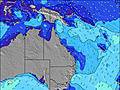 |  |  | 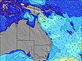 | 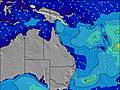 | 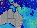 | 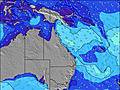 | |||||||||||||
Wave Height (m) Direction Period (s) | SE 10 | SE 10 | ESE 9 | ESE 8 | E 11 | E 10 | E 9 | E 9 | E 8 | E 7 | ENE 7 | ENE 7 | ENE 7 | ENE 8 | E 7 | E 9 | E 9 | E 9 | E 9 | E 9 |
Wave Graph | ||||||||||||||||||||
127 | 98 | 31 | 25 | 57 | 122 | 99 | 55 | 33 | 28 | 27 | 42 | 52 | 60 | 70 | 125 | 175 | 194 | 194 | 153 | |
Wind (km/h) | ||||||||||||||||||||
Wind State on-shore cross-onshore cross-shore cross-offshore off-shore glassy | on | off | cross-off | cross-on | cross-off | cross-off | cross-on | off | glassy | on | cross-off | cross-on | cross-on | cross-off | cross | cross-on | cross-off | cross-off | cross | cross-off |
High Tide | 11:16PM1.41m | 11:56AM1.28m | 11:59PM1.29m | 12:50PM1.30m | 00:49AM1.17m | 1:55PM1.33m | 1:53AM1.05m | 3:12PM1.39m | 3:16AM0.97m | 4:34PM1.48m | 4:50AM0.96m | 5:43PM1.60m | ||||||||
Low Tide | 4:59PM0.36m | 5:40AM0.26m | 5:54PM0.43m | 6:22AM0.29m | 7:01PM0.51m | 7:12AM0.33m | 8:26PM0.56m | 8:14AM0.35m | 10:04PM0.55m | 9:25AM0.35m | 11:28PM0.46m | 10:38AM0.31m | 00:31AM0.35m | |||||||
— | — | 6:26 | — | — | 6:26 | — | — | 6:24 | — | — | 6:24 | — | — | 6:24 | — | — | 6:22 | — | — | |
5:16 | — | — | 5:17 | — | — | 5:17 | — | — | 5:19 | — | — | 5:19 | — | — | 5:20 | — | — | 5:20 | — | |
mm | — | — | — | — | — | — | — | — | — | — | — | — | — | — | — | — | — | — | — | — |
Temp °C | 18 | 17 | 19 | 18 | 17 | 21 | 20 | 18 | 18 | 18 | 17 | 17 | 17 | 16 | 18 | 18 | 16 | 19 | 19 | 17 |
Feels °C | 16 | 16 | 16 | 15 | 15 | 19 | 17 | 18 | 17 | 17 | 17 | 15 | 14 | 14 | 13 | 14 | 14 | 17 | 16 | 16 |
Swell 1 Height (m) Direction Period (s) | SE 10 | SE 10 | ENE 7 | ENE 7 | E 11 | E 10 | E 9 | E 9 | E 8 | E 7 | ENE 7 | ENE 7 | ENE 7 | ENE 8 | E 7 | E 9 | E 9 | E 9 | E 9 | E 9 |
127 | 98 | 15 | 15 | 57 | 122 | 99 | 55 | 33 | 28 | 27 | 42 | 52 | 60 | 70 | 125 | 175 | 194 | 194 | 153 | |
Swell 2 Height (m) Direction Period (s) | E 6 | ENE 7 | ESE 9 | ESE 8 | ENE 7 | E 18 | E 18 | ENE 7 | ENE 6 | E 16 | ESE 8 | ESE 10 | ESE 10 | E 9 | E 9 | E 8 | NE 9 | NE 8 | S 9 | NE 8 |
26 | 15 | 31 | 25 | 20 | 6 | 6 | 30 | 27 | 5 | 20 | 18 | 19 | 7 | 7 | 5 | 12 | 11 | 2 | 14 | |
Swell 3 Height (m) Direction Period (s) | E 15 | — | SE 9 | SE 8 | SE 7 | NE 9 | SE 8 | E 18 | E 16 | SE 14 | E 16 | SE 10 | SE 10 | SSE 10 | SSE 10 | SE 10 | SE 10 | SE 9 | S 8 | S 9 |
4 | — | 19 | 11 | 13 | 3 | 3 | 6 | 5 | 8 | 5 | 4 | 4 | 10 | 10 | 4 | 4 | 3 | 12 | 2 | |
Wind waves Height (m) Direction Period (s) | — | — | — | NE 2 | NNW 3 | — | NE 2 | — | — | ENE 6 | — | — | — | — | S 3 | SE 3 | — | — | NE 8 | — |
— | — | — | 1 | 1 | — | 1 | — | — | 23 | — | — | — | — | 6 | 3 | — | — | 24 | — | |
Nearest Offshore or Glassy | ||||||||||||||||||||
Distance (km) | 24 | 0 | 0 | 153 | 0 | 0 | 24 | 0 | 0 | 24 | 1 | 24 | 18 | 0 | 24 | 24 | 0 | 0 | 153 | 0 |
Best forecast wave conditions in Gold Coast | ||||||||||||||||||||
Best forecast wave conditions in Australia | ||||||||||||||||||||
Header Global | ||||||||||||||||||||
- Map Icons:
 Break
Break Live Wave Height (m)
 Live Wind Speed (km/h)
 Surf Rating (10 Max)
 Ocean Swells (m)
- Wind Speed (km/h)
Latest Updates


FREE! Surf-Forecast.com widget for your website
The surf report / weather widget below is available to embed on third party websites free of charge and provides a summary of our Southport Main Beach surf forecast. Simply grab the html code snippet that we provide and paste it into your own site. You can choose your preferred language and metric/imperial units for the surf forecast feed to suit users of your site. Click here to get the code.
Information about the Southport Main Beach Surf forecast
The above surf forecast table for Southport Main Beach provides essential information for determining whether the surfing conditions will be good over the next 16 days. A general guide to surfing at Southport Main Beach can be found by selecting the local surf guide option on the grey menu. Our Southport Main Beach surf forecast is unique since it includes wave energy (power) that defines the real feel of the surf rather than just the height or the period. If you surf the same spot (Southport Main Beach) regularly then make a mental note of the wave energy from the surf forecast table each time you go. Very soon you may start to choose your surf days based on the wave energy alone combined with our forecast of favourable offshore wind conditions. Our star ratings will help here and of course you will also find the usual wave height and period predictions on our surf forecasts as well as a full break down of the swell components under our advanced users option (to reveal that, click the little Einstein character under the tide times).
Further information to help with frequently asked questions about our surf forecast for Southport Main Beach may be found under the help tab on the top menu and also by moving your mouse over the question marks on the surf forecast table itself. Please always bear in mind that the forecast is for near-shore open water and local factors at each surf break influence the actual breaking wave height, such as the beach / reef profile, water depths offshore and shelter.
Southport Main Beach is 3 km (2 miles) from Surfers Paradise. If you plan a holiday in Gold Coast, look for hotels and other accommodation in Surfers Paradise. Surfers Paradise has rooms for a wide range of budgets as well as car hire and transport links.
 Nearest