

Surf Forecasts:

Luz surf forecast from 3 Aug 2026:
- Most powerful swell: Wednesday 5 Aug, 1PM (local time) - 0.5ft (0.2m), 11s period, W swell with 9 kJ wave energy.
Best Forecast Surf Conditions for Luz this week:
The most powerful waves expected at Luz in the next 16 days are 0.2m 11s and forecast to arrive on Wednesday (Aug 05) at 1PM. Winds are predicted to be cross-offshore at the time the swell arrives. The largest open ocean swell (not directed at the beach) is 1.4m 7s period and expected on Thursday (Aug 06) at 10PM.
| Wave Type | Time (WEST) & Date | Wave Height & Period |
|---|---|---|
| Next good surf (1 star+) | - | - |
| Best Surf | - | - |
| Most Powerful | 1PM (Wed 5th Aug) | 0.5ft (0.2m) 11s |
Table - best surf conditions forecast for Luz over the next 16 days.
The Lowdown
Alright, saddle up. Rusty here. Let’s cut to the chase – the next couple of weeks are looking flat and pretty grim for the lineup. I’ve got the full rundown from the 2nd through the 17th, and it’s a long stretch of nothingness.
We're looking at Luz, a point break that's already inconsistent at the best of times, and it's going to be a real test of patience. The water is sitting at 66°F, which is a solid 5°F colder than normal for this time of year. You'll want the thickest wetsuit you’ve got, because that’s properly chilly.
The whole period starts with a whole lot of nothing. From Sunday the 2nd through Tuesday the 4th, there’s not even a bump on the buoy reading. Just clean, cross-off winds and a flat, empty ocean. It’s a good time to clean the wax off your boards and fix those fins.
We finally see a whisper of life on Tuesday afternoon, but honestly, it's not worth getting wet for. A tiny 0.3ft of south swell pushes through with a 13-second period, but the energy is a paltry 3. It’s more of a ripple than a wave. Wednesday the 5th offers a similar story: the swell picks up slightly to 0.7ft from the west with a 10-second period. The energy is still weak, at 8. Winds are offshore and moderate, so the surface is clean, but it’s not breaking with any power. This is as good as it gets for the next week, and that’s saying something.
The rest of the week and into the next is a flat, offshore-blown wasteland. From Thursday the 6th all the way through Tuesday the 11th, we see nothing but zeroes in the swell column. The winds are consistently offshore and clean, so if it were breaking, it would be glassy. But there’s just no swell to push through.
There’s a tiny, almost laughable, blip on Monday morning the 10th – 0.7ft of west swell with an 8-second period. The energy is still weak at 5. Honestly, you’d need a longboard and a lot of hope to get a ride on that. On Tuesday the 11th, we get a couple of 0.3ft west swells with a short 7-second period. The energy is down to 1. It’s more like the ocean is just twitching in its sleep.
From Wednesday the 12th all the way through the end of the forecast on the 17th, it goes completely flat again. No swell, just clear skies and offshore breezes. It’s a 6-day stretch of nothing down at Luz. The setup looks stellar, but with zero waves and onshore winds picking up in the afternoons, it might be more interesting for the kite surfers than for us paddle surfers.
So, bottom line is, there are no standouts here. There is no day that’s better than another. The only honest recommendation is to find something else to do for the next couple of weeks. It’s rare to get a run this blank, even for an inconsistent spot like Luz. Forecasts can change, so we’ll keep an eye on it, but as it stands, keep the board in the car and the wetsuit in the cupboard.
Rusty.
Short Range ForecastMostly dry. Warm (max 25°C on Sun afternoon, min 19°C on Sun night). Wind will be generally light. | Days 5-7 Weather SummaryMostly dry. Warm (max 26°C on Thu morning, min 17°C on Wed night). Mainly fresh winds. | |||||||||||||||||||
Sun 2 | Monday 3 | Tuesday 4 | Wednesday 5 | Thursday 6 | Friday 7 | Saturday 8 | ||||||||||||||
PM | Night | AM | PM | Night | AM | PM | Night | AM | PM | Night | AM | PM | Night | AM | PM | Night | AM | PM | Night | |
Swell Height Map |  |  |  |  | 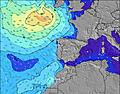 | 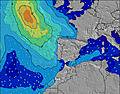 | 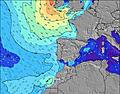 | |||||||||||||
Wave Height (m) Direction Period (s) | W 8 | W 10 | W 9 | W 9 | S 13 | WNW 9 | S 13 | S 12 | W 10 | S 12 | S 12 | S 12 | NW 7 | NW 7 | NW 7 | NW 7 | NW 7 | NW 6 | NW 4 | NW 5 |
Wave Graph | ||||||||||||||||||||
0 | 0 | 0 | 0 | 3 | 0 | 3 | 3 | 8 | 3 | 3 | 3 | 0 | 0 | 0 | 0 | 0 | 0 | 0 | 0 | |
Wind (km/h) | ||||||||||||||||||||
Wind State on-shore cross-onshore cross-shore cross-offshore off-shore glassy | cross-off | off | cross-off | cross-off | off | cross-off | cross-off | off | off | off | off | off | off | off | off | off | off | off | off | off |
High Tide | 5:33PM3.31m | 5:55AM3.08m | 6:10PM3.23m | 6:35AM3.01m | 6:53PM3.10m | 7:21AM2.91m | 7:45PM2.94m | 8:20AM2.82m | 8:51PM2.79m | 9:34AM2.77m | 10:16PM2.72m | 10:58AM2.83m | 11:43PM2.77m | |||||||
Low Tide | 11:41PM0.86m | 11:49AM0.95m | 00:19AM0.94m | 12:31PM1.05m | 1:02AM1.05m | 1:21PM1.17m | 1:56AM1.18m | 2:26PM1.29m | 3:04AM1.31m | 3:51PM1.34m | 4:29AM1.35m | 5:23PM1.26m | ||||||||
— | — | 6:41 | — | — | 6:41 | — | — | 6:41 | — | — | 6:43 | — | — | 6:43 | — | — | 6:45 | — | — | |
8:40 | — | — | 8:39 | — | — | 8:38 | — | — | 8:37 | — | — | 8:37 | — | — | 8:36 | — | — | 8:35 | — | |
mm | — | — | — | — | — | — | — | — | — | — | — | — | — | — | — | — | — | — | — | — |
Temp °C | 25 | 19 | 24 | 24 | 21 | 24 | 24 | 21 | 24 | 24 | 19 | 26 | 26 | 20 | 26 | 25 | 19 | 26 | 25 | 20 |
Feels °C | 21 | 17 | 22 | 22 | 22 | 23 | 22 | 20 | 21 | 21 | 16 | 22 | 21 | 16 | 22 | 21 | 15 | 22 | 20 | 17 |
Swell 1 Height (m) Direction Period (s) | W 8 | W 10 | W 9 | W 9 | WNW 9 | WNW 7 | S 13 | WNW 8 | WNW 8 | NW 10 | NW 9 | WNW 7 | WNW 10 | WNW 9 | WNW 9 | — | WNW 9 | WNW 9 | WNW 9 | WNW 8 |
37 | 49 | 45 | 43 | 70 | 36 | 3 | 99 | 53 | 24 | 21 | 37 | 31 | 28 | 28 | — | 16 | 15 | 15 | 14 | |
Swell 2 Height (m) Direction Period (s) | — | N 6 | NW 7 | NW 7 | S 13 | WNW 9 | N 8 | NW 11 | NW 10 | WNW 10 | WNW 10 | WNW 10 | — | — | WNW 9 | — | — | — | — | — |
— | 1 | 8 | 2 | 3 | 44 | 1 | 5 | 17 | 20 | 35 | 20 | — | — | 26 | — | — | — | — | — | |
Swell 3 Height (m) Direction Period (s) | — | — | — | — | — | N 8 | — | S 12 | W 10 | S 12 | S 12 | S 12 | — | — | — | — | — | — | — | — |
— | — | — | — | — | 1 | — | 3 | 8 | 3 | 3 | 3 | — | — | — | — | — | — | — | — | |
Wind waves Height (m) Direction Period (s) | NW 4 | NW 6 | NW 7 | WNW 3 | WNW 3 | — | WNW 9 | NNW 3 | — | WNW 8 | NW 5 | NNW 6 | NW 7 | NW 7 | NW 7 | NW 7 | NW 7 | NW 6 | NW 4 | NW 5 |
12 | 11 | 14 | 1 | 2 | — | 108 | 2 | — | 80 | 55 | 65 | 124 | 205 | 99 | 113 | 114 | 51 | 36 | 49 | |
Nearest Offshore or Glassy | ||||||||||||||||||||
Distance (km) | 379 | 53 | 347 | 391 | 14 | 0 | 14 | 0 | 14 | 391 | 45 | 45 | 302 | 240 | 289 | 698 | 300 | 56 | 700 | 343 |
Best forecast wave conditions in The Algarve | ||||||||||||||||||||
Best forecast wave conditions in Portugal | ||||||||||||||||||||
Header Global | ||||||||||||||||||||
- Map Icons:
 Break
Break Live Wave Height (m)
 Live Wind Speed (km/h)
 Surf Rating (10 Max)
 Ocean Swells (m)
- Wind Speed (km/h)
Latest Updates


FREE! Surf-Forecast.com widget for your website
The surf report / weather widget below is available to embed on third party websites free of charge and provides a summary of our Luz surf forecast. Simply grab the html code snippet that we provide and paste it into your own site. You can choose your preferred language and metric/imperial units for the surf forecast feed to suit users of your site. Click here to get the code.
Information about the Luz Surf forecast
The above surf forecast table for Luz provides essential information for determining whether the surfing conditions will be good over the next 16 days. A general guide to surfing at Luz can be found by selecting the local surf guide option on the grey menu. Our Luz surf forecast is unique since it includes wave energy (power) that defines the real feel of the surf rather than just the height or the period. If you surf the same spot (Luz) regularly then make a mental note of the wave energy from the surf forecast table each time you go. Very soon you may start to choose your surf days based on the wave energy alone combined with our forecast of favourable offshore wind conditions. Our star ratings will help here and of course you will also find the usual wave height and period predictions on our surf forecasts as well as a full break down of the swell components under our advanced users option (to reveal that, click the little Einstein character under the tide times).
Further information to help with frequently asked questions about our surf forecast for Luz may be found under the help tab on the top menu and also by moving your mouse over the question marks on the surf forecast table itself. Please always bear in mind that the forecast is for near-shore open water and local factors at each surf break influence the actual breaking wave height, such as the beach / reef profile, water depths offshore and shelter.
Luz is 5 km (3 miles) from Lagos. If you plan a holiday in The Algarve, look for hotels and other accommodation in Lagos. Lagos has rooms for a wide range of budgets as well as car hire and transport links.
 Nearest