

Surf Forecasts:

How big are the waves at Kelibya today (22 Jul):
- Morning surf: Morning surf (22 Jul, local time) - 1ft (0.3m), 4s period with S swell.
- Afternoon surf: Afternoon surf (22 Jul, local time) - 0.5ft (0.2m), 4s period with S swell.
- Evening surf: Evening surf (22 Jul, local time) - 0.5ft (0.2m), 3s period with NNE swell.
The current surf forecast for Kelibya at 1PM is: 0.2m 4s primary swell from a South direction (forecast issued at 06:00am July 22). An open ocean swell of 0.4m 4s is not directed at the surf break. The wind direction is predicted to be cross-offshore.
| Time (CET) & Date | Wave Height | Wave Period |
|---|---|---|
| Morning (22 Jul) | 1ft (0.3m) | 4s |
| Afternoon (22 Jul) | 0.5ft (0.2m) | 4s |
| Evening (22 Jul) | 0.5ft (0.2m) | 3s |
Table - waves today at Kelibya. (Swell directed towards the surf break)
Short Range ForecastMostly dry. Warm (max 35°C on Wed morning, min 25°C on Fri night). Winds decreasing (fresh winds from the WNW on Thu night, calm by Fri night). | |||||||||||||||||||||||
Wednesday 22 | Thursday 23 | Friday 24 | |||||||||||||||||||||
4 AM | 7 AM | 10 AM | 1 PM | 4 PM | 7 PM | 10 PM | 1 AM | 4 AM | 7 AM | 10 AM | 1 PM | 4 PM | 7 PM | 10 PM | 1 AM | 4 AM | 7 AM | 10 AM | 1 PM | 4 PM | 7 PM | 10 PM | |
Swell Height Map | 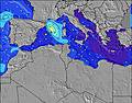 | 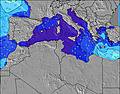 | 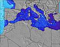 | 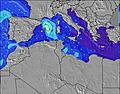 | 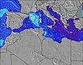 | 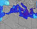 | 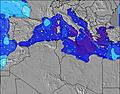 | 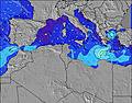 | 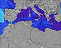 | ||||||||||||||
Wave Height (m) Direction Period (s) | S 4 | S 4 | S 4 | S 4 | N 4 | NNW 4 | NNE 3 | NNW 3 | N 6 | N 3 | N 5 | N 5 | N 5 | N 4 | S 3 | NW 3 | NW 4 | NNW 5 | NNW 5 | NNW 4 | N 4 | N 3 | NNE 3 |
Wave Graph | |||||||||||||||||||||||
2 | 2 | 1 | 1 | 0 | 0 | 1 | 0 | 1 | 1 | 2 | 2 | 2 | 1 | 1 | 0 | 0 | 0 | 0 | 0 | 0 | 4 | 3 | |
Wind (km/h) | |||||||||||||||||||||||
Wind State on-shore cross-onshore cross-shore cross-offshore off-shore glassy | cross-off | cross-off | cross-off | cross-off | cross-off | cross | cross-off | cross-off | cross-off | cross-off | cross-off | cross-off | glassy | glassy | off | cross-off | cross-off | cross-off | cross-off | cross-off | cross | cross | cross-off |
High Tide | 5:42PM0.09m | 5:28AM0.10m | 7:26PM0.09m | 6:33AM0.08m | 9:36PM0.09m | ||||||||||||||||||
Low Tide | 11:37AM0.03m | 11:15PM0.05m | 12:27PM0.04m | 1:05AM0.07m | 1:54PM0.04m | ||||||||||||||||||
5:11 | — | — | — | — | — | — | — | 5:13 | — | — | — | — | — | — | — | 5:13 | — | — | — | — | — | — | |
— | — | — | — | — | 7:30 | — | — | — | — | — | — | — | 7:30 | — | — | — | — | — | — | — | 7:29 | — | |
mm | — | — | — | — | — | — | — | — | — | — | — | — | — | — | — | — | — | — | — | — | — | — | — |
Temp °C | 35 | 31 | 31 | 35 | 31 | 29 | 29 | 29 | 29 | 28 | 30 | 31 | 32 | 30 | 31 | 28 | 27 | 27 | 28 | 28 | 28 | 27 | 25 |
Feels °C | 32 | 30 | 30 | 33 | 30 | 31 | 31 | 29 | 28 | 27 | 30 | 32 | 33 | 31 | 29 | 24 | 23 | 25 | 26 | 26 | 28 | 28 | 27 |
Swell 1 Height (m) Direction Period (s) | S 4 | S 4 | S 4 | S 4 | — | — | NNE 3 | — | — | N 3 | N 5 | N 5 | N 5 | — | S 3 | — | — | — | — | — | — | NW 5 | NW 5 |
2 | 2 | 1 | 1 | — | — | 1 | — | — | 1 | 2 | 2 | 2 | — | 1 | — | — | — | — | — | — | 1 | 1 | |
Swell 2 Height (m) Direction Period (s) | — | NNW 3 | — | — | — | — | — | — | N 6 | N 6 | — | NW 5 | NW 5 | N 4 | — | — | — | — | — | — | — | — | — |
— | 1 | — | — | — | — | — | — | 1 | 1 | — | 1 | 1 | 1 | — | — | — | — | — | — | — | — | — | |
Swell 3 Height (m) Direction Period (s) | — | — | — | — | — | — | — | — | — | — | — | — | — | NW 5 | — | — | — | — | — | — | — | — | — |
— | — | — | — | — | — | — | — | — | — | — | — | — | 1 | — | — | — | — | — | — | — | — | — | |
Wind waves Height (m) Direction Period (s) | NW 3 | NW 4 | NNW 4 | NNW 4 | N 4 | NNW 4 | NNW 4 | NNW 3 | — | NNW 3 | — | — | — | — | — | NW 3 | NW 4 | NNW 5 | NNW 5 | NNW 4 | N 4 | N 3 | NNE 3 |
1 | 6 | 6 | 7 | 9 | 4 | 1 | 1 | — | 2 | — | — | — | — | — | 5 | 27 | 37 | 40 | 22 | 14 | 4 | 3 | |
Nearest Offshore or Glassy | |||||||||||||||||||||||
Distance (km) | 810 | 830 | 1305 | 1739 | 1481 | 1337 | 865 | 582 | 857 | 862 | 1325 | 1654 | 1480 | 1158 | 1127 | 1297 | 593 | 593 | 1324 | 1654 | 1386 | 1394 | 862 |
Best forecast wave conditions in East Coast | |||||||||||||||||||||||
Best forecast wave conditions in Tunisia | |||||||||||||||||||||||
Header Global | |||||||||||||||||||||||
- Map Icons:
 Break
Break Live Wave Height (m)
 Live Wind Speed (km/h)
 Surf Rating (10 Max)
 Ocean Swells (m)
- Wind Speed (km/h)


FREE! Surf-Forecast.com widget for your website
The surf report / weather widget below is available to embed on third party websites free of charge and provides a summary of our Kelibya surf forecast. Simply grab the html code snippet that we provide and paste it into your own site. You can choose your preferred language and metric/imperial units for the surf forecast feed to suit users of your site. Click here to get the code.
 Nearest