

Surf Forecasts:

Kawana Beach surf forecast from 3 Aug 2026:
- Best quality surf: Sunday 9 Aug, 1AM (local time) - 4.5ft (1.3m), 9s period, ESE swell with glassy winds.
- Most powerful swell: Sunday 9 Aug, 1AM (local time) - 4.5ft (1.3m), 9s period, ESE swell with 264 kJ wave energy.
- Next surfable swell (1★+): Tuesday 4 Aug, 4AM (local time) - 2.5ft (0.7m), 10s period with SE swell.
Best Forecast Surf Conditions for Kawana Beach this week:
The surf forecast for Kawana Beach over the next 16 days: The first swell (rated 1 star or higher) is forecast to arrive on Tuesday (Aug 04) at 4AM. The primary swell is predicted to be 0.7m and 10s period with a secondary swell of 0.6m and 6s. The wind is predicted to be cross-offshore as the swell arrives.
The most powerful waves expected at Kawana Beach in the next 16 days are 1.3m 9s and forecast to arrive on Sunday (Aug 09) at 1AM. Winds are predicted to be glassy at the time the swell arrives. The largest open ocean swell (not directed at the beach) is 0.4m 2s period and expected on Monday (Aug 10) at 1AM.
| Wave Type | Time (AEST) & Date | Wave Height & Period |
|---|---|---|
| Next good surf (1 star+) | 4AM (Tue 4th Aug) | 2.5ft (0.7m) 10s |
| Best Surf | 1AM (Sun 9th Aug) | 4.5ft (1.3m) 9s |
| Most Powerful | 1AM (Sun 9th Aug) | 4.5ft (1.3m) 9s |
Table - best surf conditions forecast for Kawana Beach over the next 16 days.
The Lowdown
Alright folks, Rusty here. Let’s have a look at what’s cookin’ for Kawana Beach over the next couple of weeks.
Honestly, it’s a tough one to start. The first few days are pretty flat and messy. Tuesday the 4th and Wednesday the 5th offer tiny, weak swell, but the wind is a problem – it’s either cross or cross-on, and the waves are just too small to bother with. We’re looking at a real slow start until we get a bit of a pulse.
The first real glimmer of hope comes on Sunday the 9th. That morning, the wind drops right out to glassy, and we’ve got a clean 4 ft swell from the east with a 9-second period. The combined energy sits at 268 (moderate), and for a spot that’s fairly consistent, that’s a nice little window. The water temp is about average for the time of year, so no surprises there. This is your best bet for the whole outlook – a proper Sunday morning session with clean lines. Heads up, though: crowds are possible here, so get in early.
The rest of the run is a bit of a mixed bag. Monday the 10th has a clean morning with cross-off winds and 3 ft east swell, but the energy is lower (163), and it’s just ordinary. After that, we get a long stretch of onshore winds and choppy conditions from the 11th through to the 16th. The swell bumps up a bit on the 17th and 18th, hitting 4 ft to 7 ft, and the energy jumps into the 300s and 400s (strong), but the wind is still cross-on or onshore, making it a messy, lumpy affair. That kind of size and period (6-10 seconds) with onshore wind is more of a kite-surfing show than a clean paddle session.
In short: Sunday the 9th morning is the one to circle. Glassy, clean, and fun. The rest is largely a write-off for a decent paddle. Stay patient, and keep an eye on that forecast.
Rusty.
Short Range ForecastMostly dry. Warm (max 20°C on Wed morning, min 15°C on Mon night). Wind will be generally light. | Days 5-7 Weather SummaryMostly dry. Warm (max 20°C on Sun morning, min 13°C on Thu night). Wind will be generally light. | ||||||||||||||||||
Tuesday 4 | Wednesday 5 | Thursday 6 | Friday 7 | Saturday 8 | Sunday 9 | ||||||||||||||
Night | AM | PM | Night | AM | PM | Night | AM | PM | Night | AM | PM | Night | AM | PM | Night | AM | PM | Night | |
Swell Height Map |  | 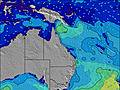 | 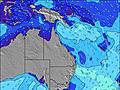 | 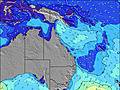 | 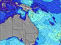 | 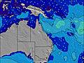 | 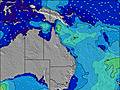 | ||||||||||||
Wave Height (m) Direction Period (s) | SE 10 | SE 9 | ENE 7 | ESE 9 | E 10 | E 8 | ENE 7 | ENE 7 | ENE 7 | ENE 7 | ENE 7 | ENE 7 | ENE 8 | ENE 8 | E 8 | ESE 9 | E 9 | E 9 | E 9 |
Wave Graph | |||||||||||||||||||
104 | 65 | 35 | 70 | 158 | 113 | 73 | 48 | 48 | 37 | 54 | 67 | 94 | 75 | 58 | 264 | 230 | 239 | 162 | |
Wind (km/h) | |||||||||||||||||||
Wind State on-shore cross-onshore cross-shore cross-offshore off-shore glassy | glassy | cross | cross-on | off | cross-off | cross-on | off | cross | on | cross-off | cross-on | on | cross | cross-on | cross-on | glassy | glassy | cross | cross-off |
High Tide | 11:01PM1.61m | 11:40AM1.45m | 11:43PM1.48m | 12:42PM1.46m | 00:34AM1.34m | 1:59PM1.50m | 1:44AM1.21m | 3:25PM1.59m | 3:16AM1.15m | 4:39PM1.72m | 4:40AM1.16m | 5:40PM1.86m | |||||||
Low Tide | 5:27AM0.35m | 5:39PM0.53m | 6:10AM0.37m | 6:46PM0.64m | 7:03AM0.39m | 8:20PM0.71m | 8:11AM0.40m | 10:01PM0.69m | 9:28AM0.37m | 11:19PM0.60m | 10:40AM0.30m | 00:19AM0.49m | |||||||
— | 6:26 | — | — | 6:24 | — | — | 6:24 | — | — | 6:24 | — | — | 6:22 | — | — | 6:22 | — | — | |
— | — | 5:21 | — | — | 5:21 | — | — | 5:22 | — | — | 5:22 | — | — | 5:22 | — | — | 5:22 | — | |
mm | — | — | — | — | — | — | — | — | — | — | — | — | — | — | — | — | — | — | — |
Temp °C | 17 | 18 | 18 | 17 | 20 | 19 | 17 | 18 | 18 | 17 | 18 | 18 | 16 | 18 | 18 | 16 | 20 | 19 | 17 |
Feels °C | 16 | 16 | 16 | 16 | 17 | 17 | 16 | 15 | 15 | 17 | 16 | 16 | 15 | 15 | 16 | 15 | 19 | 16 | 16 |
Swell 1 Height (m) Direction Period (s) | SE 10 | SE 9 | ENE 7 | ESE 9 | E 10 | E 8 | ENE 7 | ENE 7 | ENE 7 | ENE 7 | ENE 7 | ENE 7 | ENE 8 | ENE 8 | E 8 | E 9 | E 9 | E 9 | E 9 |
104 | 65 | 34 | 70 | 158 | 113 | 61 | 40 | 48 | 37 | 54 | 67 | 94 | 75 | 58 | 181 | 230 | 239 | 162 | |
Swell 2 Height (m) Direction Period (s) | ENE 6 | E 6 | SE 8 | ENE 6 | E 18 | E 18 | ESE 8 | E 8 | E 8 | ESE 8 | ESE 8 | ESE 10 | SE 10 | ESE 10 | NE 7 | NE 9 | NE 8 | NE 8 | NE 8 |
29 | 29 | 35 | 24 | 6 | 6 | 73 | 48 | 33 | 19 | 12 | 19 | 4 | 9 | 18 | 43 | 34 | 33 | 30 | |
Swell 3 Height (m) Direction Period (s) | ESE 13 | ENE 9 | ESE 11 | NE 9 | E 18 | E 18 | E 17 | E 16 | E 16 | NE 9 | E 11 | E 11 | E 15 | SE 10 | SE 10 | SE 10 | E 15 | S 9 | S 9 |
33 | 7 | 23 | 3 | 6 | 6 | 6 | 5 | 5 | 3 | 9 | 2 | 4 | 4 | 4 | 4 | 4 | 2 | 2 | |
Wind waves Height (m) Direction Period (s) | — | — | — | — | — | — | — | — | — | — | SSW 2 | — | — | S 3 | SE 4 | ESE 9 | SSW 2 | — | N 2 |
— | — | — | — | — | — | — | — | — | — | 1 | — | — | 2 | 16 | 264 | 1 | — | 2 | |
Nearest Offshore or Glassy | |||||||||||||||||||
Distance (km) | 0 | 4 | 38 | 0 | 0 | 10 | 0 | 3 | 4 | 0 | 4 | 4 | 3 | 4 | 6 | 0 | 0 | 10 | 0 |
Best forecast wave conditions in Sunshine Coast | |||||||||||||||||||
Best forecast wave conditions in Australia | |||||||||||||||||||
Header Global | |||||||||||||||||||
- Map Icons:
 Break
Break Live Wave Height (m)
 Live Wind Speed (km/h)
 Surf Rating (10 Max)
 Ocean Swells (m)
- Wind Speed (km/h)
Latest Updates


FREE! Surf-Forecast.com widget for your website
The surf report / weather widget below is available to embed on third party websites free of charge and provides a summary of our Kawana Beach surf forecast. Simply grab the html code snippet that we provide and paste it into your own site. You can choose your preferred language and metric/imperial units for the surf forecast feed to suit users of your site. Click here to get the code.
Information about the Kawana Beach Surf forecast
The above surf forecast table for Kawana Beach provides essential information for determining whether the surfing conditions will be good over the next 16 days. A general guide to surfing at Kawana Beach can be found by selecting the local surf guide option on the grey menu. Our Kawana Beach surf forecast is unique since it includes wave energy (power) that defines the real feel of the surf rather than just the height or the period. If you surf the same spot (Kawana Beach) regularly then make a mental note of the wave energy from the surf forecast table each time you go. Very soon you may start to choose your surf days based on the wave energy alone combined with our forecast of favourable offshore wind conditions. Our star ratings will help here and of course you will also find the usual wave height and period predictions on our surf forecasts as well as a full break down of the swell components under our advanced users option (to reveal that, click the little Einstein character under the tide times).
Further information to help with frequently asked questions about our surf forecast for Kawana Beach may be found under the help tab on the top menu and also by moving your mouse over the question marks on the surf forecast table itself. Please always bear in mind that the forecast is for near-shore open water and local factors at each surf break influence the actual breaking wave height, such as the beach / reef profile, water depths offshore and shelter.
Are you planning a holiday in Sunshine Coast? If you are looking for accommodation near Kawana Beach, camping, hotels and holiday cottages in Sunshine Coast, consider staying in Mooloolaba which is 4 km (2 miles) away. Other places in and around Sunshine Coast where you can find information about places to rent, and car hire include Sunshine Coast which is 9 km (6 miles) away, Buderim, Caloundra and Caboolture.
 Nearest