

Surf Forecasts:

How big are the waves at Bruny Island - Jawbones today (04 Aug):
- Morning surf: Morning surf (04 Aug, local time) - 3.5ft (1.1m), 12s period with SW swell.
- Afternoon surf: Afternoon surf (04 Aug, local time) - 3ft (0.9m), 12s period with SW swell.
- Evening surf: Evening surf (04 Aug, local time) - 3.5ft (1.0m), 12s period with SW swell.
The current surf forecast for Bruny Island - Jawbones at 2AM is: 1.1m 13s primary swell from a Southwest direction and 0.6m 17s secondary swell from a South-southwest direction (forecast issued at 09:00pm August 03). The wind direction is predicted to be cross-shore.
| Time (AEST) & Date | Wave Height | Wave Period |
|---|---|---|
| Morning (04 Aug) | 3.5ft (1.1m) | 12s |
| Afternoon (04 Aug) | 3ft (0.9m) | 12s |
| Evening (04 Aug) | 3.5ft (1.0m) | 12s |
Table - waves today at Bruny Island - Jawbones. (Swell directed towards the surf break)
Short Range ForecastLight rain (total 6mm), mostly falling on Mon night. Very mild (max 11°C on Wed morning, min 8°C on Tue night). Wind will be generally light. | ||||||||||||||||||
Mon 3 | Tuesday 4 | Wednesday 5 | ||||||||||||||||
7 PM | 10 PM | 1 AM | 4 AM | 7 AM | 10 AM | 1 PM | 4 PM | 7 PM | 10 PM | 1 AM | 4 AM | 7 AM | 10 AM | 1 PM | 4 PM | 7 PM | 10 PM | |
Swell Height Map |  |  |  |  |  | 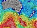 |  | |||||||||||
Wave Height (m) Direction Period (s) | SW 13 | SW 13 | SW 13 | SW 13 | SW 13 | SW 12 | SW 12 | SE 8 | SE 8 | SE 9 | SSW 20 | SSW 20 | SSW 20 | SW 14 | SW 14 | SW 13 | SW 13 | SW 13 |
Wave Graph | ||||||||||||||||||
642 | 509 | 501 | 424 | 405 | 379 | 319 | 238 | 244 | 290 | 230 | 346 | 342 | 336 | 373 | 352 | 342 | 369 | |
Wind (km/h) | ||||||||||||||||||
Wind State on-shore cross-onshore cross-shore cross-offshore off-shore glassy | cross-on | cross-off | cross-off | cross-on | cross | cross-off | cross-off | cross-off | cross-off | off | off | glassy | glassy | cross-off | cross-off | cross | cross-off | cross-off |
High Tide | 8:48PM0.50m | 11:49AM0.54m | 11:36PM0.44m | 12:08PM0.60m | ||||||||||||||
Low Tide | 4:10PM0.46m | 4:26AM0.31m | 6:32PM0.38m | 5:02AM0.35m | 7:38PM0.27m | |||||||||||||
— | — | — | — | 7:20 | — | — | — | — | — | — | — | 7:20 | — | — | — | — | — | |
— | — | — | — | — | — | — | 5:13 | — | — | — | — | — | — | — | 5:14 | — | — | |
mm | — | — | — | 1 | 2 | 1 | — | 1 | 1 | — | — | — | — | — | — | — | — | — |
Temp °C | 11 | 10 | 10 | 9 | 9 | 9 | 9 | 10 | 10 | 9 | 9 | 8 | 8 | 9 | 11 | 11 | 10 | 10 |
Feels °C | 9 | 8 | 6 | 5 | 5 | 5 | 6 | 6 | 6 | 6 | 6 | 6 | 6 | 7 | 8 | 7 | 4 | 4 |
Swell 1 Height (m) Direction Period (s) | SW 13 | SW 13 | SW 13 | SW 13 | SW 13 | SW 12 | SE 8 | SE 8 | SE 8 | SE 9 | SE 8 | ESE 8 | ESE 8 | ESE 8 | SW 14 | ESE 9 | ESE 11 | ESE 10 |
642 | 509 | 501 | 424 | 405 | 379 | 142 | 238 | 244 | 290 | 244 | 179 | 128 | 128 | 373 | 181 | 302 | 471 | |
Swell 2 Height (m) Direction Period (s) | SSW 18 | SSW 18 | SW 17 | SSW 16 | SSW 16 | ESE 5 | SW 12 | SW 12 | SW 12 | SW 12 | SW 12 | S 9 | S 9 | SW 14 | ESE 8 | SW 13 | SW 13 | SW 13 |
178 | 204 | 145 | 175 | 147 | 14 | 319 | 200 | 167 | 278 | 207 | 81 | 99 | 336 | 119 | 352 | 342 | 369 | |
Swell 3 Height (m) Direction Period (s) | NE 6 | ENE 6 | E 5 | ESE 5 | SE 13 | SSW 16 | SW 15 | SSW 15 | SW 14 | SSW 21 | SSW 20 | SSW 20 | SSW 20 | S 9 | S 7 | S 8 | S 8 | S 8 |
10 | 8 | 8 | 10 | 7 | 100 | 110 | 142 | 102 | 171 | 230 | 346 | 342 | 99 | 33 | 68 | 68 | 34 | |
Wind waves Height (m) Direction Period (s) | — | — | — | E 5 | ESE 5 | SW 3 | W 4 | W 3 | WSW 3 | W 3 | — | — | — | — | — | — | SW 3 | SW 3 |
— | — | — | 19 | 16 | 4 | 9 | 6 | 4 | 2 | — | — | — | — | — | — | 1 | 5 | |
Nearest Offshore or Glassy | ||||||||||||||||||
Distance (km) | 47 | 0 | 0 | 53 | 237 | 47 | 0 | 51 | 47 | 0 | 0 | 0 | 0 | 0 | 0 | 75 | 72 | 47 |
Best forecast wave conditions in East Coast of Tasmania | ||||||||||||||||||
Best forecast wave conditions in Australia | ||||||||||||||||||
Header Global | ||||||||||||||||||
- Map Icons:
 Break
Break Live Wave Height (m)
 Live Wind Speed (km/h)
 Surf Rating (10 Max)
 Ocean Swells (m)
- Wind Speed (km/h)
Latest Updates


FREE! Surf-Forecast.com widget for your website
The surf report / weather widget below is available to embed on third party websites free of charge and provides a summary of our Bruny Island - Jawbones surf forecast. Simply grab the html code snippet that we provide and paste it into your own site. You can choose your preferred language and metric/imperial units for the surf forecast feed to suit users of your site. Click here to get the code.
 Nearest