

Surf Forecasts:

Granites surf forecast from 27 Jul 2026:
- Most powerful swell: Monday 27 Jul, 9PM (local time) - 3.5ft (1.1m), 12s period, WSW swell with 333 kJ wave energy.
Best Forecast Surf Conditions for Granites this week:
The most powerful waves expected at Granites in the next 16 days are 1.1m 12s and forecast to arrive on Monday (Jul 27) at 9PM. Winds are predicted to be cross-onshore at the time the swell arrives. The largest open ocean swell (not directed at the beach) is 2.5m 16s period and expected on Wednesday (Jul 29) at 6AM.
| Wave Type | Time (ACST) & Date | Wave Height & Period |
|---|---|---|
| Next good surf (1 star+) | - | - |
| Best Surf | - | - |
| Most Powerful | 9PM (Mon 27th Jul) | 3.5ft (1.1m) 12s |
Table - best surf conditions forecast for Granites over the next 16 days.
The Lowdown
Alright folks, Rusty here, looking out over the region for the next 16 days. Gotta be straight with you – this is a rough stretch. We’ve got a solid gap coming.
Right now, on Monday the 27th of July, there’s a little ripple in the water at Granites, but it’s not surf. A weak, short-period NW swell of 4ft is getting torn apart by a strong 25 mph cross-shore wind. The water is sitting at 59°F, which is a bit colder than normal for this time of year. Honestly, it’s junk – a combined energy of just 43 – and the call is poor. Don't bother paddling out.
From Tuesday the 28th right through to Saturday the 9th of August, it’s a complete flat spell. There’s nothing on the cards. The winds will shift around and there will be some glassy mornings, like Thursday the 30th when a light offshore from the ENE and then glassy conditions show up, but with no swell in the water, it’s just a pretty view. This long dry run is brutal.
We finally get a pulse of swell on Sunday the 10th of August, but honestly, don’t get your hopes up. The wind is going to be howling onshore from the WSW at 34 mph. That’s a gale-force mess. The surf might be up, but it’ll be unsurfable for a paddle board. This setup looks more interesting for kite surfing than paddle surfing. That raw power will be too lumpy and blown out for a clean wave.
The pattern stays poor right through to the end of the outlook on Tuesday the 11th of August, with nothing but strong onshore winds and no real window of clean conditions. There is simply no standout session to recommend here.
Stay patient, folks. Sometimes you get a blank run like this. Forecasts can always change, but for now, leave the board in the car.
Rusty.
Short Range ForecastMostly dry. Very mild (max 15°C on Mon morning, min 11°C on Wed night). Winds decreasing (strong winds from the NNW on Mon morning, light winds from the SE by Wed night). | Days 4-6 Weather SummaryMostly dry. Very mild (max 17°C on Sat afternoon, min 10°C on Thu morning). Winds increasing (calm on Fri afternoon, fresh winds from the N by Sat morning). | ||||||||||||||||||||
Monday 27 | Tuesday 28 | Wednesday 29 | Thursday 30 | Friday 31 | Saturday 1 | Sunday 2 | |||||||||||||||
AM | PM | Night | AM | PM | Night | AM | PM | Night | AM | PM | Night | AM | PM | Night | AM | PM | Night | AM | PM | Night | |
Swell Height Map |  | 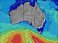 | 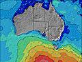 | 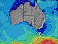 | 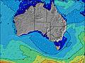 |  |  | ||||||||||||||
Wave Height (m) Direction Period (s) | NW 4 | W 4 | WSW 13 | SW 15 | SW 15 | SW 15 | SW 16 | SW 15 | SW 14 | SW 13 | SW 13 | SW 13 | SW 13 | SW 14 | SW 18 | SW 17 | SW 18 | SW 17 | WSW 16 | SW 16 | SW 16 |
Wave Graph | |||||||||||||||||||||
43 | 39 | 0 | 0 | 0 | 0 | 0 | 0 | 0 | 0 | 0 | 0 | 0 | 0 | 0 | 0 | 0 | 0 | 0 | 0 | 0 | |
Wind (km/h) | |||||||||||||||||||||
Wind State on-shore cross-onshore cross-shore cross-offshore off-shore glassy | cross | cross-on | cross-on | cross-on | cross-on | cross-on | cross | cross | cross-off | off | glassy | cross-off | cross-off | cross | cross-off | cross-off | cross | cross-off | on | cross-on | cross |
High Tide | 12:32PM0.34m | 1:03AM0.14m | 12:59PM0.36m | 1:14AM0.16m | 1:25PM0.38m | 1:30AM0.19m | 1:49PM0.38m | 1:51AM0.21m | 2:12PM0.38m | 2:14AM0.24m | 2:35PM0.36m | 2:39AM0.26m | 2:56PM0.33m | 3:07AM0.28m | |||||||
Low Tide | 8:01PM0.05m | 5:46AM0.06m | 8:07PM0.04m | 6:24AM0.03m | 8:17PM0.04m | 6:57AM0.01m | 8:29PM0.03m | 7:29AM0.00m | 8:42PM0.03m | 8:02AM-0.00m | 8:56PM0.03m | 8:34AM0.01m | 9:10PM0.03m | ||||||||
7:28 | — | — | 7:26 | — | — | 7:26 | — | — | 7:26 | — | — | 7:24 | — | — | 7:24 | — | — | 7:22 | — | — | |
— | 5:52 | — | — | 5:52 | — | — | 5:52 | — | — | 5:53 | — | — | 5:53 | — | — | 5:54 | — | — | 5:55 | — | |
mm | — | — | — | — | — | — | — | — | — | — | — | — | — | — | — | — | — | — | 1 | — | — |
Temp °C | 15 | 15 | 15 | 13 | 14 | 13 | 12 | 12 | 12 | 12 | 13 | 12 | 13 | 16 | 15 | 14 | 17 | 17 | 13 | 13 | 13 |
Feels °C | 5 | 7 | 10 | 6 | 8 | 7 | 8 | 7 | 8 | 9 | 11 | 7 | 7 | 14 | 10 | 6 | 11 | 10 | 6 | 5 | 6 |
Swell 1 Height (m) Direction Period (s) | SW 14 | SW 14 | — | — | — | — | SW 16 | SW 15 | SW 14 | SW 13 | SW 13 | SW 13 | SW 13 | SW 14 | SW 13 | SW 17 | SW 18 | SW 17 | — | — | SW 16 |
49 | 66 | — | — | — | — | 906 | 623 | 357 | 253 | 208 | 138 | 87 | 125 | 87 | 362 | 621 | 465 | — | — | 853 | |
Swell 2 Height (m) Direction Period (s) | SW 11 | — | — | — | — | — | — | — | — | — | — | — | SW 21 | SW 20 | SW 18 | — | — | — | — | — | — |
18 | — | — | — | — | — | — | — | — | — | — | — | 18 | 97 | 112 | — | — | — | — | — | — | |
Swell 3 Height (m) Direction Period (s) | — | — | — | — | — | — | — | — | — | — | — | — | — | — | — | — | — | — | — | — | — |
— | — | — | — | — | — | — | — | — | — | — | — | — | — | — | — | — | — | — | — | — | |
Wind waves Height (m) Direction Period (s) | NW 4 | W 4 | WSW 13 | SW 15 | SW 15 | SW 15 | — | — | — | — | — | SE 2 | NNE 3 | — | NNE 3 | N 4 | NNW 4 | N 4 | WSW 16 | SW 16 | — |
43 | 39 | 423 | 606 | 614 | 881 | — | — | — | — | — | 1 | 3 | — | 4 | 17 | 7 | 18 | 683 | 619 | — | |
Nearest Offshore or Glassy | |||||||||||||||||||||
Distance (km) | 511 | 842 | 515 | 908 | 1373 | 1026 | 1026 | 22 | 8 | 8 | 8 | 8 | 42 | 42 | 42 | 431 | 431 | 511 | 1027 | 842 | 354 |
Best forecast wave conditions in Eyre Peninsula | |||||||||||||||||||||
Best forecast wave conditions in Australia | |||||||||||||||||||||
Header Global | |||||||||||||||||||||
- Map Icons:
 Break
Break Live Wave Height (m)
 Live Wind Speed (km/h)
 Surf Rating (10 Max)
 Ocean Swells (m)
- Wind Speed (km/h)


FREE! Surf-Forecast.com widget for your website
The surf report / weather widget below is available to embed on third party websites free of charge and provides a summary of our Granites surf forecast. Simply grab the html code snippet that we provide and paste it into your own site. You can choose your preferred language and metric/imperial units for the surf forecast feed to suit users of your site. Click here to get the code.
Information about the Granites Surf forecast
The above surf forecast table for Granites provides essential information for determining whether the surfing conditions will be good over the next 16 days. A general guide to surfing at Granites can be found by selecting the local surf guide option on the grey menu. Our Granites surf forecast is unique since it includes wave energy (power) that defines the real feel of the surf rather than just the height or the period. If you surf the same spot (Granites) regularly then make a mental note of the wave energy from the surf forecast table each time you go. Very soon you may start to choose your surf days based on the wave energy alone combined with our forecast of favourable offshore wind conditions. Our star ratings will help here and of course you will also find the usual wave height and period predictions on our surf forecasts as well as a full break down of the swell components under our advanced users option (to reveal that, click the little Einstein character under the tide times).
Further information to help with frequently asked questions about our surf forecast for Granites may be found under the help tab on the top menu and also by moving your mouse over the question marks on the surf forecast table itself. Please always bear in mind that the forecast is for near-shore open water and local factors at each surf break influence the actual breaking wave height, such as the beach / reef profile, water depths offshore and shelter.
Are you planning a holiday in Eyre Peninsula? If you are looking for accommodation near Granites, camping, hotels and holiday cottages in Eyre Peninsula, consider staying in Thevenard which is 90 km (56 miles) away.
 Nearest