

Surf Forecasts:

Elliott Heads surf forecast from 1 Aug 2026:
- Best quality surf: Tuesday 4 Aug, 10PM (local time) - 2.5ft (0.7m), 7s period, ENE swell with glassy winds.
- Most powerful swell: Sunday 2 Aug, 7PM (local time) - 3.5ft (1.0m), 8s period, E swell with 127 kJ wave energy.
- Next surfable swell (1★+): Tuesday 4 Aug, 10PM (local time) - 2.5ft (0.7m), 7s period with ENE swell.
Best Forecast Surf Conditions for Elliott Heads this week:
The surf forecast for Elliott Heads over the next 16 days: The first swell (rated 1 star or higher) is forecast to arrive on Tuesday (Aug 04) at 10PM. The primary swell is predicted to be 0.7m and 7s period with a secondary swell of 0.7m and 7s. Another secondary swell of 0.2m and 9s is also forecast. The wind is predicted to be glassy as the swell arrives.
The most powerful waves expected at Elliott Heads in the next 16 days are 1.0m 8s and forecast to arrive on Sunday (Aug 02) at 7PM. Winds are predicted to be cross-onshore at the time the swell arrives.
| Wave Type | Time (AEST) & Date | Wave Height & Period |
|---|---|---|
| Next good surf (1 star+) | 10PM (Tue 4th Aug) | 2.5ft (0.7m) 7s |
| Best Surf | 10PM (Tue 4th Aug) | 2.5ft (0.7m) 7s |
| Most Powerful | 7PM (Sun 2nd Aug) | 3.5ft (1.0m) 8s |
Table - best surf conditions forecast for Elliott Heads over the next 16 days.
The Lowdown
G’day, Rusty here, and I’ve gotta be straight with ya – the next 16 days at Elliott Heads are lookin’ pretty grim. We’ve got a long stretch of poor surf, so don’t get your hopes up for anything decent. The first recommendation doesn’t pop up until Sunday the 2nd, and honestly, it’s a tough one to get excited about. From there, it’s a real flat spell with no standout sessions, and the whole period is basically a write-off for paddle surfing.
Right out of the gate, Sunday morning the 2nd of August, there’s a small 4ft east swell rollin’ in, but it’s a short-period 5-second windswell – just none of the good energy. The wind’s a cross-on from the ESE at 16 mph, whippin’ it up choppy. Combined wave energy is weak at 91. Water temp’s about average for the time of year, so no surprises there. It’s a poor session, and the afternoon ain’t any better with a 3ft east swell, 8-second period, and cross-on wind at 12 mph kickin’ up a chop. Energy picks up to 114, but it’s still messy.
Monday the 3rd is more of the same, with a 3ft ENE swell, 7-second period, and cross-on wind from the SSE at 12 mph. Choppy and poor. Tuesday the 4th drops to 2ft, and Wednesday the 5th bottoms out at 1ft – the wind goes light and cross-off, giving clean conditions, but there’s barely a ripple. Combined energy’s down to 30. That clean surf won’t save ya when there’s no wave to ride.
From Thursday the 6th through to the end of the first week, it’s all tiny 1ft to 2ft swells with cross or cross-on winds, energy sittin’ between 25 and 42. Just a whole lot of nothin’. Wednesday the 12th sees a tiny 3ft north swell, 6-second period, but it’s cross-shore wind and still poor. Energy’s only 49.
Now, into the second week – Thursday the 13th of August, we get a glimpse of a 0.7ft ENE groundswell with a 12-second period, cross-off wind from the NNW at 12 mph, so it’s clean. But that’s a ripple, not a wave – energy’s a measly 17. Friday the 14th through to Monday the 17th, the swell stays tiny at 0.7ft to 1.0ft, with fresh cross-onshore winds howlin’ at 19 to 22 mph. Energy maxes out at 35, but with that wind and those tiny lumps, it’s more of a kite-surfing setup than a paddler’s dream.
There’s no standout here. The whole 16-day window is a bust. Sometimes it’s just like that at Elliott Heads – a blank run like this is pretty normal for the area. Keep an eye on the forecasts, though, because it rarely stays this poor for long.
Rusty
Short Range ForecastLight rain (total 2mm), mostly falling on Sat night. Very mild (max 19°C on Sun morning, min 15°C on Mon night). Wind will be generally light. | Days 5-7 Weather SummaryMostly dry. Warm (max 21°C on Wed morning, min 14°C on Wed night). Wind will be generally light. | ||||||||||||||||||
Sunday 2 | Monday 3 | Tuesday 4 | Wednesday 5 | Thursday 6 | Friday 7 | ||||||||||||||
Night | AM | PM | Night | AM | PM | Night | AM | PM | Night | AM | PM | Night | AM | PM | Night | AM | PM | Night | |
Swell Height Map |  | 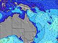 | 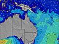 | 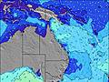 | 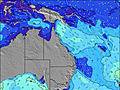 |  |  | ||||||||||||
Wave Height (m) Direction Period (s) | ENE 6 | E 5 | E 8 | ENE 8 | ENE 7 | ENE 7 | ENE 7 | E 7 | ENE 7 | ENE 7 | ENE 7 | ENE 7 | ENE 9 | ENE 9 | ENE 8 | ENE 7 | ENE 7 | ENE 7 | ENE 7 |
Wave Graph | |||||||||||||||||||
48 | 77 | 111 | 73 | 68 | 64 | 34 | 34 | 28 | 31 | 18 | 19 | 46 | 30 | 24 | 18 | 21 | 28 | 63 | |
Wind (km/h) | |||||||||||||||||||
Wind State on-shore cross-onshore cross-shore cross-offshore off-shore glassy | cross-on | cross-on | cross-on | cross-on | cross-on | cross-on | cross-on | cross-on | on | glassy | cross-off | cross-on | cross-off | cross | on | cross-off | cross | cross-on | cross |
High Tide | 10:06PM2.92m | 10:25AM2.46m | 10:43PM2.81m | 11:10AM2.46m | 11:25PM2.65m | 12:03PM2.44m | 00:14AM2.44m | 1:07PM2.40m | 1:15AM2.22m | 2:26PM2.40m | 2:35AM2.04m | 3:50PM2.48m | |||||||
Low Tide | 4:30AM0.43m | 4:27PM0.46m | 5:07AM0.44m | 5:13PM0.58m | 5:49AM0.49m | 6:07PM0.74m | 6:38AM0.57m | 7:14PM0.92m | 7:38AM0.66m | 8:41PM1.04m | 8:51AM0.71m | 10:20PM1.02m | |||||||
— | 6:26 | — | — | 6:26 | — | — | 6:24 | — | — | 6:24 | — | — | 6:24 | — | — | 6:24 | — | — | |
— | — | 5:24 | — | — | 5:25 | — | — | 5:25 | — | — | 5:27 | — | — | 5:27 | — | — | 5:28 | — | |
mm | 2 | — | — | — | — | — | — | — | — | — | — | — | — | — | — | — | — | — | — |
Temp °C | 18 | 19 | 19 | 16 | 19 | 19 | 18 | 19 | 19 | 18 | 21 | 21 | 19 | 19 | 19 | 18 | 19 | 19 | 17 |
Feels °C | 15 | 14 | 15 | 13 | 15 | 15 | 15 | 16 | 16 | 18 | 18 | 18 | 19 | 16 | 16 | 16 | 15 | 16 | 16 |
Swell 1 Height (m) Direction Period (s) | ENE 6 | NE 7 | E 12 | ENE 8 | ENE 7 | E 15 | ENE 7 | E 7 | ENE 7 | ENE 7 | ENE 7 | ENE 7 | ENE 9 | ENE 9 | ENE 8 | ENE 7 | ENE 7 | ENE 7 | ENE 7 |
48 | 14 | 3 | 73 | 68 | 4 | 34 | 34 | 28 | 31 | 18 | 19 | 46 | 30 | 24 | 18 | 21 | 28 | 63 | |
Swell 2 Height (m) Direction Period (s) | E 12 | — | — | E 16 | — | — | ENE 9 | NE 9 | NE 9 | ENE 9 | ENE 9 | ENE 9 | — | — | NE 9 | NE 9 | NE 9 | NE 10 | NE 9 |
3 | — | — | 5 | — | — | 8 | 13 | 14 | 8 | 9 | 17 | — | — | 3 | 12 | 3 | 4 | 3 | |
Swell 3 Height (m) Direction Period (s) | — | — | — | — | — | — | E 12 | E 15 | E 15 | NE 14 | NE 9 | — | — | — | — | N 14 | — | — | N 12 |
— | — | — | — | — | — | 3 | 4 | 4 | 8 | 3 | — | — | — | — | 4 | — | — | 3 | |
Wind waves Height (m) Direction Period (s) | SSE 3 | E 5 | E 8 | SSE 4 | SSE 3 | ENE 7 | SE 4 | S 3 | — | — | — | — | — | — | — | — | SSE 3 | SE 3 | — |
5 | 77 | 111 | 8 | 4 | 64 | 7 | 2 | — | — | — | — | — | — | — | — | 1 | 2 | — | |
Nearest Offshore or Glassy | |||||||||||||||||||
Distance (km) | 173 | 173 | 132 | 132 | 132 | 132 | 132 | 132 | 86 | 84 | 84 | 132 | 84 | 95 | 132 | 86 | 132 | 132 | 173 |
Best forecast wave conditions in Queensland North Coast | |||||||||||||||||||
Best forecast wave conditions in Australia | |||||||||||||||||||
Header Global | |||||||||||||||||||
- Map Icons:
 Break
Break Live Wave Height (m)
 Live Wind Speed (km/h)
 Surf Rating (10 Max)
 Ocean Swells (m)
- Wind Speed (km/h)
Latest Updates


FREE! Surf-Forecast.com widget for your website
The surf report / weather widget below is available to embed on third party websites free of charge and provides a summary of our Elliott Heads surf forecast. Simply grab the html code snippet that we provide and paste it into your own site. You can choose your preferred language and metric/imperial units for the surf forecast feed to suit users of your site. Click here to get the code.
Information about the Elliott Heads Surf forecast
The above surf forecast table for Elliott Heads provides essential information for determining whether the surfing conditions will be good over the next 16 days. A general guide to surfing at Elliott Heads can be found by selecting the local surf guide option on the grey menu. Our Elliott Heads surf forecast is unique since it includes wave energy (power) that defines the real feel of the surf rather than just the height or the period. If you surf the same spot (Elliott Heads) regularly then make a mental note of the wave energy from the surf forecast table each time you go. Very soon you may start to choose your surf days based on the wave energy alone combined with our forecast of favourable offshore wind conditions. Our star ratings will help here and of course you will also find the usual wave height and period predictions on our surf forecasts as well as a full break down of the swell components under our advanced users option (to reveal that, click the little Einstein character under the tide times).
Further information to help with frequently asked questions about our surf forecast for Elliott Heads may be found under the help tab on the top menu and also by moving your mouse over the question marks on the surf forecast table itself. Please always bear in mind that the forecast is for near-shore open water and local factors at each surf break influence the actual breaking wave height, such as the beach / reef profile, water depths offshore and shelter.
 Nearest