

Surf Forecasts:

Charlot surf forecast from 8 Jul 2026:
- Most powerful swell: Saturday 11 Jul, 2AM (local time) - 7.5ft (2.3m), 8s period, ENE swell with 688 kJ wave energy.
Best Forecast Surf Conditions for Charlot this week:
The most powerful waves expected at Charlot in the next 16 days are 2.3m 8s and forecast to arrive on Saturday (Jul 11) at 2AM. Winds are predicted to be cross-offshore at the time the swell arrives. The largest open ocean swell (not directed at the beach) is 0.2m 4s period and expected on Wednesday (Jul 08) at 5PM.
| Wave Type | Time (AST) & Date | Wave Height & Period |
|---|---|---|
| Next good surf (1 star+) | - | - |
| Best Surf | - | - |
| Most Powerful | 2AM (Sat 11th Jul) | 7.5ft (2.3m) 8s |
Table - best surf conditions forecast for Charlot over the next 16 days.
Alright, Rusty here.
It's a tough stretch ahead. We've got some swell on the way, but the wind just won't play nice for the most part. The whole window is a proper battle of cross-off and cross winds, which is going to keep things messy. For the first week especially, you're looking at a fairly consistent 5ft to 7ft range of short-period ENE swell (8 seconds), but the wave energy sits between moderate and strong, peaking around 743 on Thursday the 9th. The problem is the wind. It's a constant 19 to 22 mph breeze from the east or east-northeast, keeping the surface raw and lumpy most afternoons.
Let’s talk about the only real spot on the menu: Charlot, a reef break. It's a fairly consistent intermediate wave, though it can get busy. The water temp is sitting about average for this time of year.
If you are dedicated and looking for a window, the mornings are your only shot. The wind turns cross-offshore, which cleans things up, but the quality is still rated as marginal because of that persistent fresh breeze. The morning of Thursday July 9th and Friday July 10th are your best bets, with the swell a touch over 6ft (6.9ft and 7.2ft respectively) from the ENE. The energy is respectable (743 on Thursday, 629 on Friday). It won't be perfect, but it'll be the cleanest and most powerful of the lot.
By the second week, from around July 15th onwards, the swell drops off noticeably, down to 5ft or less, with the energy fading into the weak to moderate range (180 to 320). The wind stays similar, but there is just less push. It's a bit of a grind.
The real standout, and the only thing worth planning a session around, is Thursday July 9th morning at Charlot. It’s the peak of the energy and the cleanest conditions we'll see. Don't expect perfection, but it's the best on offer.
Short Range ForecastLight rain (total 4mm), mostly falling on Wed night. Warm (max 28°C on Wed morning, min 26°C on Tue night). Mainly fresh winds. | Days 5-7 Weather SummaryMostly dry. Warm (max 28°C on Sat morning, min 26°C on Sun night). Mainly fresh winds. | ||||||||||||||||||||
Wednesday 8 | Thursday 9 | Friday 10 | Saturday 11 | Sunday 12 | Monday 13 | Tue 14 | |||||||||||||||
Night | AM | PM | Night | AM | PM | Night | AM | PM | Night | AM | PM | Night | AM | PM | Night | AM | PM | Night | AM | PM | |
Swell Height Map |  |  |  |  |  |  |  | 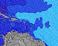 | |||||||||||||
Wave Height (m) Direction Period (s) | ENE 8 | ENE 8 | ENE 8 | ENE 8 | E 8 | ENE 8 | E 8 | ENE 8 | ENE 8 | ENE 8 | ENE 8 | ENE 8 | ENE 8 | ENE 8 | ENE 8 | ENE 8 | ENE 8 | E 8 | ENE 7 | E 8 | E 8 |
Wave Graph | |||||||||||||||||||||
375 | 473 | 509 | 599 | 632 | 588 | 617 | 629 | 574 | 688 | 588 | 483 | 471 | 350 | 310 | 324 | 300 | 258 | 327 | 430 | 407 | |
Wind (km/h) | |||||||||||||||||||||
Wind State on-shore cross-onshore cross-shore cross-offshore off-shore glassy | cross-off | cross-off | cross | cross-off | cross-off | cross-off | cross-off | cross-off | cross | cross-off | cross-off | cross | cross | cross-off | cross | cross-off | cross-off | cross-off | cross-off | cross-off | cross-off |
High Tide | 8:34PM0.41m | 9:13AM0.26m | 9:12PM0.43m | 9:57PM0.44m | 10:51PM0.46m | 11:53PM0.48m | 4:48PM0.28m | 00:58AM0.49m | 4:57PM0.29m | 2:02AM0.50m | 5:21PM0.30m | ||||||||||
Low Tide | 4:29AM0.18m | 1:24PM0.22m | 5:32AM0.12m | 6:30AM0.06m | 7:26AM0.01m | 8:20AM-0.02m | 5:49PM0.28m | 9:12AM-0.04m | 7:09PM0.28m | 10:02AM-0.03m | |||||||||||
— | 5:39 | — | — | 5:41 | — | — | 5:41 | — | — | 5:41 | — | — | 5:41 | — | — | 5:41 | — | — | 5:41 | — | |
6:37 | — | 6:37 | — | — | 6:37 | — | — | 6:37 | — | — | 6:37 | — | — | 6:37 | — | — | 6:37 | — | — | 6:37 | |
mm | — | — | — | 3 | 1 | — | — | — | — | — | — | — | — | — | — | — | — | — | — | — | — |
Temp °C | 27 | 28 | 28 | 26 | 27 | 27 | 27 | 27 | 28 | 27 | 28 | 28 | 27 | 28 | 28 | 27 | 28 | 28 | 27 | 28 | 28 |
Feels °C | 27 | 27 | 27 | 24 | 27 | 25 | 25 | 25 | 26 | 25 | 26 | 27 | 25 | 27 | 28 | 27 | 27 | 27 | 27 | 27 | 26 |
Swell 1 Height (m) Direction Period (s) | NE 13 | NE 12 | ENE 12 | NE 7 | NE 8 | SSE 6 | NE 8 | SE 4 | SE 4 | SE 4 | N 14 | N 13 | N 12 | N 12 | N 11 | NNE 11 | NNE 11 | N 10 | NNE 10 | NNE 10 | NNE 10 |
7 | 6 | 14 | 77 | 109 | 4 | 88 | 1 | 1 | 1 | 4 | 3 | 3 | 11 | 10 | 12 | 11 | 8 | 10 | 10 | 10 | |
Swell 2 Height (m) Direction Period (s) | E 13 | NE 12 | SSE 4 | — | SSE 4 | SE 4 | — | — | — | — | SE 4 | SE 4 | N 12 | N 12 | N 12 | SE 4 | N 11 | N 9 | N 8 | N 8 | N 8 |
3 | 6 | 1 | — | 2 | 1 | — | — | — | — | 1 | 1 | 3 | 11 | 11 | 1 | 9 | 1 | 1 | 1 | 1 | |
Swell 3 Height (m) Direction Period (s) | N 9 | — | NE 12 | — | E 10 | — | — | — | — | — | N 14 | N 13 | SE 6 | SE 4 | S 6 | — | SE 4 | SE 4 | — | E 15 | E 15 |
1 | — | 6 | — | 2 | — | — | — | — | — | 4 | 3 | 1 | 1 | 1 | — | 1 | 1 | — | 4 | 4 | |
Wind waves Height (m) Direction Period (s) | ENE 8 | ENE 8 | ENE 8 | ENE 8 | E 8 | ENE 8 | E 8 | ENE 8 | ENE 8 | ENE 8 | ENE 8 | ENE 8 | ENE 8 | ENE 8 | ENE 8 | ENE 8 | ENE 8 | E 8 | ENE 7 | E 8 | E 8 |
375 | 473 | 509 | 599 | 632 | 588 | 617 | 629 | 574 | 688 | 588 | 483 | 471 | 350 | 310 | 324 | 300 | 258 | 327 | 430 | 407 | |
Nearest Offshore or Glassy | |||||||||||||||||||||
Distance (km) | 671 | 615 | 788 | 454 | 518 | 764 | 719 | 788 | 755 | 505 | 788 | 319 | 319 | 414 | 178 | 319 | 414 | 414 | 719 | 615 | 788 |
Best forecast wave conditions in Martinique | |||||||||||||||||||||
Best forecast wave conditions in Martinique | |||||||||||||||||||||
Header Global | |||||||||||||||||||||
- Map Icons:
 Break
Break Live Wave Height (m)
 Live Wind Speed (km/h)
 Surf Rating (10 Max)
 Ocean Swells (m)
- Wind Speed (km/h)


FREE! Surf-Forecast.com widget for your website
The surf report / weather widget below is available to embed on third party websites free of charge and provides a summary of our Charlot surf forecast. Simply grab the html code snippet that we provide and paste it into your own site. You can choose your preferred language and metric/imperial units for the surf forecast feed to suit users of your site. Click here to get the code.
Information about the Charlot Surf forecast
The above surf forecast table for Charlot provides essential information for determining whether the surfing conditions will be good over the next 16 days. A general guide to surfing at Charlot can be found by selecting the local surf guide option on the grey menu. Our Charlot surf forecast is unique since it includes wave energy (power) that defines the real feel of the surf rather than just the height or the period. If you surf the same spot (Charlot) regularly then make a mental note of the wave energy from the surf forecast table each time you go. Very soon you may start to choose your surf days based on the wave energy alone combined with our forecast of favourable offshore wind conditions. Our star ratings will help here and of course you will also find the usual wave height and period predictions on our surf forecasts as well as a full break down of the swell components under our advanced users option (to reveal that, click the little Einstein character under the tide times).
Further information to help with frequently asked questions about our surf forecast for Charlot may be found under the help tab on the top menu and also by moving your mouse over the question marks on the surf forecast table itself. Please always bear in mind that the forecast is for near-shore open water and local factors at each surf break influence the actual breaking wave height, such as the beach / reef profile, water depths offshore and shelter.
Charlot is 24 km (15 miles) from Sainte-Marie. If you plan a holiday in Martinique, look for hotels and other accommodation in Sainte-Marie. Sainte-Marie has rooms for a wide range of budgets as well as car hire and transport links.
 Nearest