

Surf Forecasts:

Capoons Bay - Bombas surf forecast from 8 Jul 2026:
- Most powerful swell: Thursday 9 Jul, 2PM (local time) - 4.5ft (1.3m), 7s period, E swell with 186 kJ wave energy.
Best Forecast Surf Conditions for Capoons Bay - Bombas this week:
The most powerful waves expected at Capoons Bay - Bombas in the next 16 days are 1.3m 7s and forecast to arrive on Thursday (Jul 09) at 2PM. Winds are predicted to be cross-offshore at the time the swell arrives. The largest open ocean swell (not directed at the beach) is 1.5m 6s period and expected on Thursday (Jul 09) at 2AM.
| Wave Type | Time (AST) & Date | Wave Height & Period |
|---|---|---|
| Next good surf (1 star+) | - | - |
| Best Surf | - | - |
| Most Powerful | 2PM (Thu 9th Jul) | 4.5ft (1.3m) 7s |
Table - best surf conditions forecast for Capoons Bay - Bombas over the next 16 days.
Alright folks, Rusty here. Let’s be straight with you – this forecast is a tough one. We’re looking at a long, quiet stretch for Capoons Bay - Bombas. The next 16 days are basically a write-off for any decent surf. There is no swell to speak of.
We start off on Wednesday afternoon, July 8th, with a weak 4ft easterly swell, but it's short period at 7 seconds and the wind is a cross-off at 19 mph. The energy is pretty weak, and the whole thing just looks messy. The water temp is sitting at 83°, which is about average for this time of year, so nothing unusual there.
From Thursday the 9th all the way through to Wednesday the 23rd of July, we’re looking at a massive gap. Swell heights barely manage to tickle 2ft, and most of the time they're sitting at 0.3ft or 0.7ft. The wind is relentless – a constant 16 to 22 mph cross-off from the east. It’s clean, but there’s just nothing to ride. The combined wave energy drops into single digits and low double digits for most of that period, which tells you all you need to know. It’s a flat spell, plain and simple.
There is a tiny blip on Thursday July 16th, with a 2ft northerly swell and a period of 8 seconds, but it’s not enough to get excited about. The energy is still low. This is a reef break that needs a proper north swell to work, and we just aren't getting it. For the whole 16 days, the optimum swell direction from the north never shows up with any size or power.
If you’re a beginner, there’s nothing to worry about because there’s nothing to ride. For the experts, it’s the same sad story. This set-up is a beach-and-reef situation, and with the strong winds and no waves, it’s looking more like a kite session than a paddle surf. Honestly, it’s a blank run. Hang in there, forecasts can change, but for now, leave the boards at home.
Rusty.
Short Range ForecastMostly dry. Warm (max 28°C on Wed afternoon, min 26°C on Wed night). Mainly strong winds. | Days 5-7 Weather SummaryMostly dry. Warm (max 28°C on Sat night, min 27°C on Sat afternoon). Mainly fresh winds. | ||||||||||||||||||||
Wed 8 | Thursday 9 | Friday 10 | Saturday 11 | Sunday 12 | Monday 13 | Tuesday 14 | |||||||||||||||
PM | Night | AM | PM | Night | AM | PM | Night | AM | PM | Night | AM | PM | Night | AM | PM | Night | AM | PM | Night | AM | |
Swell Height Map |  |  |  |  |  |  |  | 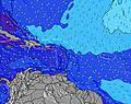 | |||||||||||||
Wave Height (m) Direction Period (s) | E 7 | ENE 11 | NE 11 | NE 10 | ENE 10 | NE 10 | E 7 | NE 10 | E 5 | N 13 | N 12 | N 12 | NNW 9 | NNW 8 | N 11 | N 11 | N 11 | N 10 | N 10 | N 10 | N 9 |
Wave Graph | |||||||||||||||||||||
177 | 12 | 5 | 24 | 10 | 4 | 161 | 4 | 0 | 3 | 3 | 3 | 7 | 6 | 9 | 9 | 9 | 8 | 3 | 3 | 2 | |
Wind (km/h) | |||||||||||||||||||||
Wind State on-shore cross-onshore cross-shore cross-offshore off-shore glassy | cross-off | cross-off | cross-off | cross-off | cross-off | cross-off | cross-off | cross-off | cross-off | cross-off | cross-off | cross-off | cross-off | cross-off | cross-off | cross-off | cross-off | cross-off | cross-off | cross-off | cross-off |
High Tide | 4:55PM0.25m | 5:50PM0.29m | 6:44PM0.32m | 7:37PM0.34m | 8:28PM0.36m | 9:17PM0.36m | 10:00PM0.35m | ||||||||||||||
Low Tide | 9:14AM-0.04m | 9:50AM-0.07m | 10:33AM-0.10m | 11:25AM-0.11m | 12:23PM-0.10m | 1:19PM-0.08m | |||||||||||||||
— | — | 5:48 | — | — | 5:48 | — | — | 5:48 | — | — | 5:48 | — | — | 5:48 | — | — | 5:50 | — | — | 5:50 | |
6:59 | — | — | 6:59 | — | — | 6:59 | — | — | 6:59 | — | — | 6:59 | — | — | 6:58 | — | — | 6:58 | — | 6:58 | |
mm | — | — | — | — | — | — | — | — | — | — | — | — | — | — | — | — | — | — | — | — | — |
Temp °C | 28 | 27 | 27 | 27 | 27 | 26 | 27 | 27 | 27 | 27 | 28 | 27 | 28 | 27 | 27 | 27 | 27 | 27 | 28 | 28 | 27 |
Feels °C | 27 | 25 | 26 | 26 | 25 | 24 | 26 | 25 | 24 | 26 | 26 | 25 | 27 | 25 | 26 | 26 | 25 | 26 | 27 | 26 | 27 |
Swell 1 Height (m) Direction Period (s) | NE 12 | ENE 11 | NE 11 | NE 10 | ENE 10 | NE 10 | NE 10 | SE 7 | — | N 13 | NE 9 | SE 8 | NNW 9 | ESE 8 | NNW 8 | NNW 7 | N 7 | N 10 | N 7 | NW 8 | NW 7 |
6 | 12 | 5 | 24 | 10 | 4 | 4 | 22 | — | 3 | 3 | 11 | 7 | 7 | 6 | 5 | 4 | 8 | 1 | 3 | 2 | |
Swell 2 Height (m) Direction Period (s) | — | — | — | — | — | — | — | NE 10 | — | — | N 10 | NW 9 | N 11 | NNW 8 | N 11 | N 11 | N 11 | N 7 | NW 9 | N 10 | N 9 |
— | — | — | — | — | — | — | 4 | — | — | 2 | 3 | 2 | 6 | 9 | 9 | 9 | 1 | 3 | 2 | 2 | |
Swell 3 Height (m) Direction Period (s) | — | — | — | — | — | — | — | — | — | — | N 12 | N 12 | N 9 | N 11 | NE 9 | N 8 | — | N 9 | N 10 | N 6 | N 6 |
— | — | — | — | — | — | — | — | — | — | 3 | 3 | 1 | 2 | 3 | 1 | — | 2 | 2 | 1 | 1 | |
Wind waves Height (m) Direction Period (s) | E 7 | E 6 | ESE 7 | E 5 | E 6 | ESE 6 | E 7 | E 5 | E 5 | E 5 | E 5 | E 5 | E 5 | E 5 | E 5 | E 4 | E 5 | ESE 5 | E 4 | ESE 5 | ESE 6 |
177 | 141 | 176 | 83 | 141 | 131 | 161 | 66 | 97 | 67 | 71 | 59 | 45 | 47 | 57 | 40 | 55 | 58 | 37 | 84 | 75 | |
Nearest Offshore or Glassy | |||||||||||||||||||||
Distance (km) | 901 | 216 | 873 | 272 | 554 | 583 | 265 | 632 | 901 | 873 | 519 | 772 | 811 | 189 | 830 | 901 | 206 | 143 | 206 | 143 | 901 |
Best forecast wave conditions in Tortola - BVI | |||||||||||||||||||||
Best forecast wave conditions in British Virgin Islands | |||||||||||||||||||||
Header Global | |||||||||||||||||||||
- Map Icons:
 Break
Break Live Wave Height (m)
 Live Wind Speed (km/h)
 Surf Rating (10 Max)
 Ocean Swells (m)
- Wind Speed (km/h)


FREE! Surf-Forecast.com widget for your website
The surf report / weather widget below is available to embed on third party websites free of charge and provides a summary of our Capoons Bay - Bombas surf forecast. Simply grab the html code snippet that we provide and paste it into your own site. You can choose your preferred language and metric/imperial units for the surf forecast feed to suit users of your site. Click here to get the code.
Information about the Capoons Bay - Bombas Surf forecast
The above surf forecast table for Capoons Bay - Bombas provides essential information for determining whether the surfing conditions will be good over the next 16 days. A general guide to surfing at Capoons Bay - Bombas can be found by selecting the local surf guide option on the grey menu. Our Capoons Bay - Bombas surf forecast is unique since it includes wave energy (power) that defines the real feel of the surf rather than just the height or the period. If you surf the same spot (Capoons Bay - Bombas) regularly then make a mental note of the wave energy from the surf forecast table each time you go. Very soon you may start to choose your surf days based on the wave energy alone combined with our forecast of favourable offshore wind conditions. Our star ratings will help here and of course you will also find the usual wave height and period predictions on our surf forecasts as well as a full break down of the swell components under our advanced users option (to reveal that, click the little Einstein character under the tide times).
Further information to help with frequently asked questions about our surf forecast for Capoons Bay - Bombas may be found under the help tab on the top menu and also by moving your mouse over the question marks on the surf forecast table itself. Please always bear in mind that the forecast is for near-shore open water and local factors at each surf break influence the actual breaking wave height, such as the beach / reef profile, water depths offshore and shelter.
Capoons Bay - Bombas is 8 km (5 miles) from Road Town. If you plan a holiday in Tortola - BVI, look for hotels and other accommodation in Road Town. Road Town has rooms for a wide range of budgets as well as car hire and transport links.
 Nearest